Tel Be’er Sheva: An Iron Age Judean City in Israel
Site at a Glance
- Rating
- 4.5
- Popularity
- Medium
- Country
- Israel
- Primary era
- Iron Age
- External website
- Open
- Eras represented
- Iron Age, Classical, Medieval
- Civilizations
- Achaemenid, Ancient Greek, Byzantine, Israelite, Roman
- Site type
- City
On this page16 sections
History
Tel Be’er Sheva is an archaeological settlement mound identified with the ancient biblical town of Beersheba in Be’er Sheva, Israel. Its principal remains belong to a fortified Judean city of the Iron Age, whose major construction phase occurred in the ninth century BCE. Positioned between the Nahal Hebron and Nahal Be’er Sheva valleys, the city served as an administrative and military center of the Kingdom of Judah and as an important center in the Negev.
Early settlement and the Iron Age
The earliest remains date to the fourth millennium BCE, during the Chalcolithic period, or Copper Age, when early metal use existed alongside stone tools. This occupation was followed by an abandonment lasting about 2,000 years. Settlement resumed in the early Iron Age, by the twelfth or eleventh century BCE. The Iron Age in the southern Levant extended broadly from the late second millennium into the first millennium BCE, and Tel Be’er Sheva preserves several successive phases within that period.
Beersheba appears repeatedly in the Hebrew Bible in narratives concerning Abraham, Abimelech of Gerar, Isaac, and Jacob. It was later connected with the tribal territories of Judah and Simeon and described as a southern boundary of the Israelite and Judean kingdoms. The mound is generally identified with Beersheba, although some interpretations associate it with the nearby biblical town of Sheba. Its location near water sources and routes across the Negev supported the movement of inhabitants, traders, and caravans.
The first substantial fortifications probably belong to the early Iron Age IIA. Some scholars have linked this phase with Saul’s conflicts with the Amalekites, but comparative evidence and radiocarbon dating place it more probably between the mid-tenth and late ninth centuries BCE. The settlement was rebuilt several times. Its main fortified city was eventually destroyed during the Assyrian period, although the precise dating and historical cause of its destruction remain debated. One interpretation connects a major conflagration with the Assyrian king Sennacherib’s campaign against Judah in 701 BCE. Another associates an earlier destruction with the Egyptian pharaoh Sheshonq I’s campaign around 925–926 BCE.
Later occupation and modern history
After earlier destruction, the city was rebuilt, but occupation was not continuous. A small Persian-period fortress with stables was constructed in the fifth or fourth century BCE. Later activity included a Hellenistic altar, a Roman fortification, and settlements or other remains from the Herodian, Byzantine, and Crusader periods. In the later Roman and Byzantine periods, the urban center shifted toward the area of modern Beersheba.
The site was later abandoned and remained in ruins until Ottoman authorities began constructing the modern city of Beersheba farther west in 1880. During the First World War, the mound formed part of an Ottoman defensive position occupied by about 900 soldiers equipped with machine guns. New Zealand mounted troops captured the position on 31 October 1917, with assistance from Australian mounted forces later that day. This action preceded the British capture of Beersheba.
Excavations took place from 1969 to 1976 under the direction of the Institute of Archaeology of Tel Aviv University, principally led by Yohanan Aharoni and, during the final season, Ze’ev Herzog. Work in 1974–1976 reached bedrock in parts of the mound and exposed four earlier occupational strata, numbered VI to IX. Herzog and his colleagues returned from 1993 to 1995 to complete investigations of the water system and the area near the well. The Israel Nature and Parks Authority extensively restored the site in 1990, and the water system opened to the public in 2003.
Tel Be’er Sheva forms part of the UNESCO World Heritage property Biblical Tells, Megiddo, Hazor and Beer Sheba, inscribed in 2005. The designation recognizes the mound as one of the representative biblical tells and acknowledges its substantial remains of a city associated with biblical history.
Remains
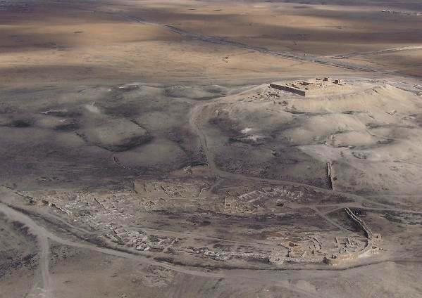
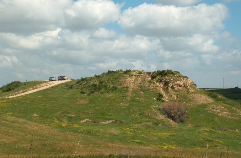
Tel Be’er Sheva is a tell, a settlement mound created by repeated construction, destruction, abandonment, and rebuilding in one location. The mound rises about 20 metres above the surrounding plain and stands approximately 307 metres above sea level, where the Nahal Hebron and Nahal Be’er Sheva valleys meet. These valleys linked the site with the northern Negev, the hill country, the Dead Sea, and the coastal plain. The archaeological area covers about 3.09 hectares, and roughly 75 percent of the mound has been excavated.
Early occupation and fortified city
Chalcolithic and early Iron Age remains
Chalcolithic occupation is represented by artifacts rather than surviving buildings. Among the finds are marble figurines, some about 30 centimetres high, carved in a local workshop from imported stone. Several are thin and elongated, with the arms held close to the body. The earliest Iron Age settlement, Stratum IX, consisted chiefly of seven large pits measuring about 6 to 10 metres across. It may have covered approximately 2,990 square metres and contained around 20 dwelling pits and 10 granaries for a population of roughly 100 to 140 people. After this settlement was abandoned, the area was reused and new structures were built.
Iron Age houses and defenses
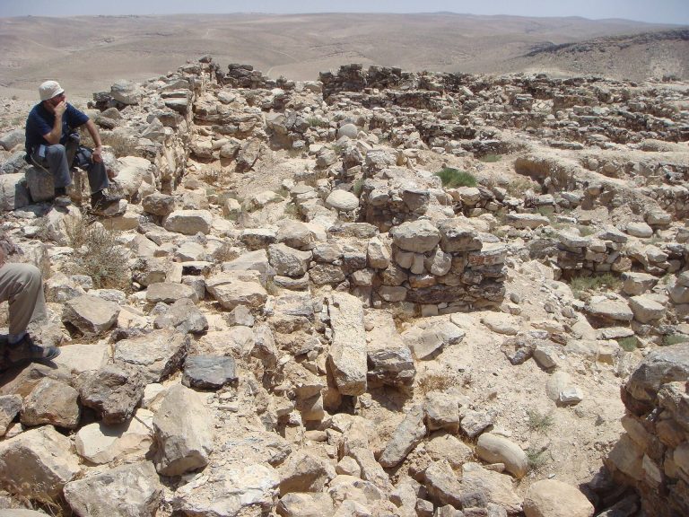
Stratum VIII, dated to the eleventh century BCE, contains the first securely identified houses. It too was abandoned rather than destroyed. Stratum VII, from the late eleventh century BCE, comprised five domestic units in a possibly enclosed settlement and appears to have been built by the same community that occupied Stratum VIII. The houses had elongated plans with parallel spaces and a transverse room, while some included open areas at the front. In places, their outer walls formed part of the defensive perimeter.
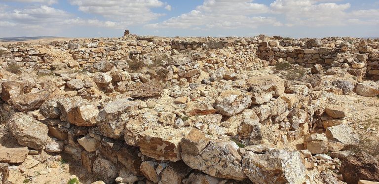
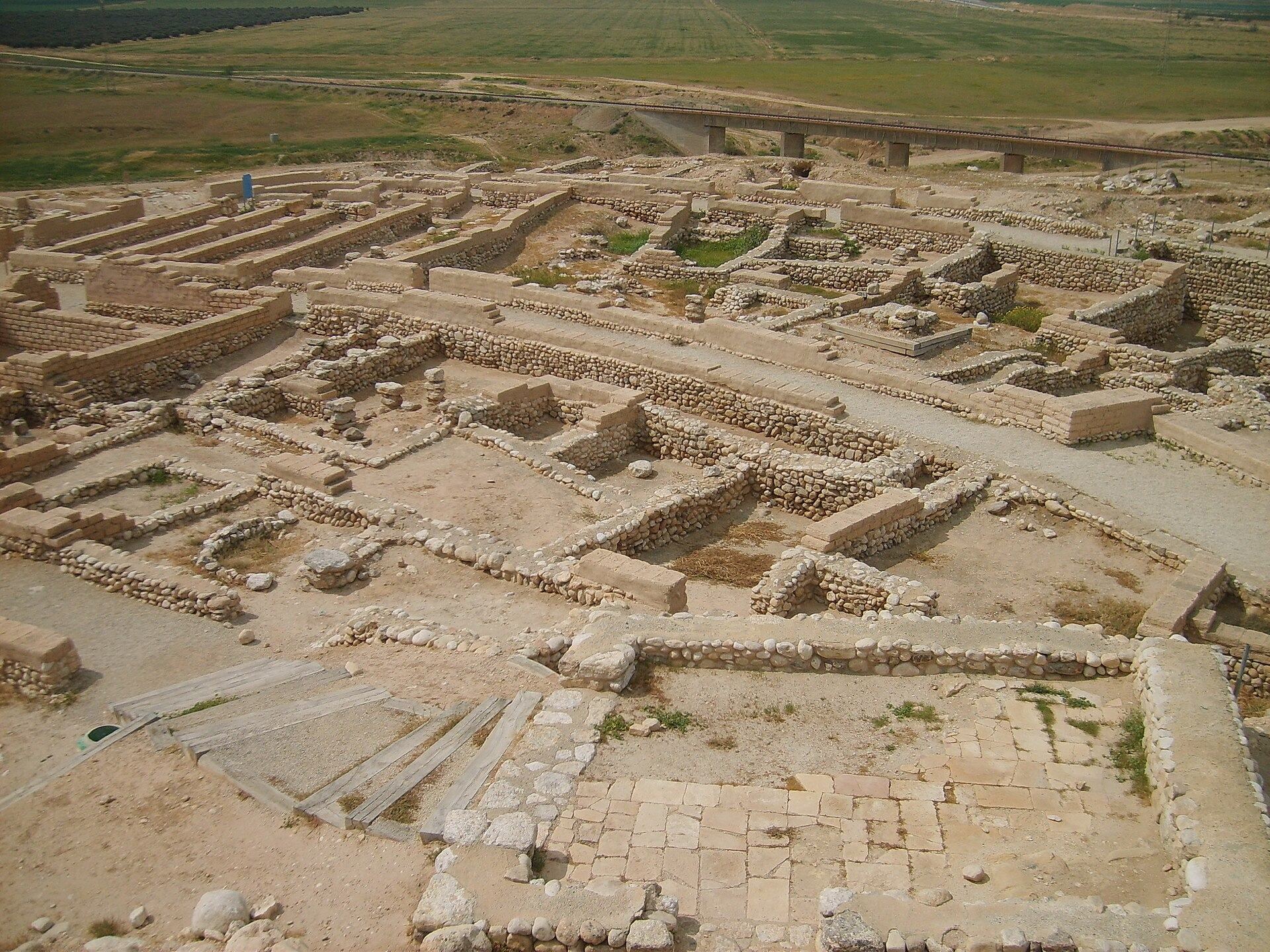
The later Iron Age city was planned as a coherent urban unit. Its roughly elliptical perimeter was enclosed by a casemate wall, a defense made of parallel walls joined by cross-walls that created enclosed chambers. Some of these chambers were incorporated into houses and other buildings, giving residents a direct role in the city’s defense. The settlement is estimated to have housed about 350 people. Its material culture included cooking pots, jars, bowls, lamps, loom weights, and a small number of seals.
Gate, streets, and public buildings
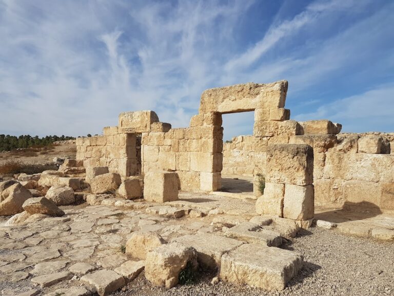
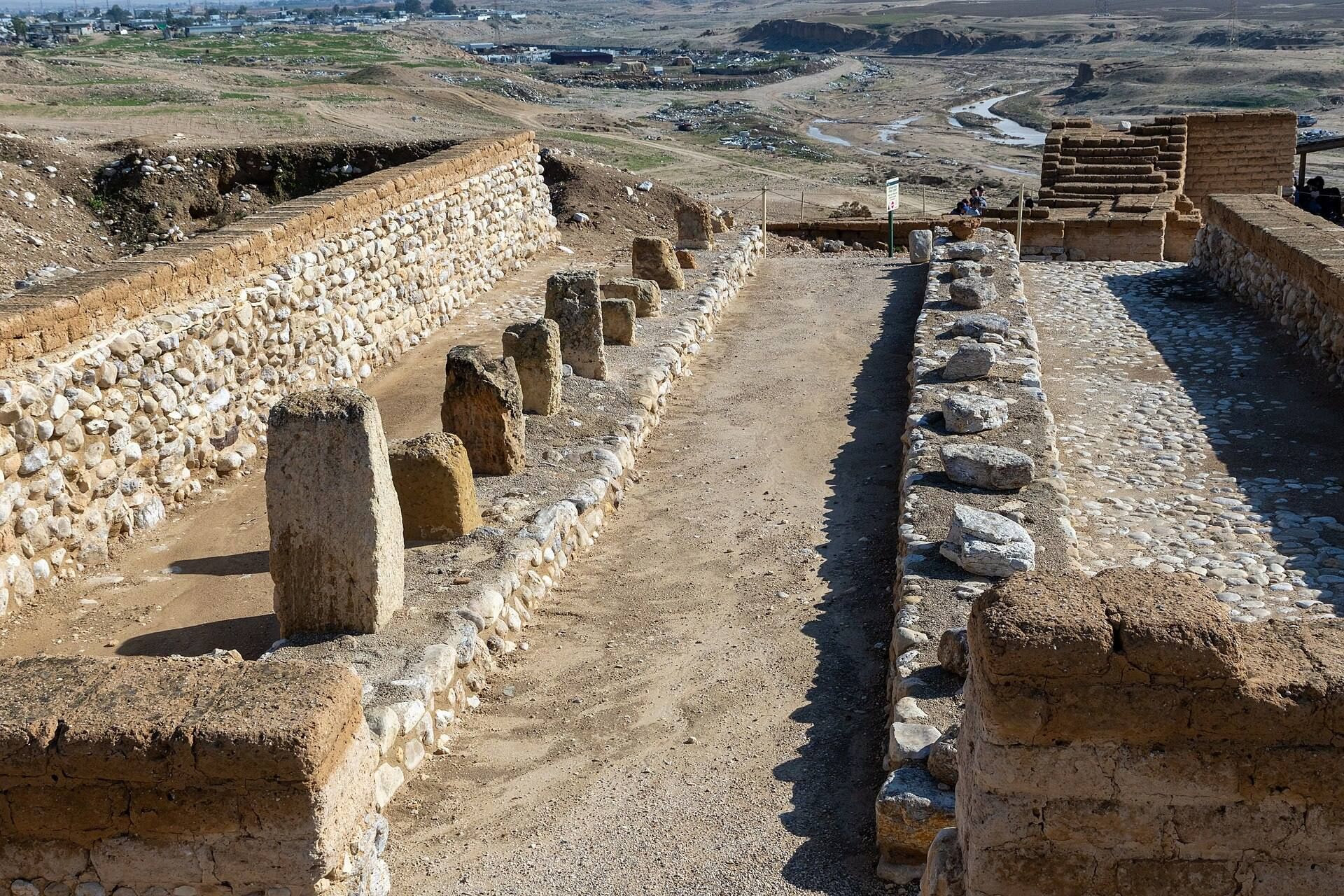
The principal gate stood on the eastern side of the city. Its inner complex had four chambers, two on each side, and one chamber contained stone benches along three walls. This space may have served public gatherings or official activity. The gate also had an outer section flanked by towers. One tower survives in part and retains stone benches on its first level.
A peripheral street about 2 metres wide divided the city into three main sectors while following the line of the city wall. Two other streets crossed the settlement and led toward a central urban space at the gate. The planned layout included residential quarters, administrative buildings, inner and outer street rings, and drains beneath some streets for carrying away rainwater.
Governor’s Palace and storage buildings
The Governor’s Palace stood near the intersection of the ring roads. Its plan included an entrance corridor, three long halls, paved rooms that may have served ceremonial or representational purposes, a kitchen, and a storeroom. Near the gate complex were large storage buildings. The principal excavated storehouse covered about 600 square metres and contained three long rooms, each with two rows of stone pillars. Hundreds of ceramic vessels were found inside.
A residential quarter occupied the western part of the city between the outer street and the city wall. It contained several rooms, casemates, and areas separated by rows of columns that were probably used for animals. These buildings formed part of the urban arrangement rather than a separate settlement.
Water systems
Well beside the gate
A well outside the wall, next to the gate, reached about 69 metres below ground level and penetrated limestone in its lower section. It probably supplied both the inhabitants and caravans passing through the area.
Subterranean reservoir
The internal water system was designed to function during a siege. A dam across the Nahal Hebron collected floodwater, which passed through a covered channel into a subterranean reservoir cut into chalk. A stairway inside a shaft provided access from the city. The shaft was about 20 metres deep, while the limestone reservoir held approximately 700 cubic metres. The system remained in use until the late first century BCE and was later destroyed, possibly by an earthquake.
Religious and later structures
Judean horned altar
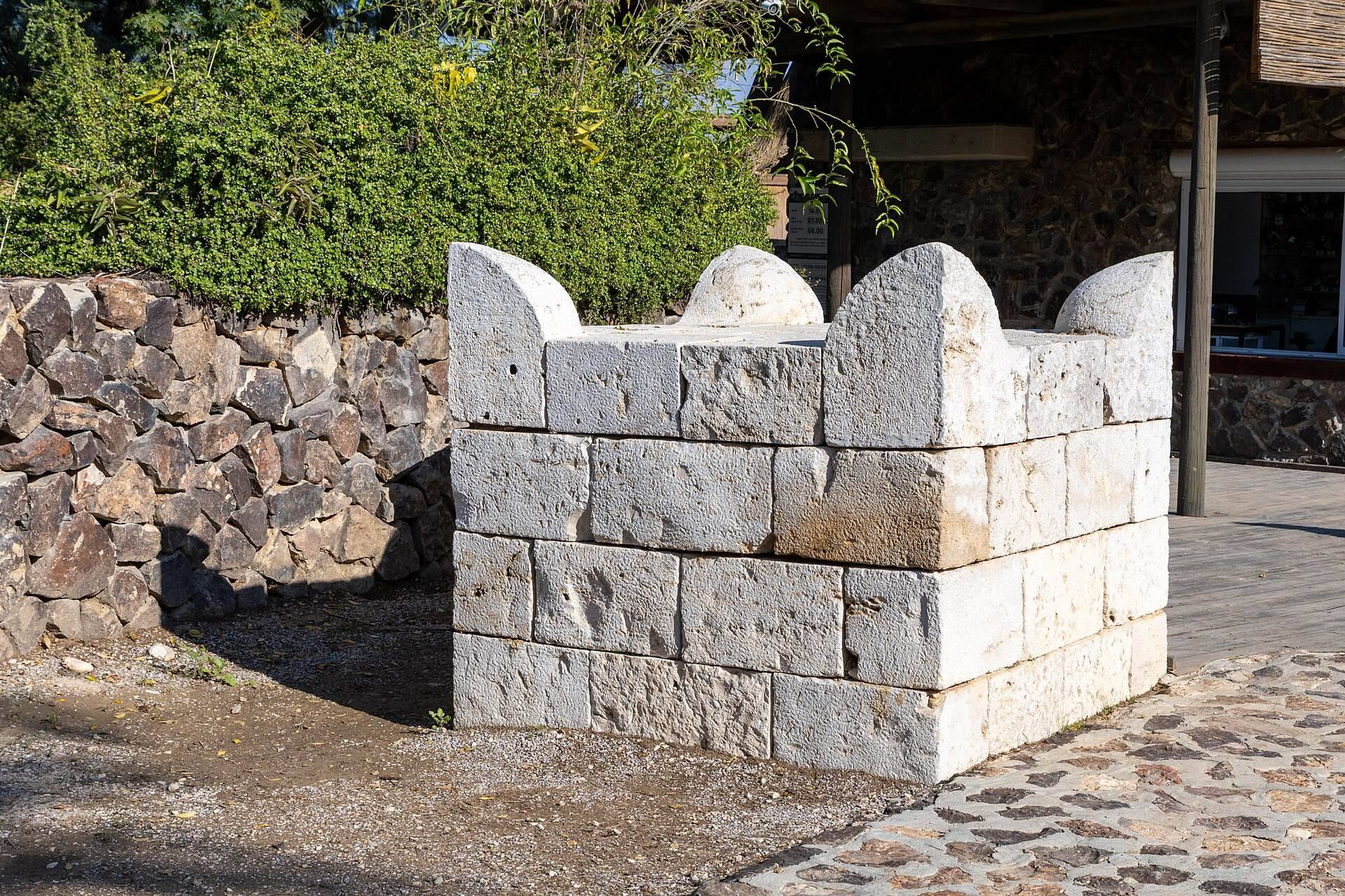
A large four-horned altar from the Judean period was discovered dismantled and reused in a later wall. A horned altar has projecting corners traditionally associated with sacrifice and refuge imagery in the Hebrew Bible. The Tel Be’er Sheva altar measures about 1.60 by 1.60 metres and is built of dressed stone; one stone bears an engraved serpent. Its reconstruction is displayed at the entrance to the excavation, while the original is preserved in the Israel Museum in Jerusalem.
The reuse of the altar stones has been interpreted as evidence that a local cult installation was dismantled during the religious reforms of Hezekiah, king of Judah from approximately 715 to 686 BCE. The altar’s date and interpretation remain disputed. Its remains indicate the former presence of a temple or another religious center, but they do not securely identify it with the altar mentioned in biblical narratives.
Persian and Hellenistic features
A smaller Persian-period incense altar made of limestone and decorated with animal figures was also found, along with figurines of Egyptian deities. Near a building with deep cellar rooms are the remains of a Hellenistic altar. At the western corner of the outer street ring, a house contained two cellar rooms about 4 metres deep. Their unusual depth has been interpreted as possibly resulting from the dismantling of an earlier temple.
Roman, Byzantine, and later remains
A Roman fortification was built in the center of the mound over the foundations of the abandoned Iron Age city. A later rock-cut structure, dated to the sixth or seventh century CE, lies about 1.20 metres below the modern surface. It contains two rooms separated by a passage approximately 1.3 metres wide. The western room measures about 2.1 by 3.5 metres, while the eastern room is about 2 metres wide from east to west and has lost its northeastern corner to a modern drainage channel. The rooms were cut into rock at slightly different levels, and the purpose of a rounded depression in the eastern room remains uncertain.
The southern entrance wall of this structure was built from large limestone blocks on its eastern face, with irregular stones filling the interior. Constructed without mortar, it survives to about 1.6 metres high. Its upper part formed the southern doorjamb, while the lintel is missing. A probably Nabataean capital, an architectural element associated with Nabataean building traditions, was also found. Later excavation identified a tribal cemetery containing Ottoman-period infant jar burials, commonly associated with nomadic or itinerant workers of Egyptian origin.
The entrance gate and other high sections of the site were extensively reconstructed, including areas that had originally been built of mud brick. UNESCO criticized parts of these reconstructions because they were considered potentially harmful to the site’s historical character.