Painted Rock Petroglyph Site: A Hohokam Rock-Art Landscape in Arizona
Site at a Glance
- Rating
- 4.5
- Popularity
- Low
- Country
- United States
- Primary era
- Stone Age
- External website
- Open
- Eras represented
- Stone Age
- Civilizations
- Hohokam
- Site type
- Civic
- Remains
- Rock Art
On this page9 sections
History
Painted Rock Petroglyph Site is a Hohokam rock-art site near Dateland, Arizona, in the United States, on the eastern edge of the Painted Rock Mountains. The ancient images belong to the wider history of the Hohokam, an agricultural tradition of the Sonoran Desert, and the site lies near the western edge of their cultural area.
Hohokam settlement and regional traditions
The surrounding landscape is mostly flat and sandy, with the Gila River providing the nearest irrigation water. Hohokam communities lived and farmed across the region. Late Pioneer Period villages, dating to AD 350–550, and Early Colonial Period villages, dating to AD 550–700, lay to the north and west. Sedentary and Classic Period villages, dating to AD 900–1400, occurred to the south and east. These period names describe successive phases in regional Hohokam history.
Painted Rock reflects the cultural variety of the lower desert. Petroglyphs farther east show more typical Hohokam characteristics, while those farther west display more Patayan characteristics. The Patayan tradition was an archaeological culture of the lower Colorado River region and adjacent parts of the Southwest. Archaic petroglyphs also occur at Painted Rock and at nearby locations along the Gila River.
Travel routes and later history
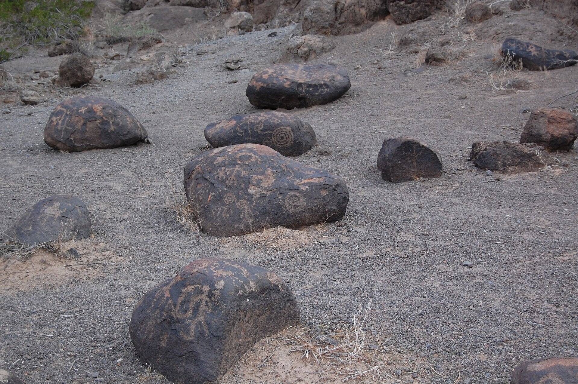
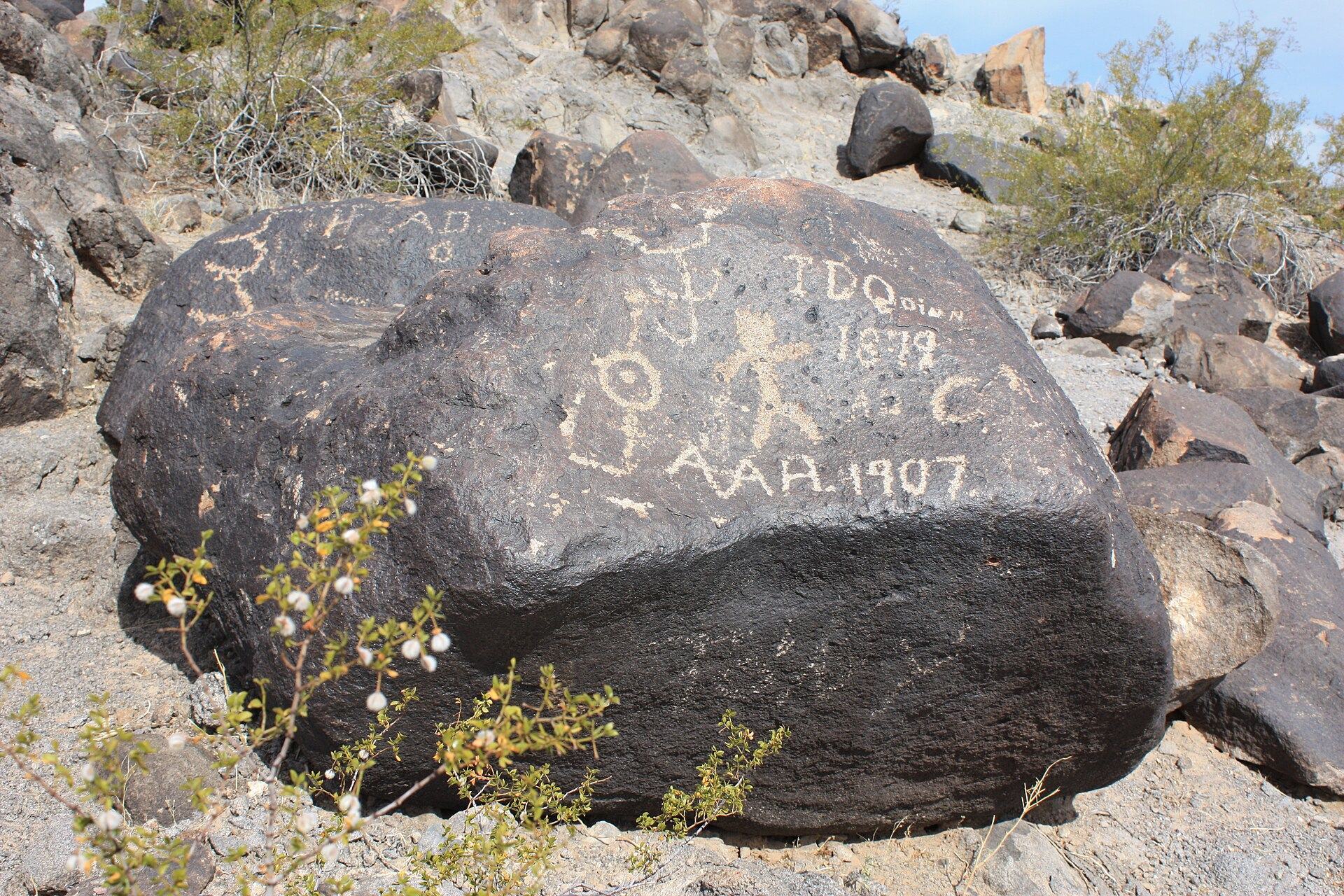
More than forty petroglyph sites have been recorded in the surrounding area, but Painted Rock is the largest known, with about 800 ancient images. Its position near historic travel routes brought later visitors through the landscape. Juan Bautista de Anza’s expedition of 1775–1776 passed nearby, followed by the Mormon Battalion, a United States Army unit formed during the Mexican–American War, and the Butterfield Overland Mail, a nineteenth-century stagecoach service linking the eastern United States with California. Historic travelers added inscriptions among the earlier Indigenous carvings.
During World War II, General George Patton used the area as a headquarters for tank training. The site later formed part of Painted Rock State Park. In 1989, Arizona transferred control of the park to the Bureau of Land Management, the federal agency that administers extensive areas of public land and helps protect archaeological resources. The nearby reservoir camping area, known as the Lake Unit, was then closed because of concerns about pollution in the Gila River and was not maintained by the Bureau.
Protection and conservation
Painted Rock was added to the National Register of Historic Places in 1977. This register is the United States’ official list of places considered important in national, state, or local history. The Bureau of Land Management operates and maintains the site, which is also classified as an Area of Critical Environmental Concern.
In the 1990s, the Bureau removed a large fence around the rock formation and replaced it with signs. Before that change, visitors climbed on the rocks and some stones were stolen. Vandalism declined after 2000 but continued on many rocks. Natural weathering, vandalism, tourism, and the expansion and population growth of Phoenix continue to threaten the carvings. Archaeology Southwest has undertaken conservation projects and is working toward national-monument designation for the wider Great Gila River Bend, partly to support a fuller inventory of archaeological sites and landmarks.
Remains
The site centers on an east–west-oriented granite outcrop overlain by weathered basalt boulders. The outcrop forms an oval about 400 feet (120 m) long and about 20 feet (6 m) high, with two small knob-like tops. Most of the carved boulders are concentrated along its eastern edge, although their marked surfaces face in all directions from that edge.
Basalt carvings
Petroglyphs are images made by abrading a rock surface, and at Painted Rock they were produced by pecking the basalt. About 800 ancient images survive on the boulders, together with later inscriptions left by historic travelers. The carvings occupy a naturally weathered formation whose materials and arrangement preserve the relationship between the granite outcrop and the basalt stones lying over it.
Regional imagery
Comparable petroglyphs occur about 15 miles, or approximately 20 kilometers, up the Gila River in the Gila Bend Mountains. They include standing stick figures with long, wavy headdresses and solid circles at the centers of their bodies. This combination is described as uncommon elsewhere in the American Southwest and provides a regional point of comparison for the imagery associated with Painted Rock.
Weathering and present condition
Wind and water are the main natural forces weathering the rocks. The hot, arid setting limits lichen growth, while calcium carbonate has been found at the bases of some rocks below the petroglyphs. This material may result from erosion caused by foot traffic and could accelerate deterioration if it accumulates in greater quantities. The stable basaltic cliff-side setting and the difficulty of reaching some areas provide a measure of natural shelter for the carvings.
Public interpretation and management features
The managed site includes a walking trail, paved roads, parking areas, informational signs, maintained campsites, and eating areas. These features support public interpretation while the Bureau of Land Management oversees the archaeological landscape and its protection.