Caral-Supe: A Monumental Urban Center of the Caral Civilization
Site at a Glance
- Rating
- 4.6
- Popularity
- Medium
- Country
- Peru
- Primary era
- Stone Age
- External website
- Open
- Eras represented
- Stone Age
- Civilizations
- Caral–Supe
- Site type
- City
On this page14 sections
History
Caral-Supe is the principal urban center of the Caral civilization in Barranca, Peru. This preceramic Andean civilization developed in the Supe Valley during the Late Archaic and early Formative periods, approximately 3000 to 1800 BC. Caral is about 5,000 years old and is considered the oldest known city in the Americas with such a varied combination of monumental buildings, ceremonial spaces, and administrative functions, although its priority over sites such as Bandurria remains debated.
Origins and development
Radiocarbon dating estimates the main construction period at approximately 2600 to 2000 BC. Radiocarbon dating measures the decay of radioactive carbon in organic material, and at Caral the most useful samples included reeds and woven carrying bags that had been used to transport stones before being incorporated into construction fills. The settlement grew through successive remodeling and rebuilding over nearly a millennium.
The archaeological sequence begins with an initial settlement around 5000 BC. Large-scale construction followed around 3000 to 2600 BC, while general remodeling and the addition of circular plazas took place around 2600 to 2300 BC. Public buildings expanded between approximately 2300 and 2200 BC. The settlement began to decline around 2200 to 2100 BC as Era de Pando expanded in the lower valley, and its buildings were gradually abandoned and buried between approximately 2100 and 1800 BC.
The reason for the abandonment is unknown. Earthquakes and El Niño, a periodic change in Pacific Ocean temperatures and atmospheric circulation that can affect water supplies, agriculture, flooding, and settlement stability, have been proposed as possible factors. Caral formed the most extensive and architecturally monumental settlement within a network of major Supe Valley centers, including Áspero, Miraya, Lurihuasi, Chupacigarro, Allpacoto, Pueblo Nuevo, Cerro Colorado, and Llapta. It probably held a pre-eminent position in this regional system.
Society, exchange, and belief
Caral probably housed between 1,000 and 3,000 people, while the wider Supe Valley may have supported about 20,000. Society was strongly differentiated, with governing and religious authorities, specialists, and a larger population involved in farming, fishing, building, and other manual work. Religious and administrative institutions appear to have coordinated production, the movement of goods, and the wider population. Rituals took place in public spaces, temples, and residential areas and included offerings, hearths, ceremonial gatherings, and repeated renovation of monumental buildings.
The settlement probably functioned as an economic capital for a broad region. Agricultural goods were exchanged with coastal fishing communities and other populations, while the abundance of marine remains at Caral indicates sustained contact with the Pacific coast, approximately 20 kilometers away. Áspero, near the mouth of the Supe River, was probably Caral’s fishing settlement or port. Human remains associated with sacrifices, including two children and a newborn, were found there, and the remains of a woman thought to have belonged to the local elite were discovered at Áspero in 2016.
No clear evidence of weapons, fortifications, organized armies, or warfare has been identified at Caral. Its regional influence may instead have been exercised peacefully for approximately 500 to 1,000 years, although this interpretation depends on the archaeological evidence. The Caral tradition is regarded as a major foundation of Andean civilization because it brought together early forms of centralized government, reciprocal exchange, ceremonial calendrical activity, monumental temple construction, and organized urban life.
Caral is generally described as preceramic, or aceramic, because no developed pottery tradition has been identified. Its inhabitants nevertheless made small anthropomorphic clay figures, shaped as male and female bodies, that were dried in the sun. These figures were probably used in rituals connected with building renovation and fertility.
Rediscovery and protection
Archaeological attention to the Supe Valley began with Max Uhle’s investigation of Áspero in 1905 and Julio C. Tello’s work there in 1937. Neither recognized Caral. Paul Kosok and Richard Schaedel visited the site in 1949, when it was known as Chupacigarro, and Kosok identified it as potentially very ancient without establishing its date. Carlos Williams recorded it as Chupacigarro Grande during his 1975 survey and used it in studies of Andean architectural development. Frederic Engel excavated and mapped the site in 1979 and proposed that it predated pottery in the Andes.
Ruth Shady returned to the Supe Valley in 1994 and identified eighteen settlements with related architectural characteristics. She distinguished Caral from Chupacigarro, Miraya, and Lurihuasi by using the names of nearby settlements. Excavations directed by Shady began at Caral in 1996, and she presented the results in 1997. Intensive excavation subsequently established the site’s preceramic antiquity. The Caral-Supe Archaeological Project has continued research and restoration at Caral and at contemporary settlements in the Supe and Huaura valleys.
UNESCO inscribed the site as the Sacred City of Caral-Supe on 28 June 2009. The World Heritage designation recognizes its antiquity, monumental architecture, urban design, extent, and combination of pyramids and plazas. The protected area covers approximately 626 hectares. In 2021, housing construction encroached on the archaeological area amid tensions between archaeologists and people claiming land rights, creating a modern threat to the site’s protection.
Remains
Caral occupies approximately 66 hectares in the Supe Valley, about 23 kilometers from the Pacific coast and at an elevation of roughly 350 to 359 meters. The site lies within a fertile, geographically defined section of the valley about 10 kilometers long, bounded by hills that constrict it toward the east and west. Its remains consist of a central or nuclear zone and a peripheral zone. The central zone contains 32 public structures and several residential complexes, while groups of houses occupy the valley margins.
Urban layout and construction
The central zone is divided into Caral Alto to the north and Caral Bajo to the south. Caral Alto contains the largest public and residential buildings, monumental pyramids, two sunken circular plazas, the Central Plaza, the Plazuela de la Huanca, officials’ residences, and a large residential complex for specialists and servants. Caral Bajo contains smaller public buildings, including the Amphitheater complex and the Circular Altar building.
Residential buildings served several purposes. They included multifaceted residential complexes, officials’ residences attached to public buildings, workshops, and peripheral housing groups. Named areas include the Major Residential Complex in Sector A, the Minor Residential Complex in Sector NN2, the Peripheral Residential Sector in Sector X, and Residential Subcomplex D1 in Sector D. Attached units include B1, B2, and B5 beside the Quarry Pyramid, Elite Residential Complex I2 beside the Huanca Pyramid, Residential Sector H2 beside the Gallery Pyramid, and Residential Unit Q1 beside the Circular Altar building.
The builders used shicras, plant-fiber bags filled with stones, to form the cores and platforms of temples. Their loosely packed construction allowed stone-filled foundations to move slightly during earthquakes and settle into a stable position. Reeds and woven carrying bags used to transport stones were also placed in construction fills. Pyramid walls were covered with mud plaster and painted white or pale yellow, with occasional red paint. Each pyramid was associated with a circular enclosure.
Monumental buildings
Caral Alto pyramids
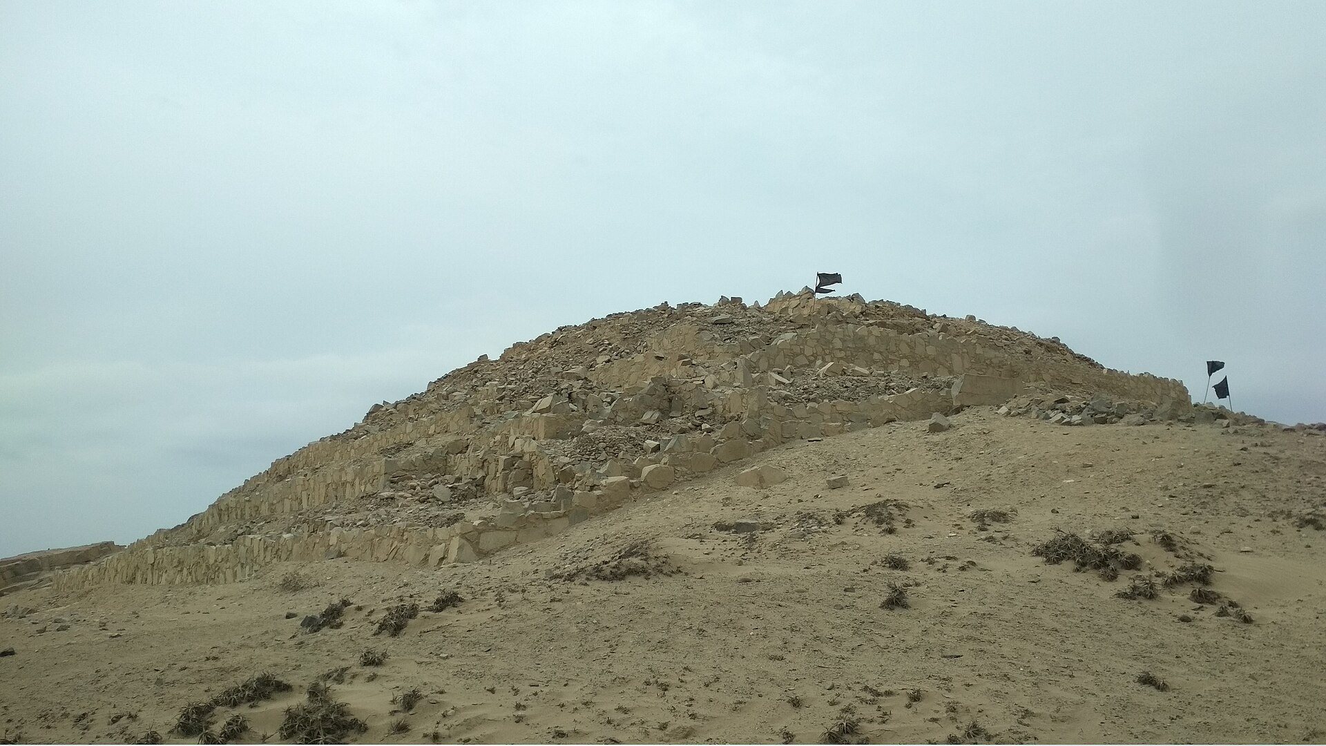
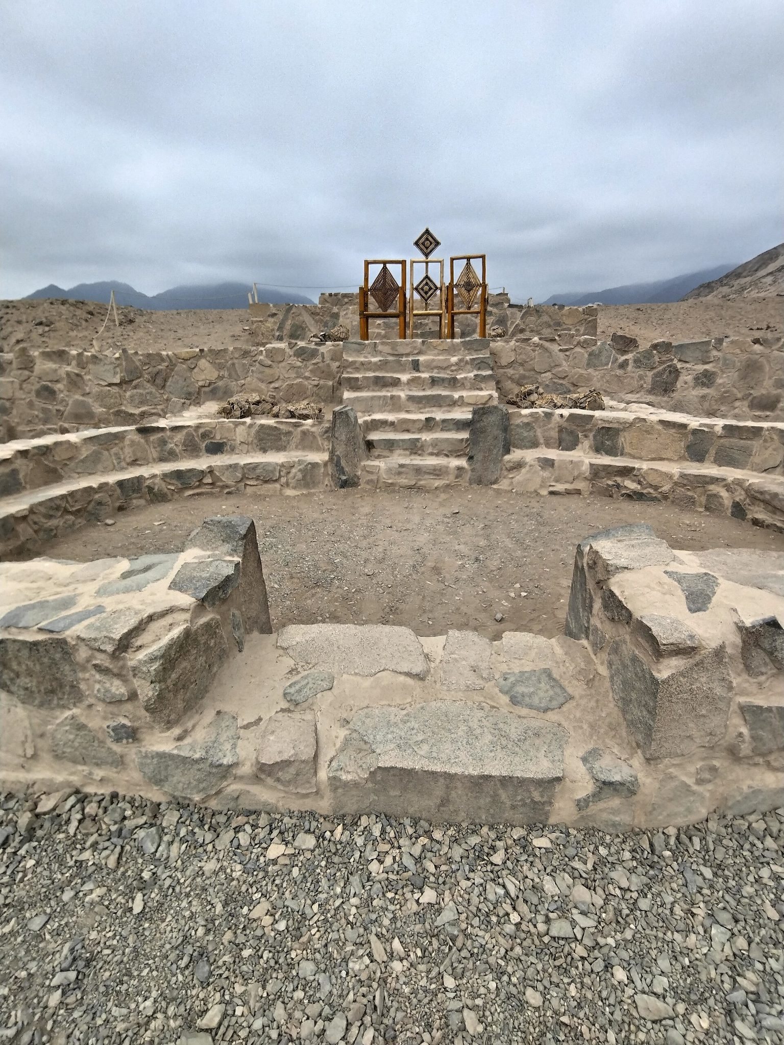
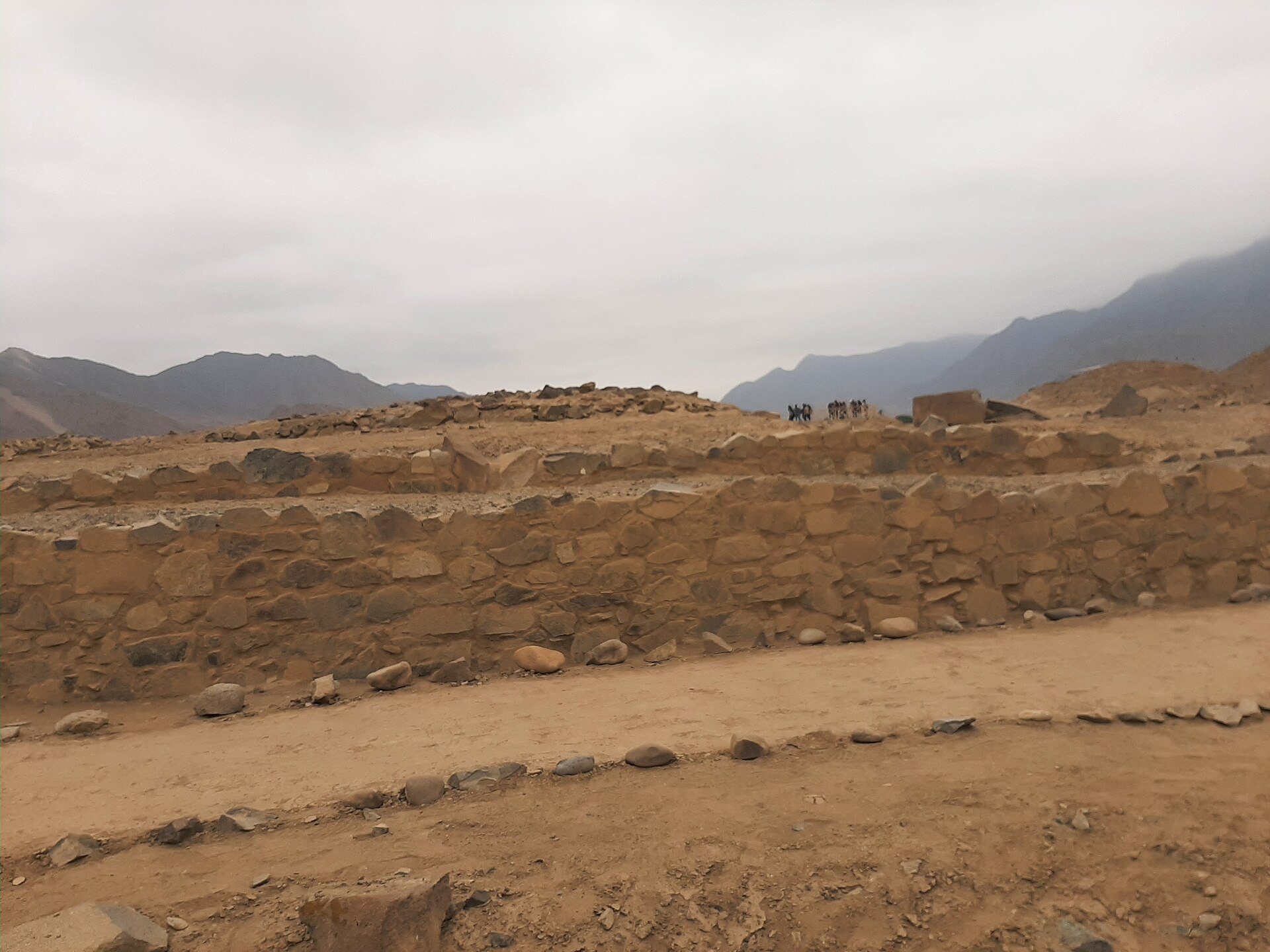
The Great Pyramid, also called the Major Pyramidal Building in Sector E, is the largest structure at Caral. It measures approximately 150 meters long, 110 meters wide, and 28 meters high. It overlooks the Central Plaza, which was probably used for fairs or other large gatherings, and forms part of a complex with a sunken circular plaza and stepped platforms. The Quarry Pyramid in Sector B stands on a rocky prominence formerly used as a quarry. Its summit contains a circular altar with a large hearth and underground ducts.
The Lesser Pyramid in Sector G originally had its principal staircase on the north side, but the staircase was later moved to the west. The Central Pyramid in Sector C rises about 18 meters west of the Central Plaza, with a ritual plaza beside it. The Gallery Pyramid in Sector H stands at the eastern end of the city and contains a subterranean gallery on its summit. These pyramids had flat upper platforms rather than pointed summits. A central staircase led to upper rooms, where low platforms bordered the principal room and a hearth occupied a mud-lined depression in the floor.
Caral Bajo complexes
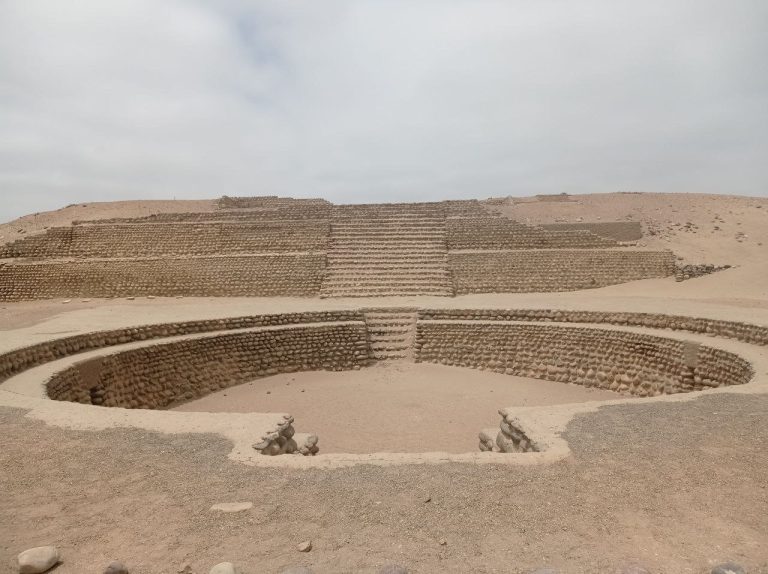
The Amphitheater Temple in Sector L is a walled complex containing Caral’s largest sunken circular plaza. The plaza is approximately 29 meters in diameter and is shaped like an amphitheater. The complex is the most imposing structure in Caral Bajo. The Circular Altar building in Sector P contains another circular altar, with a hearth and underground ducts.
Other public buildings
The Banqueta Building in Sector N is a smaller temple that was modified during several periods. The Special Buildings in Subsector E2-E3 began as two separate pyramidal buildings and were later converted into one structure. The Huanca Pyramid in Sector I has a monolith known as the Huanca set into the ground in front of its facade. The stone is approximately 2.15 meters high.
Objects and evidence of intellectual life
Recording, textiles, and figurines
A textile fragment from the Gallery Pyramid has been interpreted as a quipu, a recording device made from cords and knots. Representations of quipus also appear on three stone blocks forming part of the Lesser Pyramid’s platforms. Cotton seeds and fibers show that people produced plain garments, footwear, bags, cords, ropes, and fishing nets from naturally brown, dark brown, cream, and beige cotton. They also used reeds, rushes, and agave fibers with interlacing and twisting techniques.
Fragmented anthropomorphic clay figurines depict male and female figures. Their proposed association with building-renewal rituals and fertility practices gives them a place in the interpretation of Caral’s ceremonies. They also preserve information about clothing, headdresses, and hairstyles.
Musical instruments
Three groups of wind instruments were found at the site. They include 38 cornets made from guanaco and deer bone, 32 transverse flutes made from condor and pelican bone with animal designs, and four reed panpipes bound with cotton thread. The transverse flutes were radiocarbon dated to approximately 2170 ± 90 BC.
Astronomical features and the geoglyph
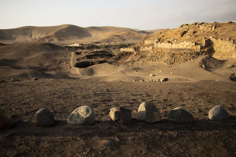
Evidence of astronomical knowledge includes geoglyphs, lines, scattered carved stones, a subterranean structure that may have been an observatory, and the Huanca monolith in a public plaza. Such knowledge may have influenced the ceremonial calendar and the orientation of public buildings. In 2000, a geoglyph was found on the desert floor west of the principal site among circular lines of stones. It depicts a human face with long hair and an open mouth. Its precise meaning is unknown, although it is considered approximately contemporary with Caral and may have been associated with the nearby ceremonial site of Chupacigarro.
Caral’s main buildings are now archaeological ruins, while excavation and restoration have exposed its monumental architecture, residential remains, plazas, altars, installations, and associated artifacts.