Bandurria, Peru: A Late Preceramic Monumental Center
Site at a Glance
- Rating
- 4.6
- Popularity
- Low
- Country
- Peru
- Primary era
- Bronze Age
- External website
- Open
- Eras represented
- Bronze Age
- Civilizations
- Caral–Supe
- Site type
- City
On this page11 sections
History
Bandurria is a Late Preceramic archaeological complex at Playa Chica, south of Huacho, Peru, built by coastal communities during the fourth to third millennia BCE. The Late Preceramic, also called the Late Archaic, was a period before widespread pottery when large settlements, social differences, and ceremonial architecture developed in the central Andes. Dates place Bandurria around 3200 BCE, while its abandonment belongs to the second millennium BCE.
A Coastal Settlement in the Late Preceramic Period
Bandurria began as an early coastal fishing settlement and later developed monumental stone architecture. Rosa Fung investigated the site in 1973 and 1977, establishing its Late Preceramic chronology and identifying a small ceremonial stone structure among its remains. Her initial interpretation described Bandurria as a village.
The settlement’s inhabitants are described as organizing their society around the ayllu, a kin-based social unit whose members shared obligations, labor, and reciprocal ties. Agriculture, fishing, and craft production formed part of everyday life. The social system also included differentiated education for governing groups and for the wider population.
Flooding, Destruction, and Reinterpretation
Before 1973, the surrounding desert plain was known as Pampas de las Bandurrias. Its name referred to the buff-necked ibis associated with the nearby coastal wetlands. Irrigation water from the Santa Rosa project flooded the area that year, damaging part of the settlement and exposing funerary bundles and other archaeological material. Engineer Domingo Torero Fernández de Córdova and his father, Domingo Torero Arrieta, alerted the authorities and recovered disturbed remains.
Investigations at Caral from 1994, directed by Ruth Shady, helped establish the Late Archaic chronology and importance of monumental settlements along Peru’s north-central coast. This work encouraged a broader reassessment of Bandurria and related sites. Research resumed in August 2005 through the Bandurria Archaeological Project, led by Alejandro Chu. The discovery of substantial monumental architecture changed the interpretation of Bandurria from a village to an urban center, probably connected with other monumental settlements associated with the early Caral civilization.
Protection and Continuing Damage
Systematic destruction affected Bandurria after the 1973 flooding. By 2002, the self-described José Olaya Artisanal Cooperative had occupied the southern part of the site with precarious houses and corrals while extracting reeds and other wetland vegetation. Following a complaint to Peru’s National Institute of Culture, the site was declared National Cultural Heritage on 29 October 2002. The declaration was corrected in 2004, after which the archaeological area was delimited. In 2005, the regional government declared archaeological work at Bandurria a matter of regional interest.
Preservation efforts included fencing the archaeological area with support from local businesses and institutions and installing signs. Students from the José Faustino Sánchez Carrión National University also contributed to site care. These measures followed extensive physical damage, especially in the southern sectors.
Remains
Bandurria covers approximately 54 hectares beside the Paraíso, or Playa Chica, Wetland. The archaeological complex is divided into a domestic sector of about 11 hectares and a monumental sector of about 20 hectares. Playa Chica forms a broad bay roughly 10 kilometers south of Huacho. Cerro Sanú rises to 282 meters above sea level southwest of the site, while nearby elevations and ravines contain other remains of pre-Hispanic occupation.
Wetland Setting and Domestic Sector
The adjacent wetland extends for up to 8 kilometers and varies from 100 meters to 2 kilometers in width. It covers about 440 hectares and consists of northern and southern water bodies reaching a maximum depth of 1.5 meters. The wetland contains 19 identified plant species, as many as 125 bird species, two fish species, and one reptile species. Migratory birds use it as a resting and feeding area, placing the settlement within a varied coastal environment.
Residential Occupation
Sector I contains a dense occupation reaching as much as 5 meters below the surface. Residential structures made from perishable materials stood alongside food remains and deposits linked to daily activities. Irrigation-water infiltration destroyed approximately two-thirds of this sector. The southern area has also been affected by reed gathering and remains physically altered by later houses and corrals.
Monumental Architecture
Artificial Mounds and Platforms
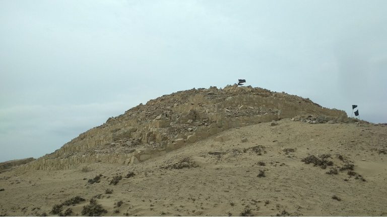
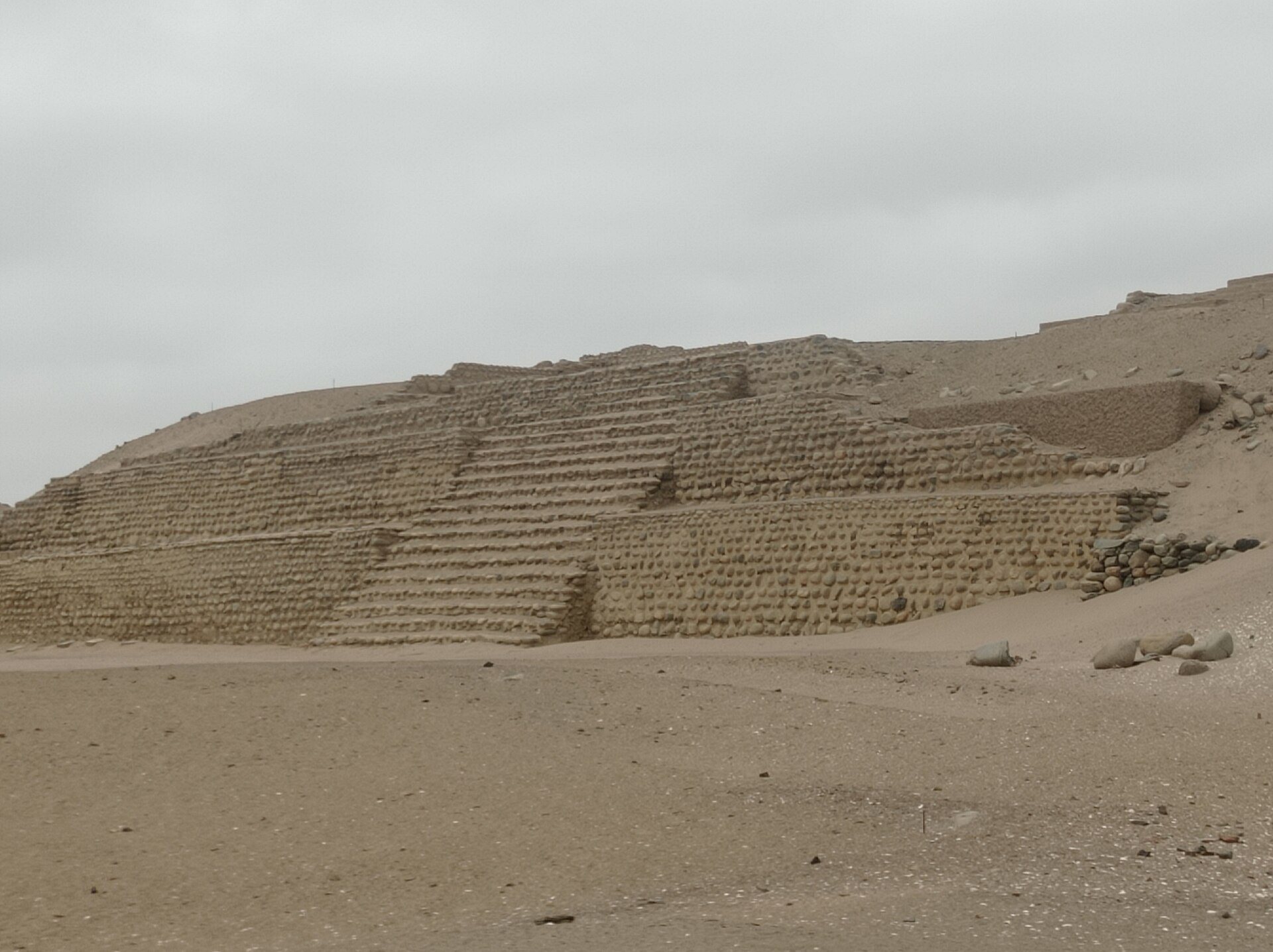
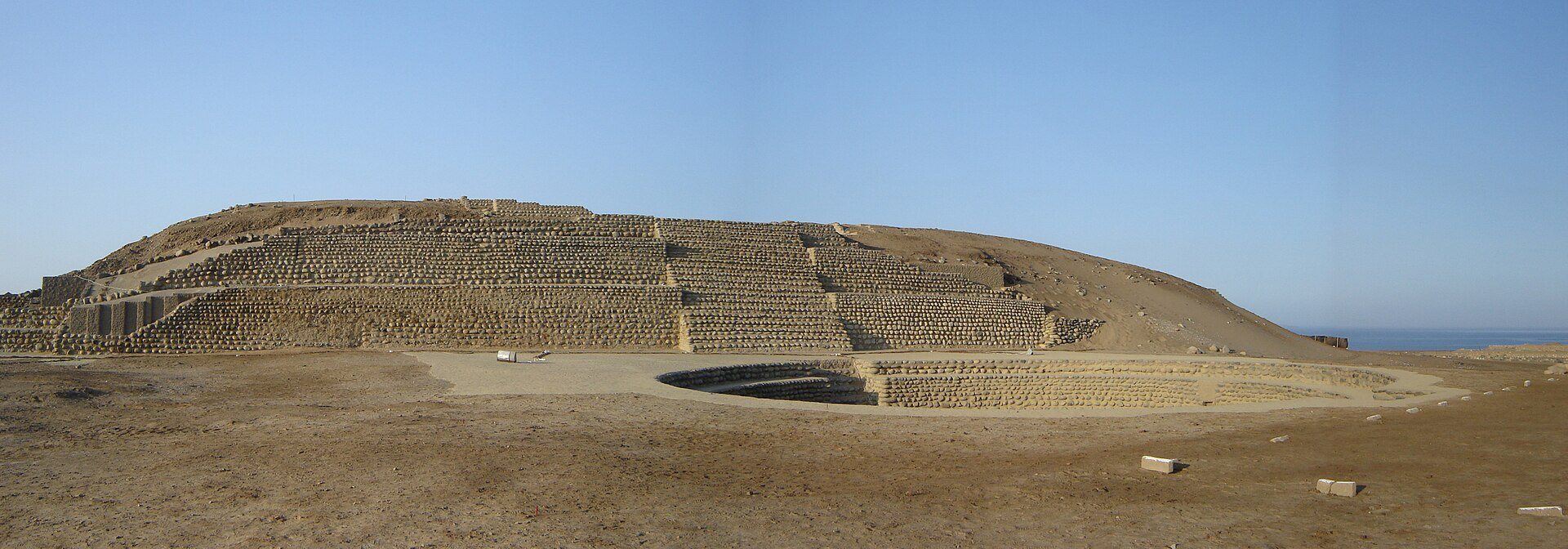
Sector II initially appeared to consist of low natural rocky hills, but surface examination revealed an artificial complex with at least four major mounds and associated smaller mounds. The principal mounds average 10 to 15 meters in height. Their regular sides and consistent slopes indicate underlying structures. Terraces and projecting platforms interrupt some slopes, probably forming stepped facades and platforms attached to the mounds.
Plazas and Stone Structures
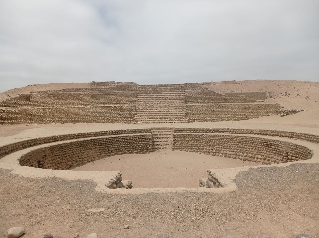
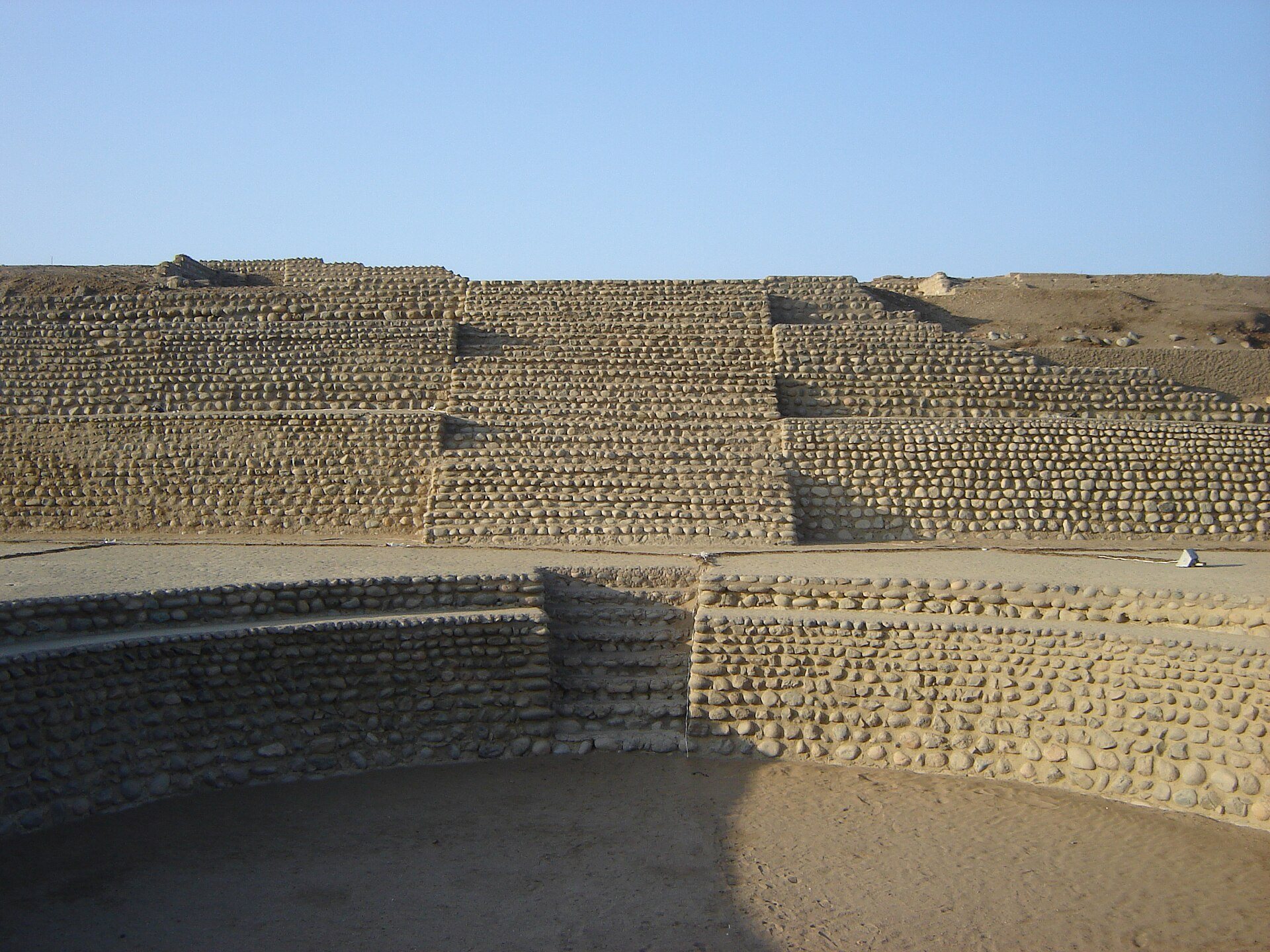
Excavations in 2005 exposed monumental construction made from cobbles or boulders set with mortar. The complex includes a sunken circular plaza, a ceremonial open space excavated below the surrounding ground level, as well as pyramidal structures, stairways, and other buildings arranged symmetrically. A small stone structure at the southwestern end provides early evidence of ceremonial stone architecture.
Open Spaces and Associated Walls
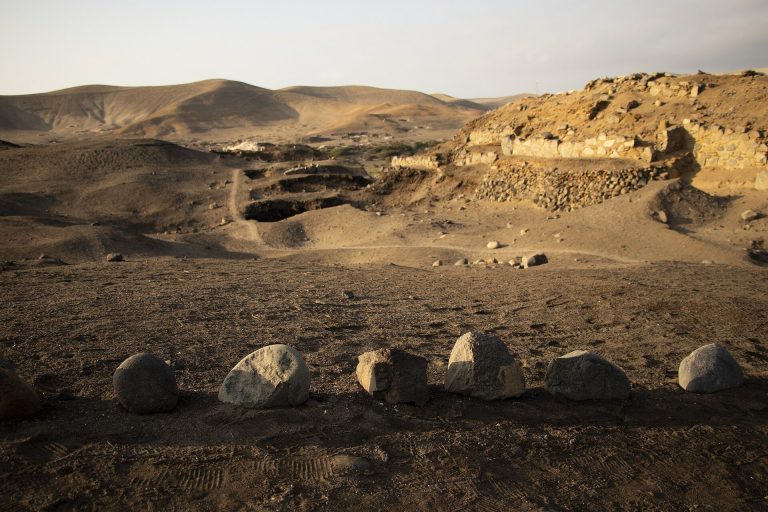
Ash deposits and shell middens occupy level open areas around the monumental mounds. Small stone alignments beside these deposits probably represent exposed walls. They may belong to habitation areas, including possible elite residences, associated with the pyramids and other monumental buildings. Together, the mounds, platforms, plaza, stairways, open areas, and wall alignments define a complex settlement that extended beyond a simple residential village.