Ordu-Baliq: Imperial Capital of the Uyghur Khaganate
Site at a Glance
- Rating
- 4.6
- Popularity
- Very Low
- Country
- Mongolia
- Primary era
- Medieval
- Eras represented
- Medieval
- Civilizations
- Unclassified
- Site type
- City
On this page14 sections
History
Ordu-Baliq was the imperial capital of the Uyghur Khaganate on the western bank of the Orkhon River in Arkhangai Province, Mongolia. Built by the Uyghurs in the eighth century, with its construction traditionally dated to 751 during the reign of Kutlug Bilge Kul Khan, the city became a major political, commercial, and cultural center of the Uyghur state.
Foundation and imperial capital
In 744, an alliance of Uyghurs, Karluks, and Basmyls defeated the last Göktürk khagan. The Uyghurs then established their capital on the site of the former Göktürk imperial capital. The city was also known as Mubalik and Karabalghasun, while its ruins are called Kharbalgas in Mongolian, meaning “black ruins.” Bayanchur Khan is associated with the establishment and development of the capital, whereas the tradition linking its construction to 751 belongs to the reign of Kutlug Bilge Kul Khan, also known as Peilo.
The Uyghur Khaganate was a powerful Inner Asian empire that ruled much of Mongolia during the eighth and ninth centuries. At its height, its territory extended from the Altai Mountains to the Khingan Mountains and from the Gobi to the Sayan Mountains. Ordu-Baliq flourished for roughly a century within this political sphere. Its development was supported by relations with neighboring states and by the employment of Sogdian and Chinese craftsmen, whose skills contributed to the city’s construction and material culture.
Life and destruction
In 821, the Samanid ambassador Tamim ibn Bahr visited the Uyghur capital. He described a large, densely settled, and wealthy city surrounded by closely spaced cultivated villages. He also noted its markets and numerous trades, and reported that Manichaeism, a religion centered on a cosmic struggle between light and darkness, predominated among the inhabitants.
The conflict with the Yenisei Kyrgyz began around 820 under their ruler Ajo. Internal unrest, including a rebellion associated with the Uyghur general Külüg, weakened the city’s position. Ajo received support from Baga Tarqan, a royal adviser and distant relative who favored China. In 840, the Yenisei Kyrgyz captured and destroyed Ordu-Baliq, and the Uyghur khagan was killed during the fighting.
The city may later have been reused by the Khitans, the Inner Asian people who established the Liao dynasty in northern China and neighboring regions. Evidence for reuse during the reign of Ögedei Khan remains uncertain and ambiguous.
Rediscovery and archaeological investigation
The Russian traveler Paderin was the first recorded modern visitor to the ruins, in 1871. Nikolay Yadrintsev investigated the site in 1889, followed by two Finnish Finno-Ugric Society expeditions in 1890 and an expedition led by Friedrich Wilhelm Radloff for the Russian Academy of Sciences in 1891. Their work established that the ruins belonged to a Uyghur capital rather than to the later Mongol capital of Karakorum.
Yadrintsev examined a fragmented trilingual inscription in 1889 and removed two large fragments bearing Sogdian and Chinese writing to Saint Petersburg. Radloff spent twelve days at the site in 1891, preparing its first plan and investigating the inscriptions. D. Bukinich carried out eight test excavations in 1934. A Mongolian-Soviet expedition directed by S. V. Kiselev and Kh. Perlee worked there in 1948 and 1949, refining the plan and excavating the central part of the principal fortified enclosure.
D. Tsevendorj and Y. S. Khudyakov surveyed the ruins in 1976 and 1979, prepared a plan of the principal fortified complex, and collected mainly pottery. Their work contributed to the study of Ordu-Baliq ceramics and Uyghur cultural remains, including the discovery and investigation of the monument known as the Second Turkic Inscription of Kharbalgas.
A Mongolian-German Orkhon Expedition began work in 2007. Since 2009, the Orkhon Valley–Kharbalgas project has worked with the Archaeological Institute of the Mongolian Academy of Sciences. Aerial laser survey subsequently revised the estimated urban area from approximately 25 square kilometers to at least 32 square kilometers. The ruins form part of the Orkhon Valley Cultural Landscape, a UNESCO World Heritage Site.
Remains
Ordu-Baliq occupied at least 32 square kilometers in the grassy Talal-khain-dala steppe of Khotont sum, along an important east-west route across Mongolia and in a region favorable for pasturage. The urban area was organized into commercial, craft, residential, administrative, palatial, and religious zones. Its largest central sector was enclosed by a continuous wall, while temples and houses extended south of the center and the khan’s residential palace stood in the northeastern part of the city.
Fortifications and palace complex
Palace enclosure
The principal palace or temple complex measured approximately 360 by 404 meters. Double clay walls, about 10 meters high and separated by roughly 4 meters, enclosed the compound. Fourteen watchtowers strengthened the walls, with eight on the southern side and six on the northern side, and two main entrances provided access. Moats and additional earthen defensive platforms or towers surrounded the enclosure.
The complex contained buildings with elaborate decoration and architectural elements associated with Tang-period China. Excavations recovered Tang-period roof tiles and building ornaments, while the overall plan also incorporated architectural elements derived from elsewhere in Inner Asia.
Citadel
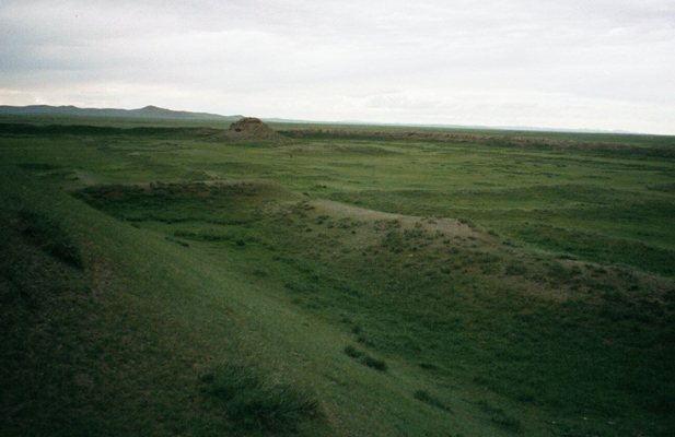
A separately fortified citadel occupied the southeastern corner of the complex. A citadel was the fortified part of a city used as a stronghold and center of political authority. The surviving structure rises to approximately 12 meters. A central stupa, a Buddhist commemorative or reliquary tower, reached about 14 meters. A golden tent or yurt reportedly stood on the citadel’s flat summit, where the khagan held court. Tamim ibn Bahr stated that it could accommodate about 100 people and could be seen from a considerable distance.
Religious building and inscriptions
The palace or temple complex included a walled religious building that apparently held images or objects of worship. In front of it stood inscribed stone monuments in Sogdian, Chinese, and Orkhon-Yenisei scripts. Sogdian was used by merchants and communities involved in long-distance exchange, while the Orkhon-Yenisei scripts were early Turkic runiform writing systems. The monuments honored Uyghur khagans, the supreme rulers of the Uyghur Khaganate.
Urban districts and material remains
Commercial and craft areas
Commercial and craft buildings were concentrated especially in the western and northwestern parts of the city. Excavations revealed metalworking remains, including flat bronze material, residues from bronze smelting, and other evidence associated with smithing. The wider urban remains include stables, military and commercial storage buildings, administrative structures, houses, temples, a monastery, and a water-drainage system.
Pottery and movable finds
Uyghur pottery from the site includes vessels of varied shapes, sizes, and functions. The vessels were made on a wheel from well-prepared, compact gray clay and fired evenly. Some carry horizontal lines, impressed grooves, interlaced patterns, or circular motifs, while others are undecorated. A Chinese coin dating to around 840 was also found at Ordu-Baliq.
Monument in the northeastern palace area
A green-granite monument with a dragon sculpture on top was discovered in the northeastern palace area. Its runic inscription glorifies the Uyghur khagans and forms part of the evidence for the political and commemorative functions of the palace district.
Preservation of the ruins
The fortified section remains relatively intact, while the western and southern districts have been severely damaged, particularly where later agricultural plowing disturbed the city’s cultural layers. The ruins preserve collapsed walls, towers, buildings, and other urban features associated with the destruction attributed to the Yenisei Kyrgyz conquest.