Corinth Canal: Greece’s Sea-Level Canal Across the Isthmus
Site at a Glance
- Rating
- 4.7
- Popularity
- Medium
- Country
- Greece
- Primary era
- Modern
- Eras represented
- Classical, Modern
- Civilizations
- Greek, Roman
- Site type
- Infrastructure
- Remains
- Canal
On this page11 sections
History
The Corinth Canal is a sea-level waterway in Greece, cut through the Isthmus of Corinth and completed in 1893 during the modern era of industrial canal construction. It connects the Gulf of Corinth, an inlet of the Ionian Sea, with the Saronic Gulf, an inlet of the Aegean Sea, separating the Peloponnese from mainland Greece and shortening the maritime route around the peninsula by about 700 kilometres.
Ancient canal schemes
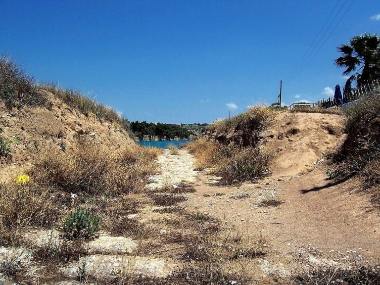
The idea of cutting through the isthmus reaches back to the seventh century BC. Periander, the tyrant of Corinth traditionally associated with the first scheme, considered a navigable canal but abandoned the plan. Its enormous cost, the possible shortage of labour, and the fear that a canal might weaken Corinth’s position as a commercial entrepôt may all have influenced the decision. Instead, he built the Diolkos, a stone trackway that allowed ships to be hauled overland across the isthmus at lower expense.
Demetrius Poliorcetes, a Hellenistic ruler and military commander, revived the idea in the late fourth century BC to improve communications. His surveyors incorrectly calculated the levels of the adjacent seas, and the project was abandoned because of fears that a canal would cause catastrophic flooding. Julius Caesar later considered a similar undertaking. In AD 40, Caligula commissioned a study that wrongly concluded that the Corinthian Gulf stood higher than the Saronic Gulf and that excavation would flood the island of Aegina. Neither Roman plan proceeded.
Nero’s excavation and later proposals
Emperor Nero made the first substantial attempt to excavate the canal in AD 67. About 6,000 Judean prisoners of war dug trenches from both sides of the isthmus, while another group drilled shafts to examine the rock. Work ended soon after Nero’s death, and his successor Galba terminated the costly project.
Herodes Atticus, a Greek philosopher and Roman senator, considered another canal in the second century AD. The Venetians also thought about the project after conquering the Peloponnese in 1687, but neither initiative led to substantial construction. The canal was additionally linked with a prophecy attributed to Apollonius of Tyana, a first-century Greek philosopher and religious teacher. According to the tradition, illness would befall anyone who proposed digging it.
The nineteenth-century project
After Greece gained independence from the Ottoman Empire in 1830, Ioannis Kapodistrias, the first governor and president of the new Greek state, commissioned a French engineer to assess the proposal. The estimated cost of 40 million gold francs was too high for the young country. Interest revived after the Suez Canal opened in 1869, and the government of Prime Minister Thrasyvoulos Zaimis authorized construction the following year.
A French company began the modern undertaking but went bankrupt after French banks refused further loans during the financial collapse of a company involved in the Panama Canal project. In 1881, the Société Internationale du Canal Maritime de Corinthe received a new concession to build and operate the waterway for 99 years. King George I of Greece formally inaugurated the construction on 23 April 1882. Hungarian engineers István Türr and Béla Gerster were associated with the canal’s design, and Türr later headed the company responsible for the work.
The project began with capital of 30 million francs. After eight years, the funds had been exhausted. An attempt to issue 60,000 bonds, each valued at 500 francs, failed when fewer than half were sold. Türr, the company, and the bank expected to provide further financing all went bankrupt. In 1890, responsibility passed to a Greek company, which completed the canal on 25 July 1893 after eleven years of work.
Traffic, instability, and war
The canal was designed to attract nearly 4 million net tons of annual traffic, but only about 500,000 net tons passed through in 1906. Traffic reached 1.5 million net tons in 1913 before falling sharply during the disruption caused by the First World War. Its economic role later remained limited because of the narrow channel, difficult navigation, landslides, and the increasing size of commercial ships during the twentieth century.
Although the canal formally opened in July 1893, landslides delayed navigation until November. Stabilization work on the walls caused a cumulative closure of four years between 1893 and 1940. In 1923, about 41,000 cubic metres of rock fell into the channel, requiring two years to remove. The canal’s unstable geology continued to shape its operation and maintenance.
During the Battle of Greece on 26 April 1941, German parachute and glider troops attacked the principal bridge over the canal. British and Anzac forces, the latter drawn from the Australian and New Zealand Army Corps, defended the crossing and had prepared it for demolition. German troops captured the bridge, but an explosion destroyed it. The blast has been attributed variously to British detonation of the prepared charges, artillery fire, or a rifle shot. A combined railway and road bridge later replaced it. Allied attempts to block the canal during the Axis occupation were unsuccessful.
In October 1944, retreating German forces made the canal unusable in a scorched-earth operation intended to hinder advancing forces. Explosives triggered landslides, bridges were destroyed, and locomotives, bridge wreckage, equipment, mines, and the steamship Vesta were dumped into the channel. More than 645,000 cubic metres of soil and debris blocked the canal, while silt accumulated during the period without maintenance.
Postwar clearance and present use
The United States Army Corps of Engineers began clearing the waterway in November 1947. Dredges, cranes, excavators, and other floating and land-based equipment removed the obstructions. The canal reopened to shallow-draft vessels on 7 July 1948 and to all vessels by September that year.
Its economic role has since declined, and it is used mainly by tourist and smaller recreational vessels. About 15,000 vessels pass through annually. On 9 October 2019, the cruise ship MS Braemar became the longest and widest vessel to transit the canal. Landslides continue to interrupt operations. Heavy rain caused a temporary halt in February 2018, and a major landslide closed the canal in early 2021. It reopened temporarily from June to October 2022 and reopened again on 1 June 2023 after additional safety measures.
Remains
Channel and geological setting
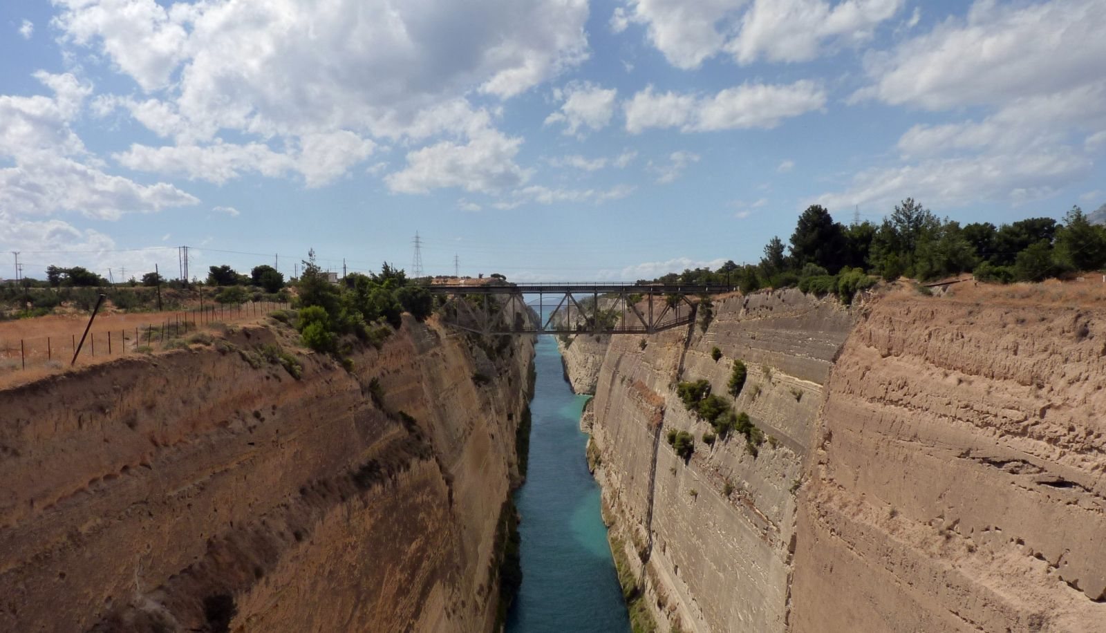
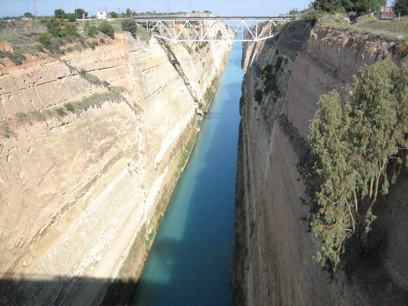
The Corinth Canal is approximately 6.34 kilometres long and was excavated to a depth of 8 metres. It is 24.6 metres wide at sea level and 21.3 metres wide at the bottom. Operational limits generally restrict vessels to a maximum beam, or width, of 17.6 metres and a draft, or depth below the waterline, of 7.3 metres. Because the channel was cut at sea level, it has no locks, which are chambers used to move vessels between different water levels.
The rock walls rise to about 90 metres above sea level and form near-vertical slopes of roughly 80 degrees. They consist mainly of limestone within heavily faulted sedimentary rock in an active seismic zone. This geological structure makes the sides unstable and prone to landslides. Ship wakes have also eroded the walls, so retaining walls were built along the water’s edge for more than half the canal’s length. These walls use approximately 165,000 cubic metres of masonry.
Bridges and crossings
Railway, road, and motorway bridges cross the canal at a height of about 45 metres. A railway bridge and three road bridges form part of these elevated crossings. Since 1988, submersible road bridges have also operated at sea level near the eastern harbour of Isthmia and the western harbour of Poseidonia, providing an additional crossing at each end of the channel.
Ancient and Roman traces
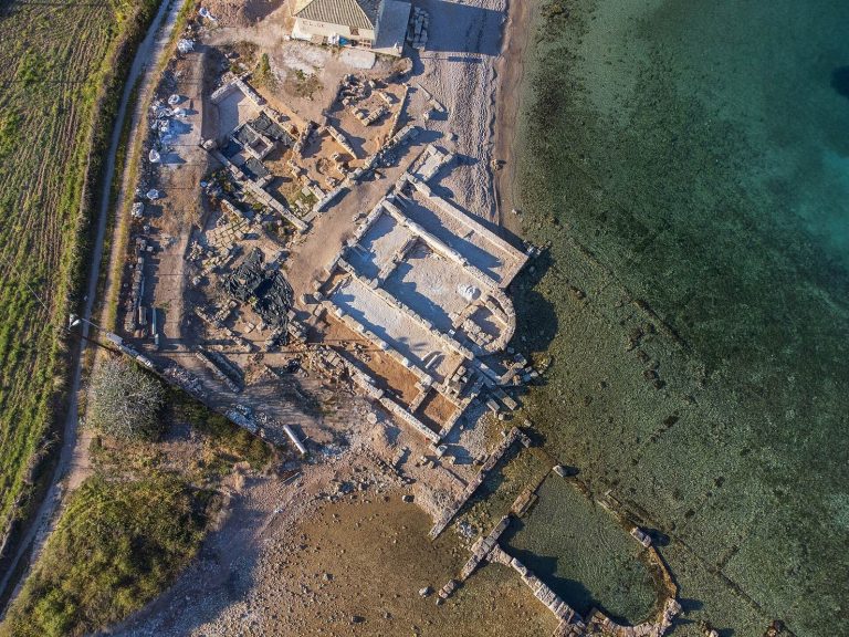
The surviving remains of the Diolkos stand beside the modern canal. This ancient stone transport trackway represents the practical alternative used to move ships overland across the isthmus before a navigable channel existed. The Roman excavation left a relief of Hercules as a memorial in the canal cutting. Since the modern waterway follows the same general course as Nero’s excavation, no other substantial remains of that Roman attempt survive.
Navigation conditions
The canal functions as a one-way waterway, allowing only one convoy to pass at a time. Larger vessels must be towed by tugboats, partly because their wakes threaten the unstable walls. The channel is too narrow and shallow for most large ocean-going ships, although the 22.5-metre-wide and 195-metre-long MS Braemar, carrying about 900 passengers, passed through in October 2019.
Its steep walls funnel wind along the channel, while differences in the timing of tides between the two gulfs produce strong tidal currents. These conditions combine with the canal’s limited width and shallow depth to make navigation difficult and restrict its use by larger vessels.