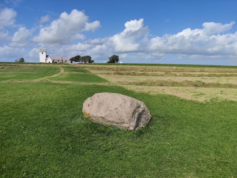
Fyrkat: A Viking Ring Fortress in Denmark
Site at a Glance
- Rating
- 4.4
- Popularity
- Very Low
- Country
- Denmark
- Primary era
- Medieval
- External website
- Open
- Eras represented
- Medieval
- Civilizations
- Danish
- Site type
- Military
- Remains
- Fort
On this page8 sections
History
Fyrkat is a former Viking ring fortress in Denmark, built around 980 near Hobro in Northern Jutland. Positioned on a narrow strip of land beside a stream and marshy ground, it may have helped control the main overland trading route between Aalborg and Aarhus. Its construction probably took place during the reign of Harald Gormsson, commonly known as Harald Bluetooth, or his son Sweyn Forkbeard, both Danish kings of the tenth and early eleventh centuries.
Foundation and Short Occupation
Fyrkat may have functioned as a barracks, a defensive stronghold, or a combination of both. Its exact relationship to royal authority remains uncertain, but its highly regular design links it with a group of fortresses built during the consolidation of the Danish realm. Tree-ring dating, which compares the annual growth rings of wooden remains with established sequences, places the construction of Trelleborg near Slagelse in spring 981. Fyrkat may be one or two years older, while Aggersborg may be slightly later.
The close similarity between Fyrkat and the other ring fortresses has led to the interpretation that they followed a single plan or may even have been created by one designer. Their association with the House of Knýtlinga, also called the Jelling dynasty, connects them with the royal family that included Harald Bluetooth and Sweyn Forkbeard.
Fyrkat appears to have remained in use for no more than about a decade, and possibly for less time. It seems to have been abandoned by around 1000 and was burned soon afterward. A cemetery beside the fortress contained about thirty identified burials of men, women, and children. The richness of the most elaborate grave indicates that the community included people with considerable wealth.
Excavation and Heritage
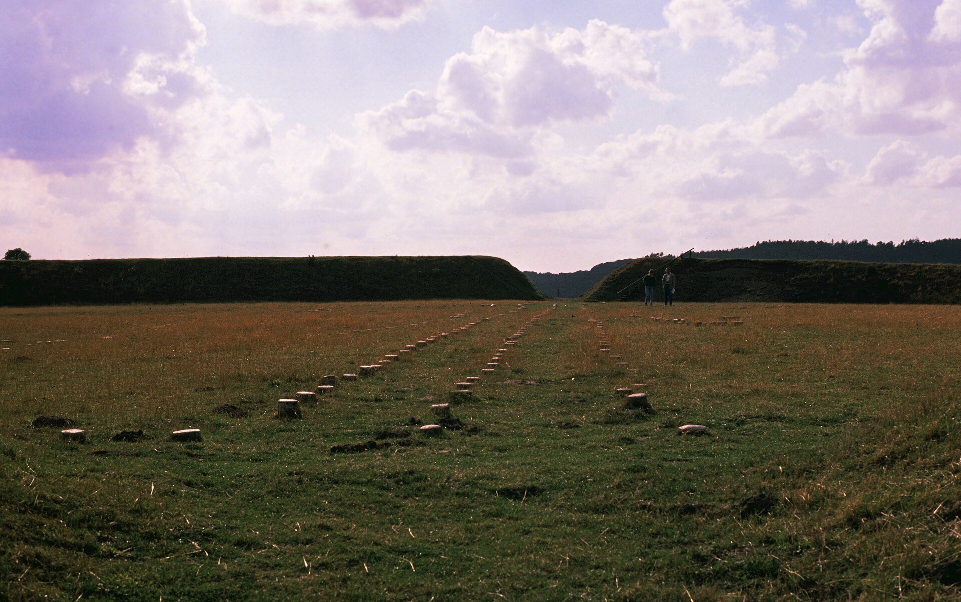
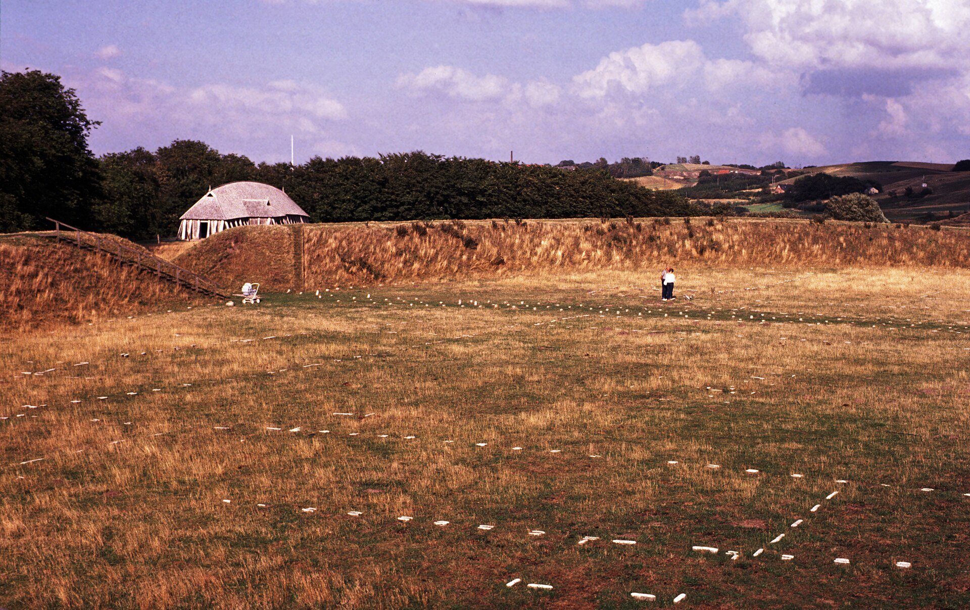
The architect and museum inspector C. G. Schultz excavated Fyrkat between 1950 and 1958. Ploughing had almost levelled the ramparts, so they were rebuilt during the archaeological work. Concrete was used to fill the postholes that marked the former roads and buildings, preserving their positions for interpretation.
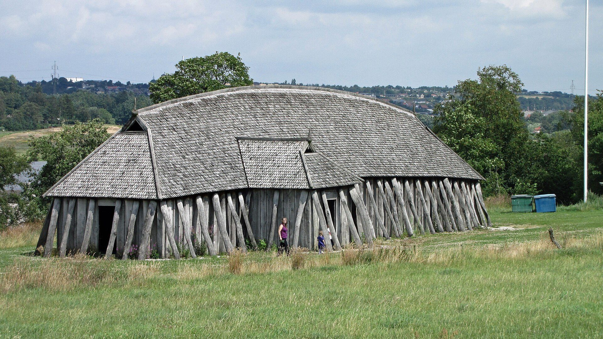
A longhouse was reconstructed outside the fortress beside the ramparts in 1985. In 1993, the Viking Center Fyrkat was established about one kilometre away as an educational reconstruction of a Viking settlement supplying the fortress. Its nine reconstructed buildings include a large longhouse, a smithy, a barn, and exhibition buildings. The designs were based on excavated examples from Vorbasse in southern Jutland.
In 2023, Fyrkat became part of the UNESCO World Heritage property Viking-Age Ring Fortresses, together with Aggersborg, Nonnebakken, Trelleborg, and Borgring. The inscription recognizes their distinctive architecture and their evidence for the strategic power of the House of Knýtlinga. The listed property covers 65.94 hectares and has a buffer zone of 3,278 hectares.
Remains
Fortress Layout and Defenses
Fyrkat was laid out as an exact circle with an inner diameter of 120 metres. Four gates stood opposite one another, and two wooden roads crossed at right angles at the precise centre. A circular road followed the inside of the ramparts. The four quarters each contained four identical longhouses arranged in a square around a smaller central house.
The ramparts were 12 to 13 metres wide at the base. Three rows of upright wooden posts were connected by beams, while the spaces between them were packed with approximately 10,000 cubic metres of turf. Horizontal planks formed the inner and outer wall surfaces. Slanting beams strengthened the outer row and probably supported a parapet. A plank walkway ran along the top, and the outer wall is estimated to have reached about four metres in height.
The northeastern quarter was protected by a ditch about 7 to 8 metres wide and less than two metres deep. Its pointed bottom was suited to a defensive barrier. The ditch on the western and southwestern sides was unfinished, while the stream and marshy ground protected the remaining sides. A structure outside the western gate may have served as a gatehouse.
Roads and Longhouses
The internal roads rested on three to five rows of short posts supporting lengthwise beams. Planks laid across the beams formed their surfaces. The circular road beside the ramparts was supported by two rows of beams. This road system connected the gates with the central crossing and organized access to the fortress quarters.
The sixteen identical longhouses were each 28.5 metres long. They were about five metres wide at the ends and 7.5 metres wide in the middle, with long walls that curved slightly outward. Double rows of posts supported walls made with horizontally inserted planks. Slanting exterior posts may have provided upper support or formed part of a cruck-like roof structure, in which curved or slanting members carry the roof.
The exact roof covering remains uncertain. Reeds, wooden shingles, and a plank construction resembling a ship’s structure are possible interpretations. Each building had a large central room about 18 metres long and a small enclosed room at either end. The end rooms may have served as pantries or storerooms. They had external doors and could also be entered from the central room, while doors near the ends of the central space opened diagonally towards small porches.
A large hearth occupied the middle of each longhouse, and broad raised benches along the outer walls served as sleeping platforms. At least two buildings contained smithies, or metalworking workshops, while gold was worked in two others. About one quarter of the excavated houses appear to have been used as warehouses, showing that the fortress accommodated several kinds of work and storage.
Cemetery
The cemetery lay northwest of the fortress and was reached by a wooden-planked road. Two lines of postholes crossed the burial ground and probably marked this route. The road ran parallel to one of the fortress axes and was probably constructed at the same time as the fortress. Its supports were denser near the main concentration of graves.
About thirty east-west-oriented inhumation graves, meaning burials in which the intact body was placed in the ground, were identified. They varied in preservation, and eighteen retained traces of coffins. The graves measured approximately 75 to 220 centimetres in length. Burial mounds may once have stood over some of them, although they have not survived.
Burial containers included coffins, a cart, and a chest. Ten graves contained grave goods, objects deliberately placed with the dead, while three contained objects that probably entered the graves accidentally. Finds included beads, other jewellery, household objects, textiles, and everyday items. One definite combat weapon was found, while a small axe may have had symbolic rather than practical meaning. Objects were often placed at chest level or inside boxes.
Grave 4 was the richest burial. It contained a woman accompanied by numerous ornaments and several foreign objects. Graves that combined coffins with grave goods clustered around a platform in the centre of the cemetery. Grave lengths below 150 centimetres were used to identify child burials. Axes were generally associated with male graves, boxes, keys, and brooches with female graves, and knives and whetstones with both.
The most valuable find was a piece of gold jewellery decorated with a bird’s head. Some burials used wagon-like containers comparable to those from Oseberg, a richly furnished Viking ship burial in Norway that also included wagon-related remains. Other individuals were placed in coffins. Most excavated cemetery objects are now housed at the museum in Hobro.
Reconstructed Buildings
The reconstructed longhouse outside the ramparts dates from 1985. The Viking Center Fyrkat, built about one kilometre from the fortress in 1993, presents a reconstructed settlement with nine buildings, including a large longhouse, a smithy, a barn, and exhibition buildings. These reconstructions draw on excavated buildings from Vorbasse and provide architectural comparisons for the remains within the ring fortress.