Fortifications of Chania: Defensive Walls and Strongpoints in Greece
Site at a Glance
- Rating
- 4.6
- Popularity
- Low
- Country
- Greece
- Primary era
- Early Modern
- External website
- Open
- Eras represented
- Medieval, Early Modern
- Civilizations
- Byzantine, Ottoman, Venetian
- Site type
- Military
- Remains
- Wall
On this page14 sections
History
The Fortifications of Chania are a defensive complex in Chania, Greece, developed around the ancient settlement of Cydonia from the Hellenistic period onward. The site combines inner and outer walls, gates, bastions, a harbor fortress, and other strongpoints that reflect the changing control of Crete from the ancient world through the Byzantine, Venetian, and Ottoman periods.
Cydonia and Byzantine Chania
Cydonia, an ancient city-state on the site of modern Chania, was enclosed by walls by about the 3rd century BC, during the Hellenistic period that followed the conquests of Alexander the Great. The Byzantine Empire, the eastern Roman Empire centered on Constantinople, reinforced the defenses during the 6th and 7th centuries. Some of these later walls used stone taken from the ruins of Cydonia and other destroyed buildings.
Saracens destroyed the city in 828. The Byzantines recovered Chania in 961 under Nikephoros Phokas, a Byzantine emperor and military commander who led the reconquest of Crete from Arab rule. They built a new fortress on Kastelli Hill to guard against another Arab invasion and strengthen Byzantine control of Crete and the Aegean region. Chania also became an episcopal seat, giving the Byzantine city an important religious and administrative role.
Venetian expansion
After the Fourth Crusade in 1204, Crete was assigned to Boniface of Montferrat, who sold the island to the Republic of Venice. Venice established its administrative center at Chania and initially occupied the Byzantine defenses on Kastelli Hill. As the settlement expanded beyond the hill, outer neighborhoods developed and new enclosing walls were decided upon in 1336. Construction was completed about two decades later, and the walls were later modified and heightened.
Under Venetian rule, Chania was officially known as La Canea and became the seat of a rector, the Venetian regional administrator. It also developed as an important commercial center for a fertile agricultural region. The city’s growth brought Greek-Byzantine and Italian-Renaissance cultural influences into contact.
The expansion of the Ottoman Empire led Venice to commission new defenses at Chania, Heraklion, and Rethymno. Work on Chania’s new fortifications began in 1536 to designs by Michele Sanmicheli, an Italian Renaissance military architect known for advanced artillery defenses. The project was completed in 1568. The fortifications and a fortress on the island of Thodorou cost 87,000 ducats in total.
Ottoman conquest and rule
By 1630, the city’s armament included 319 cannons, 30,695 cannonballs, and 413,274 pounds of gunpowder. These defenses were tested during the Cretan War, the conflict in which the Ottoman Empire conquered Crete from Venice between 1645 and 1669. Ottoman forces reached Crete on 23 June 1645, landed west of Chania, and besieged the city for 56 days. They captured it on 22 August after breaching the southwestern walls.
The Ottomans repaired the breach and later modernized and renovated the defenses. They converted several city churches into mosques, including the Dominican church of Saint Nicholas, which became the central mosque. An Ottoman bathhouse and other buildings were added, and Chania became the seat of a pashalik, an Ottoman administrative territory governed by a pasha. Ottoman control continued until November 1898.
Demolition and modern historical status
The Cretan State, an autonomous polity established on Crete under international oversight, demolished sections of the southern walls in the early 20th century because they restricted the city’s expansion. On 1 December 1913, the union of the Cretan State with Greece was celebrated at Firkas Fortress.
The fortifications are now partially intact. Sections of the Byzantine and Venetian walls survive alongside later defensive structures, while other parts were demolished during the 20th century. The complex is identified as a cultural monument.
Remains
Defensive layout
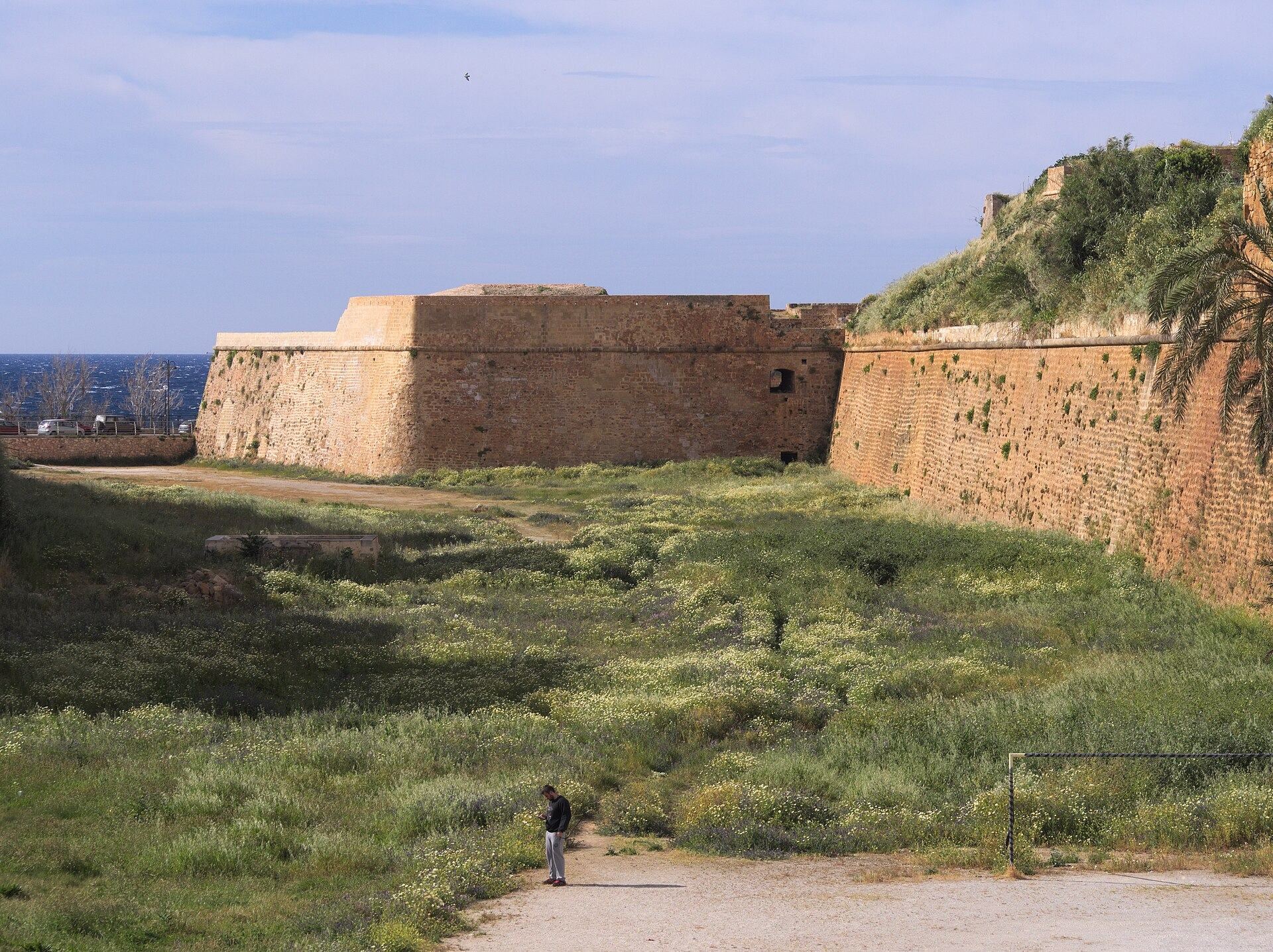
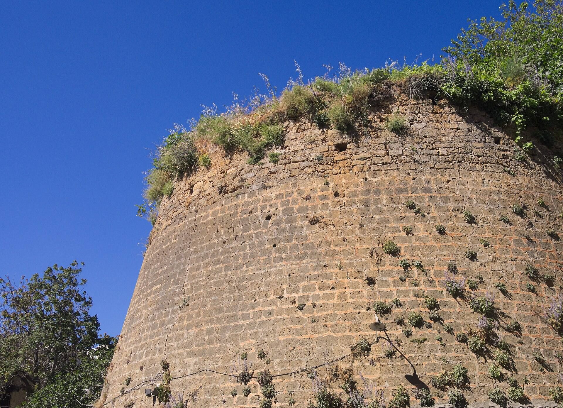
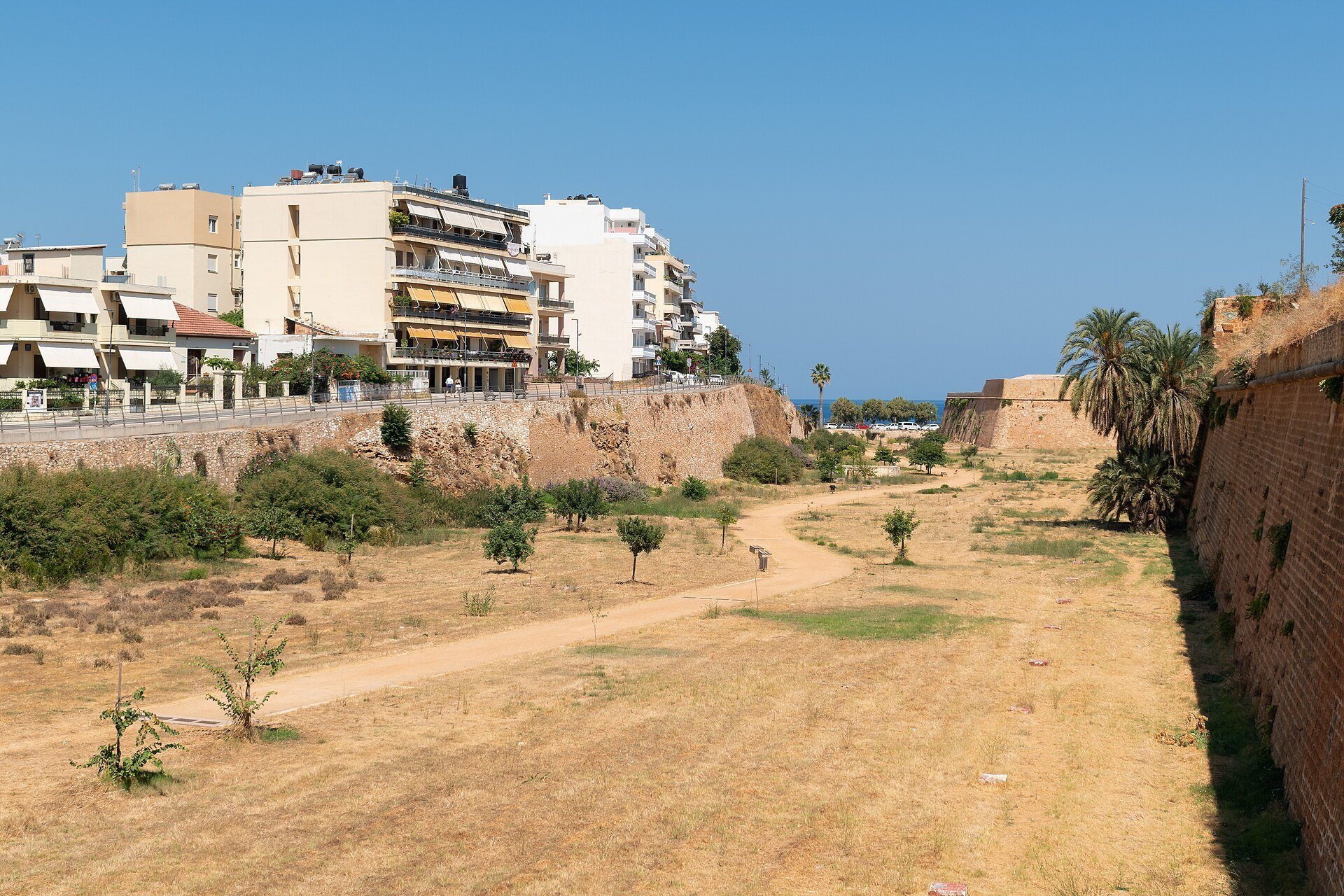
The defensive complex had an approximately square plan, with walls rising as high as 20 metres. Their faces sloped outward at about 20 degrees from the vertical, a design intended to make cannonballs ricochet. A ditch approximately 60 metres wide and 15 metres deep surrounded the walls. Seawater supplied the ditch around the Byzantine fortification, and the ditch remains visible on the western side, where the walls are best preserved.
The Venetian defenses included the ditch, a counterscarp, which is the outer slope facing the fortification, projecting bastions, and heart-shaped ramparts. The principal entrances were Porta San Salvatore on the west, Porta Retimiota or Rethymno Gate on the south toward Rethymno, and Porta Sabbionara or Sand Gate on the east. The eastern and western entrances were enclosed by square towers. The eastern gate stood at the junction of Kanavero and Daskalogiannis streets, while the western entrance was near Syntrevani Square.
Harbor and eastern defenses
Firkas Fortress
Firkas Fortress stands at the entrance to Chania harbor near San Salvatore Bastion. Its walls retain low-set gun openings directed toward enemy ships entering the harbor. The entrance lies on the southern side, where the Maritime Museum of Crete is located. During Venetian rule, Firkas contained the governor’s headquarters and barracks. The Ottomans continued these uses and also employed the fortifications as a prison.
Santa Lucia Bastion
Santa Lucia was a semicircular bastion built in 1568 and named after a church on Minoos Street. It covered the southern part of the eastern defenses beside the Sand Bastion. Its remains were buried in the 1930s during the construction of new streets.
Sand Bastion and Sand Gate
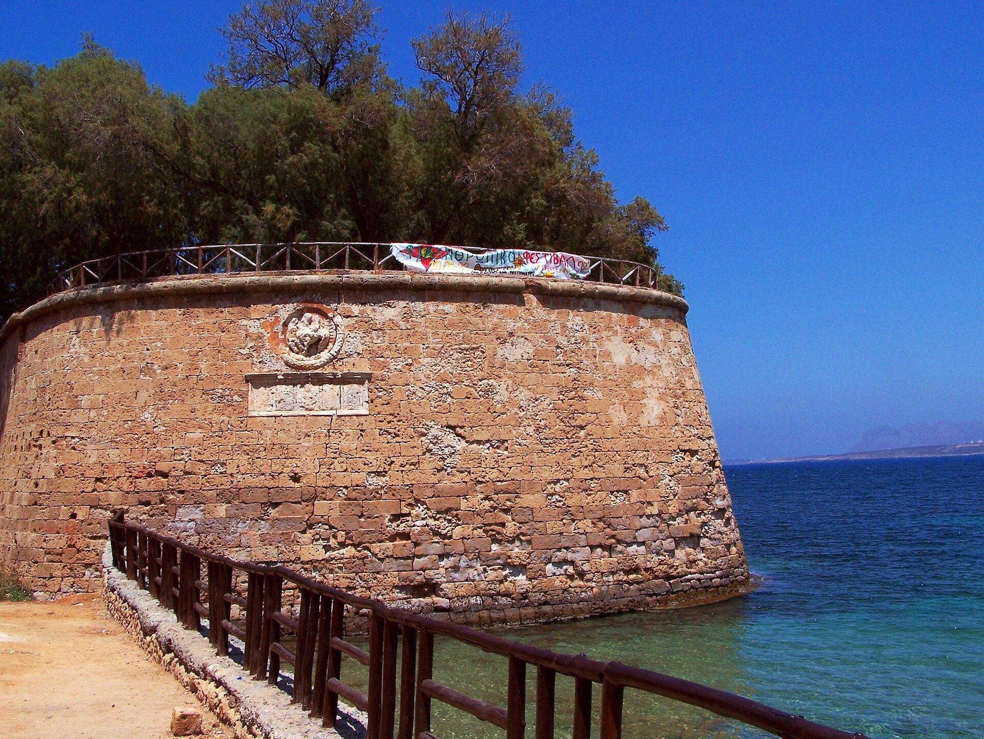
The Sand Bastion, also called Mocenigo or Sabbionara, formed the northeastern part of the defenses on an artificial peninsula created by the Venetians when they filled an area of the sea. Its surviving emblem is the Lion of Saint Mark, the principal symbol of the Venetian Republic and the emblem of Saint Mark, Venice’s patron saint.
The Venetians built the Sand Gate south of the bastion to lead toward a sandy beach. The Ottomans partly rebuilt the entrance and reduced its size. The bastion and gate formed part of the eastern defensive sector, alongside Santa Lucia.
Walls and bastions
Named bastions
The four corner bastions were San Salvatore or Gritti in the northwest, San Dimitrio or Schiavo or Lado in the southwest, Santa Lucia in the southeast, and Mocenigo or Sabbionara, the Sand Bastion, in the northeast. A bastion is a projecting part of a fortification that enables defenders to fire along the faces of adjoining walls. Together, these strongpoints shaped the outer Venetian defense system.
Byzantine wall on Sifaka Street
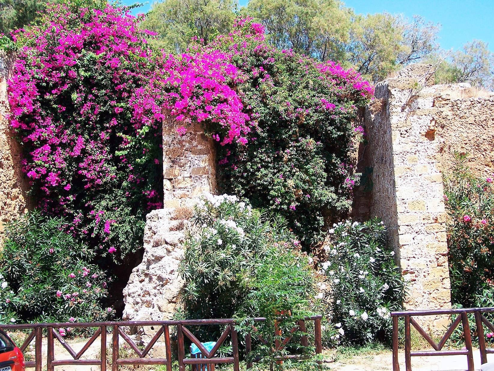
Parts of the Byzantine wall survive on Sifaka Street. The later Venetian expansion made the earlier seventh-century defenses obsolete for active military use, although sections of the Byzantine construction remained physically preserved within the later fortified city.