Daubariai Hillfort: A Fortified Settlement Complex in Lithuania
Site at a Glance
- Rating
- 4.5
- Popularity
- Very Low
- Country
- Lithuania
- Primary era
- Medieval
- External website
- Open
- Eras represented
- Classical, Medieval
- Civilizations
- Unclassified
- Site type
- Military
- Remains
- Fortified Town
On this page8 sections
History
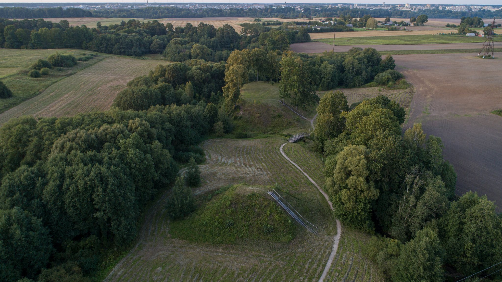
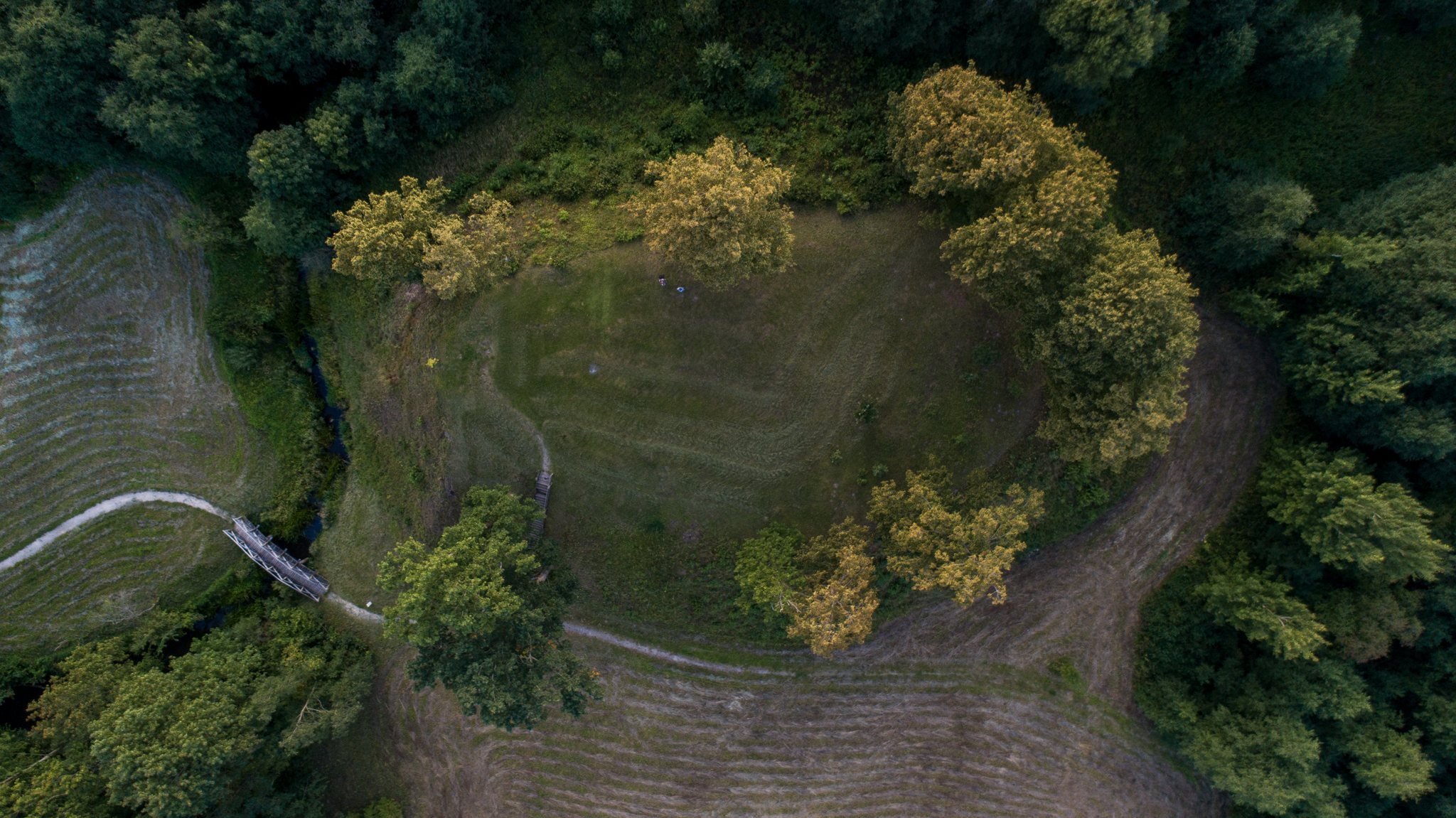
Daubariai hillfort in Lithuania is a complex of two fortified elevations and an associated settlement at the confluence of the Venta and Viešetė rivers. The hillforts are believed to have contained the settlement of Viešetė, also known as Vesete, mentioned in a 1253 deed dividing lands between the Livonian Order, a medieval Catholic military order in the eastern Baltic, and the Bishop of Courland, the medieval bishop responsible for that ecclesiastical territory.
Early settlement and medieval occupation
Archaeological layers at Daubariai II include material from the first half of the first millennium AD. Further layers at the hillforts and settlement belong to the fifth through eighth centuries and the ninth through thirteenth centuries AD. Together, these remains show occupation across several periods before and during the era in which Viešetė entered the written record.
The settlement at the foot of the hillforts covered about 1 hectare. Its occupation deposits range from the first millennium AD to the thirteenth century AD, and the finds indicate craft activity alongside domestic and defensive functions. A house associated with a jeweller contained four birch-bark bags filled with bronze scrap.
Investigation and conservation
Lithuanian archaeologist Vytautas Daugudis investigated Daubariai I in 1975 and Daubariai II in 1976. The excavations identified layers from different periods and revealed fortifications, structures, furnaces, hearths, and objects connected with settlement and craft production.
Conservation work on both hillforts took place in 2009. At Daubariai I, the slope affected by erosion from the Viešetė was reinforced, vegetation was thinned, and the ground was covered with grass. The work also established paths, stairs, a bridge over the stream, information signs, resting and observation areas, and a parking area.
Remains
The two hillforts
Daubariai I
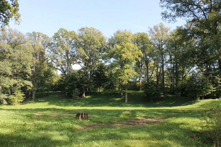
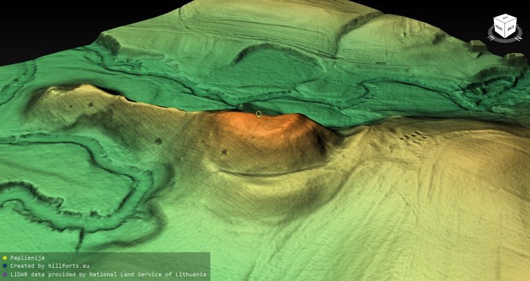
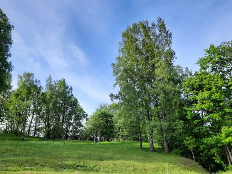
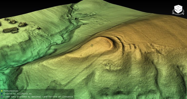
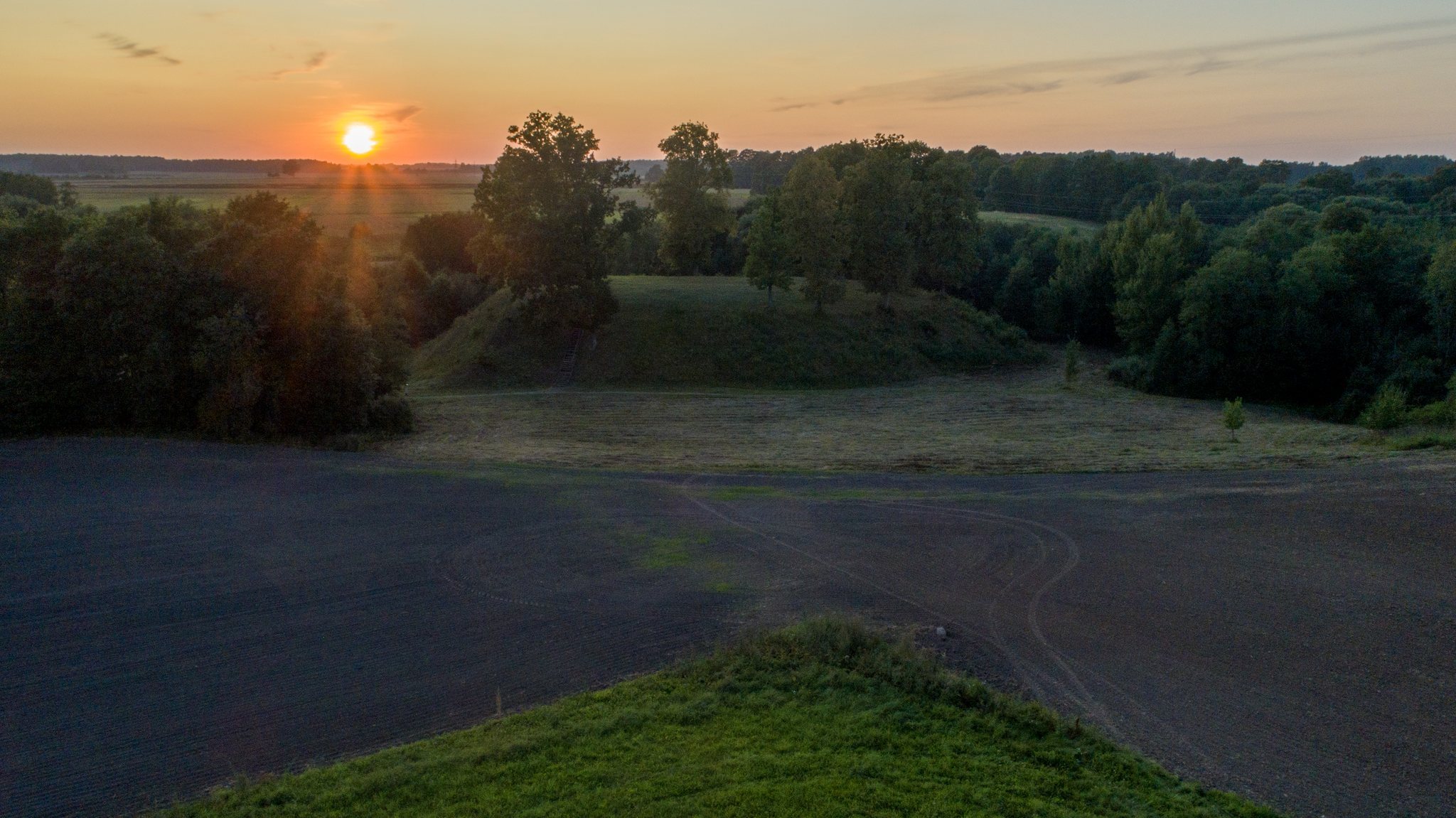
Daubariai I occupies a separate hill in the Viešetė valley on the river’s right bank. Its oval summit runs from north to south and measures 51 by 26 metres. Steep slopes rise about 8 metres, while a swamp borders the hill to the north and a cultivated field lies to the east. The western and southern sides have been washed away, and erosion continues on the southern slope. Sparse deciduous trees cover the slopes, while grassland covers the summit.
The hillfort has a cultural layer, an accumulated archaeological deposit containing traces of human occupation, 0.5 to 1 metre thick. Excavation exposed wooden fortifications, stone pavements, and smooth pottery. A wooden defensive structure 1.5 to 2 metres wide followed the edge of the summit. Inside it was a pavement of small stones, while the clay-coated walls consisted of horizontal logs supported by buried posts 15 to 20 centimetres in diameter.
The looping Viešetė divided Daubariai I into two remnants. The larger remnant remains on the river’s right bank.
Daubariai II
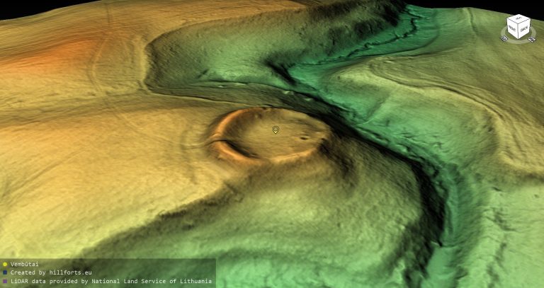
Daubariai II lies about 150 metres south of Daubariai I, on the left bank of the Viešetė where that river meets the Stulpas. It survives as the western slope of a truncated-cone-shaped mound. Its steep slopes are about 8 metres high, and the excavated summit area measures 8 by 3 metres and bears marks from excavation pits. Grassland covers the mound, with several deciduous trees growing on it.
Settlement and defenses
The settlement occupied the eastern and southeastern foot of the hillforts. Its cultural layer ranges from 0.2 to 1.5 metres in thickness. Excavations revealed a stone-built furnace, postholes, hearths, and the remains of an iron-smelting furnace. The four birch-bark bags of bronze scrap found in a jeweller’s house provide evidence of metalworking within the settlement.
Other finds include iron arrowheads, awls, knives, a rod-shaped pin, part of a sickle, a bronze bracelet, a horseshoe brooch, rings, fragments of additional bronze objects, stone spindle whorls, a whetstone, clay weights, and smooth, rough, and wheel-made pottery. A horseshoe brooch is a curved metal fastening used to secure clothing, while a spindle whorl is a weighted object that helps twist fibers into thread.
A defensive ditch followed the eastern edge of the settlement. Excavated across a 70-metre stretch, it measured 4 metres wide at the top, 2 metres at the bottom, and up to 1.5 metres deep. The ditch was dug around the middle of the first millennium AD to protect the settlement.