Torsburgen: An Ancient Hillfort and Refuge on Gotland
Site at a Glance
- Rating
- 4.3
- Popularity
- Very Low
- Country
- Sweden
- Primary era
- Classical
- Eras represented
- Classical, Medieval
- Civilizations
- Unclassified
- Site type
- Military
- Remains
- Fort
On this page11 sections
History
Origins and defensive use
Torsburgen is the remains of an ancient hillfort near Kräklingbo on Gotland, Sweden, first constructed at the beginning of the first century AD and generally associated with the Late Roman Iron Age, the later part of the European Iron Age around AD 200–400. Major building stages have been dated to about AD 300 and AD 900. The fortification remained in use until approximately AD 1100 and is traditionally interpreted as “Thor’s fort,” referring to Thor, the Germanic thunder god.
The site probably served chiefly as a refuge rather than as a permanently occupied settlement. No internal buildings have been demonstrated, while estimates suggest that nearly 1,000 soldiers would have been needed to defend the walls. Its large enclosed area may have sheltered Gotland’s entire early medieval population, estimated at between 6,000 and 10,000 people.
One interpretation places Torsburgen within an island-wide warning system. Fires may have been lit on hillforts and plateau hills to signal the approach of enemy ships. This proposed network would have allowed warnings to travel across Gotland through a chain of elevated locations.
Traditions and later history
Torsburgen appears in the Gutasaga, a medieval account of Gotland’s legendary and historical past. Its story of the island’s population describes one-third of the Gotlanders taking temporary refuge at Torsburgen after being ordered to leave because of overpopulation. They were later forced to leave Gotland, and the tradition connects their descendants with the Goths.
The plateau also reflects the effects of later fires. When the Swedish botanist Carl Linnaeus visited Torsburgen in 1741, he observed that it was almost treeless. This condition was probably linked to a major fire in 1655 that affected the districts of Alskog, Ala, Ardre, and Kräklingbo. Most of the surrounding coniferous forest was later destroyed by the Kräklingbo fire of 1992. The fire helped create habitat for fire-dependent fungi, plants, and insects, including endangered species.
Archaeology and protection
Archaeological investigation has been limited. In 1977, the archaeologist Johan Engström excavated a profile through the rampart to examine its construction and date charcoal remains. The work showed that substantial quantities of gravel had been laid over an earlier beach ridge before the wall was built. A small excavation carried out during restoration of the stonework at Ardre luke in 1983 recovered four small metal objects.
Torsburgen became a nature reserve in 1994. The reserve covers the plateau and the area immediately around its base, approximately 158 hectares in total. On 30 August 2005, it became part of Natura 2000, the European Union network of protected areas established to conserve important habitats and species. Torsburgen is also described as the third-largest fortified hillfort in Scandinavia, after Halleberg in Västergötland and Lollands Österborg on Lolland. Grogarnsberget is the second-largest hillfort on Gotland.
Remains
Plateau and fortifications
Natural setting
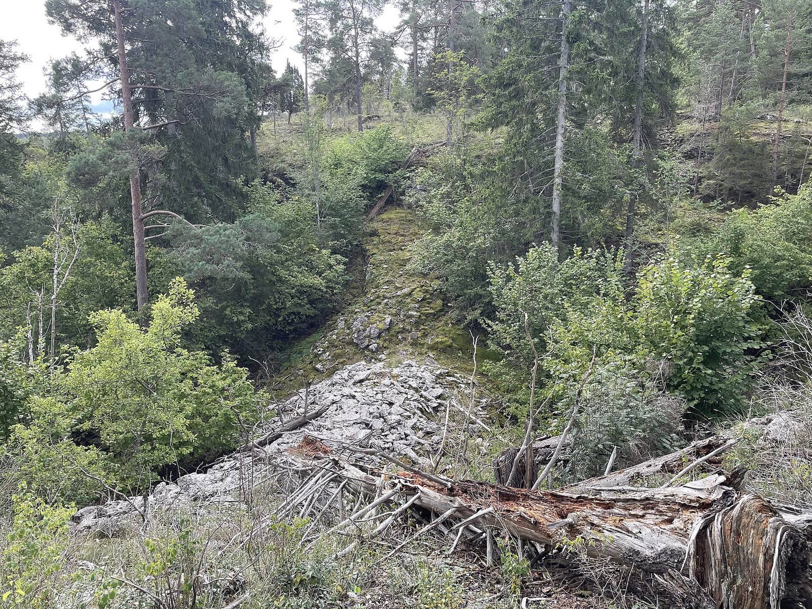
The hillfort occupies an entire plateau hill in east-central Gotland at an elevation of about 71 metres. The plateau covers approximately 1.2 square kilometres, or 112.5 hectares, while the fortified area measures roughly 1,300 metres by 730 to 1,200 metres. Its natural perimeter is almost 5 kilometres long. Steep cliffs between 10 and 25 metres high defend the western, northern, and eastern sides, leaving constructed or reinforced walls to complete nearly 2 kilometres of the enclosure.
In the southwest, glacial and postglacial water movements formed gravel beach ridges. These natural embankments were incorporated into the defensive layout, and the small mire known as Torsburgsmyr formed inside them. The combination of cliffs, ridges, and built walls gave the plateau its defensive character.
Walls and entrances
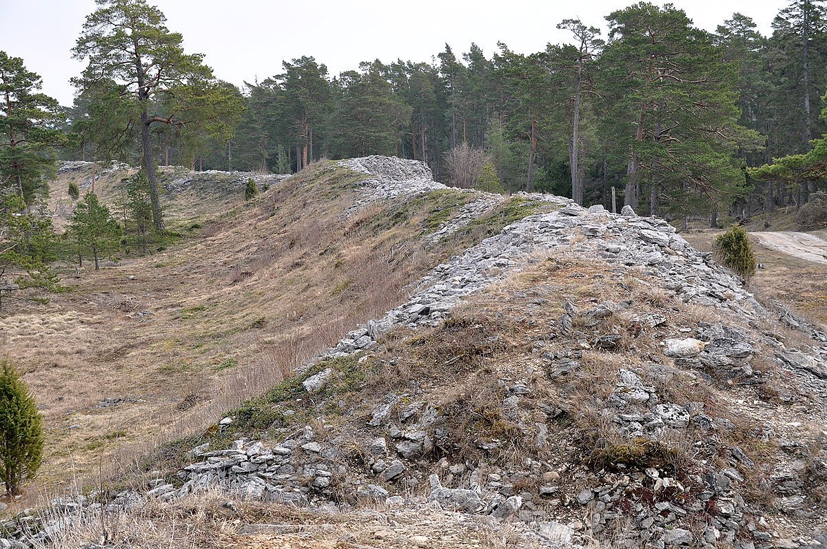
The fortification walls are between 4 and 7 metres high and reach up to 24 metres in width. The northeastern sector contains a roughly 40-metre-long wall made from large limestone blocks and known as the Castle. Along the southwest and southern sides, a wall extends for about 1.5 kilometres. Its western part consists of limestone slabs, while the southwestern and southern sections use limestone rubble and earth. Limestone for the construction was quarried in the northern part of the plateau.
Excavation showed that the rampart was built in stages. Gravel was first placed over the former beach ridge, after which the stone wall was constructed. The interior contains a core of burned limestone, which may relate either to the building method or to the effects of fire. The lower sections date from the first century AD and were renewed around AD 300, while the upper sections date from the ninth century. A wooden palisade, a defensive barrier of upright logs, probably stood along the crest. Six openings pierce the fortification; in Gutnish they are called luke, and each traditionally had its own name.
Caves and living environment
Cliff caves
Several caves occur in the cliffs along the northwestern side of the plateau. Burglädu, whose Gutnish name means “Castle barn,” is the deepest. It extends 16 metres into the rock and is approximately 12 metres wide and 16 metres long. Other named caves include Linnaeus’ Cave, Rindarhulet, and Stuxberg’s Cave.
Fire-shaped vegetation
The plateau and the surrounding reserve contain rare plants that survived the 1992 fire. They include hard shield-fern, scorpion senna, Orobanche alba, and Pulsatilla vulgaris gotlandica. These species form part of the protected environment that developed alongside the surviving walls, cliffs, caves, and former fire-affected woodland.