Forte de São Lourenço: A Historic Coastal Fort in Brazil
Site at a Glance
- Rating
- 4.6
- Popularity
- Low
- Country
- Brazil
- Primary era
- Early Modern
- External website
- Open
- Eras represented
- Early Modern, Modern
- Civilizations
- Portuguese
- Site type
- Military
- Remains
- Fort
On this page7 sections
History
Forte de São Lourenço is a Portuguese coastal fort in Brazil, built in 1711 at the northern tip of Itaparica Island to protect the Bay of All Saints and nearby maritime trade. Its position developed from an earlier whaling station and a Dutch earthwork fortification, and the site later became part of Brazil’s military and naval history.
Whaling and the Dutch occupation
The site was used for whaling in the early seventeenth century. In 1624, João Francisco, a Portuguese whale fisherman, established a small whaling port at the island’s northern point, then known as Ponta da Baleia, or Whale Point.
During the Dutch occupation of Brazil from 1630 to 1654, when the Dutch West India Company controlled substantial parts of northeastern Brazil, a small earthwork fortification was built there in 1647 under Siegsmundt Van Schkoppe. Called the Fort of the Eminence, it occupied a hill overlooking the island’s only natural port. The fort resisted an attack led by Francisco Rebelo in October 1647, but Dutch forces destroyed it when they withdrew to Recife.
Portuguese reconstruction
Rodrigo da Costa, governor of Bahia, planned to rebuild the fort in 1704. After arriving in Brazil in 1710, the Portuguese military officer Miguel Pereira da Costa recognized the northern point of Itaparica as a strategic position. From there, a fort could protect the Bay of All Saints and the small boats carrying goods from the productive Recôncavo region around the bay to Salvador.
Pereira da Costa requested funds from Lourenço de Almeida, the governor, to complete the work. The French invasion of Rio de Janeiro in 1711 encouraged the Portuguese authorities to finance construction on the site of the former Dutch fortification. The fort was built that year and reconstructed in its present form during the early eighteenth century. Sancho de Faro, governor of Brazil, inspected the fort and its military works in 1719. A further inspection took place in 1722, followed by repairs in 1782.
Independence and later military use
During Brazil’s struggle for independence in 1823, Barros Galvão, a Brazilian independence fighter, climbed the fort’s walls after the Portuguese had abandoned it. He searched for weapons and occupied the position. Brazilian forces repelled Portuguese attacks on January 7, 1823, after which the fort became the property of the Brazilian Navy.
By 1859, the fort had fallen into ruins. When Dom Pedro II, Brazil’s second and final emperor, visited that year, its cannons were unusable and the Command House was serving as a public jail. The fort was rebuilt between 1862 and 1863 under a nationwide program to repair Brazilian forts. In 1892, it was converted into a hospital.
The Brazilian Navy altered or removed internal structures in 1970. Between 1974 and 1975, the fort was remodeled as a degaussing station, a facility for reducing a vessel’s magnetic signature as a defense against magnetic mines. Brazil’s National Institute of Historic and Artistic Heritage listed it as a federal historic structure in 1938.
Remains
Setting and defensive plan
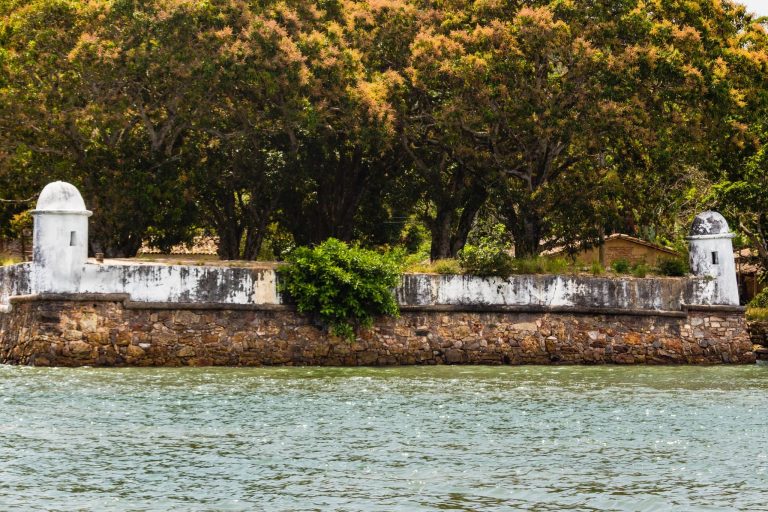
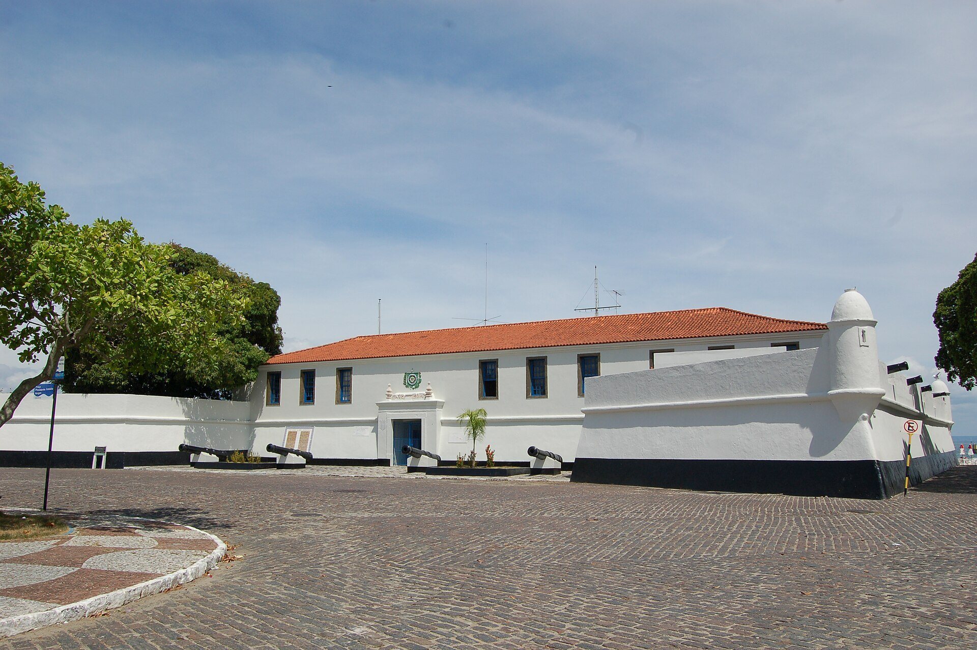
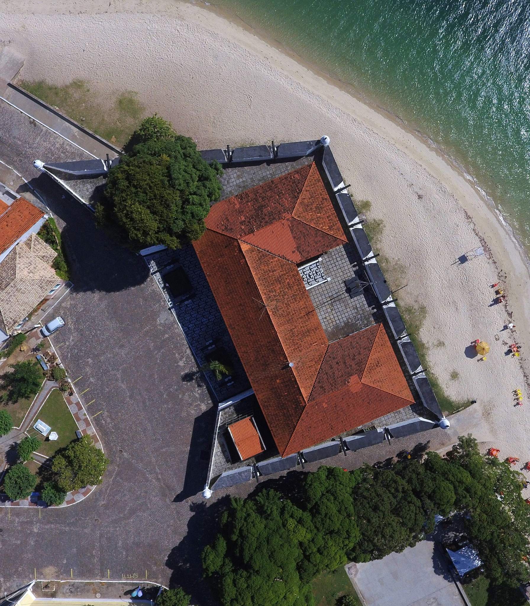
Forte de São Lourenço stands at the northern point of Itaparica Island, facing a broad beach. A smaller beach with tamarind trees lies to the east, while Praça Getúlio Vargas is on its right. The fort forms part of an architectural ensemble that also includes the Church of Saint Lawrence, the Parish Church of the Blessed Sacrament, and Itaparica Town Hall.
The fort covers approximately 1,190 square metres and combines stone masonry with reinforced concrete. Entry is reached through a tunnel and a ramp. Its defensive plan is formed by two irregular hornwork demi-bastions. A hornwork is an external defensive work projecting from a fortification, while a demi-bastion is a partial bastion that strengthens a defensive angle. Together, the two demi-bastions create six projecting angles and two reentrant angles, which point inward between the projecting sections. This arrangement was designed to counter attacks from the sea and assaults by infantry from the land.
Internal buildings and later alterations
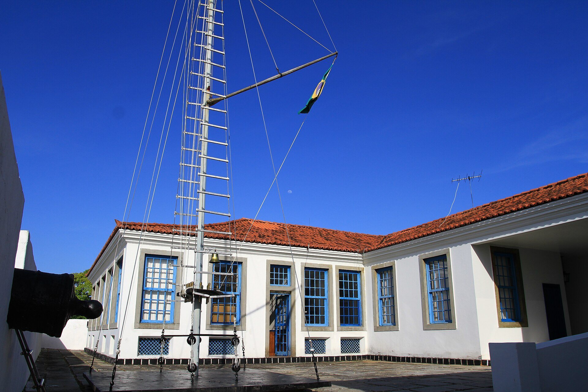
The fort contained a captain’s residence, barracks, and a prison. The former barracks and prison are covered by cradle vaults, which are continuous barrel-shaped roofs or ceilings. These spaces belong to the internal organization of the fort, alongside the access route formed by the tunnel and ramp.
Between 1974 and 1975, a U-shaped reinforced-concrete structure was installed for the degaussing station. The Command House was demolished during these alterations, changing the internal arrangement that had previously included the building used as a public jail in the nineteenth century.