Burg Eselsberg: A Medieval Hilltop Castle in Germany
Site at a Glance
- Rating
- 4.5
- Popularity
- Low
- Country
- Germany
- Primary era
- Medieval
- External website
- Open
- Eras represented
- Medieval
- Civilizations
- Holy Roman Empire
- Site type
- Military
- Remains
- Castle
On this page12 sections
History
Burg Eselsberg is a medieval hilltop castle in Germany, above Ensingen, now part of Vaihingen an der Enz in Baden-Württemberg. The castle existed before 1188 and was first recorded on 23 April that year as a possession held directly by the Staufers, the medieval German dynasty that supplied several kings and emperors of the Holy Roman Empire. Its position on the Eselsberg gave it a commanding place above the surrounding valleys and later made it important to several noble families and to Württemberg.
Staufer Possession and the Lords of Eselsberg
Burg Eselsberg was included among 30 Staufer possessions arranged as a bridal gift for the planned marriage of Conrad, the son of Emperor Frederick I, to Berengaria, daughter of King Alfonso VIII of Castile. The marriage did not take place, and the intended transfer therefore remained unfulfilled.
The castle later passed to a noble family loyal to the Staufers. By 1194, members of this family had adopted the name von Eselsberg. The brothers Werner and Heinrich von Eselsberg were recorded in that year in connection with King Henry VI. The family may earlier have used the name von Owenbühl and may have represented a branch of the Lords of Kräheneck, although these relationships remain uncertain.
Belrein von Eselsberg first appears in 1232 as a witness for the counts of Vaihingen and Calw. He was married to Agnes von Bilversheim. In 1241, the couple founded Rechentshofen Convent, a religious community over which the family also held a protective bailiwick, meaning secular guardianship of the institution and its interests. Their known daughters were Berchtrade and Agnes.
Transfer to the Counts of Vaihingen
After Belrein probably died around 1253, his inheritance, including Burg Eselsberg and the protective bailiwick over Rechentshofen Convent, passed through his daughter Agnes to her husband, Count Conrad II of Vaihingen. Conrad is recorded at Burg Eselsberg on 11 November 1271.
The counts of Vaihingen later sold their castle and town of Vaihingen. Their successors then used Eselsberg as their principal residence during the fourteenth century. They apparently enlarged the castle and encouraged the urban development of Horrheim and Hohenhaslach as replacements for Vaihingen.
Around 1353, Count Conrad V of Vaihingen temporarily sold Burg Eselsberg and the villages of Ensingen and Glattbach to his nephew, Count Otto II of Hohenberg-Nagold. In 1363, Otto was compelled to sell inherited estates to the House of Württemberg, the dynasty that ruled the historical territory of Württemberg in southwestern Germany.
Inheritance and Württemberg Control
In 1356, Heinrich, the last count of Vaihingen, bequeathed his future inheritance to Count Eberhard of Württemberg. Heinrich died in 1364, but his sister Mechthild of Zollern-Eselsberg continued to control Burg Eselsberg and nearby communities. Her control probably rested on a lifelong right of use or on the delayed payment of 7,500 pounds of Heller, which was not settled until 1396.
Württemberg probably gained full control only after the death of Mechthild’s daughter Anna. Anna still maintained a bailiff at Eselsberg in 1396. Fürderer III von Wunnenstein held that office and sealed documents at the castle in 1385, 1390, and 1393. Mechthild’s husband, Count Frederick of Zollern-Schalksburg, also called himself “Lord of Eselsberg,” reflecting the castle’s continuing importance to the Vaihingen and Zollern families.
For Württemberg, Eselsberg initially had strategic value on the western edge of its territory. The frontier toward the Counts Palatine of the Rhine, major territorial princes of the medieval Holy Roman Empire, was secured in part by the Landgraben, a frontier earthwork formed from a ditch and embankment. The extensive outer fortification on the hill spur may have been constructed under Württemberg rule.
Decline, Ruin, and Investigation
The castle lost its military relevance by 1519, after Duke Ulrich was expelled and an Austrian interim government cooperated with the Electoral Palatinate, the territory associated with the electoral office of the Counts Palatine of the Rhine. The circumstances of Eselsberg’s destruction or abandonment remain uncertain. It may have been destroyed in 1525 by the insurgent Zabergäu peasant force under Hans Menckler, together with Rechentshofen Convent and other castles. By the eighteenth century, it was already described as a greatly reduced ruin.
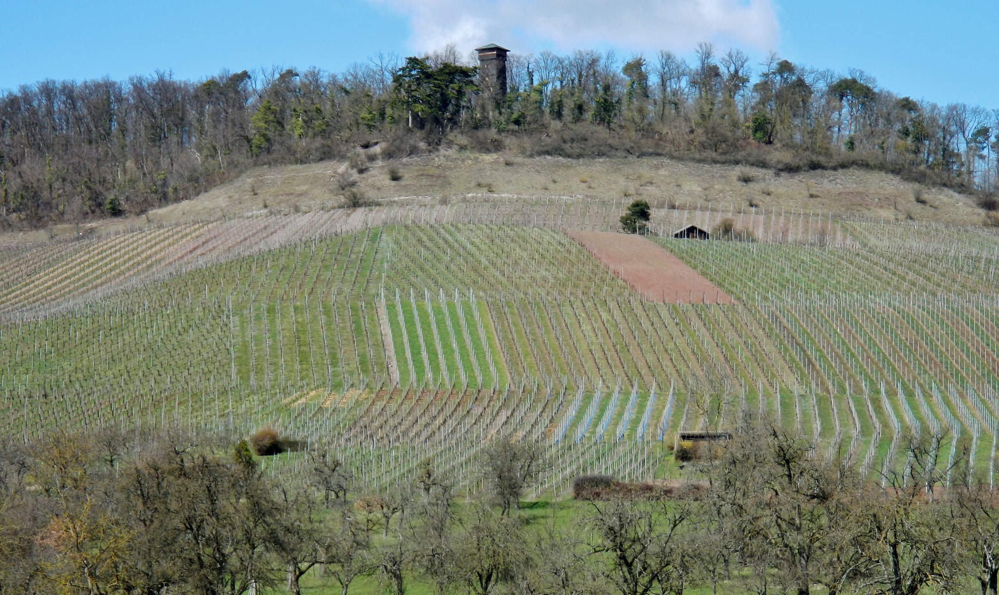
In 1856, considerably more of the castle and its outer fortifications could still be seen than today, including possible walls extending toward Ensingen. Later consolidation of the vineyards altered and erased parts of these remains. Konrad Albert Koch surveyed the castle core in 1925 and produced a reconstruction drawing based on surviving walls, banks, and ditches. That year, the Ensingen branch of the Swabian Alb Association made the site an excursion destination and erected a wooden lookout tower.
The wider earthworks have sometimes been interpreted as a prehistoric Hallstatt-period hillfort. The Hallstatt period was an early Iron Age archaeological culture of central Europe. Karl Eduard Paulus had already identified the surrounding earthworks in 1856 as medieval parts of Burg Eselsberg, and the prehistorian Rüdiger Krause judged the Hallstatt interpretation highly doubtful in 2001 because archaeological evidence did not support it.
Remains
Castle Core and Ridge Setting
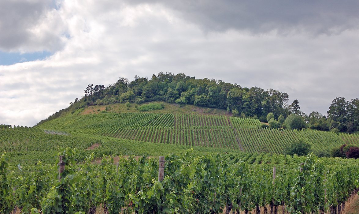
Burg Eselsberg occupied the 392-metre-high Eselsberg, a spur of the Stromberg north of Ensingen. The Metter valley lay to the north and east. A broad neck ditch cut across the ridge extending westward and separated the castle from the higher ground; a wooden bridge now crosses this feature.
Core Castle
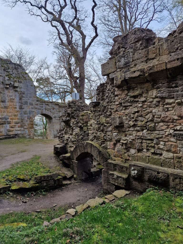
The core castle had an unusual oval plan measuring approximately 95 by 55 metres, excluding the outer earthworks. Its surviving physical features include banks, sections of ditch, wall foundations, and remains of a keep. The keep had a roughly square plan, with sides of about seven metres. Its ground-floor walls were approximately 2.5 metres thick.
Parts of the keep and additional wall remains were still visible when Koch surveyed the site in 1925. He used these remains, together with the banks and ditches, to prepare his reconstruction drawing. The modern wooden lookout tower, about 18 metres high, stands at the centre of the castle on the base of the former keep.
Outer Fortifications
Burgrain Enclosure
A much larger area known as the Burgrain appears on the original cadastral map of 1832. Fifty boundary stones marked its extent. A rectangle enclosing its irregular outline would have measured more than 670 metres from end to end and almost 530 metres across.
The Burgrain contains wedge-shaped cuts beside its access routes. Its lower section northeast of the path along the 350-metre contour appears to have been added later. The southern boundary follows surviving banks, indicating that a broad outer fortification was built around the core castle at a later stage. This enclosure may have provided room for a small medieval town, although its date, builder, purpose, and completion remain uncertain.
Alte Burg
Northwest of Burg Eselsberg lies the nearby fortification called the Alte Burg. It represents an earlier or separate fortified site associated with the castle landscape. Its remains are identified as a nearby fortification, while its date has not been assigned to the prehistoric period.
Surviving Landscape Features
The medieval castle site is represented chiefly by earthworks and the neck ditch. The slopes exposed to the sun were remodelled for intensive viticulture, and vineyard consolidation later altered parts of the former castle area and its surrounding defences. The present site is also overlaid by the wooden lookout tower, a shelter, a barbecue area, and a beer garden.