Fort Fredrick: A Portuguese and Dutch Fortress in Trincomalee, Sri Lanka
Site at a Glance
- Rating
- 4.4
- Popularity
- Medium
- Country
- Sri Lanka
- Primary era
- Early Modern
- Eras represented
- Early Modern, Modern
- Civilizations
- British, Dutch
- Site type
- Military
- Remains
- Fort
On this page10 sections
History
Fort Fredrick is a historic fortress in Trincomalee, Sri Lanka, completed by the Portuguese colonial administration of Ceylon in 1624 on the Konamamalai promontory. Built during the early modern European colonial period, it was intended to strengthen Portuguese control of the eastern coast and protect it against rivals including the Dutch. The fort later became a Dutch and British military position, reflecting Trincomalee’s importance as a sheltered harbor on sea routes toward India and East Asia.
The destruction of Koneswaram Temple
The Portuguese fort was built on the site of Koneswaram Temple, a major Hindu pilgrimage center traditionally known as the Temple of a Thousand Pillars. Portuguese forces led by General Constantino de Sá de Noronha destroyed the temple on April 14, 1622, during the Tamil New Year. Some priests fleeing the attack buried sacred statues, while other rescued images were later housed at the Ati Konanayakar Temple at nearby Thampalakamam, built between 1639 and 1689.
The former temple complex extended across the rocky heights of the promontory. A surviving plan showed three pagodas at different elevations, and Sá de Noronha described the grounds as about 600 fathoms long, with a width varying from 80 feet to 30 feet. An inscription attributed the construction of one pagoda to Kulakottan, a traditional figure associated with the early history of Koneswaram. The temple stones and carved pillars were subsequently reused in the Portuguese fort.
Portuguese control of the peninsula
European competition at Trincomalee had begun before the Portuguese completed their fortress. A Danish fleet arrived by the end of 1619, occupied Koneswaram Temple in May 1620, and began fortification work before Portuguese forces defeated it. In 1612, the Portuguese had also sought assistance from the kingdom of Jaffna to build a fort, but that request was refused. After the destruction of the temple, the Portuguese completed their own position on the isthmus of the peninsula.
The settlement beside the fort included Portuguese casados, or married colonial settlers, and local residents. A separate village stood between the fort and the bay. Contemporary descriptions place the garrison at roughly 40 to 50 soldiers, with accounts also mentioning either 30 casados or approximately 45 settlers alongside the soldiers. The fort therefore served both as a military enclosure and as the center of a small colonial community.
Dutch reconstruction and changing ownership
A Dutch fleet captured the Portuguese fort in 1639. The Dutch dismantled the earlier structure and rebuilt the position during the 1660s, completing the new fort in 1665. The Dutch East India Company, a chartered corporation that administered Dutch colonial possessions and conducted military and commercial operations in Ceylon, used the fortress to defend Dutch territory against British and French expansion. The fort later acquired the name Fort Fredrick after the British takeover and renaming in 1795.
Trincomalee changed hands repeatedly during the later seventeenth and eighteenth centuries. French forces occupied the position in 1672 but soon withdrew, allowing the Dutch to recover it. During the Fourth Anglo-Dutch War, a conflict between Britain and the Netherlands, British forces under Admiral Edward Hughes captured Trincomalee and the nearby fort of Oostenburg in January 1782. French forces under Pierre André de Suffren retook the position later that year. The fort suffered only limited damage during these changes of control, and it returned to the Dutch East India Company under the Peace of Paris in 1783–1784.
The British captured Trincomalee again in 1795 and retained it permanently. Under the Peace of Amiens in 1802, Ceylon was formally assigned to Great Britain. The Dutch had built Oostenburg in the early eighteenth century under Governor Hendrik Becker on a height near the entrance to the inner harbor, but that additional fort no longer survives.
A strategic harbor and British military base
Trincomalee’s deep, sheltered, all-season harbor gave the fort continuing strategic value. Its position connected the settlement with maritime routes toward India and East Asia. Plans proposed making the harbor a major center of Asian trade and moving the administration of Ceylon there from Colombo, but Trincomalee remained principally an outpost. The cinnamon-producing region that supported the colonial economy lay mainly in southwestern Ceylon, while the eastern region was relatively dry, sparsely populated, and poorly connected with the west. These conditions contributed to variable levels of maintenance and garrisoning.
The fort remained under British control until 1948. The British Army abandoned the fort and harbor in January 1905 during a military reorganization, although coastal-artillery guns were installed during both the First and Second World Wars. Arthur Wellesley, later the 1st Duke of Wellington, stayed at the fort while serving as a colonel in the British East India Company. The building associated with his residence, Wellesley Lodge, later became the officers’ mess of the 2nd (Volunteer) Battalion of the Gajaba Regiment.
Twentieth-century conflict and protection
During the second half of the twentieth century, fighting between the Sri Lankan Army and the Tamil Tigers affected the wider Trincomalee area. The town outside the fort was heavily damaged, while the fort itself remained largely outside the fighting. Fort Fredrick is now an Archaeological Protected Monument of Sri Lanka, remains under state control, and is garrisoned by a detachment of the Gajaba Regiment.
Remains
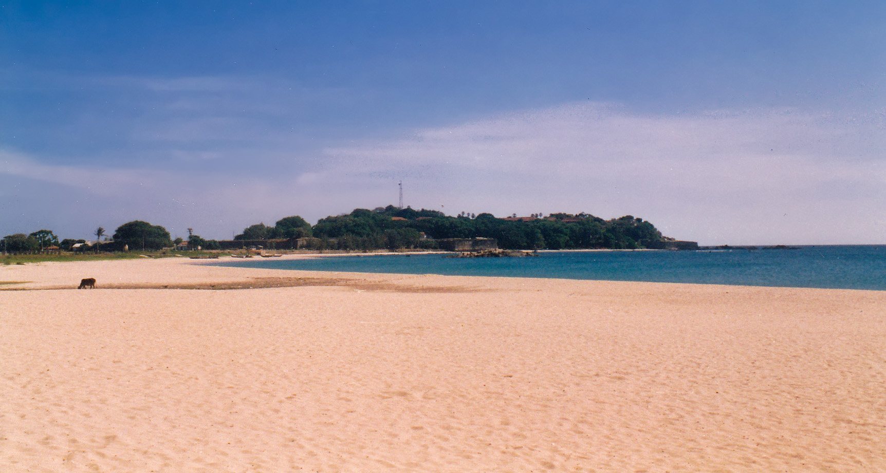
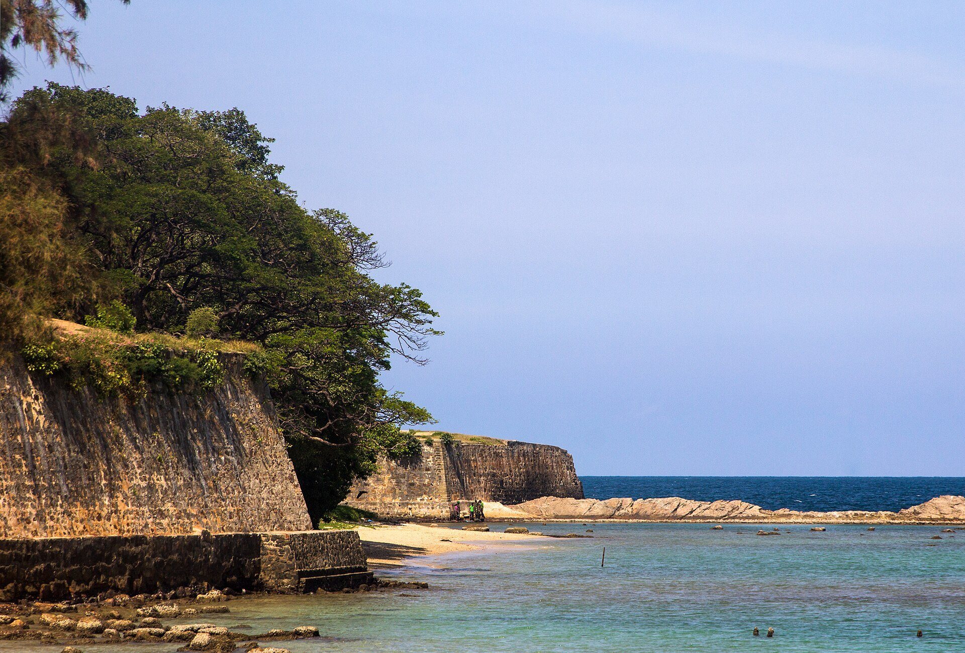
Fort Fredrick occupies a rocky peninsula that rises toward the sea at the elevated viewpoint now called Swami Rock, formerly known to the Dutch as Pagoodsberg. The Portuguese fort stood across the isthmus, while the later Dutch fortress occupied the same general position near the point where the peninsula joins the coast. The surviving fort combines defensive works and buildings from the Dutch and British periods with physical evidence of the earlier Portuguese occupation.
The Portuguese fortification
The first Portuguese fort was triangular and built of stone bonded with mortar. Its principal defenses were the three projecting bastions, or gun platforms designed to fire along adjoining walls, named Santa Cruz, Santo António, and the smaller São Tiago. A map also indicates a possible fourth isolated bastion on a rock south of the fort. Santa Cruz stood on the southern side of the isthmus, faced the bay, and carried six guns. Santo António guarded the northern end with five guns, while São Tiago stood on the northern side of the peninsula with three.
A wall joined Santa Cruz and Santo António across the narrowest part of the isthmus. Contemporary measurements give the shorter sides of the fort as about 75 metres and the longer side as about 150 metres. Another description gives a wall approximately 100 pasos long, three and a half brazas high, and six palmos thick. A second wall connected São Tiago with Santa Cruz, while a parapet along the sea cliff extended toward Santo António. The Portuguese steepened the cliff below this parapet, and a ditch may have protected the two principal bastions.
The entrance lay along the southern wall, facing the settlement of the casados. Within the enclosure stood the Church of Our Lady of Guadalupe, a storehouse for goods and ammunition, accommodation for soldiers and officers, and quarters for a chaplain and a constable. Maps from the Portuguese period identify the church as “Nossa Senhora de Guadalupe” or “N. S. de Guadalupe.” Accounts give differing totals for the fort’s artillery, including ten iron guns and sixteen pieces, some of them taken from a Danish vessel.
The Dutch fortification
The Dutch reconstruction produced a generally square fortification. Its largest bastion, Zeeburg, occupied the position of the Portuguese São Tiago and controlled the landward side as well as the former Northern Bay, now called Back Bay. Bastion Amsterdam stood on the coast beside the former Southern Bay, now Dutch Bay. A wall crossed the peninsula between these two defenses.
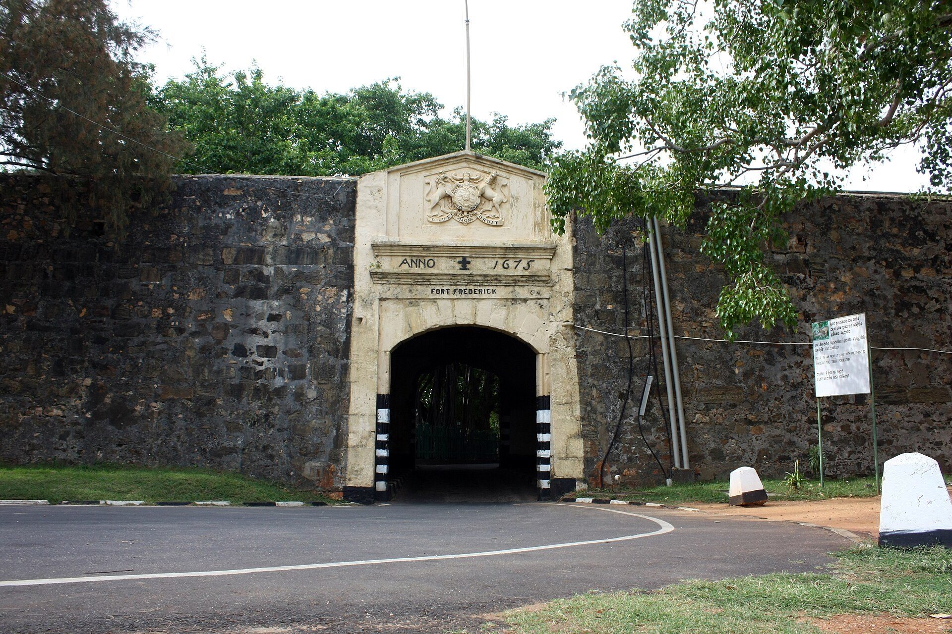
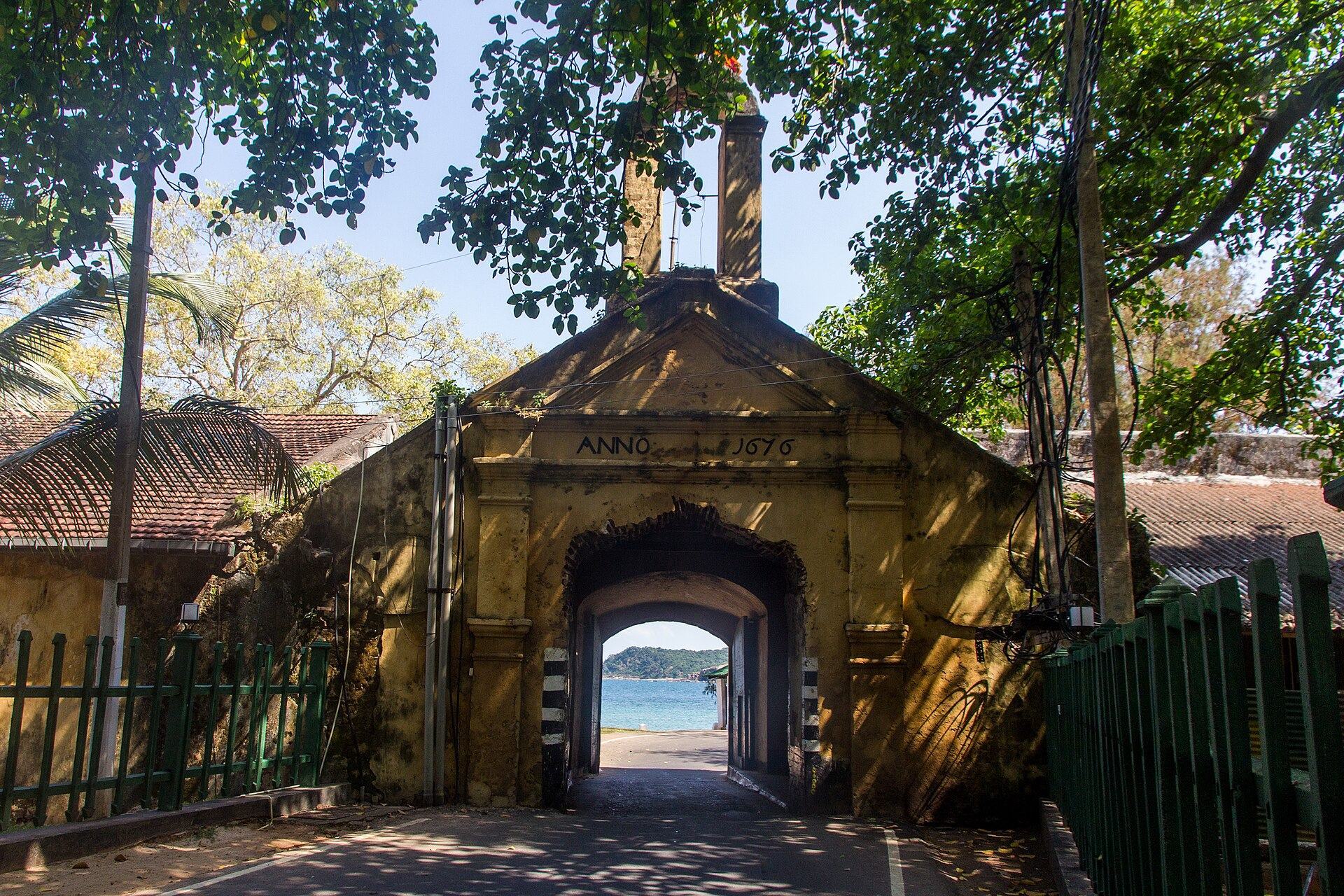
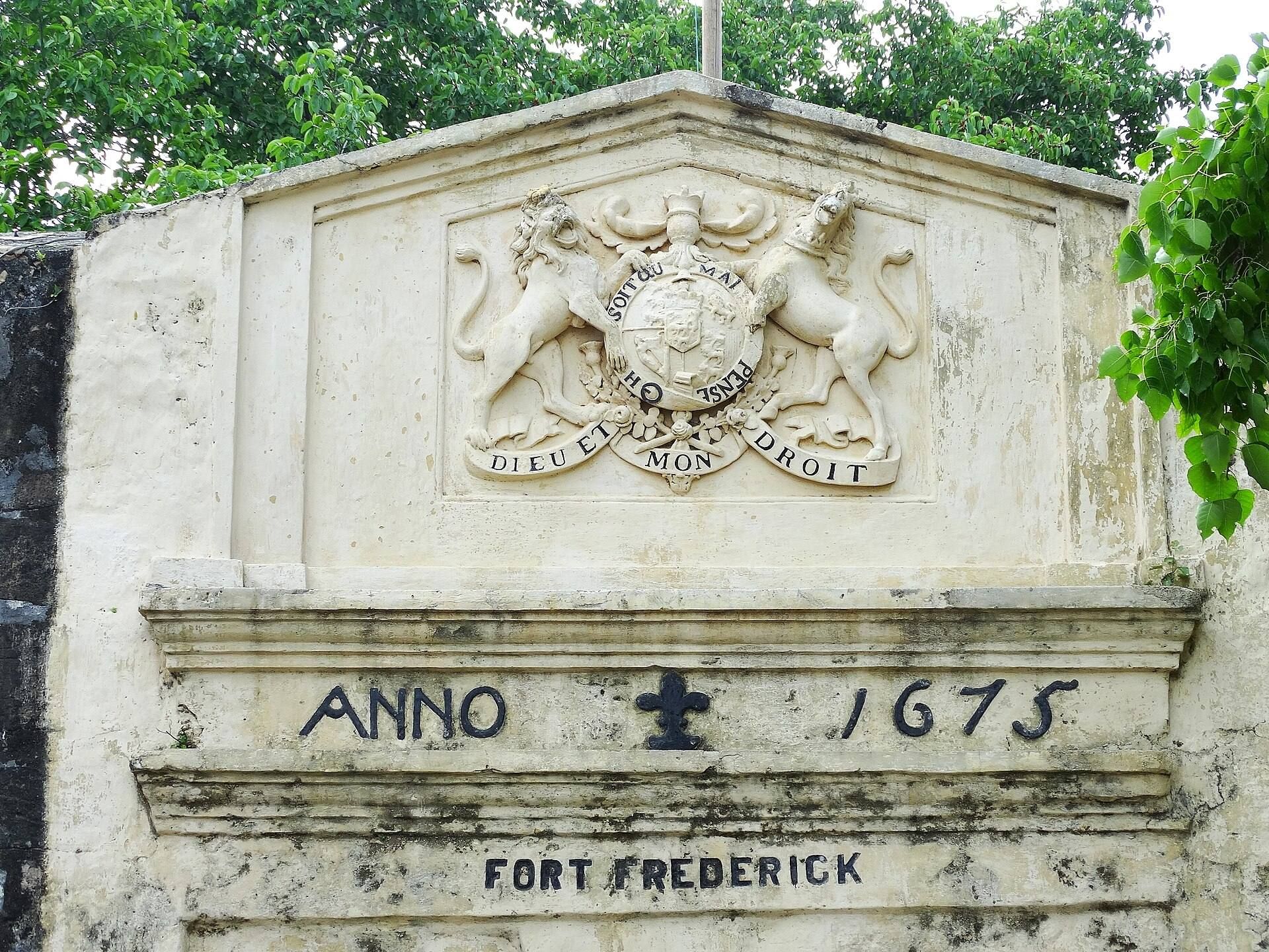
Along Back Bay, another wall ran from Zeeburg to the smaller Cavalier, also called the Kat, which carried a gun platform. A small water gate opened through this wall, and a square redoubt, a smaller enclosed defensive work, stood beyond the Cavalier. On the opposite side, a wall extended from Amsterdam to bastion Enkhuizen, with the land gate between them. The gate bears the date 1675 and displays the name Fort Frederick together with the British arms.
Beyond Enkhuizen, the wall continued toward higher ground and reached a small fourth bastion called Portuguese Point, later bastion Holland. The rising rock on the northeastern side formed a natural fourth side of the fortification. Together, the walls, bastions, gate, water gate, and natural rock helped define the surviving defensive layout.
Buildings, graves, and the sacred landscape
Buildings inside the fort survive from both the Dutch and British periods. The grounds include an exercising area, many trees, and gravestones belonging to Dutch East India Company employees and their families. Wellesley Lodge also stands within the enclosure and now serves as the officers’ mess of the 2nd (Volunteer) Battalion of the Gajaba Regiment. The fort is described as being in good condition.
The temple stones and carved pillars incorporated into the Portuguese fort came from Koneswaram Temple. The former temple site occupies the elevated rocky area of Swami Rock, where a Hindu temple was rebuilt in the early 1960s. These surviving elements connect the present military enclosure with the earlier sacred landscape that occupied the promontory before the Portuguese construction.