Chagres and Fort San Lorenzo: A Spanish Fortress and Atlantic Port in Panama
Site at a Glance
- Rating
- 4.7
- Popularity
- Medium
- Country
- Panama
- Primary era
- Early Modern
- External website
- Open
- Eras represented
- Early Modern
- Civilizations
- Spanish
- Site type
- Military
- Remains
- Fort
On this page17 sections
History
Chagres and Fort San Lorenzo is a former Spanish Atlantic port and fortress in Panama, near Colón at the mouth of the Chagres River. Spain developed the fort between 1587 and 1601 as part of its seventeenth-century military architecture and its defense of the transisthmian route linking the Caribbean with Panama City. Chagres became an important gateway for colonial trade, especially the movement of Peruvian treasure across the isthmus.
The river route and the first fortifications
Christopher Columbus encountered the Chagres River during his fourth voyage in 1502. After Spain conquered Peru, the river became part of the Camino Real de Cruces, Spain’s rainy-season route across the isthmus. This system combined overland travel with river navigation between Panama City and Caribbean ports, first Nombre de Dios and later Portobelo. A separate overland route served travelers during the dry season.
Pirate attacks along Panama’s Caribbean coast increased from about 1560. Raids on Nombre de Dios and pressure on the treasure route led Spain to strengthen the Chagres estuary. The first defenses developed from a sea-level battery and associated tower. King Philip II ordered the principal construction in 1598, and the fortifications were completed in 1601. Their plans were prepared by Bautista Antonelli, an Italian military engineer employed by the Spanish Crown.
Morgan’s attack and reconstruction
In late 1670 or early 1671, the Welsh buccaneer Henry Morgan directed an assault on San Lorenzo during his campaign against Panama City. Joseph Bradley led the land attack after landing with about 400 men at a nearby port instead of approaching directly from the sea. The fort was defended by approximately 300 men. Fourteen defenders were captured, while the attackers suffered 110 deaths and 80 wounded. After taking and destroying the fort, Morgan’s force crossed the isthmus and sacked Panama City.
Spain built a new fort on higher ground during the 1680s and established the town of Chagres under its protection. The settlement occupied the area around the fort and the river mouth. The new position stood about 24 metres above the water, overlooking the harbor entrance and improving the defenses against an attack from the landward side.
Eighteenth-century defenses and decline
Improvements directed by Nicolas Rodriguez in 1730 were followed by a major rebuilding campaign from 1761 to 1768 under Lieutenant Colonel Manuel Hernandez. These works formed part of the Bourbon Reforms, a program of administrative, military, and economic measures introduced by Spain’s Bourbon monarchy to strengthen imperial control. The reconstruction adapted San Lorenzo to newer artillery and siege methods and joined previously separate defensive elements into one enclosed fortress.
British Admiral Edward Vernon attacked Spanish defenses at Chagres and Portobelo in 1739 and 1740 during the War of Jenkins’ Ear, a conflict between Britain and Spain over trade, naval power, and access in the Caribbean. As Portobelo declined under the Bourbon Reforms, Spain reinforced Chagres and the upstream defenses at Gatun. Chagres consequently became the leading Atlantic port of the isthmus.
By the middle of the eighteenth century, Spain had largely abandoned the older transisthmian routes in favor of the sea passage around Cape Horn. San Lorenzo later served as a state prison for more than a century. The fort’s military importance therefore gave way to a penal use while Chagres remained associated with the river and its port.
Revival and abandonment of Chagres
The discovery of gold in California in 1848 briefly revived Chagres as a transit point. Westbound prospectors followed the old Camino Real de Cruces route and began their journeys from Yankee Town, also called Yanqui Chagres, a boomtown on the opposite bank from the original village and fort.
Steamboat service reduced the river crossing to about twelve hours by 1853. The Panama Railway, completed in 1855, shortened the journey to approximately three hours. Colón then became the principal Atlantic port, and Chagres lost its commercial importance.
The Panama Canal, completed in 1914, required Gatun Dam about 11.6 kilometres upstream and permanently separated the Chagres River from inland trade. The Panama Canal Zone was expanded to include the river mouth in 1916. Chagres then contained about 96 houses and between 400 and 500 inhabitants. The population was removed and resettled at Nuevo Chagres, about 13.2 kilometres to the southwest.
Protection and archaeological study
Panamanian conservation legislation protected San Lorenzo and Portobelo in 1908, and Fort San Lorenzo became a National Monument in 1941. Excavations in 1966 revealed an additional landward gun position intended to control the open ground before the fort, addressing the vulnerability exploited during the 1671 assault. The fort was partially restored in 1995.
The fort and the Chagres village site lie within the approximately 12,000-hectare San Lorenzo Protected Area. Fort San Lorenzo and the fortifications of Portobelo entered the UNESCO World Heritage List in 1980 as the Fortifications on the Caribbean Side of Panama. The property was extended in 1990 and placed on the List of World Heritage in Danger in 2012. In 2025, San Lorenzo also became part of the UNESCO serial property The Colonial Transisthmian Route of Panama.
Remains
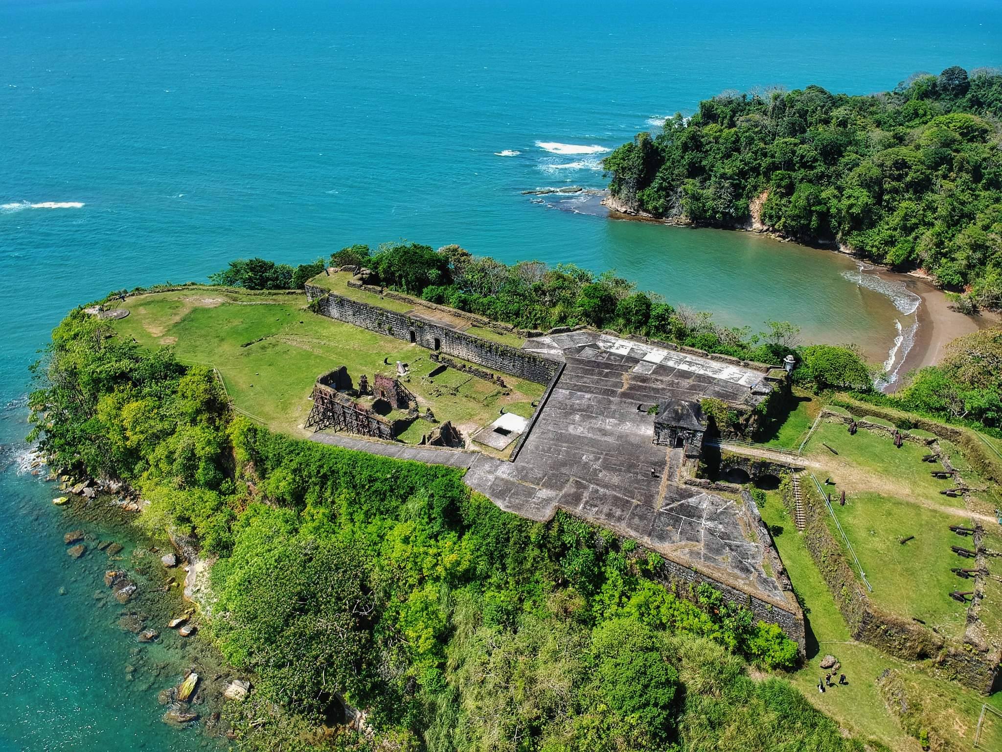
The surviving site occupies a promontory and high reef or cliff above the mouth and entrance of the Chagres River. From this position, the defenses controlled the river approach and a broad stretch of sea. The fort is partly cut into the natural rock beneath the cliff and combines masonry walls, batteries, underground spaces, and defensive works adapted to the terrain.
Early defenses and sea approach
Sea-level battery and tower
The earliest fortification developed as a sea-level platform with gun batteries and a tower attached to the cliff. The tower provided accommodation for the garrison and served as an observation point. Earth-filled palisades functioned as defensive walls. At the seaward end, a stone spiral staircase descends inside the tower to a lower underground level. This tower may be the structure associated with Bautista Antonelli, and the staircase may have linked it with lower marine batteries at the foot of the escarpment.
Lower batteries and river entrance
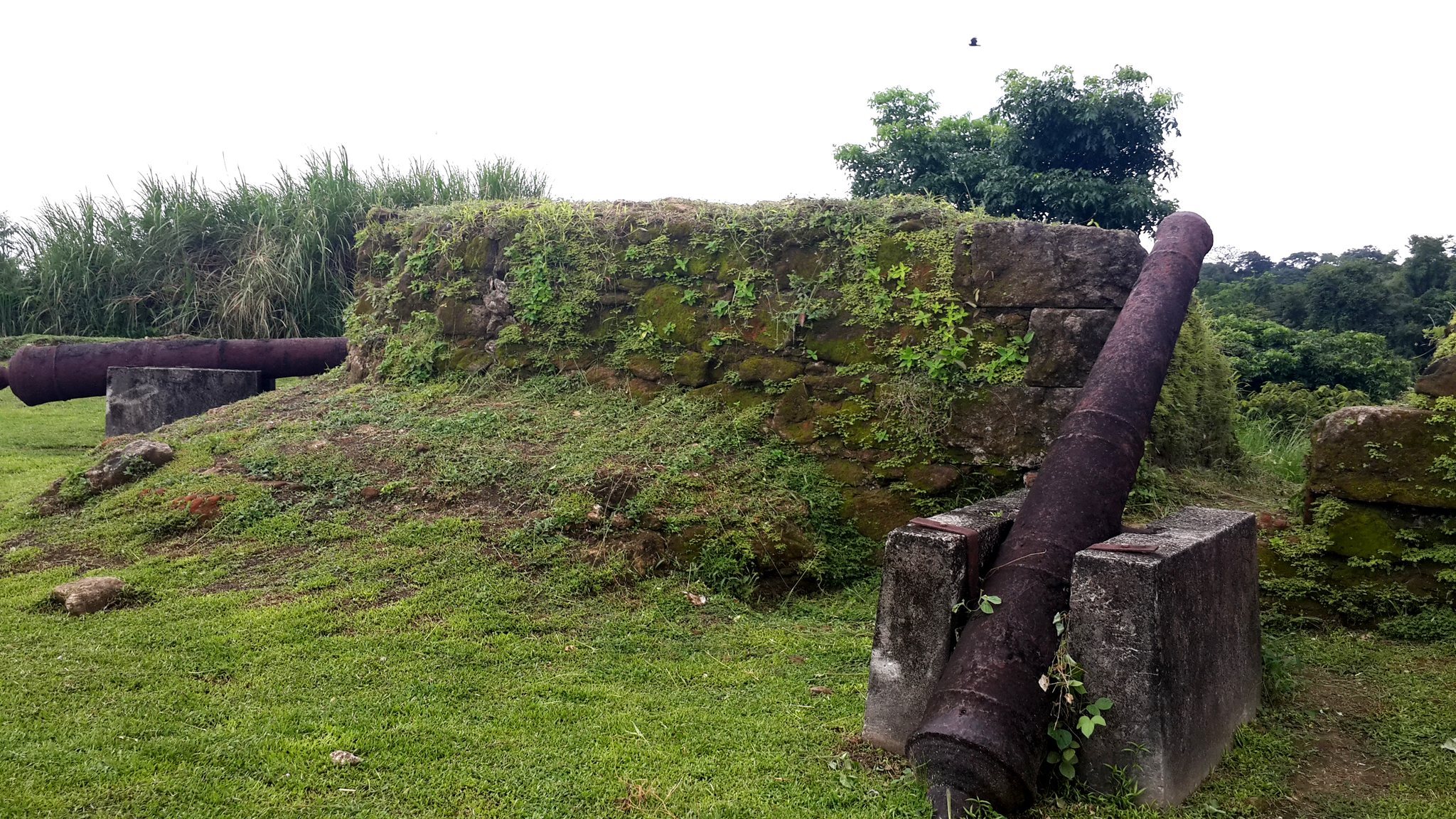
Seventeenth-century descriptions include two covered batteries at water level and a sea-facing tower equipped with eight cannon to defend the river entrance. The fort also contained upper gun batteries, guardhouses, casemates, a drawbridge, and a dry moat. Heavy cannon remain visible, while a 1908 inspection noted gun-carriage remains, culverins, mortars, domestic utensils, chains, and shackles.
Later fortress
Cliff-top fort and landward defenses
The fort built during the 1680s stood about 24 metres above the water on a cliff overlooking the harbor entrance. Its landward side used a dry moat and drawbridge. Excavations in 1966 exposed another gun emplacement on this side, positioned to command the open ground in front of the fortress and to guard against an assault from the rear.
Eighteenth-century enclosure
The rebuilding of 1761 to 1768 added a lunette, a projecting defensive work with two faces and two flanks, and deepened the existing moat. It also completed the hornwork, an outer defense formed by a central wall and projecting bastions. An upper platform, traverse, sea-front batteries, and an exterior battery were constructed, while separate defensive elements were joined into a continuous fortified perimeter.
Interior spaces and associated settlement
Courtyard and water storage
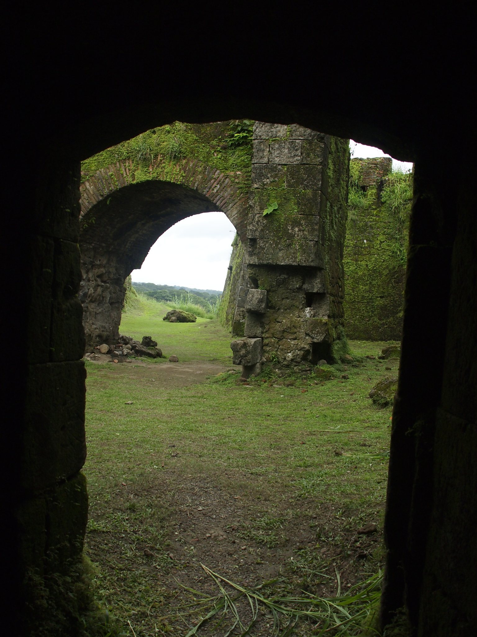
The masonry fortress contains semicircular arches, brick lintelled openings, and brick sentry structures. A large courtyard cistern collected rainwater, providing stored water within the enclosed fort.
Prison galleries and cells
Underground galleries and dark cells survive from the period when San Lorenzo served as a state prison. These spaces form part of the fort’s later history and preserve evidence of its reuse after the decline of its role in the transisthmian defense system.
Chagres and Yankee Town
The historic village site lies near the fort and the river mouth. Yankee Town, or Yanqui Chagres, occupied the opposite bank and developed during the brief traffic boom that followed the discovery of gold in California. Together, the locations reflect the changing settlement pattern around the river crossing and the fort’s long association with Atlantic transportation.