The Confluence: Historic Site and Parkland in Calgary, Canada
Site at a Glance
- Rating
- 4.3
- Popularity
- Medium
- Country
- Canada
- Primary era
- Modern
- External website
- Open
- Eras represented
- Modern
- Civilizations
- Unclassified
- Site type
- Military
- Remains
- Fort
On this page14 sections
History
The Confluence is a historic site and parkland in Calgary, Canada, at the meeting of the Bow and Elbow rivers. The North-West Mounted Police, a Canadian federal police force created to impose Canadian authority in the western territories and control the illegal liquor trade, established the original outpost in 1875. The site developed from a police post into a district station, transportation and trading centre, and later a place for interpreting Calgary’s Indigenous, colonial, and urban history.
An Indigenous Gathering Place and Police Outpost
The river confluence occupies an age-old gathering place on the traditional territories of the Niitsitapi, or Blackfoot Confederacy, the Îyârhe Nakoda, the Tsuut’ina, and the Métis Nation, Region 3. Its position at the junction of the Bow and Elbow rivers shaped the history of the area long before the establishment of the police fort.
After Fort Macleod was established, the North-West Mounted Police decided in June 1875 to create an outpost midway between Fort Macleod and Fort Edmonton. “F” Troop, commanded by Éphrem-A. Brisebois, established the post later that year. It was first called the Bow River Fort, then Fort Brisebois in December 1875, and finally Fort Calgary from June 1876. James Macleod recommended the last name, which came from Calgary House, a castle at Calgary Bay on the Isle of Mull in Scotland.
The outpost was completed in December 1875 at a cost of C$2,476. Poor heating and insulation, together with dissatisfaction with Brisebois’ leadership, contributed to a mutiny among members of “F” Troop during the winter of 1875–76. Brisebois was replaced by Lawrence Herchmer, another North-West Mounted Police officer, in August 1876.
Fort Calgary supported efforts to control the illegal whisky trade and to establish relationships with Indigenous peoples. The surrounding area also became a transportation and trading centre on the Whoop-Up Trail. An I. G. Baker Company trading post, a relocated Hudson’s Bay Company post, a temporary mission of the Roman Catholic Missionary Oblates of Mary Immaculate, and a permanent church established by 1877 joined the developing settlement.
Expansion into a District Post
The decline of the illegal whisky and buffalo trades reduced the need for a fortified outpost, and the detachment had declined to four constables by 1880. Plans to develop the surrounding area led to a major expansion in the early 1880s. In August 1882, the post became a district post, a permanent police station with continuing policing and administrative duties for the surrounding area and the adjacent Canadian Pacific Railway reserve.
James Walker was contracted to enlarge the station. The work included new or expanded facilities such as a barracks, a guardroom with 12 holding cells, a hospital, officers’ quarters, a sergeants’ mess, and buildings for tradesmen. The palisades were removed, and several earlier buildings were demolished. Between 1882 and 1902, structures were repeatedly altered, demolished, and replaced as the needs of the post changed.
Railway Acquisition and Demolition
Police operations ended in 1914 when the Grand Trunk Pacific Railway bought the site for C$250,000. The remaining fort buildings were demolished for a railway terminal. The former fort site was designated a National Historic Site of Canada on 15 May 1925, preserving its historical importance even after the physical structures had been removed.
Archaeology and Changing Interpretation
In 1975, the municipal government purchased land containing the historic site and began archaeological work to locate the demolished fort. Archaeologists uncovered portions of the original wooden fort and associated artifacts, but the remains were rapidly re-covered because exposure to open air caused uncontrolled deterioration. An interpretive centre was built in 1977, and the site reopened in 1978 as Fort Calgary Historic Park.
The museum initially concentrated on the North-West Mounted Police, its relationships with First Nations, and the force’s representation in popular culture. Its focus broadened in 1995 to include Calgary’s wider history. After the 2015 final report of the Truth and Reconciliation Commission of Canada, which examined the relationship between Indigenous peoples and Canadian institutions, the museum expanded its interpretation of Indigenous perspectives.
From 2014 to 2020, a three-phase expansion and restoration project included work on Deane House and Hunt House, the creation of the “F” Troop memorial exhibit, and the renovation and expansion of the interpretive centre. On 2 May 2024, Fort Calgary Historic Park was rebranded as The Confluence Historic Site and Parkland. The new name emphasizes the area’s history before the fort and its position at the river confluence. The City of Calgary owns the site, which is administered as a historic park and social centre.
Remains
The Confluence occupies a grassy floodplain along the south shore of the Bow River near its junction with the Elbow River. The overall historic site covers 16 hectares, while the National Historic Site designation surrounds the original fort within an approximately 12-hectare parcel. The surviving landscape combines archaeological evidence, reconstructed police buildings, later historic houses, and contemporary installations that mark the former fort’s boundaries.
The Fort Site and Its Interpretation
Original Fort
The original fort was enclosed by a wooden palisade and contained stables, barracks, a guardroom, and storage facilities. Spruce and pine used in its construction were logged upstream and floated down the rivers to the site. Archaeological work in 1975 revealed sections of the wooden fort and associated artifacts. The excavated remains were then covered again to protect them from the rapid deterioration caused by exposure to open air.
Reconstructed Police Buildings
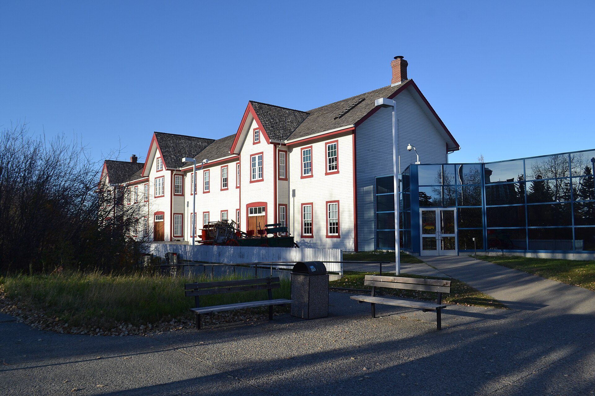
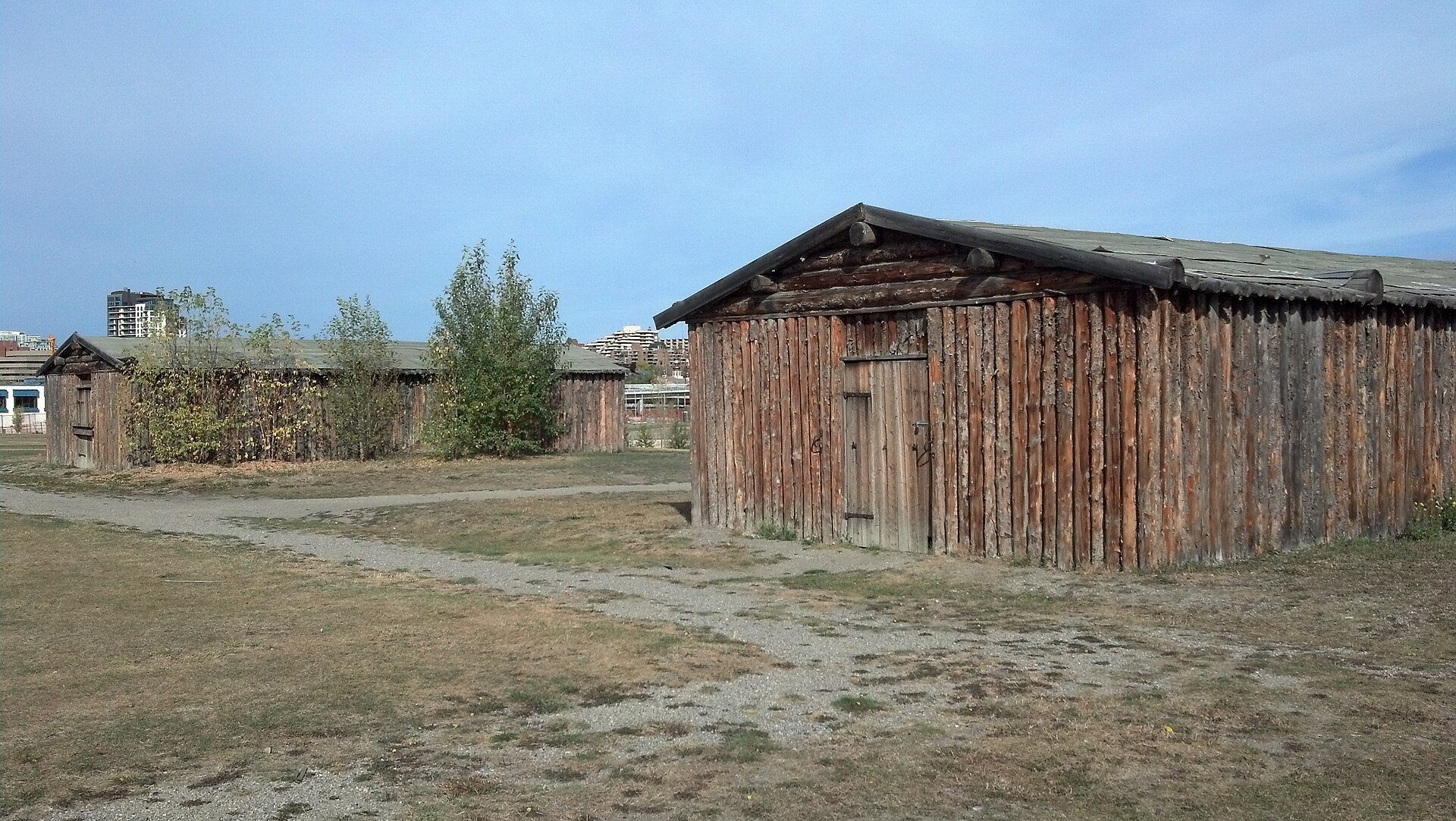
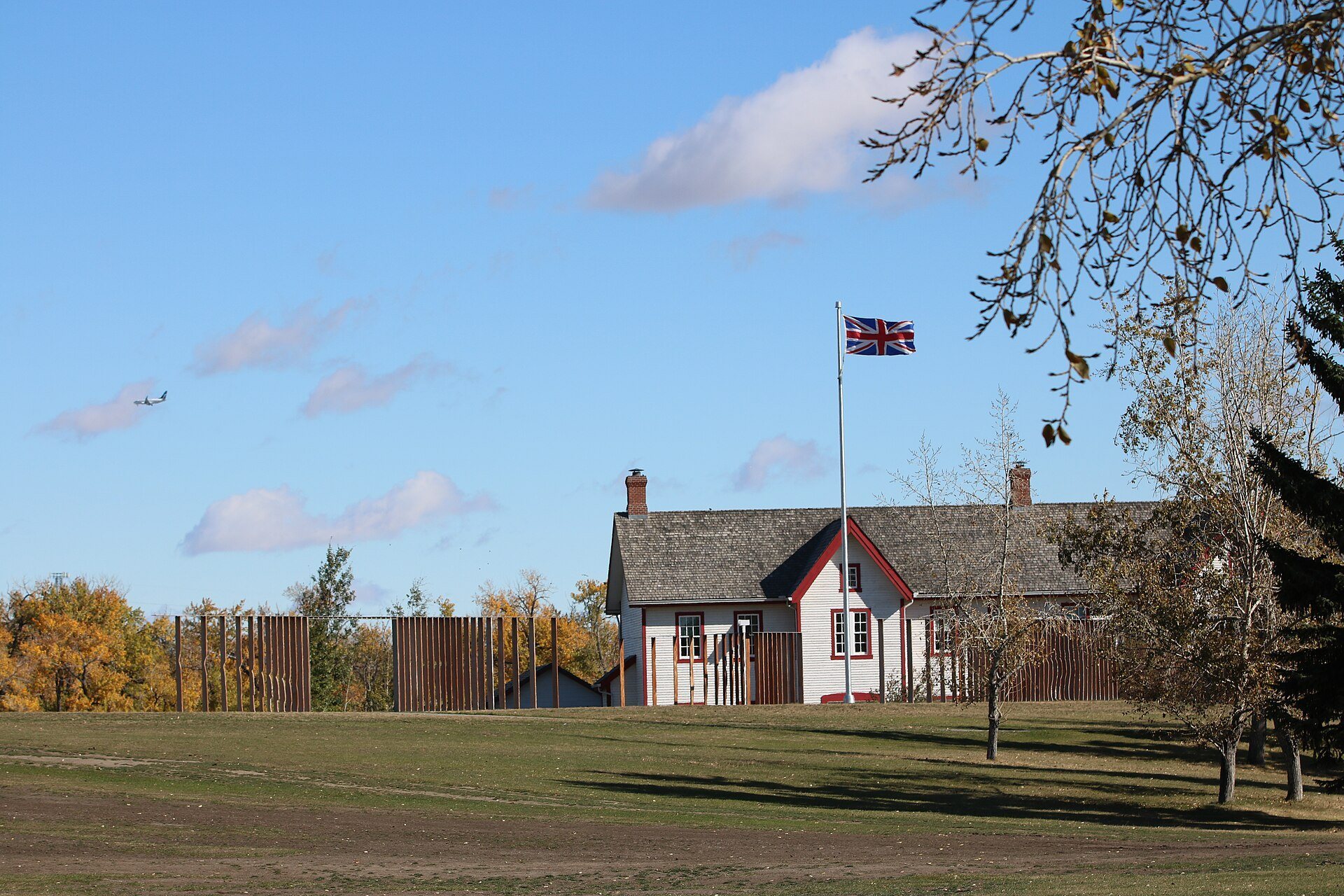
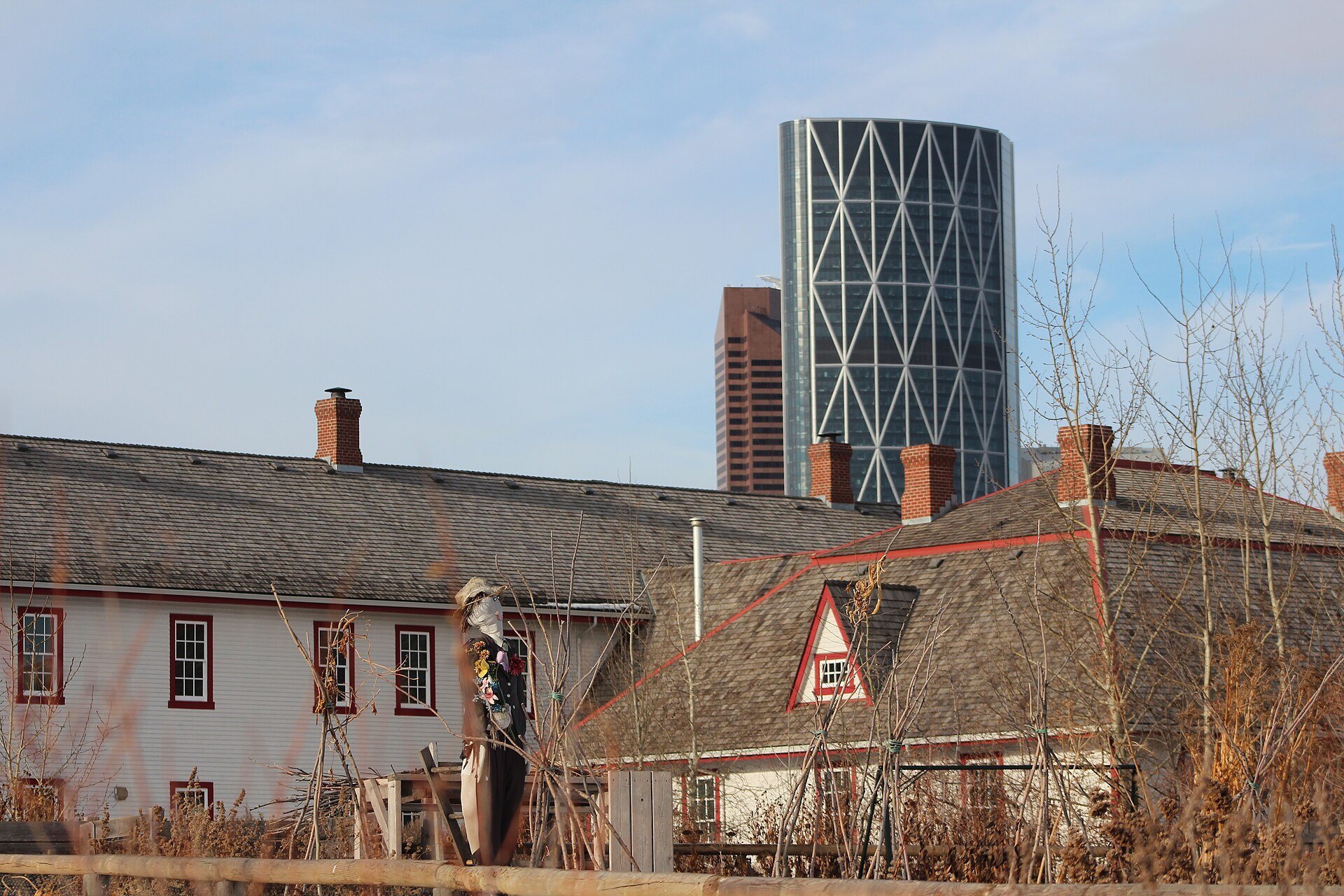
Reconstructions of the fort’s stables and wagon shed were built during the 1990s. A replica of the two-storey North-West Mounted Police barracks, modeled on the barracks constructed in 1888, was completed in 2000. The reconstructed buildings contain exhibits, audiovisual presentations, and interactive displays concerning Calgary’s history and the North-West Mounted Police.
Interpretive Centre
The interpretive centre first erected in 1977 was expanded during the 2010s to approximately 5,000 square metres. Its displays present the history of the site, the North-West Mounted Police, and the wider development of Calgary, including a fuller treatment of Indigenous perspectives introduced as the museum’s interpretation changed.
Marking
Marking, an art installation unveiled in 2016, follows the outline of the original fort with vertical wooden slats topped by metal. The slats are approximately as high as the fort’s palisades. From a particular angle, they form the appearance of 12 standing figures, and red light illuminates the installation at night. The work was created by artist Jill Anholt.
Historic Houses
Deane House
Deane House was built in 1906 near the fort for Captain Richard Burton Deane, superintendent of Fort Calgary. It originally stood near the intersection of 9th Avenue and 6th Street Southeast and faced east toward the barracks. In 1914, the Grand Trunk Railway bought the house, moved it to the southeast corner of the property, and used it as an office and station master’s house.
C. L. Jacques purchased Deane House in 1929 and moved it across the Elbow River. It subsequently served as a boarding house, Jasper Lodge, and Gaspé Lodge. The City of Calgary acquired the building in 1973 and converted it into a cooperative studio for artists and writers and the Dandelion Gallery. The Dandelion Artists’ Cooperative closed in 1978, after which the building was intended for use as a teahouse and restaurant. It remains city-owned and operates as the Deane House restaurant following substantial renovation through the site’s MakeHistory upgrades.
Hunt House
Hunt House was built between 1876 and 1881 for Métis employees of the Hudson’s Bay Company store. The log building remains on its original site at 890 Ninth Avenue Southeast and became an Alberta Provincial Historic Resource in 1977. It is the oldest building in Calgary still standing on its original site.
Its construction uses dovetail corners, in which projecting log ends interlock at the corners, rather than the post-on-sill method that places wall logs on a horizontal sill beam. The dovetail technique is characteristic of southern Alberta and reflects American cultural influences. Hunt House therefore preserves both an early building tradition and a connection with the Métis workers associated with the Hudson’s Bay Company post.