Chittorgarh Fort: The Historic Stronghold of Mewar
Site at a Glance
- Rating
- 4.6
- Popularity
- Very High
- Country
- India
- Primary era
- Medieval
- External website
- Open
- Eras represented
- Classical, Medieval, Early Modern, Modern
- Civilizations
- Rajput
- Site type
- Military
- Remains
- Castle
On this page21 sections
History
Chittorgarh Fort, in Chittorgarh, India, is a fortified hill complex developed by the rulers of Mewar, with its earliest fortifications dating to the fifth century and its most substantial defensive and architectural expansion taking place under the Sisodia Rajputs in the fifteenth century. Originally called Chitrakut, it became the capital of Mewar and later its principal stronghold, occupying a rocky hill above the present-day city.
Early traditions and the Guhila rulers
The fort’s earliest history is uncertain. Tradition attributes its construction to the Mori ruler Chitrangada Mori, while another legend connects its origin with Bhima, the heroic figure of the Sanskrit epic Mahabharata. The Bhima tradition is associated with the artificial Bhimlat Kund. These accounts preserve the antiquity of the site but do not establish a secure foundation date.
The Guhila ruler Bappa Rawal is said to have taken Chittor in 728 or 734. Later traditions variously describe the transfer as a dowry or as a conquest from the Moris or another group. Some historians question whether the Guhilas controlled Chittor at that time. The earliest discovered Guhila inscription at the fort belongs to the reign of Tejasimha in the mid-thirteenth century and names Chittor as Chitrakuta-maha-durga, meaning the great fort of Chittor.
Chittorgarh was successively associated with the Moris of Chittorgarh, the Guhilas of Medapata, and the Sisodias of Mewar. Under the Guhilas it served as the seat of a regional kingdom. Under the Sisodias, who became the ruling Rajput dynasty of Mewar, it developed into the kingdom’s chief military and political centre.
Sultanate attacks and the rise of Hammir
Between 1251 and 1258, armies led by Balban repeatedly attacked and besieged Chittor, as well as the forts of Ranthambore and Bundi. In 1303, Alauddin Khalji of the Delhi Sultanate besieged the fort, then ruled by the Guhila king Ratnasimha. After an eight-month siege, Alauddin captured Chittor. Amir Khusrow reported that the conqueror ordered the massacre of 30,000 local Hindus.
Later narratives claim that Alauddin attacked in order to seize Ratnasimha’s queen, Padmini, and that Padmini and other women performed jauhar, the mass self-immolation of women facing the imminent capture of a fortified settlement. Modern historians generally reject the Padmini story as historical, while the occurrence of a jauhar after the conquest remains disputed. Alauddin assigned the fort to his young son Khizr Khan, renamed it Khizrabad, and placed its administration under Malik Shahin.
Khizr Khan’s rule ended in 1311 after pressure from Rajput forces. The Sonigra chief Maldeva then controlled the fort for seven years, until Hammir Singh seized it. Hammir restored Chittor’s prosperity and expanded Mewar into a substantial kingdom. His descendants became known as the Sisodias.
Revival under the Sisodias
Hammir was followed by Kshetra Singh and then by Lakha, who came to the throne in 1382 and won several wars. Rana Kumbha succeeded to the throne of Mewar in 1433, when the rulers of Malwa and Gujarat were seeking to extend their power against the kingdom.
Also known as Maharana Kumbhakarna, Rana Kumbha ruled from 1433 to 1468 and presided over a major revival of Chittor and Mewar. He strengthened the kingdom’s military power, built 32 forts, and carried out extensive defensive and architectural works at Chittorgarh. The more substantial defensive complex on the hill belongs chiefly to this period, when the royal entrance was relocated and protected by seven gates.
Rana Kumbha’s brother, Rana Raimal, took power in 1473. After Raimal’s death in May 1509, his son Sangram Singh, known as Rana Sanga, became ruler. Beginning in 1509, Rana Sanga expanded Mewar across Rajasthan, Malwa, parts of Gujarat, and parts of northern India. He defeated Ibrahim Lodhi at Khatoli and Dholpur and granted Chanderi and parts of Malwa to his vassal Medini Rai.
Rana Sanga united several Rajput states and advanced against Babur with a large Rajput army. The confederacy was defeated at Khanwa, where Babur’s tactics and extensive use of artillery and firearms helped establish Mughal power in northern India. Prithviraj Singh I of Jaipur and Maldeo Rathore of Marwar carried Rana Sanga from the battlefield. His nobles later poisoned him, and he died at Kalpi in January 1528.
The sieges of 1535 and 1567 to 1568
After Khanwa, Babur defeated Medini Rai at Chanderi and captured Chanderi and Malwa. Accounts associated with that conquest describe the self-immolation of Rajput women and children, but those events took place at Chanderi rather than at Chittorgarh.
In 1535, Bahadur Shah, the Sultan of Gujarat, besieged and sacked Chittorgarh. Rana Vikramaditya and Udai Singh II escaped to Bundi. Traditions state that Rani Karnavati led approximately 13,000 Rajput women in jauhar, while about 3,200 Rajput warriors made a final sortie and died in battle.
The final major siege began in 1567, when the Mughal emperor Akbar attacked Mewar, then ruled by Rana Uday Singh II. Akbar sought to bring Mewar under Mughal control, gain access to the Gujarati ports, and establish a trade route. Uday Singh withdrew with his family to Gogunda, leaving Jaimal and Patta to defend the fort with approximately 8,000 Rajput soldiers.
Akbar reached the plains outside Chittorgarh on 20 October 1567 and maintained the siege for four months. On 22 February 1568, Jaimal was killed by a musket shot attributed to Akbar. Jauhar was performed in the houses of Patta, Aissar Das, and Sahib Khan. The following day, the defenders opened the gates and attacked. Chittorgarh was conquered, and between 20,000 and 25,000 civilians were killed alongside the fort’s army.
Later history and cultural memory
In 1615, a treaty between the Mughal emperor Jahangir and Amar Singh returned Chittorgarh to Amar Singh. The fort was refurbished in 1905 during the British Raj. In 2013, it was included with five other Rajasthan forts in the UNESCO World Heritage serial property Hill Forts of Rajasthan, inscribed at the World Heritage Committee’s 37th session in Phnom Penh.
Chittorgarh Fort and the city host the annual Jauhar Mela, a Rajput commemorative festival associated with the memory of the fort’s three jauhars and the bravery of Rajput ancestors. Its principal association is generally considered to be the jauhar attributed to Padmavati, although the festival also serves as a public forum for contemporary political views. Chittorgarh has also been suggested as a possible inspiration for the ruined city of Cold Lairs in Rudyard Kipling’s The Jungle Book. Kipling visited Chittorgarh in 1887, but the proposed identification remains tentative.
Remains
Hill, walls, and gateways
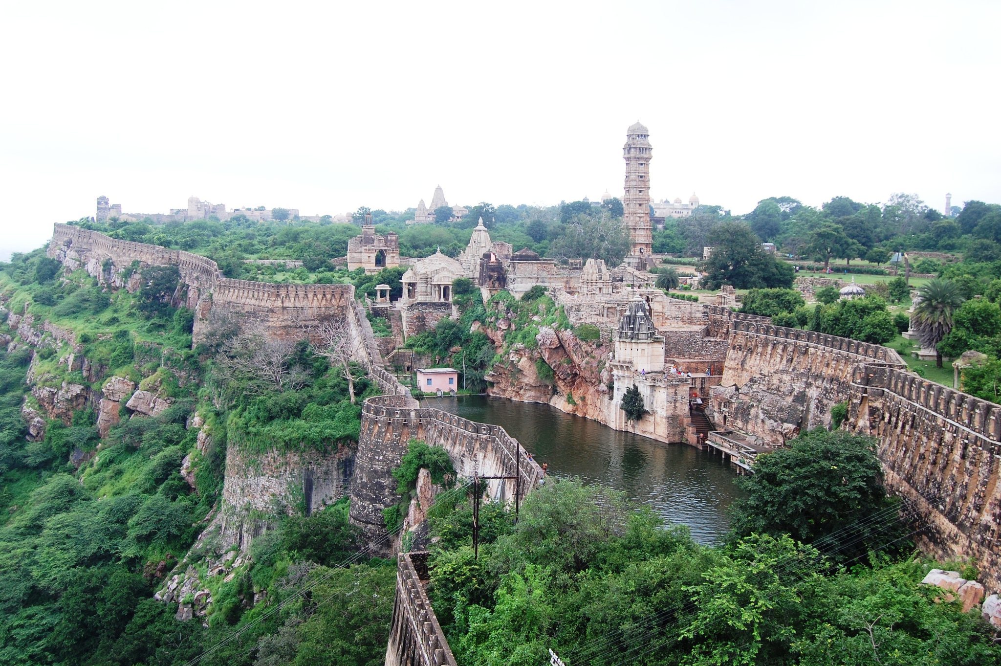
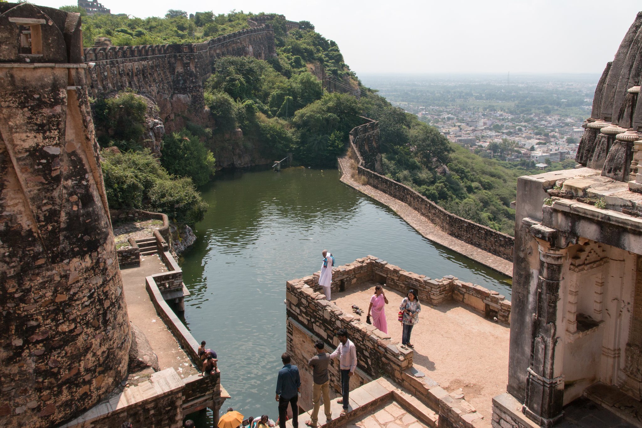
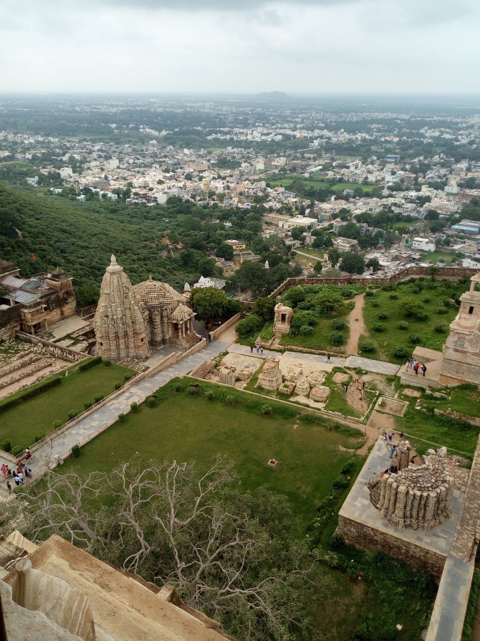
Chittorgarh Fort occupies an isolated rocky hill about 180 metres above the surrounding plains, on the left bank of the Berach River, a tributary of the Banas. The hill is roughly fish-shaped, approximately 2 kilometres long and 155 metres wide in one description, with a maximum length of about 5 kilometres, a circumference of approximately 13 kilometres, and an area variously given as about 280 hectares, 700 acres, or 2.8 square kilometres. Its steep escarpment rises at about 45 degrees.
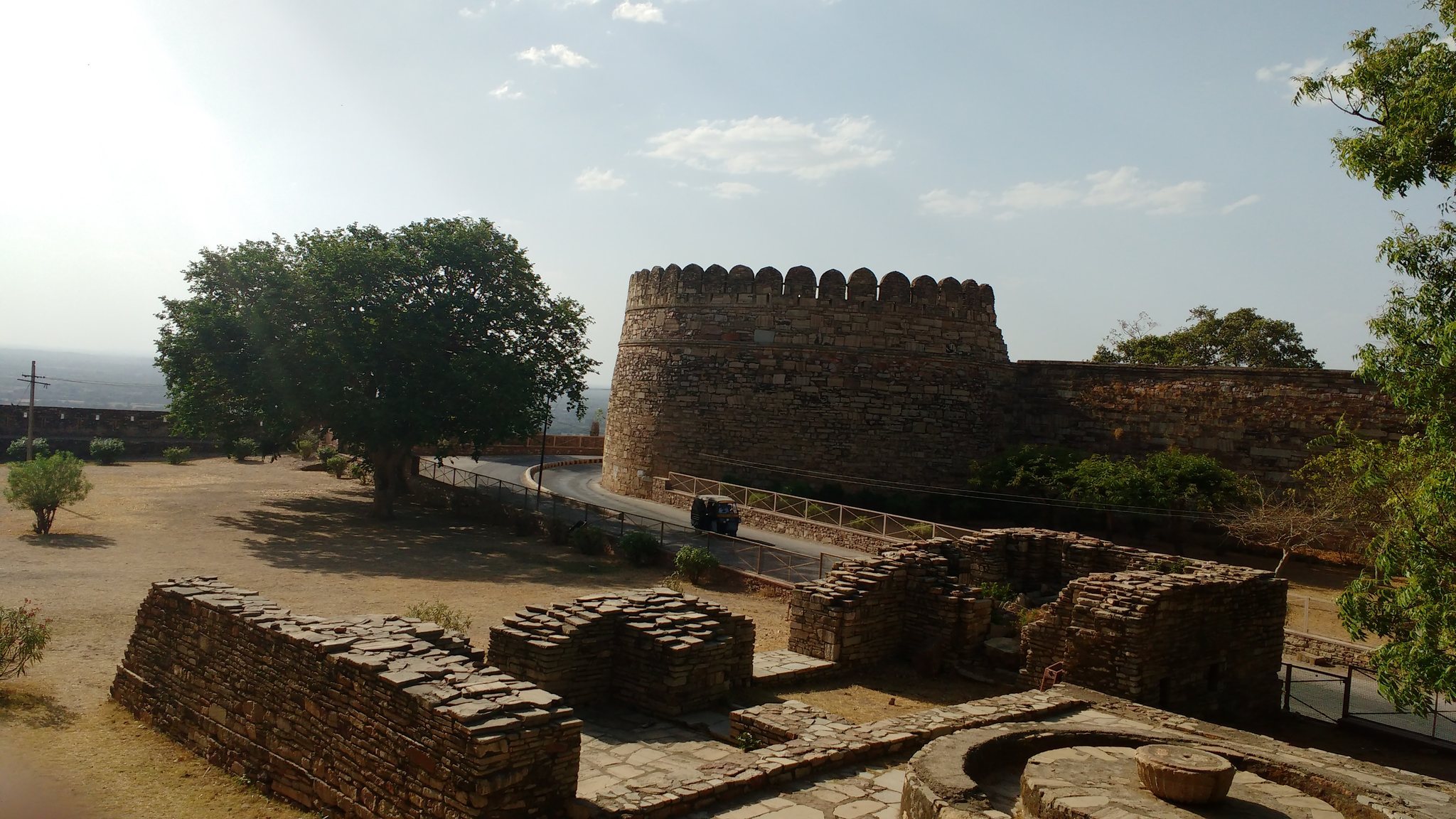
A winding ascent of more than 1 kilometre leads from the plains to the western entrance, crossing a limestone bridge over the Gambhiri River. The bridge has ten arches, including one curved arch and the remainder pointed arches. Within the fort, a circular road connects the gates and monuments. The perimeter defences include a 13-kilometre outer wall, while another wall system extends for approximately 4.5 kilometres. Dressed stone masonry set in lime mortar and integrated circular elements reinforce the walls.
The seven western gates
The principal ascent passes through seven western gates, Padan Pol, Bhairon Pol, Hanuman Pol, Ganesh Pol, Jorla Pol, Laxman Pol, and Ram Pol. These massive stone gateways have pointed-arched entrances, notched parapets for archers, and reinforcements intended to withstand elephants and cannon fire. The final gate, Ram Pol, opens directly into the palace precinct.
Jorla Pol, meaning the Joined Gate, consists of two connected gateways. Its upper arch meets the base of Laxman Pol in a configuration described as unusual within India. Lokota Bari stands at the northern tip of the fort, while a small opening at the southern end was used to throw criminals into the abyss.
Palaces and royal precincts
The palace complex occupies the highest and most secure ground in the western part of the fort. The seventh gate leads into an area combining residential and official buildings. Its predominant architecture belongs to the fifteenth century and is comparatively pure Rajput in style, although some vaulted substructures derive from Sultanate architecture.
Rana Kumbha Mahal
Rana Kumbha Mahal is a large Rajput domestic complex near the entrance and Vijaya Stambha. It now incorporates Kanwar Pade Ka Mahal, the palace of the heir, and a later palace associated with the poet Mirabai. The complex included elephant and horse stables and a temple dedicated to Shiva. Built of plastered stone, it has a notable series of canopied balconies, and its entrance through Suraj Pol leads to a courtyard.
The palace area is associated with the birth of Maharana Udai Singh, the founder of Udaipur, and with Mirabai, who is said to have lived there. Nearby are the Nau Lakha Bandar, formerly the royal treasury, the Singa Chowri Temple, a museum, and an archaeological office.
Later palace additions
Later periods expanded the royal precinct. Ratan Singh Palace dates from 1528 to 1531. Fateh Prakash, also called Badal Mahal, was built by Rana Fateh Singh between 1885 and 1930 near Rana Kumbha Mahal. Its precinct contains modern houses and a small museum.
Padmini’s Palace
Padmini’s Palace is a white, three-storey building in the southern part of the fort and a nineteenth-century reconstruction of an earlier palace. Chhatris crown its roofs, and a water moat surrounds the building. Its arrangement follows the Jal Mahal concept of a palace encircled by water. The palace is connected by tradition and Mewar literary references with Rani Padmini, Rana Sanga’s confinement of Mahmud Khilji II, and later repairs by Maharana Sajjan Singh.
Hindu and Jain religious buildings
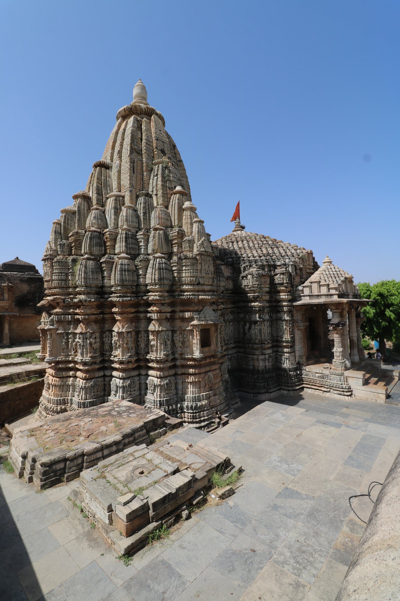
The fort contains predominantly Hindu temples from several periods. The Kalikamata Temple incorporates the remains or succession of an eighth-century Sun Temple dedicated to Surya, the Hindu solar deity. The earlier temple was destroyed in the fourteenth century and rebuilt as a temple dedicated to Kali. Other Hindu buildings include the Kshemankari Temple, dated 825 to 850, the Kumbha Shyam Temple of 1448, and the Adbuthnath Temple, dated to the fifteenth or sixteenth century.
Mira and Kumbha Shyam temples
The Mira, or Meerabai, Temple near Vijaya Stambha was built by Rana Kumbha in an ornate Indo-Aryan style. It is associated with Mirabai’s devotion to Krishna and with her devotional songs, known as Meera bhajans. An image of Mirabai praying before Krishna is installed inside.
The larger temple in the same compound is the Kumbha Shyam, or Varaha, Temple. Its pinnacle has a pyramidal form, and it was among the important buildings constructed during the fifteenth-century development of the fort.
Jain buildings and memorial canopy
Jain buildings include Sattaees Devari, Shringar Chauri, dated 1448, and Sat Bis Devri, dated to the middle of the fifteenth century. In front of the Meera Temple stands a chhatri, a domed pavilion or canopy, associated with Ravidas. It bears an engraved footprint attributed to Guru Ravidas. The fort’s Jain structures also preserve the religious presence of communities active during its medieval development.
Towers and military installations
Vijaya Stambha
Vijaya Stambha, also called Jaya Stambha or the Tower of Victory, was erected by Rana Kumbha between 1458 and 1468 to commemorate his victory over Mahmud Shah I Khalji of Malwa in 1440. The tower rises 37.2 metres above a base of approximately 47 square feet. Nine storeys are connected by a narrow circular staircase of 157 steps, which reaches the eighth floor. Its interior is carved, and a later dome was damaged by lightning and repaired in the nineteenth century.
Kirti Stambha
Kirti Stambha, or the Tower of Fame, is an older Jain tower probably dating from the twelfth century. It is approximately 22 metres high, stands on a base about 9.1 metres wide, and narrows to approximately 4.6 metres at the top. The Bagherwal Jain merchant Jijaji Rathod built it in honour of Adinath, regarded in Jainism as the first tirthankara, or revered spiritual teacher. Jain sculptures decorate the exterior, while figures of other tirthankaras occupy niches on the lowest floor. A narrow staircase of 54 steps rises through six storeys, and a twelve-column upper pavilion was added in the fifteenth century.
Western temple and cannon foundry
On the western side of the fort is an older temple dedicated to the goddess Tulja Bhavani, built by Banvir. Beside it stands the Tope Khana, or cannon foundry. Several old cannons remain in its courtyard.
Water systems and present occupation
Gaumukh Reservoir is supplied by a spring issuing from a carved cow’s mouth in the cliff. It served as a principal water source during the fort’s repeated sieges. The fort formerly contained 84 water bodies, of which 22 remain. Ponds, wells, and stepwells, meaning reservoirs reached by descending flights of steps, collect natural runoff and rainfall. Their combined storage is approximately 4 billion litres, enough to supply an army of 50,000 for four years.
The complex contains 65 historic structures, including four palace complexes, 19 principal temples, 20 large or functional water bodies, four memorials, and several victory towers. Many additional palaces and temples are ruined, while another description refers to approximately 130 temples accessible from the internal road. A municipal ward of about 3,000 inhabitants occupies part of the fort near Ratan Singh Tank at the northern end of the property. Modern houses, a school, and a small museum stand near Fateh Prakash Palace, and the wider fort is described as containing approximately 5,000 local villagers.