Chunar Fort: A Strategic Fortress on the Ganges in India
Site at a Glance
- Rating
- 4.1
- Popularity
- High
- Country
- India
- Primary era
- Early Modern
- Eras represented
- Early Modern
- Civilizations
- Mughal
- Site type
- Military
- Remains
- Fort
On this page14 sections
History
Chunar Fort is a historic fortress in India, standing above a bend of the Ganges in Uttar Pradesh. Settlements at Chunar are recorded from 56 BC, while local traditions place the fort’s construction in 1029 and associate it with King Sahadeo. Its position above the river and near routes leading into eastern India later made it an important military stronghold under the Sur, Mughal, and British regimes.
Early traditions and medieval rule
The fort is traditionally known by the names Chandrakanta Chunargarh and Charanadri. One legend connects Charanadri with Bawan Bhagwan, the divine figure in the story of King Bali who appears as a Brahmin and asks for three feet of land. The name is said to have eventually shortened to Chunar. Other traditions associate the hill with Vikramaditya of Ujjain, a legendary king remembered in Indian stories for justice and heroic rule, as well as with his hermit brother Bharthari and the saint Goraknath.
Local accounts also connect the fort with the saint Bhatinath. A black stone associated with him continues to receive worship because he is believed to remain invisibly present within the fort. Another tradition says that Prithviraj brought Chunar and neighboring villages under his authority. His descendants are said to have sold the land to Khair-ud-din Subuktagin. An imperfect Sanskrit inscription on the gateway is traditionally linked with a later takeover by Swami Raja, who supposedly erected a commemorative stone tablet.
The same tradition associates a subsequent phase of control with Sahab-ud-din, who appointed an African official and a Bahelia as governors and granted them a jagir, or landed grant. It states that the Bahelia family retained the land until the fort passed to the British. These traditions form part of Chunar’s historical memory, alongside the more securely dated military events of the sixteenth century.
The Sur and Mughal struggle
Chunar’s earliest recorded sixteenth-century history is connected with a garrison established by Babur, founder of the Mughal dynasty. In 1529, many of his soldiers were killed, and some of their tombs at Chunar continued to be venerated. In 1532, Sher Khan, later known as Sher Shah Suri, seized the fort. Sher Shah founded the Sur dynasty, which displaced the Mughal emperor Humayun in northern India before the Mughals recovered power.
Sher Khan strengthened his position through strategic marriages and the acquisition of wealth, building what was described as a state within a state. During Humayun’s four-month siege, he agreed to surrender Bengal and accept Mughal protection in return for retaining Chunar and other possessions. After Humayun marched toward Bengal, however, Sher Khan recovered the fort.
After Sher Shah died in 1545, Chunar remained under his son Islam Shah until 1553. Adil Shah, the last Sur ruler, was confined there until 1556 while his Hindu prime minister Hemu assumed much of the administrative and military authority. Hemu launched campaigns from Chunar, won several battles in northern India, captured Delhi after the Battle of Tughlaqabad in 1556, and declared himself independent. Adil Shah was killed during an attack by the king of Bengal in 1557.
The fort came under Mughal control in 1575. Akbar regarded it as strategically important because it guarded the Ganges and major land routes toward eastern India. Much of the fort’s surviving form is traditionally attributed to his reign. During the Mughal period, Jahangir appointed Iftikhar Khan as administrator. In 1663, Mirza Bairam Khan, the governor appointed under Aurangzeb, built a mosque near Bharion Burj. A west-gate inscription dates that gate to 1586 and attributes it to Muhammad Sharif Khan. The work took place while Munim Khan held the fort and surrounding lands; Munim Khan died at Chunar in 1575.
Company and British military control
Maharaja Chait Singh of Benares temporarily occupied Chunar but was expelled. Warren Hastings, the first Governor-General of Bengal, is also said to have taken refuge there. In 1791, the fort became the headquarters of an invalid battalion made up of European and Indian troops considered medically unfit for field service.
After the Marathas ceded their Bundelkhand territories to the East India Company following their defeat in the Second Anglo-Maratha War, British forces under Major Munro attacked Chunar. The attackers initially lost ground, but they breached the southwestern side with siege artillery and annexed the fort. Its formal transfer to the East India Company took place under a treaty in 1818.
For several years under British rule, Chunar served as the principal artillery and ammunition depot of the Northwestern Provinces. From 1815, it also held state prisoners. During the uprising of 1857–58 against British rule, the fort became a refuge and defensive base for the European invalid battalion, European residents, and district officials. The Bhartri Nath shrine was temporarily used as a civil treasury.
In 1849, Rani Jind Kaur was imprisoned at Chunar after the British takeover of the Sikh kingdom. She escaped disguised as a maidservant and received political asylum in Kathmandu. After troops were withdrawn in 1890, the complex passed to the civil administration and was used as a convalescent jail. It later became a religious center, and India regained control of the fort in 1947.
In the modern period, the fort was considered a possible target of Naxalite attacks because it served as a recruitment and training center for the Provincial Armed Constabulary and contained substantial arms and ammunition. The state government consequently directed the police to protect the fort and its facilities closely. Religious practice continues at the Bhartri Nath samadhi, a shrine or memorial associated with a religious figure’s burial or final spiritual resting place. Local tradition also holds that a divine presence allows the fort to be captured only during a particular interval in the morning.
Remains
Hilltop fortress and defenses
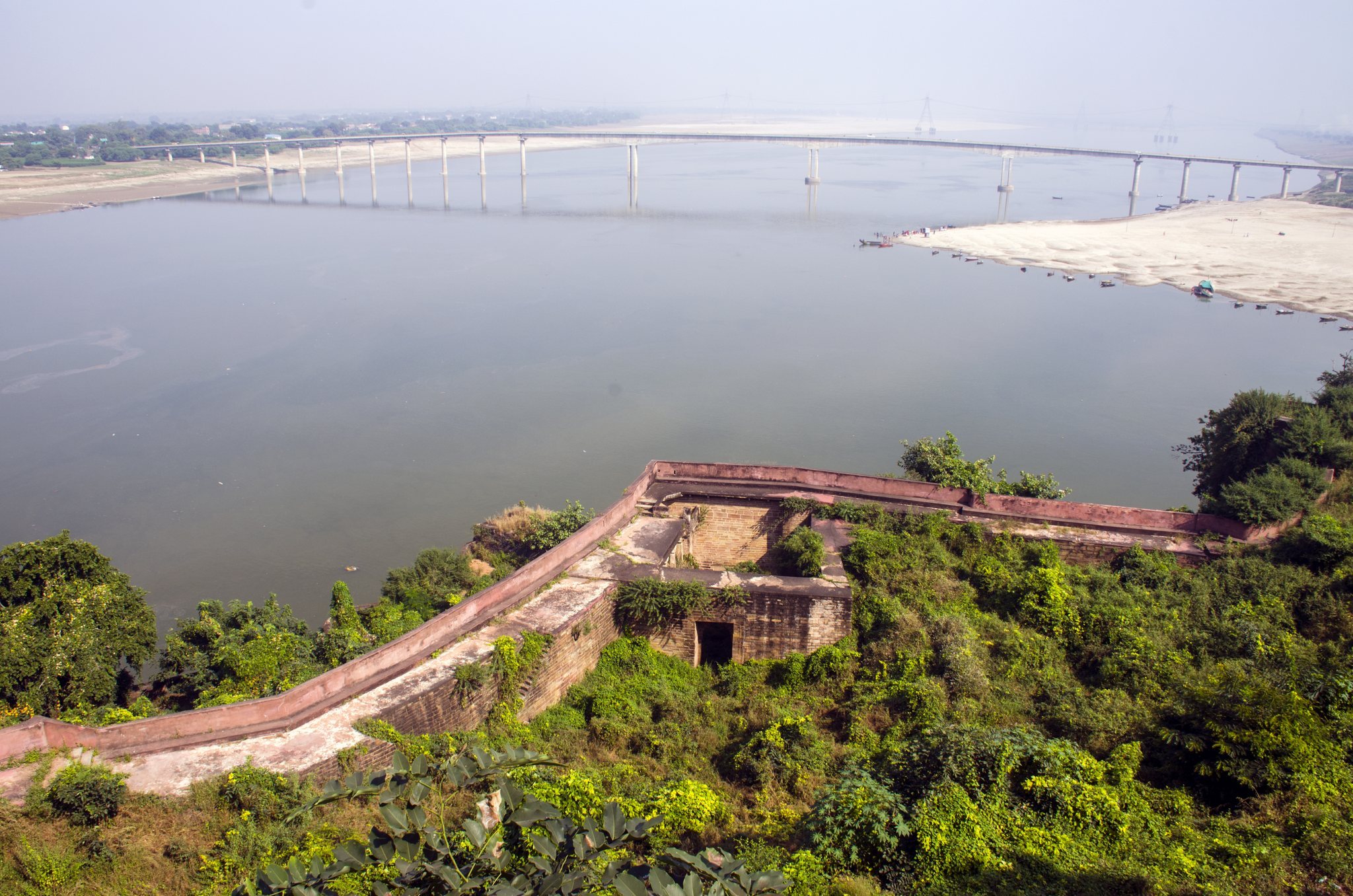
Chunar Fort occupies a detached rocky outcrop of the Vindhya Range, above a bend of the Ganges near the Kaimur Hills. Its southeastern side follows the rocky riverbank, and the outcrop extends into the river. The bluff rises about 104 feet (32 m) from the water, while a hillock roughly 200 feet (61 m) farther away reaches about 280 feet (85 m) above sea level. Boats of approximately 50 to 60 tons could navigate this stretch of the Ganges, and the fort’s batteries commanded the river.
Ramparts and towers
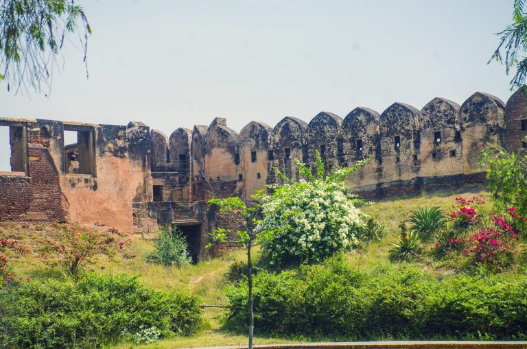
The fort rises sharply from the plain and is approached through low hills running parallel to the river. Its ramparts are built in tiers from locally quarried Chunar sandstone. The enclosed area measures about 750 yards (690 m) from north to south, reaches a maximum width of 300 yards (270 m) on the northern river-facing side, and has a perimeter of approximately 1,850 yards (1,690 m). Towers placed at regular intervals along the ramparts range from 10 to 20 feet (3.0–6.1 m) high.
Massive river-facing walls form part of the defenses, while the external walls were breached by British forces using a battering train, or siege artillery train. Chunar’s quarries, known since the Maurya period, supplied the sandstone, and local masons helped construct the fort. The open ground within the enclosure includes grassy areas and a few trees. Defenders also stored crude cylindrical objects that could be rolled down the steep slope against attackers.
Gates and citadel
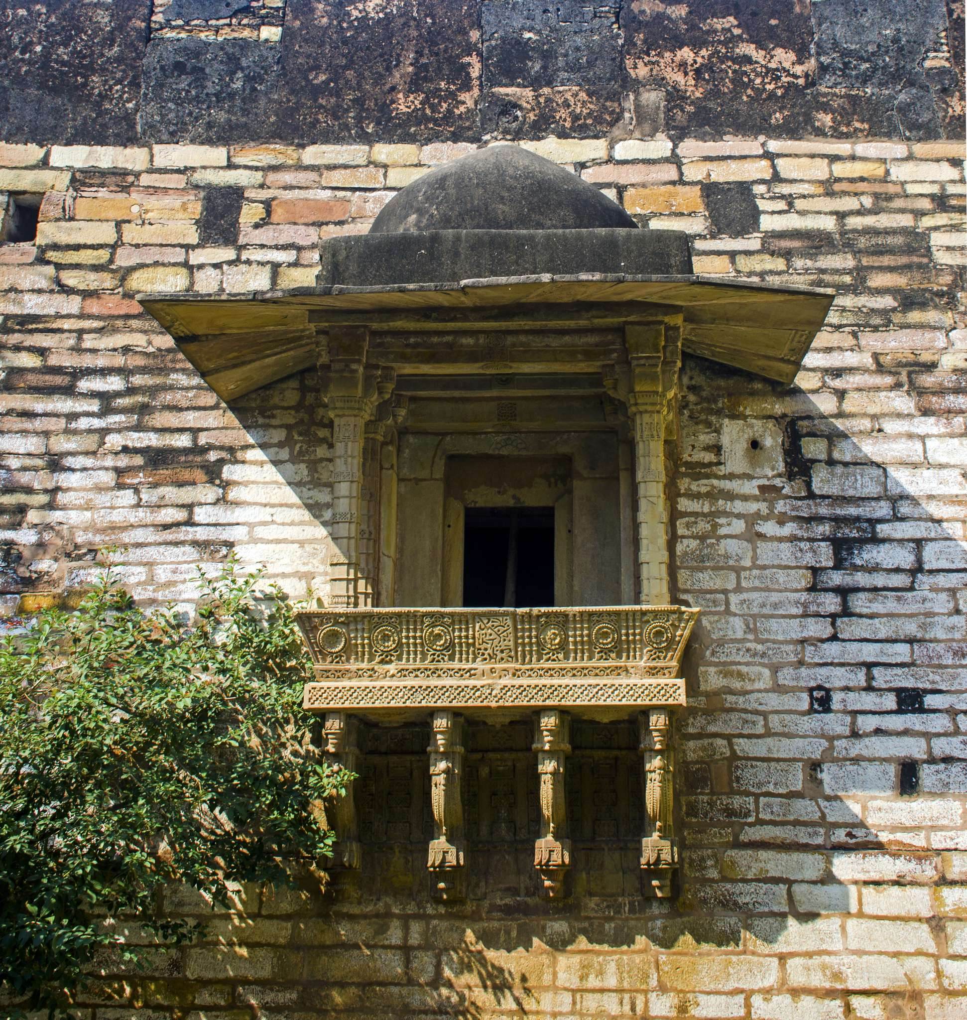
The west gate is the only gate with inscriptions. Its stone archway dates to 1586 and includes calligraphic slabs with relatively little ornamentation. The other gates contain carved panels and brackets. The citadel occupies the northeastern part of the fort, where cannons and a gunpowder magazine were kept. Its projecting windows use S-shaped brackets resembling those at Agra Fort, while knot motifs are associated with architectural traditions of the Sur period.
Palace and water structures
Hindu palace and underground spaces
At the highest point of the rocky bluff stands an old Hindu palace in the form of a very large vaulted structure. A well in this area is about 15 feet (4.6 m) in diameter and deeply sunk. An underground dungeon is now used as a storeroom.
Sonwa Mandap and tunnel
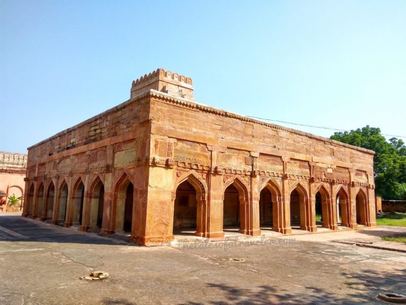
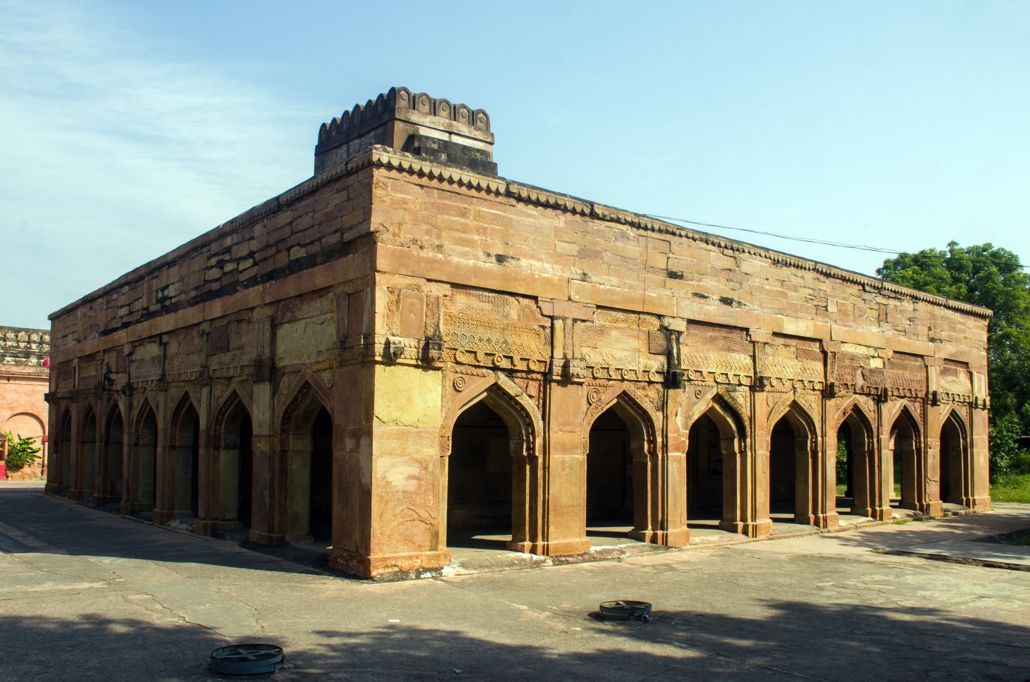
The Sonwa Mandap is a pavilion dating to 1538 that served as a gatehouse. Built in a Hindu architectural style, it has 28 pillars, four gates, and a tunnel in the front yard that can be reached from within the fort. An engraving on its arched prayer niche is believed to have been filled with gold. Behind the pavilion lies Bhartri Nath’s samadhi, where religious ceremonies are conducted.
A local tradition states that Princess Sonwa, daughter of the Nepali king Sandeva, used the tunnel in 1333 to reach the Ganges for bathing. Near the pavilion is a bawdi, a deep or stepped well providing access to stored or groundwater. It measures about 17 feet (5.2 m) across and nearly 200 feet (61 m) deep. The well contains perennial water believed to be connected with the Ganges, and tradition also associates it with Princess Sonwa’s ablutions.
Later buildings and archaeological landscape
British buildings and graves
Several bungalows among the trees served as offices and residences for British officers. The complex also contains a governor’s house, a hospital, and a state prison. An eighteenth-century sundial and neglected British graves lie below the walls, with surviving headstones bearing inscriptions.
Religious sites and surrounding quarries
A square stone slab shaded by a peepal tree is associated with a local belief that a god sits there for part of each day before moving to Varanasi. The slab and tree remain a site of religious interpretation. Immediately southwest of the fort, quarries supplied stone in the third century BC for the lions carved at Sarnath, connecting the surrounding stone-working landscape with major monuments of the Maurya dynasty.