Segontium Roman Fort: A Roman Military and Administrative Centre in Wales
Site at a Glance
- Rating
- 4
- Popularity
- Low
- Country
- United Kingdom
- Primary era
- Classical
- External website
- Open
- Eras represented
- Classical
- Civilizations
- Roman
- Site type
- Military
- Remains
- Fort
On this page21 sections
History
Segontium Roman Fort is a Roman military and administrative centre in Caernarfon, United Kingdom, founded by Gnaeus Julius Agricola in AD 77 or 78. Built after the Roman suppression of the Ordovices and the renewed conquest of Anglesey, it formed part of Rome’s consolidation of control in north Wales during the late first century. The fort controlled routes towards fertile and mineral-rich Anglesey, including its copper resources, and monitored the Menai Strait, the river mouth, mineral transport, regional roads, and the north Welsh coast.
Foundation and Roman control
Agricola was the Roman governor of Britain whose campaigns extended Roman authority across Wales and northern Britain. Segontium initially housed about 1,000 auxiliary infantrymen. Auxiliaries were non-legionary troops recruited from communities outside the Roman citizen legions. The fort was connected by Roman roads with the legionary bases at Chester, known as Deva Victrix, and Caerleon, known as Isca. Another route led to Canovium, approximately 24 Roman miles away, as listed in the Antonine Itinerary, a Roman record of roads and distances.
The fort’s position gave it a role in overseeing the Menai Strait and access to Anglesey. Its military purpose later focused more strongly on defending the coast against Irish raiders and pirates. A civilian settlement, or vicus, grew around the fort to supply its garrison. The settlement included residential, commercial, and religious activity, represented by its buildings, industrial debris, pottery, temple, Mithraeum, and cemetery. The vicus appears to have declined by the end of the second century.
Changes in the garrison
Archaeological evidence indicates that the garrison was reduced by about AD 120 or during the second century. By the third century, Segontium was occupied by the 500-man Cohors I Sunicorum, an auxiliary cohort originally recruited among the Sunici of Gallia Belgica, a Roman province in northern Gaul. The unit may also have been called the Segontienses, although that identification remains uncertain. Finds at the fort have also been interpreted as indicating a unit combining infantry and cavalry.
The first fort was built with timber and earth. It burned towards the end of the reign of Trajan and was abandoned or destroyed before being rebuilt in stone under Hadrian. Despite the reduction in military strength, Segontium continued in use through the Antonine and Severan periods and into late antiquity. An inscription records the restoration, during the reign of Septimius Severus, of an old and deteriorated aqueduct channel serving Cohors I Sunicorum.
Late Roman occupation and abandonment
Repairs to buildings, renewed road surfaces, and other works around AD 350 to 360 show that activity continued during the later Roman period. Coins indicate occupation until about AD 394, while the latest identified coin belongs to the reign of Gratian, AD 367 to 383. The final abandonment followed the weakening of Roman forces in Wales and increasing Irish raids, although the precise circumstances are uncertain. Its long occupation made Segontium one of the longest-held Roman garrison locations in Wales.
Memory and archaeological investigation
After the Roman period, Segontium became part of Caernarfon’s historical identity. Welsh tradition remembered it as Caer aber Seint, meaning “the fort at the mouth of the Saint river,” and associated it with The Dream of Macsen Wledig, one of the tales of the Mabinogion. Medieval traditions also used the names Cair Segeint and Cair Custoeint, and uncertainly connected the place with the death or monument of Constantius.
A Norman motte, a medieval fortification built on an artificial or adapted earthen mound, was established nearby in the eleventh century. Caernarfon Castle and its walled town followed after the thirteenth-century Edwardian conquest, and stone from Segontium was reused in the medieval castle.
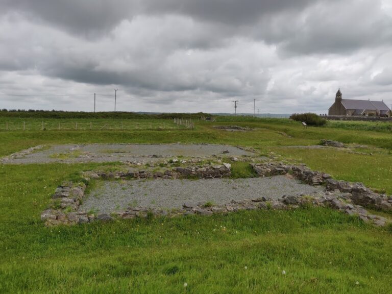
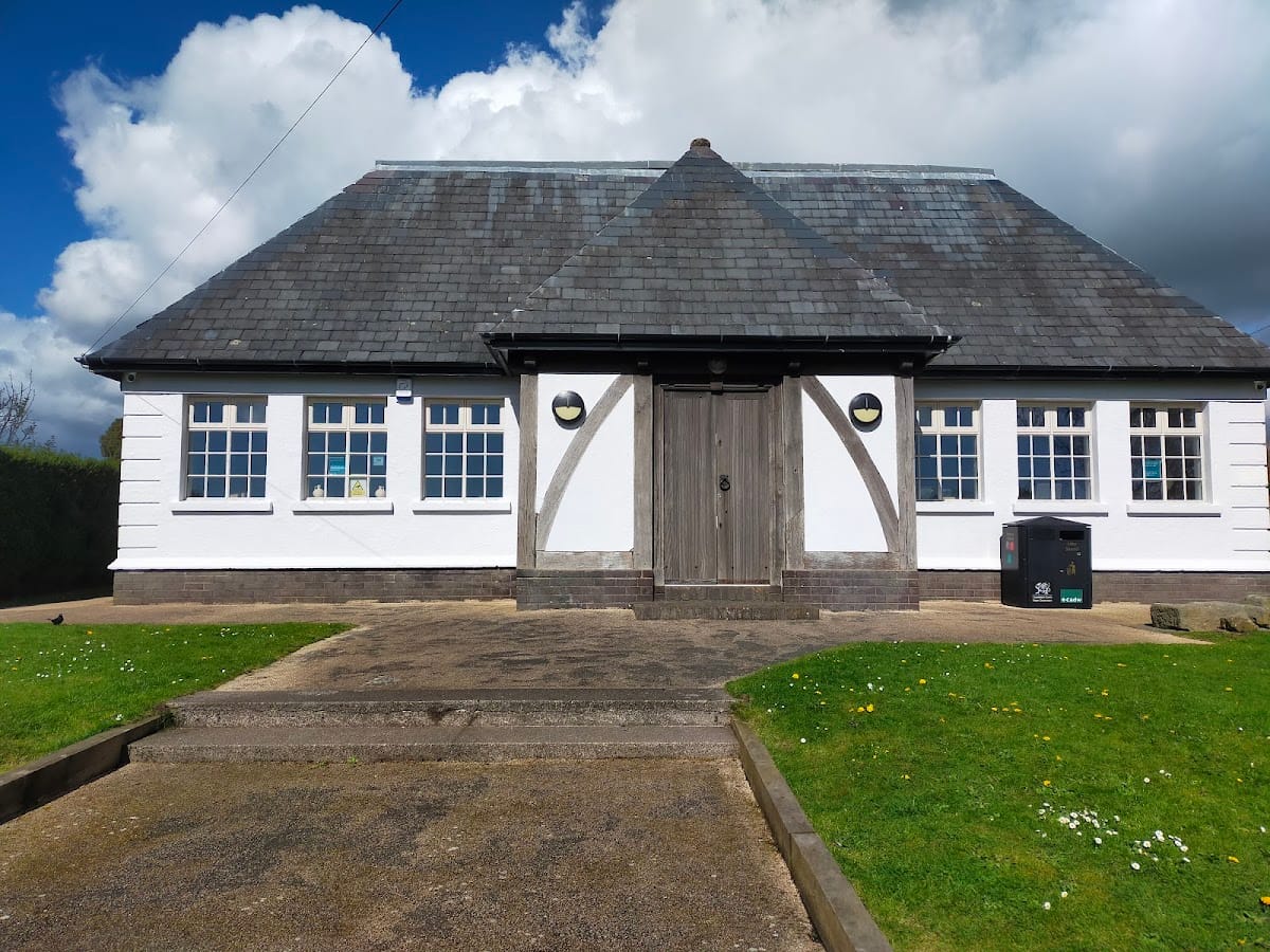
Investigation began in 1845 and 1846. Mortimer Wheeler’s major excavations in 1921 to 1923 exposed many of the foundations visible today, while further excavations took place from 1975 to 1979. By 1977, approximately 1,500 square metres of the fort had been investigated, although the south-western part remained largely unexplored. Most excavated buildings have been conserved, and the site is managed by Cadw as an archaeological display area with a visitor centre and museum.
Remains
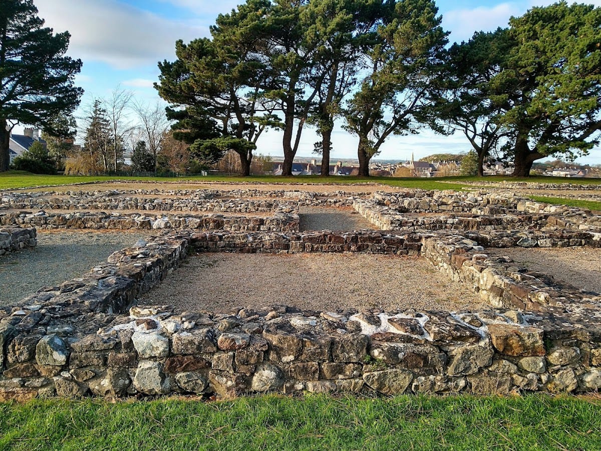
Segontium occupied a slightly elevated plateau on the eastern side of present-day Caernarfon, on the right bank of the River Seiont and less than 500 metres from it. The position overlooked the surrounding countryside, the coast, the river mouth, and the Menai Strait. The modern A4085 cuts through the site. The fort followed a rectangular plan with rounded corners, often described as a playing-card shape. It measured approximately 155 by 126 metres and covered about two hectares, with another calculation giving an area of approximately 2.27 hectares. Its principal axis faced south-west, possibly in relation to Dinas Dinlle, an Ordovician hillfort at the coastal end of the Menai route.
Fortifications and internal roads
Defensive system
The earliest defences consisted of a clay rampart 5.4 metres wide, a berm between 0.9 and 2.1 metres wide, and two ditches approximately five metres deep and 4.5 metres wide. Causeways initially crossed the ditches at the gates. Later, one ditch was filled and one causeway was replaced by a small wooden bridge, traces of which survived in the archaeological remains.
Four gates pierced the fort’s walls. The north-east and south-west gates each had two entrances, while the south gate had one. Two square towers stood on the inner side of each gate. Internal trapezoidal towers strengthened the corners, and the walls had no identified towers between the corners and gates.
Via decumana
The via decumana, the road running through the north-east gate, remained substantially unchanged from the Flavian period until approximately AD 330. The fort’s buildings originally had tiled roofs, later replaced mainly by slate. Some interior floors from the fourth century were also paved with slate.
Headquarters and residential buildings
Principia
The principia, the headquarters building of a Roman fort, stood at the centre of Segontium. Excavations between 1921 and 1923 revealed four construction phases extending from the early second century to the fourth century. Beneath its sacellum, or shrine room, was a well-preserved cellar that held the troops’ pay chest. The cellar contained 114 coins dating from the middle Imperial period to late antiquity, and its floor was repaired around AD 235.
Peristyle house
North-west of the headquarters, in the praetentura, stood a high-status house measuring approximately 25 by 35 metres and containing 13 rooms. Built in the late Hadrianic or early Antonine period, it had its own bath and a veranda-like feature. A wall divided its western section, while the walls were constructed from mortared rubble stone and a clay-brick wall stood on the south side. The building may have been the residence of the fort commander or of an official responsible for regional mining.
Barracks
The south-eastern corner contained timber barracks from the first timber-and-earth phase, dating from the first to the second century. Parts of these barracks lie beneath three modern buildings. This area of the fort may have ceased to be built over from the third century onwards.
Bath building
A bath building within the fort had two apses, or curved-ended chambers, on its eastern side. It followed a row-type plan, with warm- and hot-water basins in the south-eastern apses. A drain ran along its southern side. No heating system was identified, suggesting that the bath may never have been completed. Coins from the building debris place its construction broadly between AD 350 and 400.
Religious and water-related remains
Mithraeum
The Mithraeum stood east of the fort, approximately 46 metres from the Menai Strait, and was investigated in 1959. Mithraism was a Roman mystery cult centred on Mithras, a deity commonly shown in the ritual killing of a bull. The sanctuary was a low rectangular building measuring about 8.5 by 6.4 metres. Low benches ran along both sides of the cult room, and a relief of Mithras stood at its north-eastern end. The building was constructed around AD 200 and destroyed in the early fourth century.
Minerva altar
A temple dedicated to Minerva was associated with a dedication altar belonging to Aurelius Sabinus. The altar was found in the south-eastern part of the fort and may originally have stood either in the third-century bath or in the headquarters building.
Aqueduct inscription
An inscription from the site records the restoration of an old aqueduct channel for Cohors I Sunicorum. It links the water supply directly with the later occupation of the fort during the reign of Septimius Severus.
Civilian settlement and archaeological finds
Outside the fort, additional baths stood on the south-western side. The vicus extended along the north-western, western, and southern sides, with remains including industrial debris, pottery, and evidence of a Roman cemetery. Finds from Segontium include numerous coins, pottery, leather objects such as shoes and part of a tent, a gladius, or Roman sword, and animal bones from cattle, sheep, pigs, red deer, wild boar, hares, and wolves.
A gilded crossbow brooch from the late fourth century was found near the fort. The museum displays a replica, while the original is held by Gwynedd County Council. A stone relief may represent Mars, the Roman god of war, and the museum also displays a figurine of a Roman auxiliary soldier.
Ysgol Pendalar area
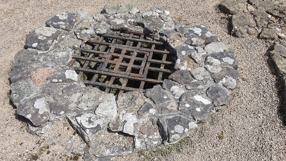
A community archaeological evaluation at the former Ysgol Pendalar site in 2019 or early 2020 exposed well-preserved Roman deposits beneath a demolished school. The features probably belonged to the rear of the vicus beside the road leading to the fort. They included two wells, four clay ovens, several pits, a group of postholes, and numerous pottery sherds beneath concrete and road surfaces.
Hen Waliau
About 150 metres west of Segontium stood the smaller late Roman fortification at Hen Waliau. It measured approximately 72 by 52 metres and enclosed about 0.37 hectares. Its walls were 1.6 metres thick. The west wall survived completely, while 37 metres of the north wall and 55 metres of the south wall could be traced. Sections survived to heights of approximately 3.6 and 4.5 metres.
One gate was identified on the southern side. The walls contained rows of scaffolding holes and bands of flat stones and brick characteristic of late Roman construction. The west wall stood close to the River Seiont, while the east wall followed a natural ridge. No defensive ditch or towers were detected. Much of the area is now covered by a major road, a petrol station, and nineteenth-century houses, but wall remains survive east of the road and behind two houses.
Excavations showed occupation at Hen Waliau from the second century and identified the surviving fortification as a late Roman structure, possibly built during the reign of Valentinian. Its purpose is uncertain. It may have been a fortified storage depot linked to Segontium, a harbour watch post, or a position for artillery.