Jautakių piliakalnis: A Hillfort and Refuge in Lithuania
Site at a Glance
- Rating
- 4.4
- Popularity
- Very Low
- Country
- Lithuania
- Primary era
- Medieval
- External website
- Open
- Eras represented
- Medieval
- Civilizations
- Unclassified
- Site type
- Military
- Remains
- Fortified Town
On this page13 sections
History
Jautakių piliakalnis is a hillfort in Lithuania, located in Jautakiai village beside the Venta River. Dating from the first millennium to the thirteenth century, it was a fortified settlement or refuge built on naturally elevated ground and strengthened with ramparts and ditches. The hillfort appears to have sheltered people from the settlement at its foot during the middle and later parts of the first millennium. It is also known as Pilalė, or Castle Hill.
Early settlement and fortification
The earliest settlement was protected by a log fence rather than a substantial earthwork. After the fence burned, a single-phase clay rampart was built on the same line. Stones and logs reinforced the rampart, and a ditch was cut beside it. A barrier of upright logs separated the settlement area from the hillfort, creating a defended refuge above the occupied area.
The associated settlement developed around the hillfort from the first millennium through the thirteenth century. Covering about 2.5 hectares to the northwest and southwest, it formed the wider community that used the hillfort and its defenses.
Archaeological investigation and later damage
The site was examined in 1966 by the Institute of History and in 1970 by archaeologists working for the Scientific-Methodological Council for the Protection of Cultural Monuments. In 1975 and 1976, Jonas Stankus and Algimantas Merkevičius investigated 325 square metres of the hillfort plateau and 166 square metres of the terrace at its southern foot. The settlement was examined between 1975 and 1977 and again in 1993, covering 1,777 square metres.
Ploughing severely damaged the hillfort. The shape of the land also changed as parts of its edges collapsed, including the northeastern corner, where a cone-shaped rampart was still visible around 1930 before falling into the Venta. Finds from the settlement are held by the National Museum of Lithuania.
Remains
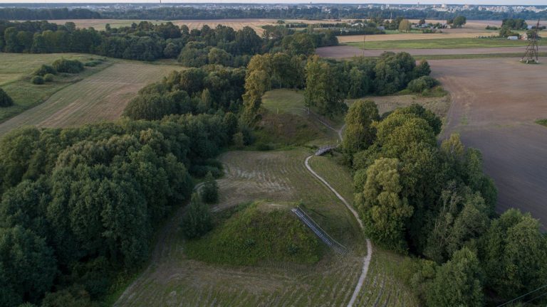
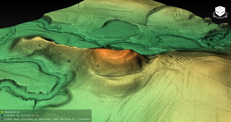
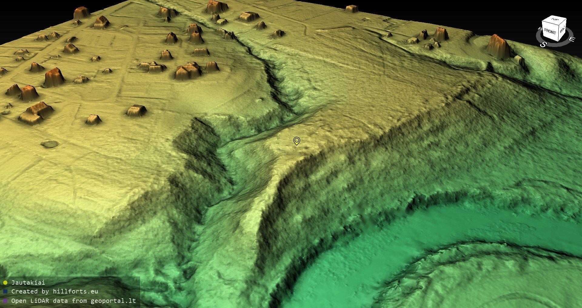
Jautakių piliakalnis occupies a promontory on the left bank of the Venta near its confluence with the Gilupis. The hillfort has an elongated, roughly triangular plateau, steep slopes, northern defenses, and a lower terrace at the southern foot. The associated settlement extended across the ground northwest and southwest of the hillfort, where houses, hearths, working surfaces, and a separate stone-built boundary have been found.
Hillfort earthworks
Plateau and northern rampart
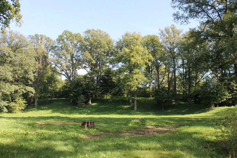
The plateau runs along a north-south axis and measures about 45 metres in length and 8 to 15 metres in width. Its eastern, southern, and western edges have been damaged and have collapsed. A rampart follows the northern edge. It is now about 1.5 metres high and 17 metres wide, although it stood about 3 metres high at the beginning of the twentieth century. A ditch behind it is approximately 4 metres wide and reaches 1.5 metres in depth. The slopes rise about 15 metres and are steep; the rampart is overgrown with raspberries, while sparse deciduous trees grow on the slopes.
Southern terrace and ditches
About 6 metres below the southern edge of the plateau lies a terrace measuring approximately 20 by 30 metres. Three ditches at the southern foot are each up to 3 metres wide and 1.5 metres deep. Two further ditches cross the terrace at intervals of 3 metres; each is about 3 metres wide and reaches 1.5 metres in depth.
Hillfort structures and occupation layer
Defensive construction
A section through the rampart showed that it was made from clay in a single building operation. Stone-filled, box-like structures about 0.5 metres in size strengthened its edges, while post-built defenses stood on top. Remains of the earlier log barrier survived along the northeastern edge of the plateau, where the later rampart was constructed. The associated ditch was about 4 metres wide and 1.5 metres deep.
Buildings and archaeological finds
Postholes in the southwestern part of the plateau probably belonged to two or three buildings made from upright posts. Stone pavements were found nearby. The hillfort’s cultural layer is between 0.3 and 1 metre thick. It contains postholes, a stone whetstone, a clay weight, a bronze ring, handmade pottery with smooth and rough surfaces, wheel-thrown pottery decorated with a wavy pattern, and animal bones.
Associated settlement
Settlement layer and material remains
The settlement’s cultural layer reaches 1.5 metres in thickness and contains remains dating from the first millennium to the thirteenth century. Its deposits include postholes, hearths, bronze objects and fragments, iron tools and fittings, a glass bead, smooth and wheel-thrown pottery, animal bones, and slag. Bronze objects include a ring, a rattle, part of a bracelet, and brooches. Iron objects include a sickle, hoe, cylindrical lock, fire striker, part of a sword crossguard, knives, and awls.
Hearths and western boundary
Twenty-one open hearths were found in the settlement. They range from approximately 0.6 by 0.9 metres to 1.0 by 1.2 metres. Postholes and stone pavements surrounded them, and some pavements lay outdoors beside windbreaks. Along the settlement’s western edge, a low wall-like rampart about 50 centimetres wide was built from medium-sized stones, adding a separate line of protection to the occupied area.