Ranthambore Fort: A Rajput Hill Fortress in Rajasthan, India
Site at a Glance
- Rating
- 4.5
- Popularity
- High
- Country
- India
- Primary era
- Medieval
- External website
- Open
- Eras represented
- Medieval, Early Modern
- Civilizations
- Mughal, Rajput
- Site type
- Military
- Remains
- Castle
On this page14 sections
History
Ranthambore Fort is a historic hill fortress in India, near Sawai Madhopur in Rajasthan, associated with the Chauhan Rajput ruling lineage and commonly dated in origin to the mid-tenth century. Its beginnings remain uncertain: the area appears to have been settled by the eighth century, while construction is traditionally linked to the Chauhan king Sapaldaksha, whose reign is dated to 944, or in other traditions to King Jayanta in either the fifth century or 1110. Building and expansion probably continued over several centuries. The fort later became a major example of Rajput military architecture and a central site in Rajasthan’s political history.
Early Chauhan history
The fort was formerly known as Ranastambha and Ranastambhapura, names meaning “City of the Battle Post.” During the twelfth-century reign of Prithviraja I, it was associated with Jainism. The Jain scholar Siddhasenasuri included it among the Jain tirthas, or holy pilgrimage places. Its religious life therefore developed alongside its role as a fortified centre of Chauhan power.
After Prithviraja III was defeated in 1192, Ranthambore came under the authority of Muhammad of Ghor, a ruler of the Ghurid dynasty. Prithviraja’s son, Govindaraja IV, governed the fort as a Ghurid vassal, while his descendants repeatedly sought to recover their independence.
Contests with the Delhi Sultanate
The Delhi Sultanate, a succession of Muslim-ruled dynasties based at Delhi, repeatedly contested Ranthambore because of its strategic strength. Sultan Iltutmish captured the fort in 1226, but the Chauhans recovered it after his death in 1236. Armies led by the future Sultan Balban failed to take it in sieges in 1248 and 1253. The fort was finally captured from Jaitrasingh Chauhan in 1259.
Shakti Dev succeeded Jaitrasingh in 1283, recaptured Ranthambore, and enlarged the kingdom. Sultan Jalal ud din Firuz Khalji then besieged the fort without success in 1290 and 1291. In 1299, the Chauhan ruler Hammiradeva sheltered Muhammad Shah, a rebel general of Sultan Ala ud din Khalji, and refused to surrender him. Ala ud din Khalji subsequently besieged and captured Ranthambore in 1301.
Mewar, Mughal, and Jaipur rule
Ranthambore later came under the authority of the rulers of Mewar, a major Rajput kingdom in southern Rajasthan. Rana Hamir Singh, Rana Kumbha, and Rana Sanga each held it during their respective reigns. Under Rana Udai Singh I, from 1468 to 1473, the fort passed to the Hada Rajputs of Bundi. Sultan Bahadur Shah of Gujarat held it from 1532 to 1535 before the fort again changed hands.
The Mughal Empire, the early-modern Islamic empire that expanded across much of the Indian subcontinent, captured Ranthambore from the Hadas during the Siege of Ranthambore in 1568. The fort passed to the Kachwaha Maharajas of Jaipur in the seventeenth century and remained part of Jaipur State until Indian independence. Jaipur State acceded to India in 1949 and became part of Rajasthan in 1950.
Religious and heritage history
Religious use continued through Hindu and Jain temples. During the Mughal period, a temple dedicated to Mallinatha, a Jain Tirthankara or enlightened spiritual teacher, was built within the fort. The site’s continuing religious associations form part of its wider historical character.
Ranthambore Fort and five other Rajasthan hill forts were inscribed together in 2013 as the UNESCO World Heritage serial property “Hill Forts of Rajasthan,” under cultural criteria (ii) and (iii). The fort is identified within that group as a major example of Rajput military architecture and as a site central to the historical development of Rajasthan.
Remains
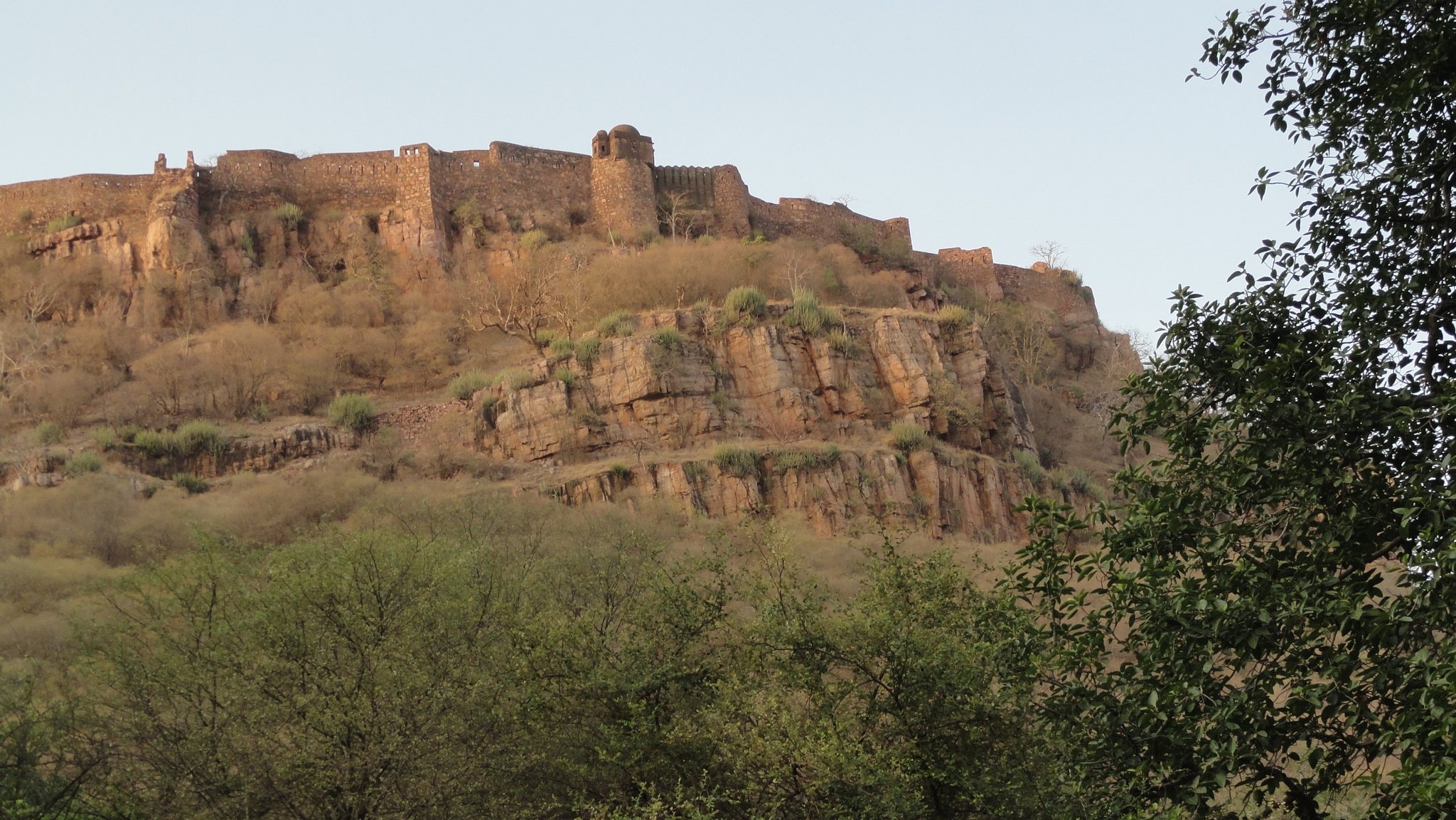
The fort occupies an oblong hill enclosure approximately 200 metres, or 700 feet, above the surrounding plain. Its long axis runs northwest to southeast, and the enclosure measures about 2.2 kilometres by 0.7 kilometres, covering 102 hectares. The fortifications follow the hill’s natural contours, with steep slopes forming part of the defensive system. Where additional protection was required, strong walls incorporated square loopholes intended for firearms and round bastions.
Fortifications and approach
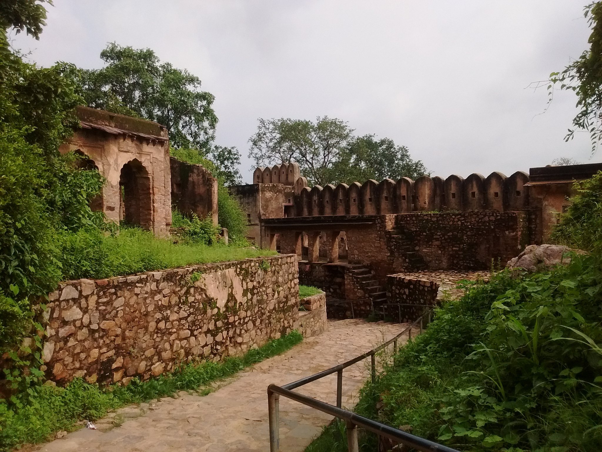
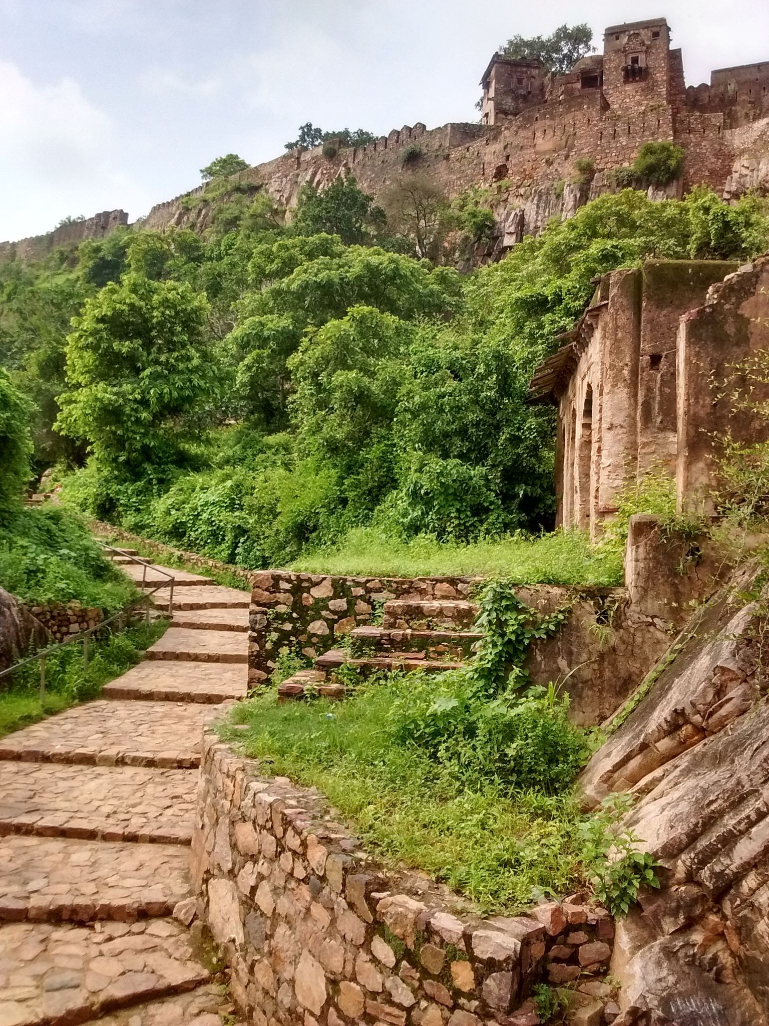
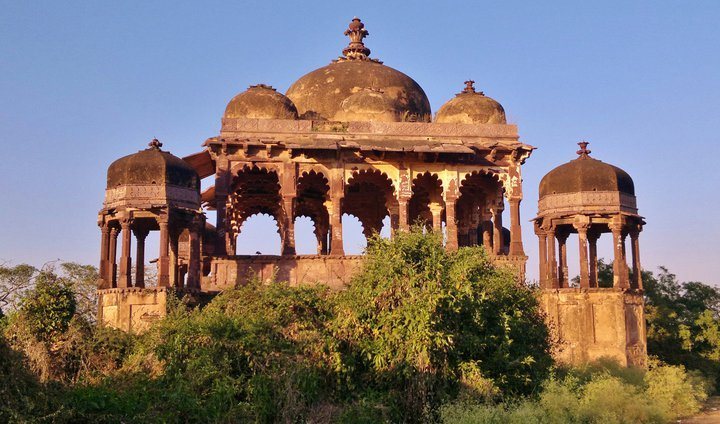
The principal approach rises from the north along stairs cut into the rock. A zigzag ascent passes through the approximately 5.4-kilometre perimeter wall and four gates named Naulakha Pol, Hathi Pol, Ganesh Pol, and Andheri Pol. The final gate leads into the palace area, beyond which lie further temples, domed chhatri pavilions, and other walled compounds. A chhatri is a domed pavilion used in Indian architecture for commemorative or ceremonial purposes.
Palaces and compounds
Hamir Mahal
Hamir Mahal dates from 1281 to 1301 and forms part of the central residential and official area. It is a Hindu-style palace whose fabric was enlarged by later additions in the seventeenth and eighteenth centuries.
Rani Mahal
Rani Mahal dates from 1283 to 1381 and also belongs to the central palace complex. Later additions included Supuri Mahal and Dhula Mahal, extending the residential and official buildings during the seventeenth and eighteenth centuries.
Hindu and Jain temples
Hindu temples
Three Hindu temples inside the fort are dedicated to Ganesha, Shiva, and Ramlalaji. Built during the twelfth and thirteenth centuries from red Karauli stone, they include the temple of Trinetra Ganesha, which is dedicated to Ganesha in his three-eyed form.
Jain temples
Jain religious buildings include temples dedicated to Sumatinatha, the fifth Jain Tirthankara, and Sambhavanatha, the third. A further temple dedicated to Mallinatha belongs to the fort’s later religious landscape.
Military and landscape remains
The surviving complex includes military works, roads, reservoirs, storehouses, barracks, tombs, the remains of a mosque, and a Muslim cemetery. The walls overlook forest and the lakes Padam Talao, Malik Talao, and Rajbagh. Padam Talao and Rajbagh are also identified as ponds below the fort. The surrounding dense forest formed an important defensive feature of Rajput forest forts and remains part of the fort’s setting within Ranthambore National Park, a habitat of Indian tigers and Hanuman langurs.