Tipaza: A Punic and Roman Coastal City in Algeria


Site at a Glance
- Rating
- 4.4
- Popularity
- Low
- Country
- Algeria
- Primary era
- Classical
- Eras represented
- Iron Age, Classical, Medieval
- Civilizations
- Byzantine, Carthaginian, Roman
- Site type
- City
On this page31 sections
History
Tipaza is an ancient coastal city in Algeria, founded by the Punic civilization in the sixth century BC beneath Mount Chenoua. It began as a maritime stop, refuge, and place of exchange on Mediterranean routes linking Icosium, near modern Algiers, with Caesarea, near modern Cherchell, and the sea routes toward the Pillars of Hercules.
Punic and Numidian Tipasa
By the second century BC, Tipasa had grown into a substantial Punic city subordinate to Carthage, the North African city founded by Phoenicians. Its harbour, cemeteries, funerary customs, and material culture reflect sustained interaction between Punic and indigenous communities. The city’s position supported both maritime movement and the exchange of goods along the coast.
After the Second Punic War, Tipasa came under Numidian influence. It prospered during the reign of Juba II, the Roman-allied king of Mauretania, an ancient North African kingdom later transformed into a Roman provincial area. Together with Caesarea, Tipasa became a centre of Graeco-Roman culture, transit, and commerce. Finds from this period include coins depicting Massinissa, a king of Numidia, Juba II, and Ptolemy of Mauretania, Juba’s son and successor.
Roman administration and prosperity
In AD 40, the Roman emperor Caligula executed Ptolemy, after which Mauretania passed under direct Roman administration. Under Emperor Claudius, between AD 41 and 54, the territory was divided into the provinces of Mauretania Caesariensis and Mauretania Tingitana. Tipasa became a municipium in AD 46, a Roman town whose inhabitants possessed defined Roman or Latin civic rights. It later became a colonia, a Roman civic community with colonial status, and received the full privileges of Roman citizenship by the end of the second century.
Tipasa reached its greatest prosperity under the later Antonine emperors and the Severan dynasty. Its harbour and position on the Roman coastal-road system supported commercial and military activity. The population may have approached 20,000, although the archaeologist Stéphane Gsell considered that estimate excessive. During this period the settlement expanded from its earlier centre above the harbour across the plain and surrounding hills.
Christian development
Christianity appeared at Tipasa during the first half of the third century. The city became an episcopal see, and churches and Christian cemeteries were established during the third and fourth centuries. This development reshaped parts of the urban landscape and produced a network of basilicas, burial grounds, chapels, and associated religious buildings.
A Christian legend preserves the martyrdom of Saint Salsa. She is said to have thrown the head of a serpent- or dragon-shaped pagan idol into the sea before being stoned and cast into the water. Her body was reportedly recovered and buried in a chapel outside the city walls. That chapel was later enlarged into the Basilica of Saint Salsa, one of the principal Christian monuments at Tipasa.
Tipasa was also affected by the Donatist schism, a Christian division in North Africa concerning church authority and clergy associated with persecution. During the revolt of Firmus in 371 to 372, a North African uprising against Roman rule, Tipasa resisted his forces, while nearby Icosium and Caesarea were attacked. This resistance probably helped the city remain prosperous for several more years.
Destruction, revival, and decline
In 430, the Vandals under King Genseric destroyed or severely damaged Tipasa. In 484, during King Huneric’s persecution of Christians who did not follow Arian Christianity, a late antique theological tradition associated with Arius and rejected by the Catholic Church, the city’s Catholic bishop was expelled and replaced by an Arian bishop. Many inhabitants subsequently fled by sea to Spain.
After the Byzantine reconquest of North Africa in 534, Tipasa experienced a limited revival. Buildings were enlarged, repaired, and adapted for new uses. After the sixth century, however, the city declined amid precarious occupation, droughts, floods, alluvial deposits, and advancing sand. It was eventually reduced to ruins.
Excavation and heritage protection
The first archaeological excavations took place in the nineteenth century. Stéphane Gsell published a major monograph on Tipasa in 1894. In 1946, Jean Baradez introduced more systematic archaeological methods while organizing the first museum collections.
Tipasa was inscribed on the UNESCO World Heritage List in 1982 under criteria relating to its cultural tradition and its architectural and archaeological remains. The serial property includes two archaeological parks near the modern town and the Royal Mauritanian Mausoleum approximately 11 kilometres southeast of Tipasa, covering about 52.16 hectares. Conservation problems and pressures from urban development, population growth, uncontrolled tourism, vegetation, illegal grazing, and uncontrolled visitor access led to its placement on the List of World Heritage in Danger from 2002 to 2006. Algerian cultural-heritage legislation, safeguarding and presentation plans, and administration by the Office of Management and Exploitation of Cultural Properties, together with the provincial Directorate for Culture, form part of its protection framework.
Remains
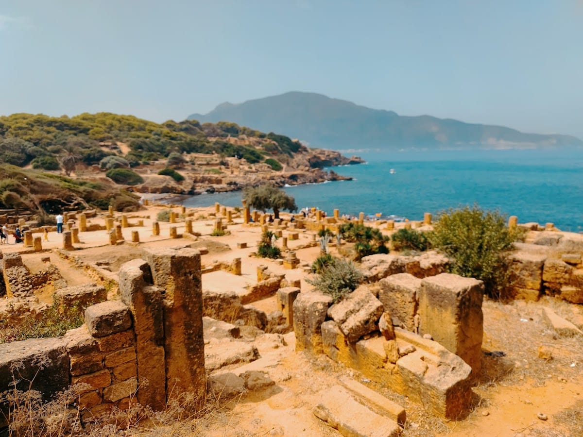
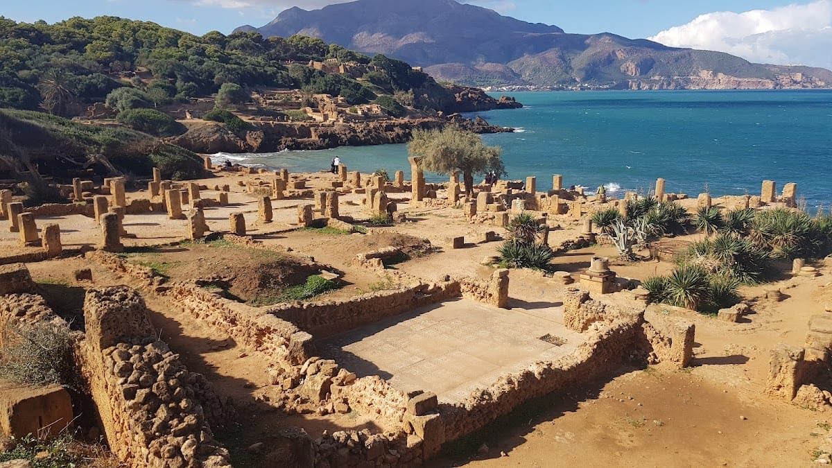
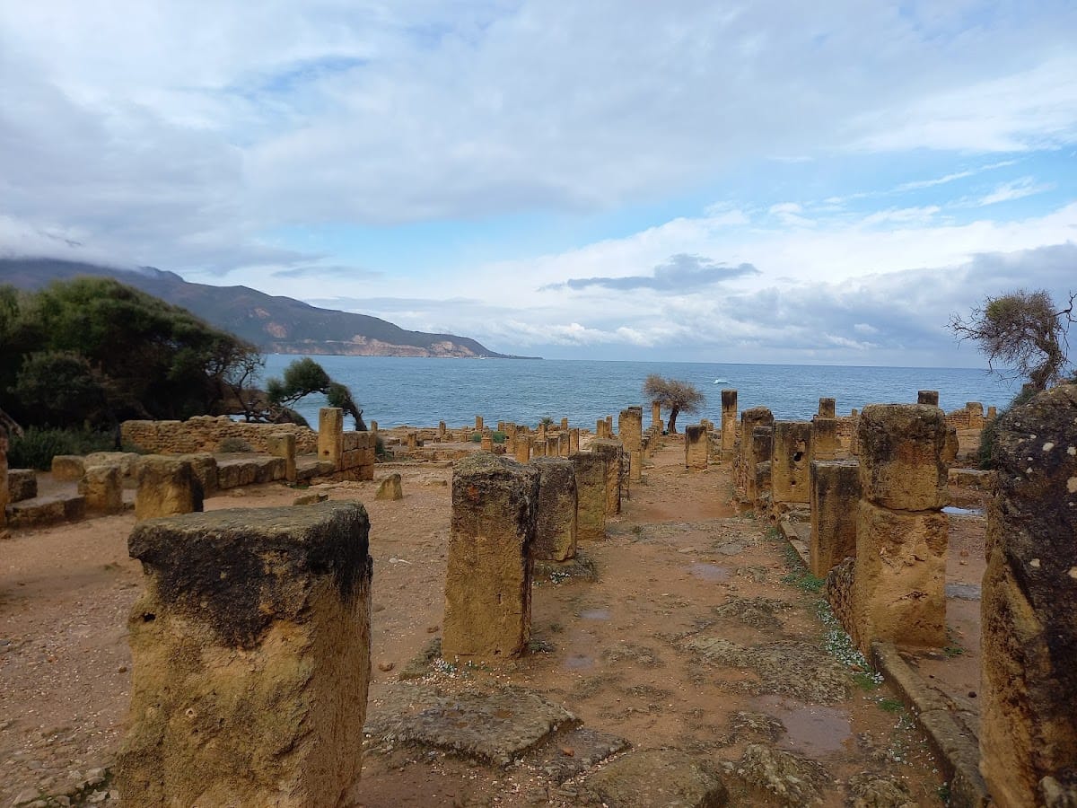
The ancient city occupies a coastal area between the western hill of Ras el Knissa and the eastern hill of Koudiat Zarzour, also called the Hill of Saint Salsa. Its remains form a dispersed archaeological landscape. Much of the settlement remains unexcavated or lies beneath later sediments and modern construction. The principal surviving areas are the archaeological park west of the modern town, the large Christian necropolis around the Basilica of Saint Salsa at the eastern entrance, and the Tipasa Museum near the harbour between them.
Punic and early urban remains
Harbour necropolis
The Punic necropolis near the harbour is among the oldest and most extensive known from the Punic world. It contains chamber and shaft tombs, later pagan burials, and varied funerary practices. A burial chamber cut into the coastal cliff later fell into the sea. Other burials include semicircular cup-shaped tombs and columbaria, burial structures for cremation urns.
Objects associated with the Punic and Numidian phases include stelae bearing the symbol of Tanit, a major Carthaginian and Punic goddess, as well as Carthaginian coins decorated with horse and palm motifs. Campanian pottery, Hellenistic lamps, Punic funerary material, and coins depicting Massinissa, Juba II, and Ptolemy of Mauretania further illustrate the city’s connections across North Africa and the Mediterranean.
Early Roman centre
The earliest Roman city occupied the hill now marked by the lighthouse above the old harbour. Houses, a forum, a judicial basilica, and a Capitolium stood there. A Capitolium was a Roman temple dedicated to Jupiter, Juno, and Minerva. This first urban area was enclosed by a smaller defensive boundary before the city expanded across the plain and onto the eastern and western hills.
Roman city and public buildings
Streets and defensive circuit
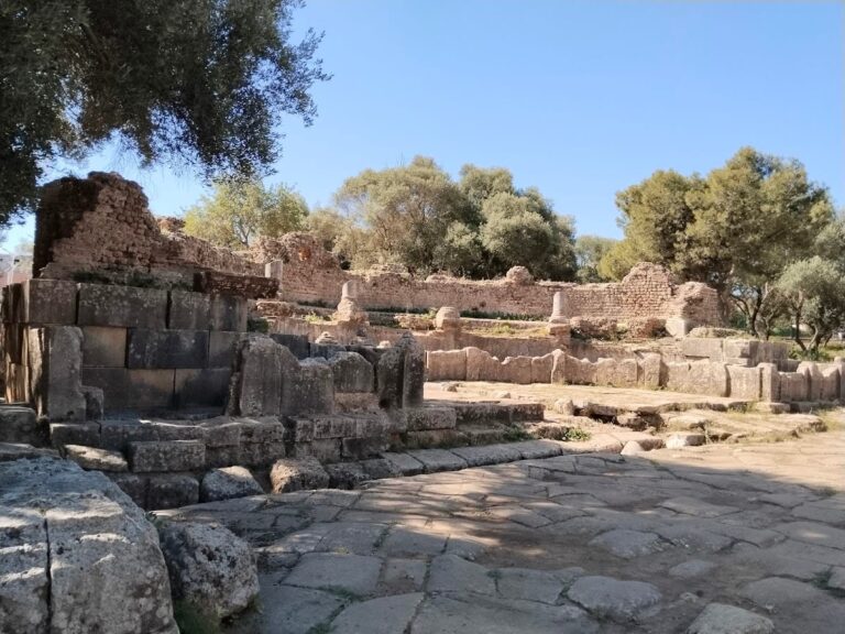
The later Roman city extended across the plain and surrounding hills within a defensive circuit approximately 2,200 to 2,300 metres long. Its principal streets were the decumanus maximus, about 14 metres wide and aligned with the road between Icosium and Caesarea, and the perpendicular cardo, which descended northward toward the sea. These roads structured the relationship between the civic centre, religious buildings, residential quarters, harbour, and surrounding districts.
Forum and Capitolium
The forum is a paved esplanade approximately 50 metres long and 25 to 27 metres wide. Porticoes bordered three sides, with one supported on the sloping ground by a vaulted cryptoporticus, a covered passage or supporting structure. The Capitolium occupied the northern end. Its surviving elements include the podium, front steps, and traces of three adjoining cellae, the enclosed chambers of the temple.
The Curia opened onto the northeastern portico. Only indistinct ruins survive, but its position formed part of the civic arrangement around the forum.
Judicial basilica
The judicial basilica dates from the late first or early second century AD. Excavated between 1914 and 1917, it had three aisles separated by two rows of columns, a slightly raised apsidal tribunal, and an entrance stairway that narrowed the decumanus. Partly standing columns remain, together with the relationship between the building and the monumental stairway leading toward the forum. The Captives Mosaic from the basilica’s apse is preserved in the Tipasa Museum.
Amphitheatre
The amphitheatre is approximately 80 metres long and oriented east to west. Only its northern part has been excavated. It preserves the vaults that supported the seating, the high walls of the arena, two principal entrances on the main axis, and three secondary entrances on each side. Built relatively late, it encroached on neighbouring temples. An earlier columbarium survives beneath it.
Temples
The anonymous temple retains its podium and part of its access stairway. Three entrances opened from a widened area of the decumanus, and a court preceded the sanctuary. Its cult attribution remains unknown.
The so-called New Temple stands opposite the anonymous temple in an almost symmetrical arrangement. It has a comparable court, portico, and cella. Dated to the late second or early third century AD, it is distinguished by more regular paving, better-preserved stairs, and later structures.
Nymphaeum
The Nymphaeum is a monumental semicircular public fountain beside the decumanus. Water descended in cascades from basin to basin between marble columns before reaching a collecting basin. Deep grooves on its rim were made by people drawing water. Blue marble colonnades, polychrome marble revetment, and the aqueduct behind the fountain survive as parts of the water-supply installation.
Theatre
The theatre was built on level ground rather than against a hillside and could accommodate approximately 3,000 to 4,000 spectators. Its masonry was seriously damaged in 1847, when blocks were removed for a cholera hospital. The remains include massive supporting piers, exterior vaults, the first rows of seating, parts of the balustrade, the semicircular orchestra, and the brick wall separating the orchestra from the stage. Underground access passages and four exterior stairways also survive, while the stage wall has been lost.
Residential and bathing quarters
Villa of the Frescoes
The Villa of the Frescoes opened onto a portico along a cardo through separate carriage and pedestrian entrances. A vestibule led to an inner courtyard surrounded by a peristyle, a courtyard encircled by columns. Residential rooms were arranged around it. The principal room, an oecus or main reception and living room, aligned with the courtyard and overlooked the patio and the sea. Fragments of painted wall plaster and traces of mosaic remain.
Lower residential quarter
The lower residential quarter contains houses, small baths, and a garum-processing installation with dolia, large storage jars. Parts of the water-distribution and sewer systems run along the cardo. A monumental stairway overlooks small baths that are relatively well preserved.
Great Baths
The eastern archaeological garden contains columns, capitals, screens, lintels, amphorae, jars, and sarcophagi, together with the partly excavated Great Baths. The walls rise approximately 9 metres above the mosaic of the frigidarium, the cold-water room of a Roman bath complex. Its floor lies about 4 metres below modern street level, and modern buildings cover part of the complex.
Christian buildings and cemeteries
Great Basilica
The Great Basilica was built in the fourth century AD and measured approximately 52 to 58 metres by 42 to 45 metres. Its central nave was more than 13 metres wide, with three side aisles on each side. It was later subdivided into nine aisles. Only some of its arcades remain, while the apse projected over the cliff above the sea.
Buildings associated with the northern side included a chapel, a circular baptistery, baths, and the bishop’s residence. A defensive tower stood at the northwest angle of the walls.
Western necropolis and mausoleum
The western necropolis contains pagan and Christian burials, including rock-cut hypogea, underground burial chambers. Its circular mausoleum has columns framing arched niches for one or more sarcophagi, a distinct central burial, and additional sarcophagi within an adjoining enclosure.
The separate Royal Mauritanian Mausoleum, also known as Kbor er Roumia, is a monumental circular funerary building. Its form combines a local basina tradition, characterized by a circular funerary monument or enclosure, with a stepped truncated roof influenced by Hellenistic and Pharaonic forms.
Basilica of Alexander
The Basilica of Alexander lies about 200 metres southwest of the circular mausoleum. Dedicated to Alexander, bishop of Tipasa, it has an irregular trapezoidal plan and was built on uneven rocky ground. A western counter-apse forms part of its unusual arrangement. The raised sanctuary rested on nine adjoining sarcophagi and was covered by a mosaic inscription now preserved in the National Museum of Antiquities and Islamic Arts in Algiers.
Basilica of Saint Salsa
The Basilica of Saint Salsa stands approximately 300 metres outside the city walls on the summit of the eastern hill. Its earliest phase was a square, stone-built chapel about 15 metres on each side, with an eastern entrance and western apse. It was later enlarged into a church with a central nave about 7.5 metres wide, two side aisles, and pillars supporting arches.
At the centre lies a tomb beneath a semicylindrical cippus, a funerary or commemorative stone monument, bearing the epitaph of Fabia Salsa, probably a pagan ancestor of the saint. During the fifth century, most of the central nave received an ornamental mosaic. An inscription near the apse commemorated Potenti, probably a fifth-century bishop.
During the first half of the sixth century, the basilica was enlarged to about 30 metres in length. Galleries were added above the side aisles and reached by stairs beside the entrance. A northern doorway led to a sloping area and a quadrangular chamber containing a ritual table. A more elaborate funerary enclosure occupied the southern side.
Fabia Salsa’s tomb was covered by a marble-faced platform and surrounded by a grille. A marble sarcophagus depicting Selene and Endymion was placed on the platform and later destroyed into fragments.
Basilica of Saints Peter and Paul
The Basilica of Saints Peter and Paul was built against the city walls in the late fifth century. A marble inscription preserved in the museum patio identifies it. Excavations revealed two anonymous sarcophagi, lamps decorated with resurrection symbols, a chrism, a Christian monogram formed from Greek letters, and an image of Saint Peter defeating Satan. Fourteen sarcophagi along the southern wall formed an enclosure probably serving as a martyrion, a structure or enclosure associated with the remains or commemoration of martyrs.
Museum collections and modern memorial
Tipasa Museum
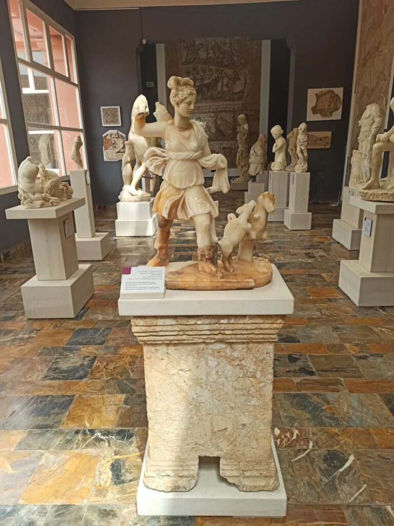
The Tipasa Museum is arranged around a patio and an exhibition room. The patio displays stelae, urns, pottery, and a sculpture of a child with an amphora. The exhibition room contains Punic, Berber, and Roman glass and pottery, sculptures, and two finely carved white-marble sarcophagi. One depicts the myth of Pelops and Oenomaus. The Captives Mosaic from the apse of the judicial basilica is also preserved there.
Albert Camus stele
A stele dedicated to Albert Camus was erected in 1961 at the western end of the archaeological park, facing the Mediterranean and Mount Chenoua.