Yucca House National Monument: An Ancestral Puebloan Settlement in Colorado
Site at a Glance
- Popularity
- Medium
- Country
- United States
- Primary era
- Medieval
- Eras represented
- Medieval
- Civilizations
- Ancestral Puebloan
- Site type
- City
On this page10 sections
History
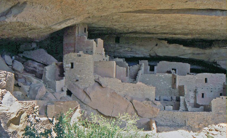
Yucca House National Monument preserves an Ancestral Puebloan settlement, created by Indigenous societies ancestral to today’s Pueblo communities, in Montezuma Valley at the foot of Sleeping Ute Mountain in southwestern Colorado, United States. The settlement dates broadly from AD 900 to 1300. It stood where important prehistoric routes met and became a leading regional center among nearby communities, including Mud Springs and Navajo Springs. Pueblo villages across the valley were occupied between AD 1100 and 1300, when about 13,000 people lived in the area.
Settlement and abandonment
Yucca House was abandoned between AD 1240 and 1280, making it one of the last inhabited pueblos in the Mesa Verde region. Linguistic evidence and Tewa oral history suggest that Tewa ancestors may have lived there. The duration of occupation and the settlement’s connections with nearby pueblos remain uncertain.
Surveys and archaeological work
W. H. Jackson first described Yucca House in 1874, after taking part in the Hayden Geological Survey of 1871, a scientific exploration of the American West. William Henry Holmes visited in 1875, prepared a report in 1878, and made the first map of the ruins. He called the place Aztec Springs, mistakenly believing Aztecs had built the settlement. J. Walter Fewkes studied and remapped the ruins in 1918. An excavation by the Museum of Natural History in New York began in the late 1910s under Earl Morris.
Monument protection and later research
Henry Van Kleeck donated 9.5 acres in 1919. On December 19 of that year, President Woodrow Wilson proclaimed the site a national monument and changed its name from Aztec Springs to Yucca House. The monument was part of a group intended to protect archaeological remains, plants, and animals for research. It was added to the National Register of Historic Places, the U.S. register of historically significant places, on October 15, 1966.
Since 1990, staff from Mesa Verde National Park have managed the monument. Hallie Ismay, who served as its unofficial steward for 62 years, donated land that brought its area to 33 acres in 1996. In the late 1990s and around 2000, the Crow Canyon Archaeological Center and Mesa Verde National Park undertook the Yucca House Mapping Project. The project produced a detailed map and analyzed pottery found on the surface. Although the work clarified the settlement’s layout, the length of occupation, the role of public buildings, and the extent of its social connections remained unresolved.
Bernard and Nancy Karwick offered to donate 160 adjoining acres in 2015, an expansion that required congressional approval. Legislation was signed in 2021, and after environmental assessments the National Park Service accepted the deed in July 2024. The monument is listed as covering 195 acres, or 79 hectares.
Remains
The largely unexcavated, vegetation-covered settlement comprises two mapped areas, Western Complex and Lower House. Its buildings include both adobe and masonry construction. The remains show a spread-out settlement with large residential and communal spaces, plazas, and smaller structures.
Western Complex
Western Complex was a large pueblo that may have held as many as 600 rooms and 100 kivas, ceremonial spaces used by Pueblo communities. It also includes a great kiva, a larger form that may have served the community. A spring runs through the complex, which has several towers, multiple plazas, and other structures whose purposes are unclear.
Upper House
Upper House is a large building within Western Complex, measuring about 80 by 100 feet. It was made of adobe, earth shaped into building blocks. Its ruins now stand about 12 to 15 feet high, though the building may once have been twice as tall.
Lower House
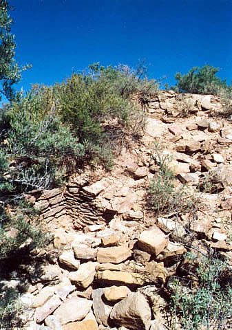
Lower House is an L-shaped pueblo measuring 200 feet by 180 inches. It has a plaza, a large kiva, and eight small rooms, each measuring 7 by 2 feet. A masonry wall at the site was stabilized in 1964.
Excavated shrine room
Work during the excavation led by Earl Morris uncovered a shrine room in its fifth year, when Dr. Clark Wissler directed the work. The room’s interior walls were painted white with red edging, and its floor was paved with carefully cut stone slabs. A wooden serpent, carved at the ceiling and measuring 2½ feet long, was found in the room. The shrine was compared with one at Mesa Verde National Park.
Landscape and mountain setting
Irrigated agricultural land surrounds the settlement, while higher elevations are too arid for irrigation. Sleeping Ute Mountain lies beside the site. Ute people described it as a mountain where yucca grew abundantly, and the monument’s name was inspired by the mountain.