Tayma: An Ancient Oasis and Crossroads in Saudi Arabia
Site at a Glance
- Popularity
- Very High
- Country
- Saudi Arabia
- Primary era
- Bronze Age
- Eras represented
- Bronze Age, Iron Age, Medieval
- Civilizations
- Unclassified
- Site type
- Settlement
- Remains
- Town
On this page22 sections
History
Tayma is an ancient oasis settlement in Saudi Arabia, with evidence of habitation reaching the early fourth millennium BC. Its dependable water made it a crossroads linking South Arabia with the Eastern Mediterranean, Mesopotamia, the Levant, and Egypt. Although it was not directly on the Frankincense Road, the oasis maintained close economic, political, and religious ties with regions across the Middle East.
Early settlement and Egyptian connections
Bedouin groups are thought to have visited Tayma for its water from the third millennium BC. The settlement grew substantially in the middle of the second millennium BC and had become an economically important community by the end of that millennium. It belonged to a political and religious confederation, while the domestication of the dromedary, or one-humped camel, helped support long-distance exchange. Weapons with connections to the Levant reflect the reach of those contacts.
Monumental construction began in the early Iron Age, with much of it linked to Egyptian influence during the Ramesside period, the era of Egypt’s Nineteenth and Twentieth Dynasties. A rectangular building at Tayma contained figurines offered to deities, vessel fragments, and human-headed scarabs made of faience, a glazed ceramic material. Egyptian interest may have included mining, but monumental building at the oasis declined after such opportunities diminished by the end of the Early Iron Age.
An inscription discovered in 2010 about 60 kilometres northwest of Tayma was the first ancient Egyptian hieroglyphic inscription found in Saudi Arabia. Commissioned by Ramesses III, an Egyptian pharaoh of the Twentieth Dynasty, it carries his royal titulary, the formal set of a ruler’s names and titles. The inscription indicates an Egyptian royal expedition in northwestern Arabia, though the nature of Egypt’s presence remains uncertain. A trade route passing through Tayma is thought to have linked the Nile Delta and the Red Sea, carrying incense, copper, gold, and silver.
Assyrian and Babylonian eras
Near Eastern records name Tayma from the eighth century BC. In an inscription dating to about 800 BC, Yariri, a ruler associated with Carchemish, boasted of knowing twelve languages and four writing systems, including Taymanitic, the language and script of Tayma.
From the eighth century BC, Tayma and its surrounding region lay within the sphere of Assyria, a Mesopotamian kingdom and empire, although Tayma was not formally annexed. Assyrian records describe Ninurta-kudurri-usur, governor of Suhu and Mari, seizing prisoners and goods from a caravan associated with Tayma over unpaid tax. A similar action took place under King Tiglath-Pileser III. A gate inscription from the reign of Sennacherib records gifts from the people of Sumu’il and Tema, pointing to continued economic relations. Assyrian records also refer to a local Arab dynasty and to the eighth-century queens Shamsi and Zabibe.
In the early sixth century BC, Nabonidus, the last king of the Neo-Babylonian Empire, used Tayma as a base for campaigns in northwestern Arabia. An inscription from Harran places the transfer of his seat of government to Tayma in his third regnal year, around 553 BC. The Nabonidus Chronicle confirms his presence there in years seven through eleven, while its record for his first six years is missing. His campaign established control in the region and included the subjugation of Yathrib, the ancient name of Medina, and Dadan. A poem about the expedition mentions a large army, but its further claims are considered propagandistic. Control of the incense trade was probably among Nabonidus’s economic aims.
It is uncertain whether Tayma became part of the Achaemenid Empire, the first Persian Empire. Inscriptions and other objects from the oasis indicate activity there during the Achaemenid period.
Regional kingdoms and religious communities
The Hebrew Bible names Tema in Genesis, Job, Isaiah, Jeremiah, and 1 Chronicles; Tema is associated with Tayma. Job presents the place as a commercial city, while Jeremiah’s prophecy includes it among the places addressed. After the Achaemenid Empire fell, Tayma declined as Lihyan, a kingdom centered on Dadan, also known as Dedan, rose in prominence. Tayma fought wars involving Dedan, Massah, and Nabaya, then came under Dedan’s dominance as its settlement contracted. Inscriptions name the Dedanite king Tulmay.
During the Hellenistic period, the age of Greek-influenced kingdoms that followed Alexander the Great’s conquests, Tayma served successively as a regional centre for Lihyan and the Nabataean Kingdom. Rome annexed Nabataean territory in AD 106.
A Jewish community lived at Tayma from the first through the sixth centuries AD. A third-century inscription from the city names a governor with a Jewish name. Arabic tradition describes a Jewish dynasty in late antiquity, the transition from the classical world to the early Middle Ages, but whether its members were exiles or descendants of Arab converts to Judaism is uncertain. Pre-Islamic Arabic poetry associates Tayma with the Jewish poet and warrior Samaw’al ibn ‘Adiya and with the poet Imru’ al-Qais.
Islamic and medieval Tayma
Muslims conquered Tayma in the 630s. Its Jewish residents were treated as dhimmis, non-Muslims living under Muslim rule with protected status and particular obligations, and many were later expelled. Islamic tradition places the expulsion under Umar, the second Muslim caliph.
Medieval writers describe Tayma as a trading town supplied by a spring and wells, with date-producing palm groves. The oasis later served as a resting place on the pilgrimage route from Syria to the holy cities. Writing in the fourth century of the Hijra, the Islamic calendar counted from Muhammad’s migration from Mecca to Medina, Ibn Hawqal described Tayma as an important market for local Bedouins and reported that its population exceeded Tabuk’s. Around 1170, the Jewish traveler Benjamin of Tudela visited Tayma and nearby Khaybar. He described a Jewish presence and claimed that a Jewish prince governed the city.
In the summer of 1181, Raynald of Châtillon, a Crusader lord, attacked a Muslim caravan near Tayma on the Damascus–Mecca route. The attack broke the truce made in 1180 between Saladin and Baldwin IV, king of Jerusalem. Tayma’s products also included dates, rock salt distributed across Arabia, and alum processed for use in camel care.
Exploration and archaeological work
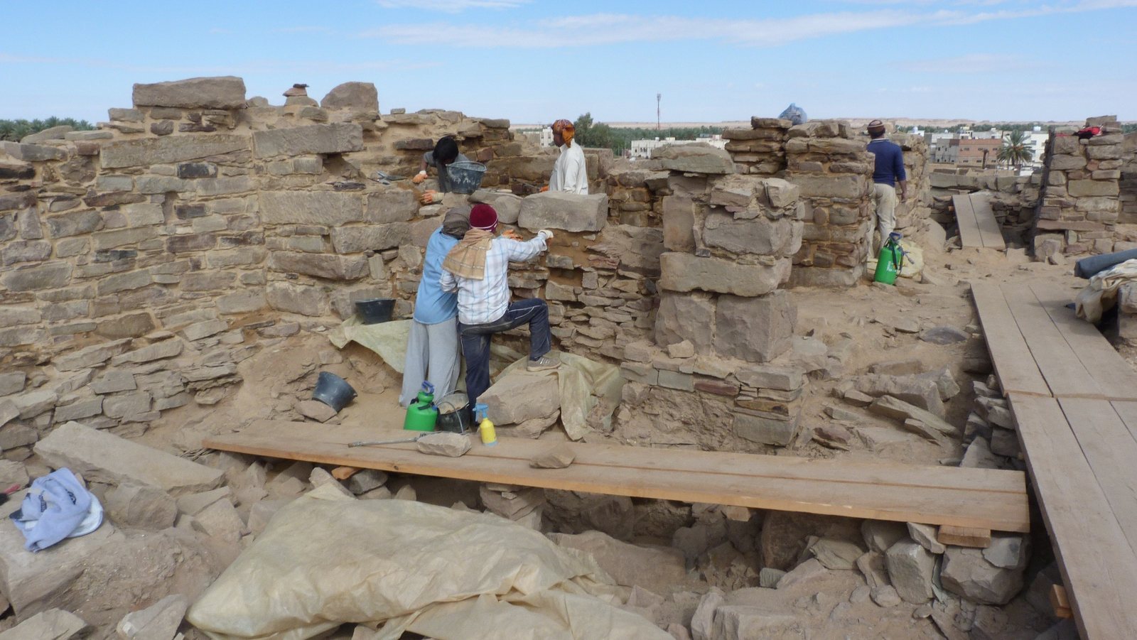
Charles M. Doughty investigated and mapped Tayma in 1877. Charles Huber discovered the Tayma Stele, an upright inscribed stone slab, in 1883; it is now in the Louvre. The German Archaeological Institute has conducted investigations at the oasis since 2004 under the direction of Ricardo Eichmann.
Remains
Tayma’s remains occupy a depression between the eastern foothills of the Hijaz Mountains and the Nafud Desert, at about 830 metres above sea level. The archaeological landscape includes extensive enclosure walls, settlement layers, buildings, burial grounds, inscriptions, and wells. A fossil lake lies north of the present settlement; it is now a salt flat that rarely holds water. The lake was substantial about 20,000 years ago and probably dried in the fifth millennium BC.
Landscape, enclosure, and settlement
Outer wall and perimeter
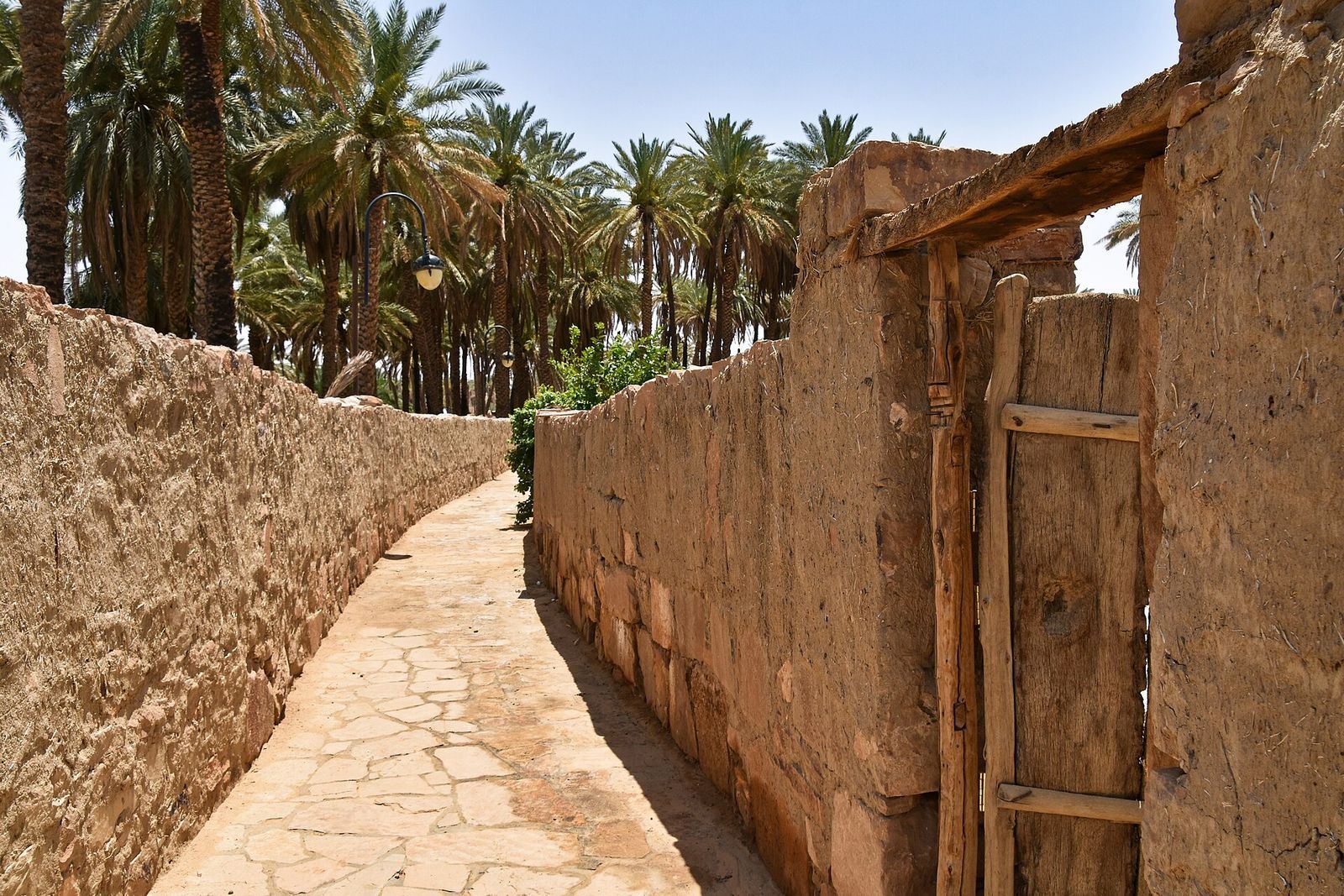
Mud from the salt flat was used to make bricks for Tayma’s substantial outer wall, built of mud brick and sandstone. The wall enclosed about 20 hectares and stood roughly 10 metres high. Construction began in the second millennium BC, and successive extensions eventually brought its circuit to about 15 kilometres. The walls remain visible. A perimeter wall tracing three sides of the old city is dated to the sixth century BC. Medieval writer Yaqut suggested that the visible walls might be remains of Qasr al-Ablaq.
Inner fortification
An inner wall with towers was built in the first millennium BC, about 100 metres inside the outer wall. This defensive line may reflect conflicts with regional powers, including the Lihyanite kingdom of Dadan.
Occupation layers and houses
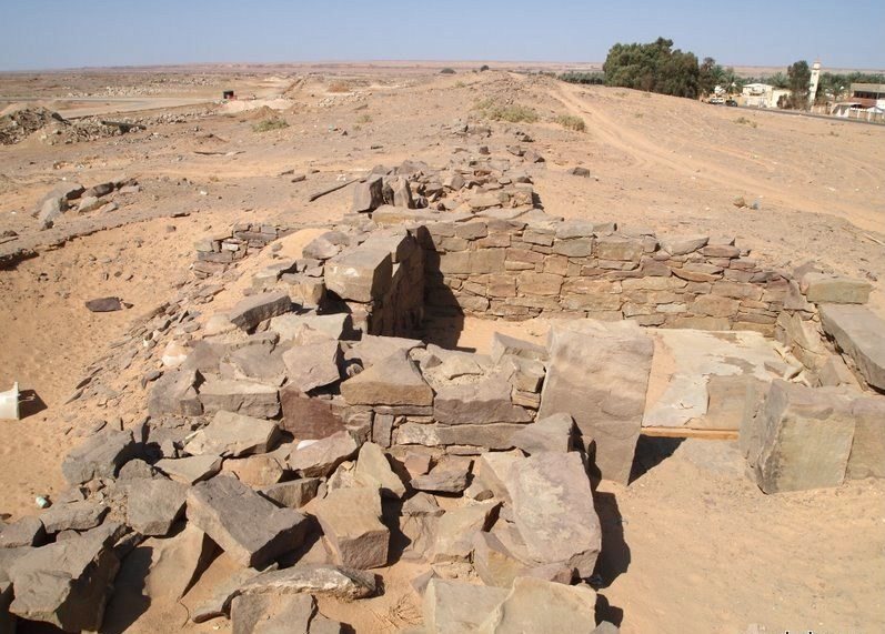
Five occupation layers, identified through pottery and other finds, extend more than six metres deep and cover about eight centuries. The Iron Age settlement included stone houses, mostly small or medium-sized dwellings with evidence of food preparation and craftwork.
Water and the oasis
Groundwater lies as close as 1.5 metres below the surface in some parts of Tayma and about 40 metres down in others. Irrigation now supports about 80,000 date palms in the oasis.
Buildings and burial grounds
Large columned building
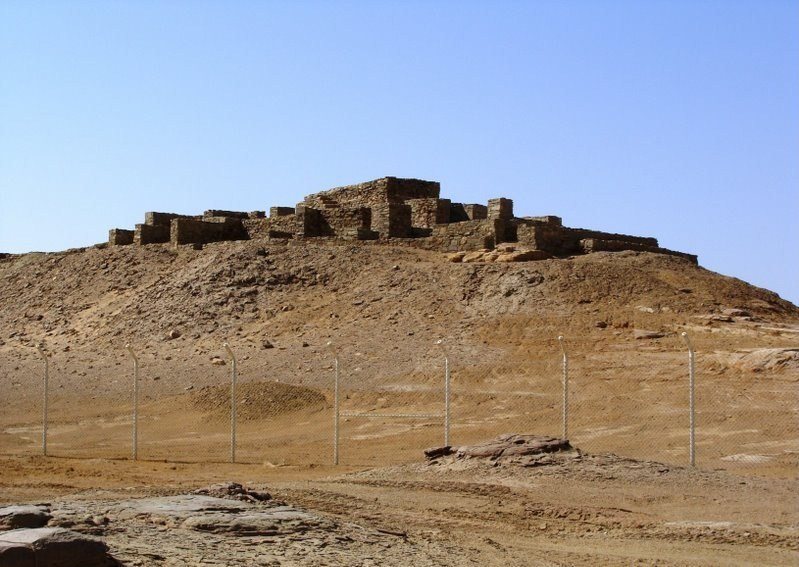
A building covering about 500 square metres included a hall with columns. Finds from it include the head of a statue carved from a single block of stone and originally about three metres tall, as well as another statue of similar size, now in the city museum. Comparisons with sculptures from nearby Dadan, together with these finds, have led archaeologists to suggest that the building was a temple.
Rectangular building
A separate rectangular building contained Egyptian figurines offered to deities, vessel fragments, and human-headed faience scarabs. These objects form part of the evidence for connections between Tayma and Egypt.
Graves and other foundations
Graves within and immediately beside the outer wall have yielded elaborately decorated objects of wood and ivory associated with the late second millennium BC. Foundations of numerous temples and other buildings, along with cemeteries, are among the identified archaeological features of the oasis.
Named palaces and buildings
Qasr al-Ablaq, a fortified building or palace, stands on the southwest side of the city. Tradition credits Samaw’al ibn ‘Adiya and his grandfather Adiya with building it in the sixth century. Qasr al-Hamra is identified as a palace built in the seventh century BC. Qasr al-Radhm and Qasr al-Bejaidi are also identified among Tayma’s structures.
Well, inscriptions, and other features
Haddaj Well
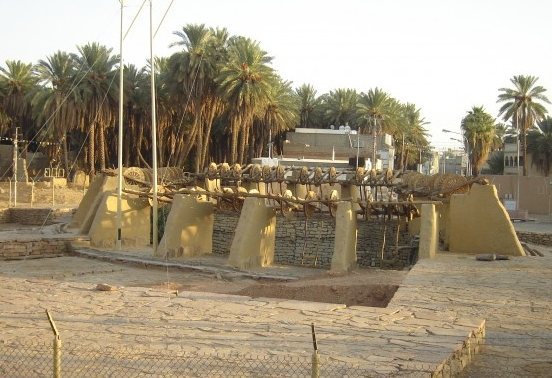
Haddaj Well is about 18 metres in diameter. Around it are roughly 70 water-lifting devices. In the traditional system, animals, usually camels, powered pulleys and ropes to raise water from a depth of about 13 metres. By 1962, six pumps were operating there as animal-powered equipment declined.
Inscriptions and writing
Inscriptions at Tayma use Aramaic, Lihyanite, Thamudic, and Nabataean, while clay tablets and stone texts in Taymanitic have been found in the ruins and around the oasis. Sixth-century BC inscriptions use cuneiform, a writing system made of wedge-shaped marks, and some Aramaic texts date to around 500 BC. On Al-Mushamrakhah, a hill southwest of Tayma, a Lihyanite rock inscription identifies Nabonidus as king of Babylon.
Tayma Stele
The sixth-century BC Tayma Stele lists three deities worshipped at the oasis: Ṣalm, Sengalla, and Ashima. Ṣalm is presented as the highest of the three. The figures are associated respectively with a winged sun, the moon, and Venus. The pronunciation of Ṣalm and the locations of three place names associated with the deities remain uncertain.
Rock carvings and landmarks
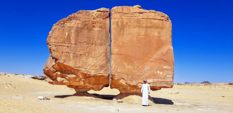
Rock carvings of people and animals in the area around Tayma provide evidence of human presence in the Neolithic period. Other identified features associated with the oasis include Al-Hadiqah Mound and the Al-Naslaa rock formation.