Sungai Batu Archaeological Site: An Ancient Port and Iron-Production Centre in Malaysia
Site at a Glance
- Rating
- 4.5
- Popularity
- Low
- Country
- Malaysia
- Primary era
- Iron Age
- External website
- Open
- Eras represented
- Iron Age, Classical, Medieval
- Civilizations
- Unclassified
- Site type
- Economic
- Remains
- Production Complex
On this page12 sections
History
Sungai Batu Archaeological Site is an ancient port and industrial settlement in Kuala Muda District, Kedah, Malaysia. Covering about 3.9 to 4 square kilometres, it forms part of the Bujang Valley archaeological landscape, a region associated with early settlements, maritime trade, iron production, and Hindu-Buddhist religious activity.
Chronology and early development
The date of Sungai Batu remains debated. Charcoal from a furnace at Site SB2H produced an Accelerator Mass Spectrometry date of approximately 788 to 537 BC. This method measures the isotopic composition of very small samples, including charcoal. Bricks from a jetty have yielded an optically stimulated luminescence date around the sixth century BC. This technique estimates when mineral grains were last exposed to sunlight or intense heat.
Other evidence points to a later chronology. Bayesian chronological modelling, which combines dating results with archaeological relationships and prior chronological information, favours a period between the second and tenth centuries AD. Typological and regional comparisons have also supported this range. The early result is treated as an outlier, and the samples leave a substantial chronological gap between the sixth century BC and the second century AD. Archaeologists have therefore argued that the site should not be dated from a single radiocarbon result and that further carbon-14 analysis is needed.
Port, trade, and iron production
Excavation has identified Sungai Batu as a port centre involved in regional and long-distance exchange. Ports and waterways connected the settlement with markets to the east and west of the Malay Peninsula. This activity has been discussed alongside the first-century account of an east-west trading system through the Golden Chersonese, the ancient Greco-Roman name for the Malay Peninsula. Ptolemy, a second-century Greek geographer, preserved information about places and trade routes in the ancient world, although the wider historical comparison does not resolve Sungai Batu’s own chronology.
Iron production appears to have been central to the settlement’s economic and political importance. Large numbers of furnaces, deposits of iron ore, and tuyeres, tubes that direct air into a furnace, point to sustained smelting. The resulting wrought iron, shaped by heating and hammering and containing relatively little carbon, was produced as a commercial commodity. The concentration of industrial remains has been interpreted as evidence that Sungai Batu participated in broader iron-trading networks. Its iron technology, tools, and weapons have also been proposed as a foundation of the settlement’s political strength.
Ritual activity and changing interpretations
Alongside its industrial and maritime functions, Sungai Batu contained a ritual complex built by the local community. Some interpretations connect its activity with animistic worship associated with Mount Jerai, a prominent mountain in Kedah. In this religious concept, natural features and other entities may possess spiritual qualities or agency. This proposed local tradition has been placed before the arrival of Hindu-Buddhist traditions in the fifth century and Islam in Kedah in the twelfth century.
The religious identity of the complex remains unsettled. Derek Kennet identified possible influence from Indian temple architecture, while Nasim Khan considered further excavation necessary before the complex could be securely identified. The remains have been discussed in relation to both Hindu and Buddhist traditions, but the evidence has not established one definitive affiliation. The circular structure has also been linked to Mount Jerai and a possible local ritual focus.
Archaeological investigation and heritage management
The Global Archaeological Research Center of Universiti Sains Malaysia excavated Sungai Batu as part of wider research into the Bujang Valley. Work at the site has brought together evidence for port activity, trade, iron production, maritime transport, and local ritual architecture. In 2015, several buried ships were found beneath a lake around the excavation area. Pottery, earthen vessels, ship masts, and ship posts have likewise been associated with an early maritime setting. Malaysia’s heritage authorities manage the site as part of efforts to investigate the historical development of the Bujang Valley.
Remains
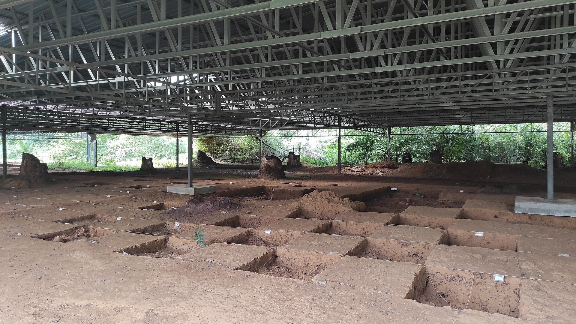
The archaeological area contains stone-built structures, building foundations, port installations, industrial zones, and ritual architecture. These remains occupy a broad settlement landscape in which maritime and manufacturing features occur alongside substantial buildings and a distinctive brick complex.
Port and industrial remains
Jetty and maritime features
An ancient jetty survives through its excavated remains, including bricks whose age has been investigated using optically stimulated luminescence. The structure is associated with the port’s trading functions. Other maritime features include possible remains of a boat, buried vessels, ship masts, and ship posts. Several ships found beneath the lake around the excavation area are estimated to be about 12 to 30 metres long and approximately 2,500 years old. Their use in commercial activity is considered possible rather than certain.
Iron-smelting areas
Iron production is represented by large clay furnaces, accumulations of iron ore, and tuyeres. These tubes or nozzles supplied air to the furnaces, allowing higher temperatures during smelting. The industrial remains are associated with the production of wrought iron for exchange and provide the clearest physical expression of Sungai Batu’s manufacturing economy.
Buildings and ritual architecture
Administrative structures
Stone building foundations, administrative building walls, and brick foundations indicate substantial infrastructure within the settlement. Their construction has been interpreted as evidence of locally developed building and architectural skills. These remains form part of the built environment that supported the port and industrial centre.
Ritual complex
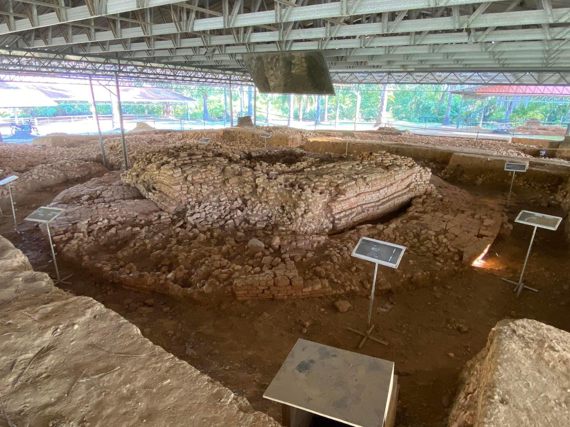
The ritual complex consists of brick blocks, a square platform, and a circular structure or circular base. The platform contains layers of brick and wall contours with ledges, overhangs, and a circular projection. These elements have been compared with architectural features associated with ancient Indian temples.
The circular base has been interpreted by some researchers as resembling the foundation of a Buddhist stupa, a commemorative monument commonly associated with relics or sacred memory. Another possibility is that a Hindu temple once stood above it. The structure has also been considered a possible focus for animistic worship connected with Mount Jerai. Its original function and religious affiliation remain provisional, while its unusual combination of square and circular forms distinguishes it within interpretations of the site’s architecture.