Sandgate Castle: A Tudor Artillery Fort on the Kent Coast


Site at a Glance
- Rating
- 4.4
- Popularity
- Very Low
- Country
- United Kingdom
- Primary era
- Modern
- External website
- Open
- Eras represented
- Early Modern, Modern
- Civilizations
- British, English
- Site type
- Military
- Remains
- Castle
On this page16 sections
History
Sandgate Castle is an artillery fort in Sandgate, Kent, in the United Kingdom, built for Henry VIII between 1539 and 1540 as part of the Tudor king’s coastal-defence programme. Known as the King’s Device programme, this system created forts against the threat of invasion by France and the Holy Roman Empire, a politically decentralised European polity ruled by an emperor who was Catherine of Aragon’s nephew. Sandgate guarded a vulnerable landing point just west of Folkestone.
Construction under Henry VIII
The fort was commissioned during a period of international tension after Henry VIII broke with Pope Paul III and annulled his marriage to Catherine of Aragon. France and the Holy Roman Empire then formed an alliance against England. In 1539, Henry ordered the construction of coastal forts for the defence of the realm.
Construction was supervised by the Moravian engineer Stefan von Haschenperg. Thomas Cockys and Richard Keys acted as commissioners. The initial workforce numbered 237 people in 1539, rising to more than 500 by that summer and to 630 in July of the following year. Masons were brought from as far away as Somerset and Gloucestershire. Sandgate was complete by autumn 1540, and Henry VIII may have inspected it during his visit to Folkestone in May 1542.
Elizabeth I visited the fort in 1573. During that visit, it was temporarily used to imprison the courtier Thomas Keyes after his unauthorised marriage to Lady Mary Grey. By 1593, Sandgate possessed seven artillery pieces as well as muskets, bows, and arrows. Its garrison in 1609 consisted of a captain, a lieutenant, five soldiers, two porters, and ten gunners.
Deterioration and civil-war conflict
The fort’s construction mortar was already seriously deteriorating by 1616. A survey then described the castle as substantially dilapidated and placed the cost of repairs at £260. A later report in 1623 linked the collapse of one-third of the southern wall to coastal erosion. It estimated that repairs, including the strengthening of the walls, would cost £560.
In 1627, the captain Richard Chalcroft reported that Sandgate was neither habitable nor defensible and could no longer command the roads. Rotten timbers and ruined walls could be climbed easily. The artillery had consequently been dismounted and placed on the beach. Repairs probably did not take place until after 1638.
Parliamentary forces captured Sandgate in 1642, at the beginning of the English Civil War, the conflicts fought between supporters of Charles I and Parliament from 1642 to 1651. The castle’s captain, Richard Hippesley, remained in post. Royalist rebels seized it again in 1648 during the Second Civil War, a renewed Royalist rising. After Parliament defeated the wider Kentish revolt at the Battle of Maidstone, Colonel Rich sent troops against the Kentish forts. Sandgate was still held by Royalists in August, but it was recaptured soon afterwards.
Reduced military role
During the Interregnum, the period of republican government between the execution of Charles I and the restoration of Charles II in 1660, Hippesley initially continued as captain. He was replaced in 1653, and the garrison was expanded to include a governor, two corporals, twenty soldiers, and three gunners.
After the restoration of Charles II, the Device Forts initially remained part of the south-coast defences. Their design, however, was considered obsolete. Sandgate’s garrison was first reduced to its pre-war level and then cut to ten men in 1682. In 1663, £200 was allocated for repairs, partly funded from lands around Sandgate confiscated from former Parliamentary supporters. The castle nevertheless continued in poor condition.
Napoleonic reconstruction and later decline
Sandgate remained in military use during the Napoleonic Wars. William Twiss proposed 58 new coastal defensive towers in 1804, and, after opposition and delays within the War Office, the old fort was converted into a secure sea battery between 1805 and 1808. The work reduced the castle’s height and transformed much of its earlier defensive fabric. The rebuilt fort was completed in 1808, armed with ten 24-pounder guns, and designed to accommodate a garrison of 40 men.
In 1859, the armament was changed to heavier 32-pounder and 68-pounder guns, and the external gun positions were redesigned. Coastal erosion continued to threaten the castle. By the middle of the nineteenth century, the sea had reached the southern edge of the walls. Protective piles failed to prevent serious flooding in 1875 and 1878, and the water caused major fissures in the masonry.
The government sold the fort in 1888 because its maintenance costs were high and its military usefulness had declined. The South Eastern Railway first purchased it with the intention of converting it into a railway station, but the castle later passed to private owners. A small museum was established there and was occasionally opened to the public for a penny.
Storm damage, restoration, and protection
Severe storms in 1927 and 1950 undermined large parts of the castle. By the early 1950s, when a new seawall was built, the sea had destroyed the southern third of the structure.
Peter and Barbara McGregor began restoring the ruins in 1975, with support from the Department of the Environment, Kent County Council, and the British Army. Archaeological investigations led by Edward Harris took place between 1975 and 1979. The castle remains privately owned. Geoffrey Boot and his wife acquired it in 2000, and the property is used by Boot’s company, AMT South Eastern Ltd.
Sandgate Castle is protected in England as a Grade I listed building, the highest category of listed-building protection and one reserved for buildings of exceptional architectural or historic interest. Two sixteenth-century construction ledger books written by the project clerk Thomas Busshe survive in the British Library. Together they contain 350 pages and have been described by the historian Peter Harrington as the most complete building account of any Tudor fortification.
Remains
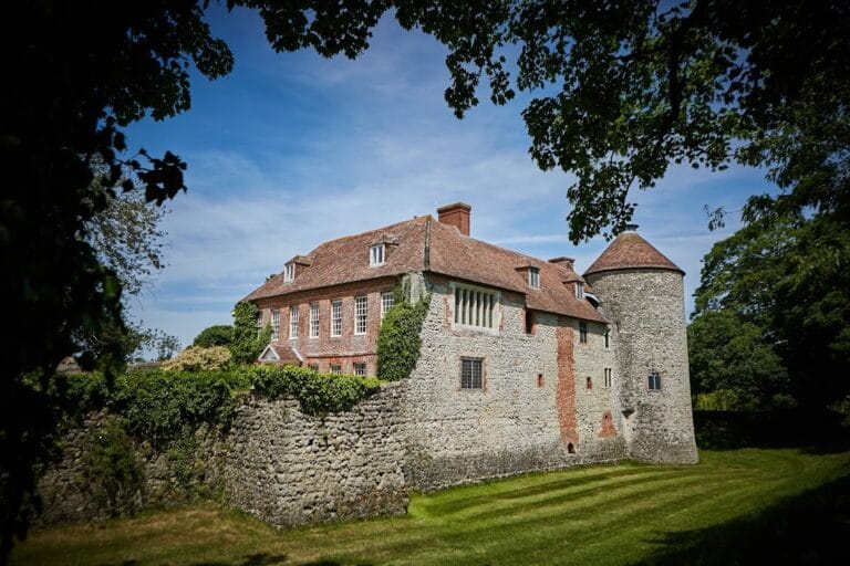
The surviving castle combines the remains of Henry VIII’s sixteenth-century artillery fort with the smaller, lower form created by the 1805 to 1808 reconstruction. The original foundations rested on beach shingle. Walls were built mainly from roughly laid Kentish ragstone, with finer ashlar and Caen stone used for details. Ragstone came from beach outcrops west and east of the site, while 459 tons of Caen stone were reused from the recently dissolved priories of Christ Church and Horton.
The sixteenth-century fort
Keep and artillery towers
The original plan centred on a circular keep, the principal fortified tower of the castle. Three ovoid towers surrounded it, forming projecting bastions on the north-west, north-east, and south sides. A gatehouse stood to the north. Covered stone passageways, originally three storeys high, connected the keep, towers, and gatehouse.
The completed Tudor fort had four tiers of artillery positions, extending from ground level to the roof of the keep. These provided 142 firing points for cannon and hand-held firearms. The arrangement closely resembled the nearby Device Forts at Walmer and Deal. By 1616, a 100-foot, or 30-metre, gun platform for ten weapons had been constructed along the southern wall, replacing the original southern battery.
Wards, entrance, and drainage
Two curtain walls, defensive walls enclosing a fortified site, formed triangular inner and outer wards. The outer ward was grassed and contained a stone cesspool beside the north-east tower. Underground sewers connected it with the inner part of the castle.
Entry was made through a doorway at the rear of the gatehouse, which was originally called the Half Moon. A stairway within a covered passage connected this entrance with the keep. The arrangement brought the principal access, circulation passages, towers, and artillery positions into a closely integrated defensive plan.
The 1805 to 1808 sea battery
Reduced keep and Martello tower
The reconstruction demolished the upper storeys of the keep, towers, covered passageways, and gatehouse, together with some buildings in the inner ward. Rubble from the demolition filled the outer ward, raising its level and effectively turning the inner ward into a dry moat. The inner curtain wall was reduced to one storey, while the outer curtain wall was refaced.
The circular keep became a two-storey Martello tower, a low and strongly built coastal artillery fortification developed during the Napoleonic Wars. Much of its original internal walling and its doorways survived. The tower was initially entered at first-floor level by a sliding drawbridge that ran on rails and retracted into the floor. Spiral stairs connected the two storeys.
The lower floor contained a brick-built artillery magazine. Its roof was supported by a central pillar extending through the height of the building, and the roof carried a single large gun emplacement. The keep was later converted into a private residence, and a new sunroom or winter garden was built on its gun platform.
Outer walls and gun positions
An esplanade, an open level area used for defensive access and gun positions, and a wall-walk were constructed around the surviving outer walls. At least eight gun emplacements formed part of the rebuilt battery. The north-east and north-west towers were reduced to one storey and covered with turf, creating a flat, grassed esplanade at the rear of the outer ward. The south tower was reduced to two storeys and continued to serve as a gun platform.
The covered passages between the keep and towers were reduced to one storey and connected with the buried towers in the north-east and north-west bastions. The upper storeys of the gatehouse were rebuilt, while its ground floor retained its sixteenth-century condition. After the reconstruction, eight 24-pounder guns stood along the outer wall, with one additional gun on the roof of the southern bastion and another on the keep.
The 1859 improvements and archaeological remains
Magazine and later emplacements
The 1859 rearmament added a large brick-built magazine divided into three rooms for storing gunpowder. Its design was intended to keep the powder dry. The exterior gun emplacements were rebuilt on foundations laid in 1806, and the two surviving positions in the north-east and north-west bastions date from 1859.
Excavated structures and surviving levels
Archaeological work between 1975 and 1979 excavated part of the 1806 esplanade around the north-east bastion. The work exposed the tower’s lower sixteenth-century masonry and the eastern side of the 1859 magazine. A newly built retaining wall secured these remains.
Restoration and excavation created two levels in the outer bailey, an enclosed area within a fortification. The western level is higher and still covers the north-west tower, while the eastern level is lower. The southern third of the castle had been destroyed by the sea by the early 1950s, while the surviving remains were restored and continue in private ownership.