Samosdelka: A Medieval Settlement in the Volga Delta
Site at a Glance
- Popularity
- Medium
- Country
- Russia
- Primary era
- Medieval
- Eras represented
- Medieval
- Civilizations
- Golden Horde
- Site type
- City
On this page15 sections
History
Samosdelka is an archaeological settlement near the village of Samosdelka in Astrakhan Oblast, Russia. Its lowest layers date to the eighth and ninth centuries, followed by urban phases of the eleventh and twelfth centuries and the thirteenth and fourteenth centuries. The settlement has been proposed as Itil, the last capital of the Khazar Khaganate, and its eleventh- and twelfth-century phase is commonly identified with Saqsin, a trading city in the Volga delta.
Khazar-period settlement
The earliest layers belong to the Khazar period, broadly dated to the ninth and tenth centuries. The Khazar Khaganate was a medieval polity whose supreme ruler was called a khagan. Samosdelka has been proposed as the site of Itil, but the identification remains disputed. The proposal draws on the settlement’s dating and interpretations of its layout and early material culture. Saltovo-Mayaki ceramics, associated with the Khazar-period world, have not been found at the site, and no recovered coin is dated to the tenth century or earlier. A 2020 assessment concluded that Itil had not been located at Samosdelka.
A separate fire layer tentatively assigned to the proposed Itil phase has been linked to Sviatoslav I’s conquest in 968 or 969. Sviatoslav I was a prince of Kievan Rus, but both the layer’s identification and the cause of the fire remain uncertain.
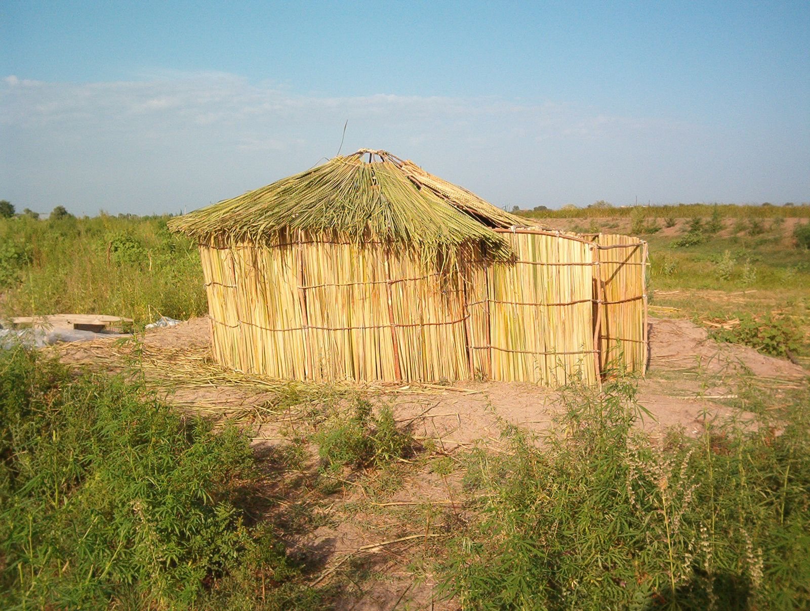
Before the Oghuz migration into the Volga region, Bulgars probably formed the settlement’s main population. The Bulgars were a distinct medieval people associated with Volga Bulgaria. Yurt-like homes and handmade pottery of broadly Turkic types have been linked to their presence.
Saqsin and the pre-Mongol city
The settlement’s eleventh- and twelfth-century phase is commonly identified with Saqsin. The medieval Muslim traveler, merchant, and writer Abu Hamid al-Garnati described Saqsin as home to forty Oghuz groups, each led by an emir, or ruler, and living in large felt-covered tents. His account also names Bulgar, Suvar, and Khazar residents, separate communal Friday mosques, and quarters for different groups. He described thousands of merchants from the Maghreb and other regions.
Interpretations of the settlement’s remains place Oghuz and Bulgar communities at the center of its life and identify Saqsin as a transit-trade hub. Its economy combined farming, herding, and fishing. Bulgars may have supplied crafted goods and helped organize commerce, even if Oghuz held political authority.
Golden Horde period and abandonment
The settlement’s upper layers have been linked either to Summerkent, a city of the Golden Horde, or to Saqsin’s continued existence. The Golden Horde was a Mongol successor state that ruled much of the western Eurasian steppe. In 1254, the traveler Guillaume de Rubruck described Summerkent in the Volga delta as unwalled and surrounded by water during floods; he also reported that it had endured an eight-year siege by the Tatars. Summerkent’s location at Samosdelka is uncertain. Some interpretations place it elsewhere and identify the Golden Horde settlement at Samosdelka with Saqsin.
In the thirteenth century, the Mongol invasion destroyed major pre-Mongol buildings and urban infrastructure. The earlier street plan declined, and local residents returned to occupy ruins. From the beginning of the fourteenth century, a modest recovery brought the removal and replanning of large pre-Mongol estate buildings. The settlement’s area contracted, and mass-produced Golden Horde pottery increasingly replaced local traditions, a change attributed to the departure of some of the people who had maintained them.
Periodic floods affected the settlement from the 1330s, and it had been abandoned by the middle of the fourteenth century. A rapid rise in the Caspian Sea during the first half of that century may have increased the flood risk and contributed to the decline. New Golden Horde cities in the lower Volga also reduced the older center’s ability to compete for trade.
Archaeological investigations
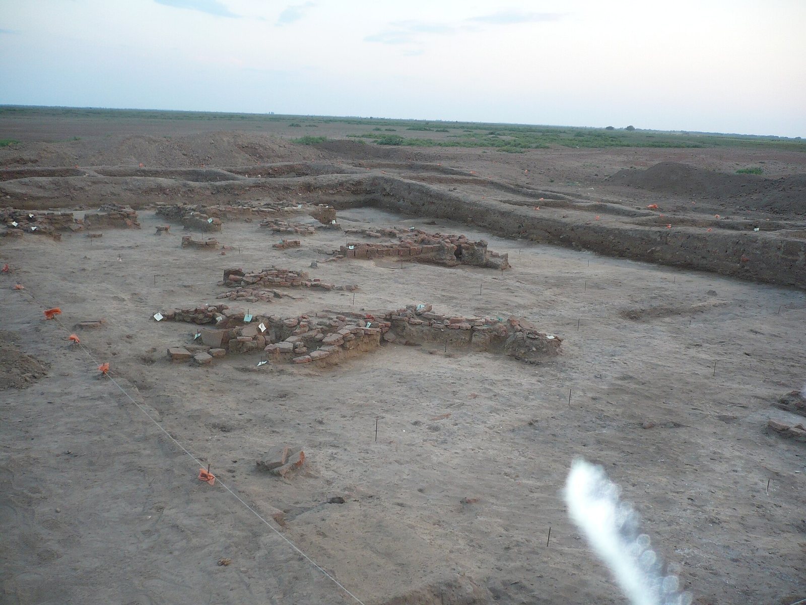
The Astrakhan provincial statistical committee examined ruins near the village in 1898 at the governor’s direction. Renewed interest followed in 1989, when local schoolteacher Alexander Pukhov collected large quantities of pottery dating to the ninth and tenth centuries. A state heritage directorate expedition led by S. A. Kotenkov began preliminary investigations in 1990. Work through 1995 included surface collection, test pits, limited excavation of Trench 1, examination of exposed sections, assessment of cultural-layer depth, and mapping of the settlement’s approximate boundaries.
Systematic investigations began around 1999–2000 with an archaeological expedition organized by the Russian Jewish Congress as part of its Khazar project. E. D. Zilivinskaya and D. V. Vasilyev led the expedition. T. Yu. Grechkina worked at the site during 2000–2005 through the joint project and independently in 2006. Trench 1 was excavated from 2000 to 2009, Trench 2 has been investigated since 2006, and Trench 3 opened in 2010. Studies of animal bones distinguished layers associated with the Mongol invasion, Saqsin, and the Khazar period, and identified the excavated area as part of an elite quarter. Research into fish remains has examined changes in delta fish populations and fishing. Later work continued as a joint project of the Russian Academy of Sciences’ Institute of Ethnology and Anthropology and Astrakhan State University. Samosdelka is recognized as a federal-level cultural heritage site in Russia.
Remains
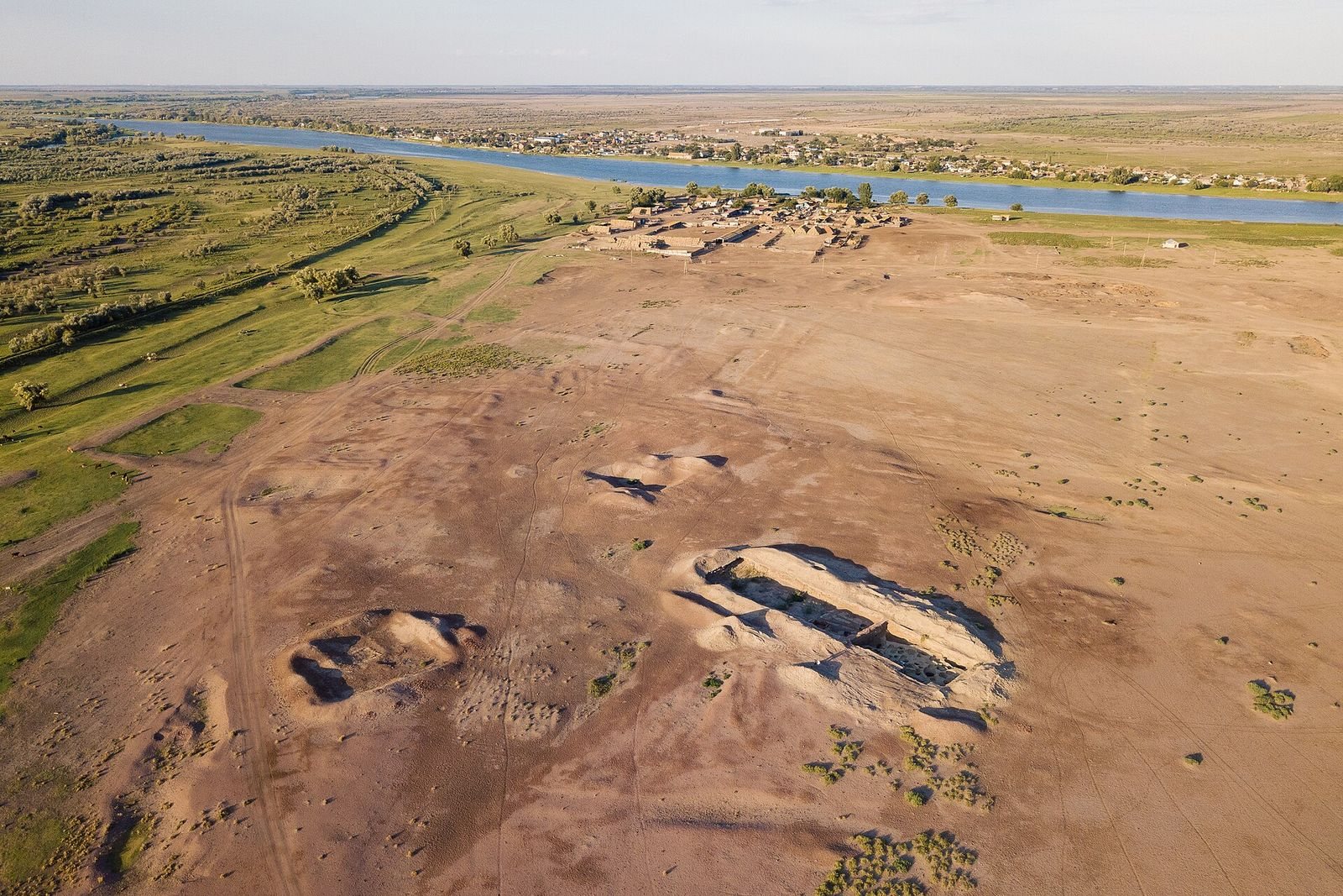
Samosdelka’s remains occupy a river-shaped landscape, with its main settlement on an elevated former island and deposits extending into nearby areas. The building evidence ranges from early timber-framed and reed-filled dwellings to larger mudbrick structures and later houses incorporating reused fired brick. A triangular central fortress has also been proposed.
Settlement layout
Main rise
The principal settlement occupies a low, uneven rise made up of accumulated cultural layers on a promontory between old and present river channels. It extends northeast to southwest along the old channel for about 1 km and measures approximately 300–500 m across. The main part once occupied an island beside an old channel, now dry, and was surrounded by dry watercourses; it is now on the right bank of the Staraya Volga, also called the Biryul, about 43 km downstream from Astrakhan and roughly 1 km west of the village. The present river may mark the eastern edge, while the old Volozhka channel forms the northern and northwestern boundary. Excavations have concentrated on the island section’s highest ground: Trench 1 lies in the center, Trench 2 on the southern slope of the central rise, and Trench 3 on its northwestern slope.
Other deposits
About 1.5 km downstream along the present river, erosion cuts into extensive cultural deposits near a former ferry crossing. These deposits represent a lower-lying southern section of the right-bank settlement. Remains dating from the ninth to fourteenth centuries have also been identified on the left bank, on the Baer hillock within the village; this area is mainly associated with the Golden Horde period. The known site covers about 2 km².
Buildings and construction
Proposed central fortress
Aerial photographs from 2005 suggested a triangular fortress at the settlement’s center, with walls of fired brick. The rise formed by the fortress ruins is reported to measure 350 by 350 by 120 m. Brick and pottery fragments are most concentrated within the triangle, where cultural deposits reach 3 m thick and are thinner elsewhere. Structures built with reused fired-brick fragments occur in layers dating from the twelfth to fourteenth centuries. The reused bricks may have come from a large palace or fortress of the Khazar period, dating to the eighth or ninth century.
Dwellings and houses
In the lower layers, some dwellings were sunken and yurt-like, with walls made from poles and woven branches coated in clay. Other early homes were light square or rectangular frames: wooden posts and poles were set into the ground, the gaps filled with reeds, and the walls coated with clay. Eleventh- and twelfth-century buildings were larger and had multiple rooms, with mudbrick walls and reused fired-brick fragments. Houses of the thirteenth and fourteenth centuries were mainly single-roomed. A widespread fire layer occurs in the thirteenth- and fourteenth-century deposits.
Pottery and other finds
Pottery
Pottery from the lower layers dates to the Khazar period. Finds from the tenth to twelfth centuries include pottery made locally by Bulgars as well as imports from Khwarazm, Transcaucasia, and Shirvan. Pottery in the eleventh- and twelfth-century layers has also been linked to steppe assemblages from central Kazakhstan and the Aral region, and to material from the lower Amu Darya and Ustyurt.
Coins and fish remains
Coins recovered at the settlement have been studied for evidence of exchange with the Caucasus and Iran. Fish remains have also been examined to investigate fishing and changes in fish populations in the Volga delta.