Saï: A Strategic Nubian Island and Egyptian Base
Site at a Glance
- Popularity
- Medium
- Country
- Sudan
- Primary era
- Bronze Age
- Eras represented
- Bronze Age, Classical, Medieval, Early Modern
- Civilizations
- Christian Nubian Kingdoms, Egyptian, Kushite, Ottoman
- Site type
- City
On this page16 sections
History
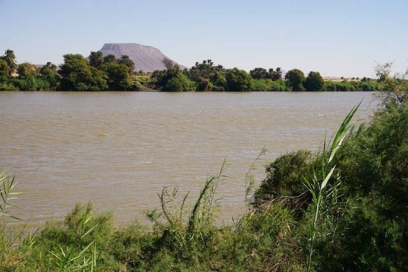
Saï is an island in the Nile in Sudan, between the Second and Third Cataracts, stretches of rocky rapids. It became the largest city in the northern part of the Kerma kingdom and later a strategic Egyptian base for expansion into Nubia. Human activity on the island extends back to the Paleolithic, an early archaeological period.
Early settlement
The name Saï may come from the Egyptian place-name Chaât, a broad term for southern territory that Egyptians regarded as a beginning. A Nubian origin is another possibility. In medieval Old Nubian, a Nubian language, the island’s name took the form Zaē.
Eight occupation levels trace human activity on Saï. The earliest included riverside camps that were abandoned after a dry phase. Around 10,000 years ago, increasing aridity west of the Nile encouraged communities to settle closer to the river and adopt new technologies. As resources became scarcer, people domesticated local species and began rudimentary farming. Pottery associated with the Khartoum Variant culture belongs to semi-nomadic communities that hunted, gathered, and fished; it dates to 7600–4800 BCE.
By about 5000 BCE, greater food production coincided with population growth and more settlements. Communities became less mobile, and increasingly hierarchical social organization made defense of territory more important.
Kerma and Egyptian rule
In the second half of the third millennium BCE, Saï became the largest city in the northern part of the Kerma kingdom, a Nubian realm united under a king and centered on Kerma. Ancient texts called its local leaders the “princes of Saï.” The island’s river setting offered natural protection, and its Kerma cemetery was the kingdom’s second largest, after the cemetery at the capital.
Egyptian armies sought control of Saï early because of its importance to Kerma. They then used the island as a base for expansion into Nubia. Early in Egypt’s 18th Dynasty, Saï was a modest port. Under Thutmose III it was fortified, and it later served temporarily as a regional administrative center. For centuries it remained an important Egyptian economic and military base in Nubia. It continued to be administered in Egypt’s name at least until the reign of Ramesses IX, late in the 12th century BCE.
Napata, Meroe, and Christian Saï
In the early first millennium BCE, the kingdom of Napata and, later, the kingdom of Meroe regained control of the region and Saï. Funerary inscriptions preserve details about the lives and family connections of local elites. Meroe collapsed in the mid-fourth century CE, after which tumuli, or burial mounds, again became a prominent form of grave marker.
As Christianity spread around the middle of the sixth century, Saï became the seat of a bishop. The island’s burial customs changed along with the new faith. Christian graves were placed around Meroitic tombs, reflecting a stronger emphasis on modesty and simplicity.
Later Nubia and archaeological research
Arabized tribes controlled Saï from the late 14th century. Ottoman authority expanded into northern Nubia in the 16th century, amid the northward advance of the Fung kingdom, a later Sudanese kingdom. A network of defensive forts and watchtowers was built, and Saï again held a strategic role.
A French archaeological mission has worked on the island since 1904. Jean Vercoutter led excavations in the 1950s and 1970s, concentrating mainly on Bronze Age finds. A wider archaeological project begun in 1993 also brought evidence of Paleolithic, Neolithic, and Iron Age occupation to light. Vercoutter supervised a French University of Lille mission that studied Egyptian Middle Kingdom cemeteries.
Saï has four villages: one in the north, one on the western shore, one in the south, and one on the eastern shore. Residents speak Nubian. The island is also known as the “Island of Teachers,” a name reflecting the number of residents who have worked in education; literacy is nearly universal.
Remains
Saï is about 12 kilometers long and 5.5 kilometers wide, making it Sudan’s second-largest island. Its surviving remains range from early occupation evidence to cemeteries, temples, and later fortifications. The island lies in Sudanese Nubia, between the Second and Third Cataracts of the Nile.
Landscape and prehistoric evidence
More than 100 million years ago, the island was covered by giant trees and had abundant water. A fossilized tree from the Cretaceous period is found there. The oldest recovered objects, dated to about 300,000 years ago, came from south of the island’s hill. One early occupation level contains evidence that people used natural pigments, including red and yellow iron oxides and black manganese. This is among the oldest known evidence of pigment use. Crocodiles, gazelles, rhinoceroses, and elephants lived in the region’s savanna environment. Several prehistoric sites contain pottery associated with the Khartoum Variant culture.
Kerma cemetery
Near the island’s center, at an elevation of about 150 meters, the Kerma cemetery contains more than 3,000 burials. Its large tumuli can reach 40 meters in diameter. Black stones border some mounds, with white pebbles placed on top. Some tumuli may have marked the graves of princes responsible for defending the kingdom’s northern frontier.
Egyptian and Ottoman built remains
Egyptian town and temple
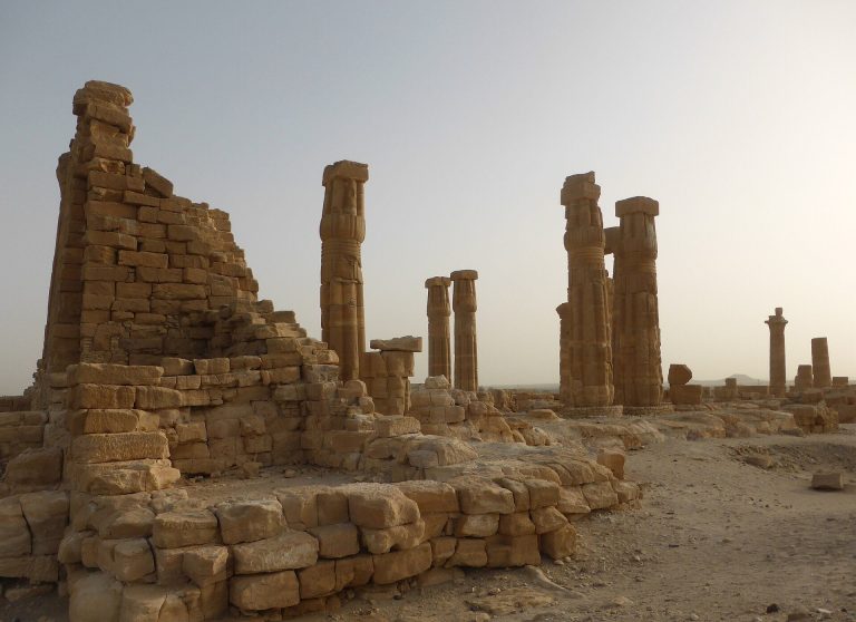
Remains of a fortified Egyptian town and tombs of Egyptian administrators survive on the island. A New Kingdom Egyptian temple in the northeast was built of stone and dedicated to Amun, a major ancient Egyptian deity.
Gold mills and nearby tombs
Numerous mills in the northeastern part of the island are associated with ancient gold production. Round tombs are also located nearby.
Qalat Sai
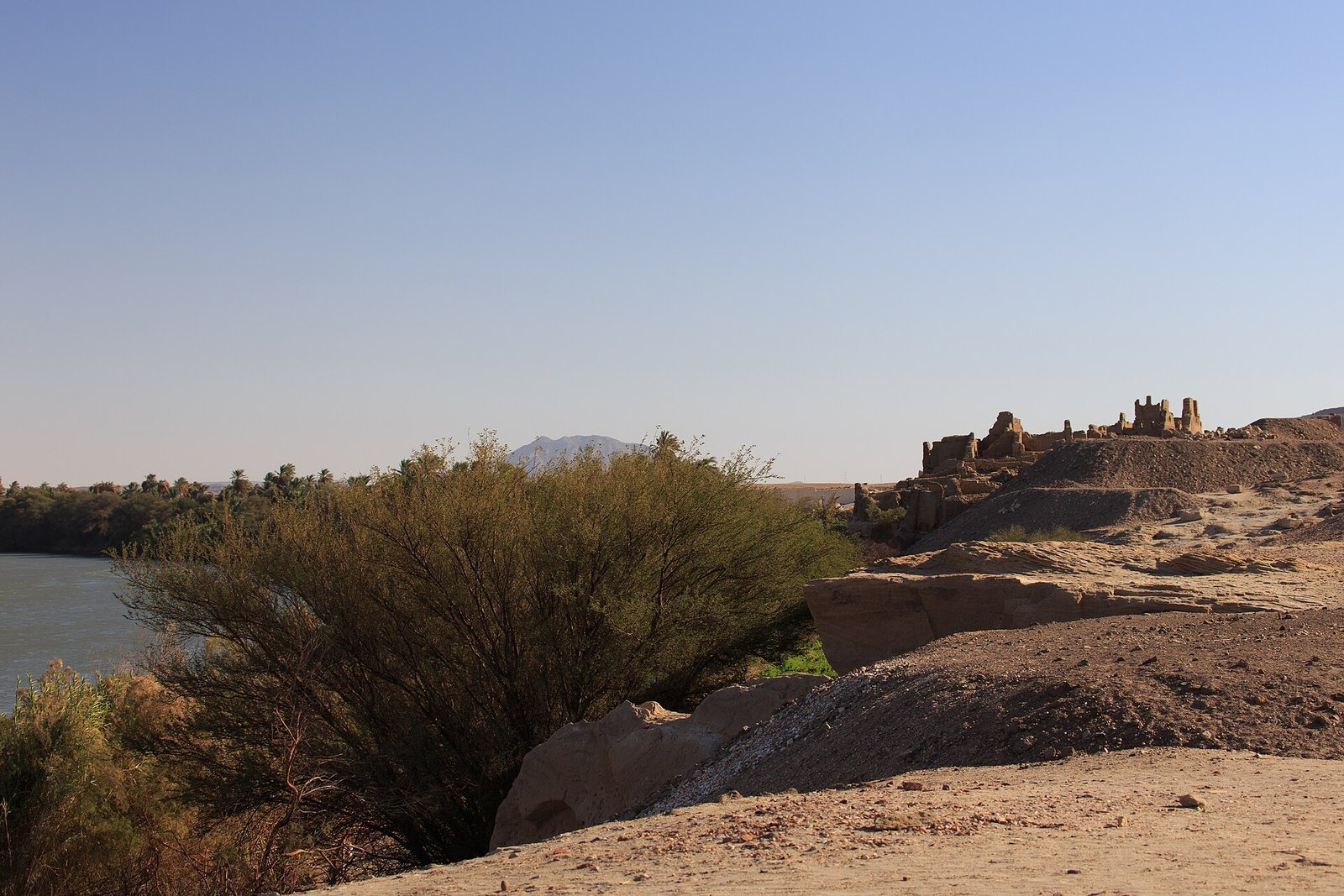
The Ottoman fortress of Qalat Sai stands on the ruins of the ancient town, atop a sandstone cliff overlooking the Nile. Its sandstone was quarried along the riverbanks, and its walls incorporate reused blocks. Some bear cartouches, oval frames around royal names in Egyptian hieroglyphs, naming Amenhotep IV and other rulers of Egypt’s 18th Dynasty. The fortress could accommodate up to 500 men.
Meroitic and later burial remains
Meroitic temple and elite burials
Decorated sandstone blocks from a first-century CE temple bear inscriptions naming Natakamani, a ruler of Meroe, Amanitore, a Kushite royal woman titled Candace, and Prince Arakakhataror. Meroitic elite graves include small pyramids modeled on royal tombs. Their grave goods reflect cultural influence from neighboring Roman Egypt, meaning Egypt under Roman rule. They include shrouds, as well as imported wine and perfumed oils. During peaceful periods, imports reached Saï more extensively than the southern part of the Meroitic kingdom.
Post-Meroitic burial mounds
After the collapse of Meroe, extensive burial grounds developed across the island, with large tumuli shaping a landscape marked by burial mounds.
Christian church and graves
A church stands in the north of the island. Christian graves surround Meroitic tombs. The dead were wrapped in simple shrouds, sometimes with a small metal cross.