Pyu Ancient Cities: Early Buddhist Urban Centers in Myanmar
Site at a Glance
- Rating
- 4.3
- Popularity
- Very Low
- Country
- Myanmar
- Primary era
- Medieval
- Eras represented
- Classical, Medieval
- Civilizations
- Pyu
- Site type
- City
On this page9 sections
History
The Pyu Ancient Cities are three ancient urban centers in Myanmar, built by the Pyu during the first millennium CE and representing a Buddhist urban civilization that flourished from approximately 200 BC to AD 900. The cities were Beikthano, Sri Ksetra, and Halin, each developing as a separate Pyu city-state in the dry zone of the Irrawaddy basin.
The Pyu city-states
The Pyu were a Tibeto-Burman population who established several related city-states rather than a single unified kingdom. Their settlements depended on sophisticated irrigation systems that supported intensive agriculture in the dry zone. The cities also participated in trade networks connecting Southeast Asia with China and India. Specialized production included terracotta, iron, gold, silver, and semiprecious stones, which served both ritual purposes and commerce.
Pyu religious life was initially influenced by Hinduism, but Buddhism was adopted during the second or third century CE. Inscriptions associate Pyu Buddhism with the Theravada tradition, which emphasizes early Buddhist teachings and the monastic community. Monasteries, royal patronage, and public support helped Buddhist institutions develop, while the replacement of earlier timber buildings with brick gave the cities more durable monumental forms. Cremated remains placed in funerary urns formed part of distinctive communal burial practices, and Buddhist missionaries carried Pali-based teachings and monastic customs through the region’s trading networks.
Early development and urban growth
Beikthano was among the earliest Pyu cities. It emerged during the second or first century BC and declined in importance during the fifth century CE. Excavations between 1959 and 1962 exposed 25 brick structures, including a palace precinct, a monastery, and a mortuary building.
Sri Ksetra is traditionally said to have been founded in AD 94 and later became the largest Pyu city. Its first excavations took place in 1904, and a palace in the city center was excavated in 1991. The city was abandoned in AD 656, although it continued to serve as a center for external trade, including commerce with China. By approximately the seventh century, the political center of the Pyu is said to have shifted from Sri Ksetra to Halin.
Halin had human activity as early as the Bronze Age and developed into an urban settlement around the first century BC. Its political importance increased as the Pyu center shifted northward, while its excavated remains show continued activity in administration, manufacturing, burial, religious construction, and water management. Archaeological work took place there in 1904 and 1905, from 1929 to 1930, during the 1960s, and into 2012.
Tradition, decline, and later influence
A traditional account identifies Beikthano with Vishnu City and attributes its foundation to Pan Htwar, a legendary princess of the Tagaung dynasty. The story says that a ruler of Sri Ksetra sacked the city, captured and subdued the princess, and later married her. The identities of these figures cannot be established securely, so the account belongs to the legendary tradition associated with the city.
Sri Ksetra gradually declined around the ninth century. In AD 832, Nanzhao, a powerful kingdom centered in the Yunnan region of present-day China, defeated the Pyu and took many people to Tuodong. Pyu political power then weakened, and the Pagan Kingdom, a later medieval Myanmar kingdom, replaced the Pyu states as the dominant power. Pyu cultural traditions continued to influence Pagan-period craftsmanship. A stone inscription from the twelfth century at Pagan preserves texts in Pyu, Mon, Burmese, and Pali.
World Heritage recognition
The Pyu Ancient Cities were inscribed on the UNESCO World Heritage List in 2014 after the 38th session of the World Heritage Committee. UNESCO is an international system for recognizing cultural and natural properties judged to have outstanding universal value. The serial property comprises three protected areas covering 5,809 hectares, with surrounding buffer zones totaling 6,790 hectares.
The cities provide early evidence for the spread of Buddhism in Southeast Asia and for the emergence of the region’s first historically documented Buddhist urban civilization. Their achievements in water management, agriculture, brickmaking, iron production, urban planning, and monumental construction influenced later state formation and urban development in mainland Southeast Asia.
Remains
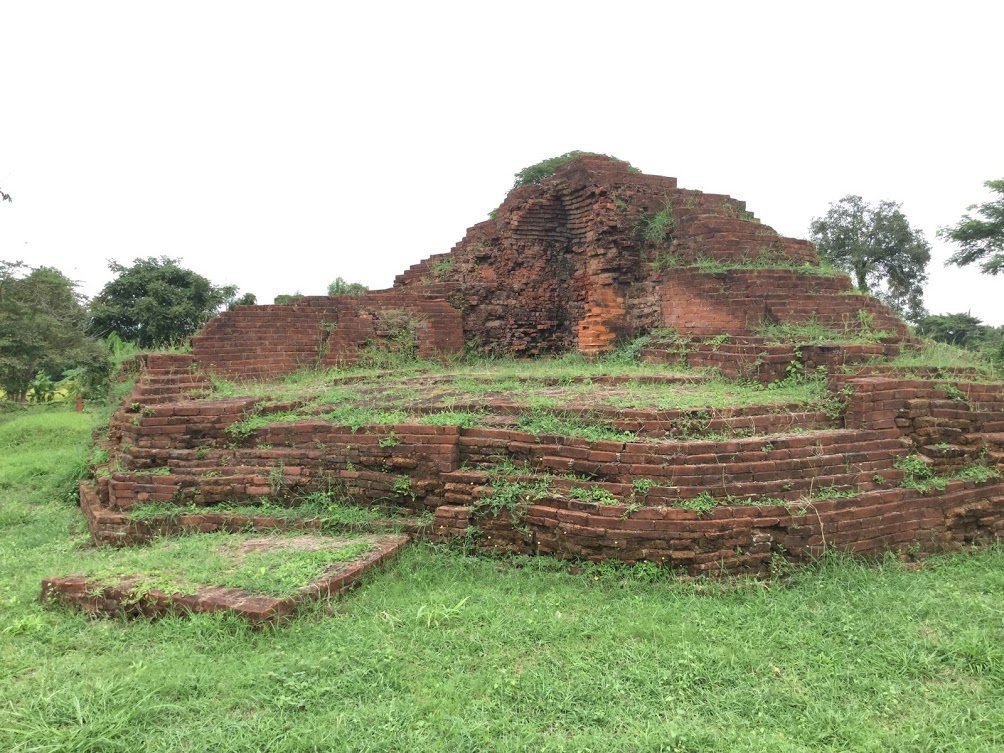
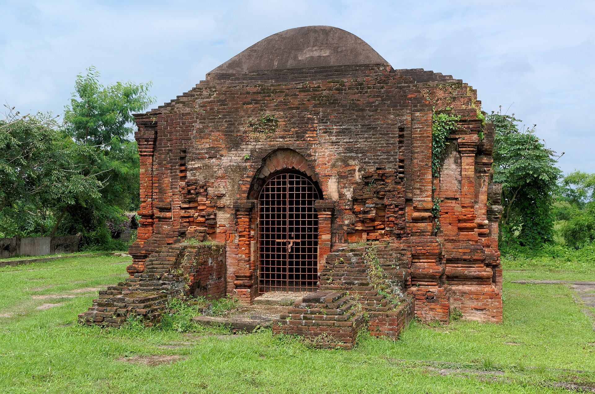
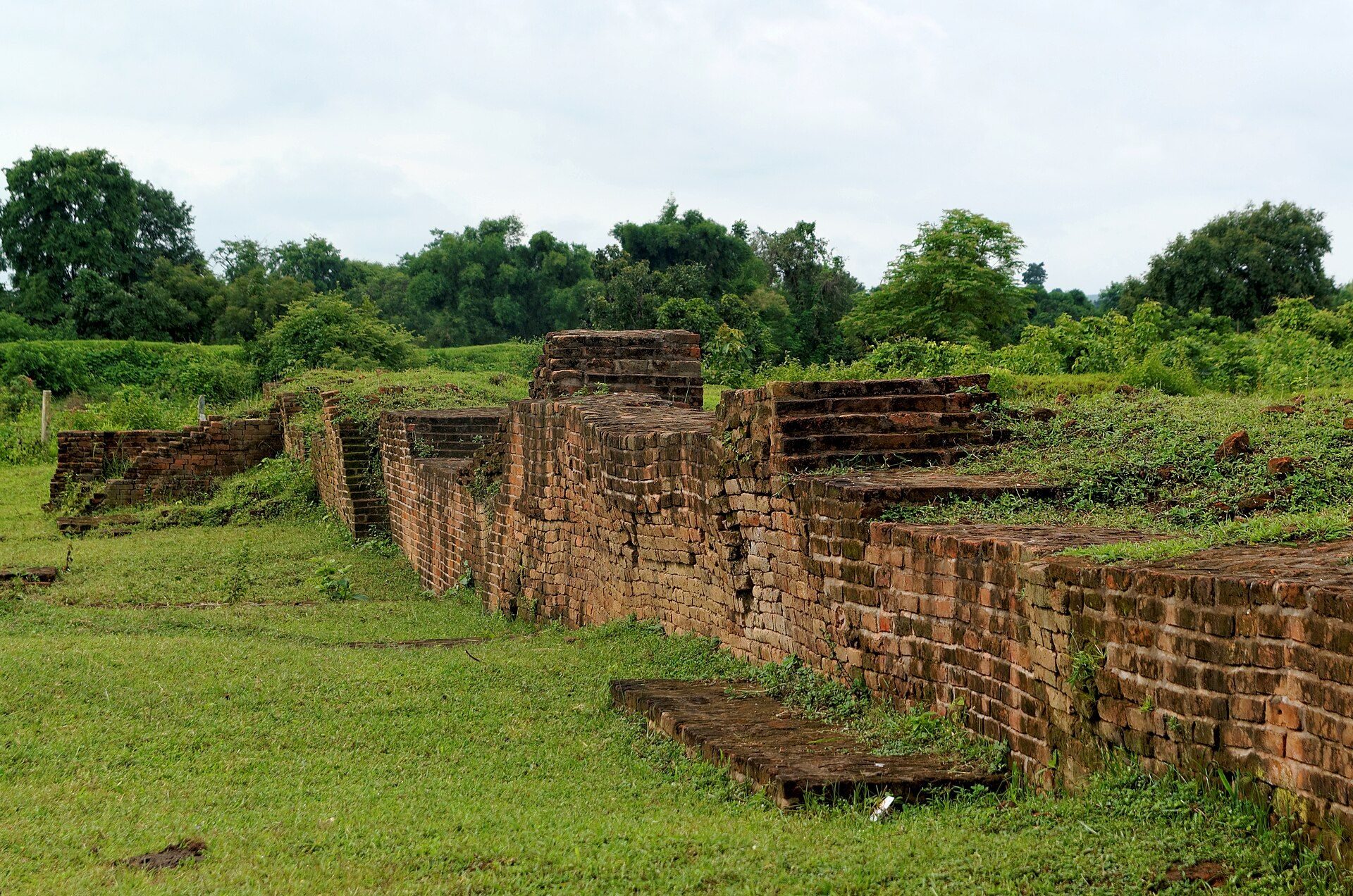
The three cities share an expanded urban model based on massive enclosing walls, moats, internal roads and canals, extramural settlement, civic institutions, monumental religious buildings, and sacred water features. An administrative complex stood at or near the center of each city, with the palace understood as the cosmic center of Pyu political and social life. Surviving remains include palace precincts, cemeteries, cremation areas, manufacturing sites, monasteries, temples, stupas, pagodas, brick inscriptions, water-management installations, and sections of city walls. Some walls remain standing, while other features survive as excavated or ruined structures.
Beikthano and Vishnu City
Beikthano had a rectangular plan measuring approximately 1 kilometre by 3 kilometres. A brick wall enclosed the city and survives in places to a height of up to 2 metres. Excavation revealed 25 brick buildings, including the palace precinct, monastery, and mortuary building. The settlement is also identified with Vishnu City in the tradition associated with Pan Htwar. Its outer enclosure measured approximately 3 kilometres by 1 kilometre, with about 300 hectares occupied by substantial fortified construction. The walls and fortifications reached approximately 6 metres in height, and radiocarbon dating places them broadly between about 180 BC and AD 610. The principal entrance faced east toward the palace. Very few inscriptions or figurative objects were found at Beikthano.
Sri Ksetra
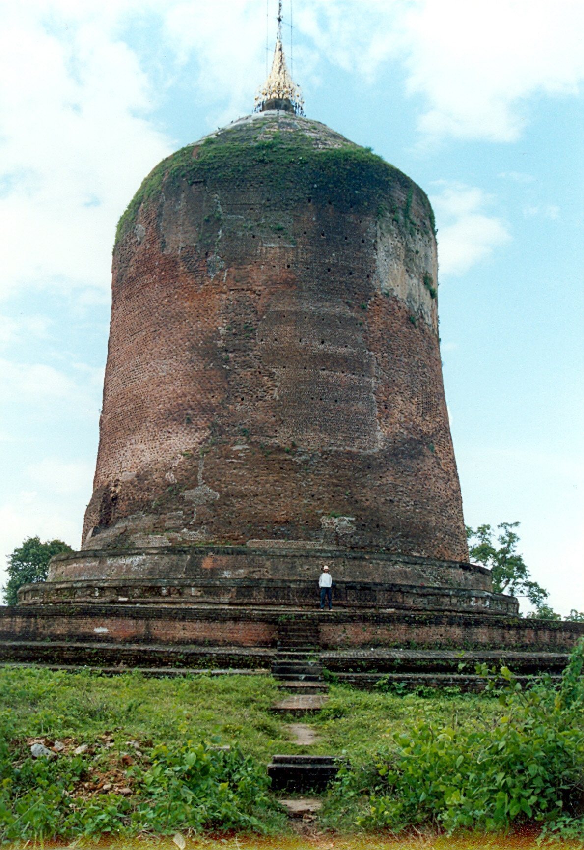
Sri Ksetra had a circular plan approximately 4.4 kilometres in diameter. Its brick wall enclosed about 1,600 hectares, while an extramural area of roughly similar size extended beyond the walled city. Excavated remains include stupas, monumental Buddhist structures usually built as solid reliquaries or commemorative monuments, pagodas, temples, and a palace in the city center. The city has also yielded sculptures in gold, bronze, and stone, together with inscriptions in Sanskrit, Pali, and Pyu. These remains indicate a substantial visual and religious culture. Most currently dated structures belong to the seventh through ninth centuries, while earlier Pyu activity is also present.
Halin
Halin occupied undulating terrain containing volcanic material, approximately 16 kilometres from the Irrawaddy and 27 kilometres from the west bank of the Mu River. Its rectangular urban plan measured approximately 1.5 kilometres by 3 kilometres and covered about 541.4 hectares. A brick wall with twelve gates enclosed the settlement, and traces of a moat survive. A separately walled palace complex stood at the center.
Excavated areas at Halin include the palace enclosure, cremation grounds, manufacturing sites, brick components of stupas, inscriptions, walls of varying sizes, and water-management installations. The excavated material includes mainly funerary urns, inscriptions, and statues, as well as eleven human skeletons preserved in fossilized condition. Hot springs in the excavation area were reportedly regarded as having healing properties.
At the HL-22 excavation area, three groups of standing stone slabs dated to the second century CE have been interpreted as evidence of a megalithic tradition. The city’s water installations formed part of a wider agricultural system, and some water-management features at the three urban sites remain in use for organized intensive agriculture.