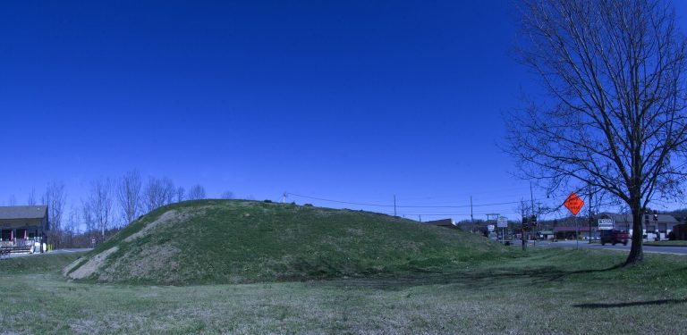
Nacoochee Mound: A Mississippian Platform Mound in Georgia
Site at a Glance
- Rating
- 4.6
- Popularity
- Very Low
- Country
- United States
- Primary era
- Medieval
- Eras represented
- Medieval, Early Modern
- Civilizations
- Unclassified
- Site type
- Religious
- Remains
- Temple
On this page11 sections
History
Nacoochee Mound is a prehistoric archaeological site on the Chattahoochee River near Helen, Georgia, United States, where South Appalachian Mississippian communities probably built an earthen platform mound between 1350 and 1600 CE. The site, also identified by the Smithsonian trinomial 9WH3, was occupied earlier during the Early Middle Woodland Cartersville Phase, from about 100 to 500 CE. Nacoochee is a Cherokee name meaning “evening star.”
Early occupation and the Mississippian center
The earliest known occupation belongs to the Cartersville Phase, a tradition of the Early Middle Woodland period in the southeastern United States. The site was used most intensively during the Lamar phase, a late regional tradition of Mississippian culture. Mississippian societies commonly built platform mounds, flat-topped earthen monuments used for ceremonial, political, or elite purposes.
During the late fifteenth and early sixteenth centuries, the settlement included villages to the east and west of the mound. Nacoochee Mound and the nearby Eastwood Site appear to have served as local administrative centers for these associated communities. The settlement was therefore more than an isolated monument, although the full extent and organization of the village have not been established.
Cherokee associations and historical traditions
The connection between the mound and historic Cherokee occupation remains uncertain. A British land grant from 1734 names Nacoochee as a town in Cherokee territory but does not identify its location. Nacoochee and Chota were also listed as Cherokee towns in the valley during Colonel George Chicken’s expedition of 1715 to 1716. The Cherokee abandoned both towns after the middle of the eighteenth century, and later Cherokee occupation at the site is possible. The evidence does not establish that the sixteenth-century mound was a Cherokee settlement.
A 1955 historical marker connects the site, through local tradition, with the Cherokee town of Gauxule and with Hernando de Soto’s visit in 1540. De Soto was a sixteenth-century Spanish explorer whose expedition traveled through parts of the southeastern region of North America. Both the identification of Nacoochee with Gauxule and the route attributed to de Soto remain disputed.
Alteration and archaeological investigation
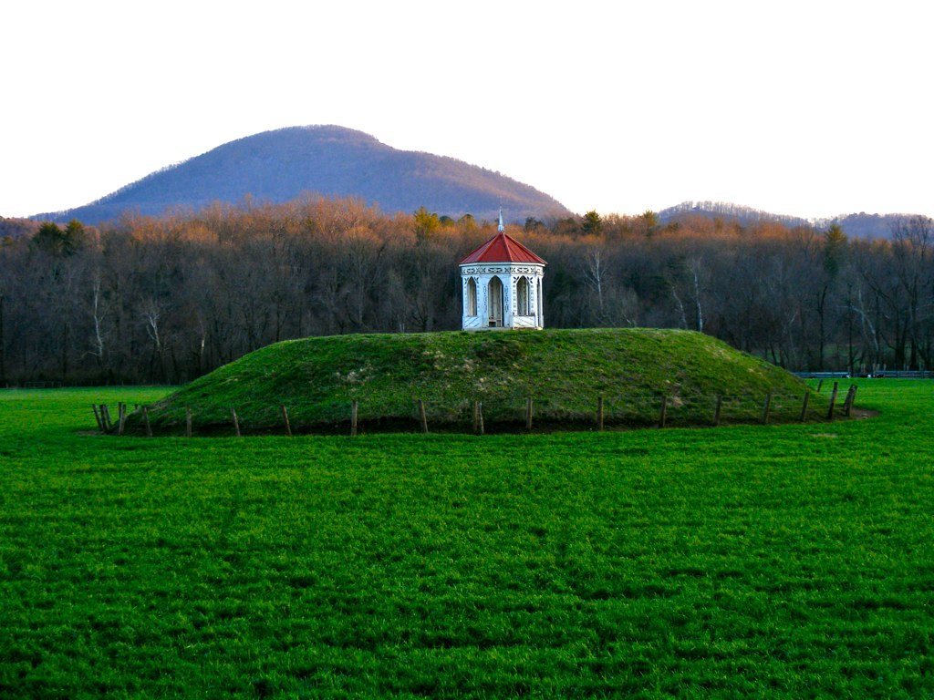
In the 1870s, Captain John H. Nichols owned the site and reported that plowing west of the mound exposed stone-box graves, in which stone slabs formed box-like structures around or over human remains. In 1890, Nichols removed the upper 2 feet of the mound and placed a gazebo on the reduced summit, altering the original monument.
Frederick Webb Hodge and George H. Pepper formally excavated the mound in 1915. George Gustav Heye, the Heye Foundation, the Museum of the American Indian in New York, and the Bureau of American Ethnology sponsored the work. The Bureau was a Smithsonian research organization devoted to the study of Indigenous peoples of North America. The excavation was among the earliest scientific archaeological investigations in Georgia and revealed two periods of mound construction as well as numerous burials. Heye, Hodge, and Pepper published the results in The Nacoochee Mound in Georgia in 1918.
A University of Georgia Archaeology Field School investigation in 2004 refined the site’s chronology and provided the first excavation evidence from the village area. That work showed that the village extended beyond the mound, although it was not fully excavated. After the original mound had been partly excavated, former Georgia governor Lamartine Griffin Hardman commissioned a reconstructed mound at his estate about two miles south of Helen. The reconstruction still stands, but it is separate from the original archaeological site. Nacoochee Mound forms part of the Sautee Valley Historic District and was added to the National Register of Historic Places on August 20, 1986.
Remains
The surviving site is organized around a prehistoric earthen platform mound near the Chattahoochee River in the Nacoochee Valley, with associated settlement areas in fields to its east and west. The mound was built in two distinguishable intervals and was linked to ceremonial and ritual activity. Its original shape and dimensions cannot be fully recovered because excavation and later alteration changed the monument.
Platform mound and burial evidence
Earthen platform mound
Charles C. Jones described the mound in 1873 as about 16 feet, or 4.9 metres, high. The upper 2 feet, or 0.61 metres, were removed in 1890 before the gazebo was installed. The monument is recorded as having supported one temple, although the form of its original superstructure is not described. As a platform mound, it consisted of an earthen elevation with a level summit that could support a ceremonial building or another important structure.
Burials and grave goods
The 1915 excavation exposed 75 human burials. These included 56 adults, seven adolescents, four children, and eight individuals whose ages could not be determined because their remains were too degraded. The burials belonged to different chronological layers, corresponding to more than one period of use. About one-third contained objects associated with social status, including hammered copper, stone celts, conch-shell beads and cups, and elaborate Mississippian pottery. Later burials included glass beads and sheet-brass ornaments, probably dating from the seventeenth-century period of European contact.
Village areas and archaeological materials
Eastern and western settlements
Evidence of associated settlement occurs in fields on both sides of the mound. A small village area lay to the east, while a much larger area to the west was occupied mainly during the later period. The 2004 investigation identified approximately 87 postholes. These traces mark places where wooden posts once stood and indicate structures or other installations, but they do not provide a complete plan of the village.
Pottery and regional connections
Pottery fragments associated with Etowah Indian Mounds near Cartersville, Georgia, were found at Nacoochee Mound. The material indicates that the two sites were occupied during the same period. Together with the mound, burial evidence, and village traces, these finds place Nacoochee within the wider Lamar-phase Mississippian cultural landscape of Georgia.