Ming Zuling: The Ming Dynasty’s First Imperial Tomb Complex
Site at a Glance
- Rating
- 4.5
- Popularity
- Very Low
- Country
- China
- Primary era
- Medieval
- Eras represented
- Medieval, Modern
- Civilizations
- Ming
- Site type
- Religious
- Remains
- Tomb
On this page17 sections
History
Ming Zuling is the earliest imperial burial complex of the Ming dynasty, in Xuyi County, Jiangsu, China. Zhu Yuanzhang, the dynasty’s founder, began the project in 1385 to honor his ancestors, and his son Zhu Di, later the Yongle Emperor, completed it in 1413. The Ming dynasty followed the Mongol-led Yuan dynasty in China. The mausoleum stood north of Sizhou, where Zhu Yuanzhang’s ancestors had lived, and gave their memorial a setting befitting their imperial honors.
Foundation and ancestral burials
Zhu Yuanzhang had his grandfather, Zhu Chuyi, reburied at the complex. The graves assigned to his great-grandfather, Zhu Sijiu, and great-great-grandfather, Zhu Bailiu, were honorary rather than burials of their remains. All three ancestors received posthumous titles as Ming emperors, respectively Yu, Heng, and Xuan. When Zhu Di completed the complex, he added the Lingxing Gate, a ceremonial gateway in traditional Chinese architecture, and the outermost wall.
Local traditions give different reasons for choosing the location. One credits a Taoist monk, from a Chinese religious and philosophical tradition, who judged the site favorably according to fengshui, the arrangement of places in relation to their surroundings, and qi, a concept of vital force. Another tradition recalls a Taoist prediction that Zhu Yuanzhang’s family would rule China. A third connects the place with Zhu Yuanzhang’s conception and his grandfather’s death.
Flooding and rediscovery
In the 1680s, during the reign of the Qing Kangxi Emperor, the Yellow River changed course and joined the Huai River. The Qing dynasty had succeeded the Ming. Sediment obstructed the Huai’s former channel, sending much of its flow into Hongze Lake. The lake then covered both Ming Zuling and nearby Sizhou.
As the lake receded, local people saw stone figures on its muddy shore in spring 1963 or 1964. The Cultural Revolution, a period of political upheaval in China from 1966 to 1976, delayed official attention. The mausoleum emerged during low water in 1966, and preliminary excavation and reconstruction began in 1976.
Conservation and later changes
Work on a 2,700-metre embankment to guard against further flooding began in 1978. Jiangsu cultural authorities and the State Administration of Cultural Heritage allocated repair funds in 1980. By 1982, the sacred way had been repaved and a wall rebuilt; the damaged Golden Brook Bridge was replaced, with pieces of the earlier bridge retained for display. The site received provincial protection as an important cultural site in 1982 and national-level protection in 1996.
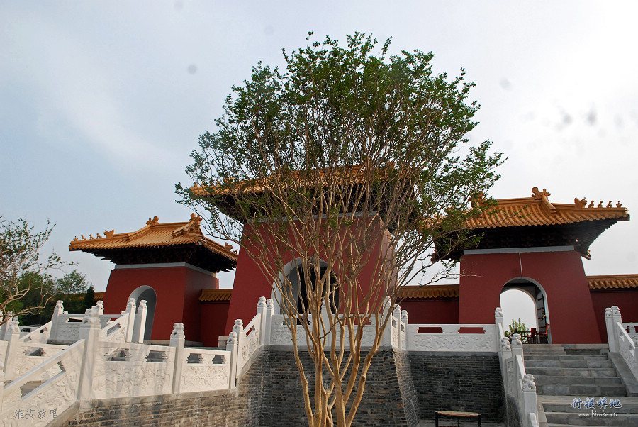
Plans to rebuild the Southern Red Gate became contentious. National heritage authorities gave general support in the late 1990s, but experts objected that partial remains could not establish the gate’s original form and that the proposed scale conflicted with conservation principles of authenticity. The county began construction on February 18, 2004, before submitting its plan for provincial review in March. Work finished in May.
The Offering Hall and side hall emerged during a drought in May 2011. Falling lake levels exposed other parts of the complex during droughts in the 2010s, after which the site was submerged again to protect its cultural relics.
Remains
The 351,000-square-metre complex lies near the point where the Huai River reaches the western side of Hongze Lake. Its broad valley has hills to the north and lower hills to the east and west, while a slope facing south drains the area. The plan follows fengshui principles, and its arrangement later served as a model for Ming and Qing tombs.
Sacred way and ceremonial precinct
Processional route
A central sacred way, the ceremonial route to an imperial tomb, extends for several li, a traditional unit of distance whose length has varied. At its entrance, a roofed gateway had separate doors for visitors of different status. Beyond it, courtyards and buildings included a reception pavilion and a commemorative pavilion for tablets honoring the dead.
Stone figures and columns
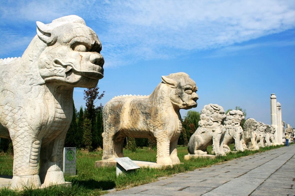
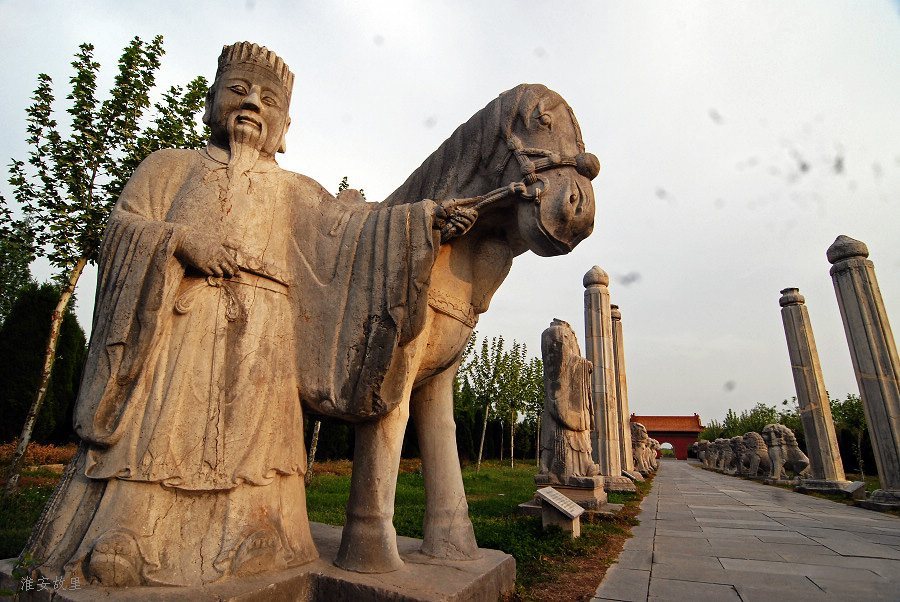
Stone figures stood in paired groups along the route. Nearest its beginning were two pairs of qilin, mythical creatures in Chinese tradition, followed by six pairs of lions. A pair of huabiao, ceremonial stone columns, came next, then pairs of horse officers, mounted messengers and saddle horses, followed by a second pair of horse officers. Past a bridge stood two pairs of civil officers and two pairs of generals. The final two pairs are described as scholar-bureaucrats or eunuchs. Most of the original statues have been recovered and restored, and ornamental columns remain in front of the mausoleum.
Bridges and ceremonial buildings
Stone bridges crossed streams arranged according to fengshui principles. A portico decorated with dragons and phoenixes led to another group of buildings, including a meditation hall and a memorial tower on the way toward the burial mound.
Burial precinct and enclosures
Tombs and walls
The tombs have trapezoidal forms and symmetrically arranged burial chambers. Their design returned to Chinese burial practice after the Mongol-led Yuan period. Three walls enclosed successive parts of the complex: the outer and middle walls were made of earth, while the innermost was built of red brick. The arrangement drew on a pattern used during the earlier Tang and Song dynasties, but later Ming tombs did not repeat it.
Pool, gates and burial mound
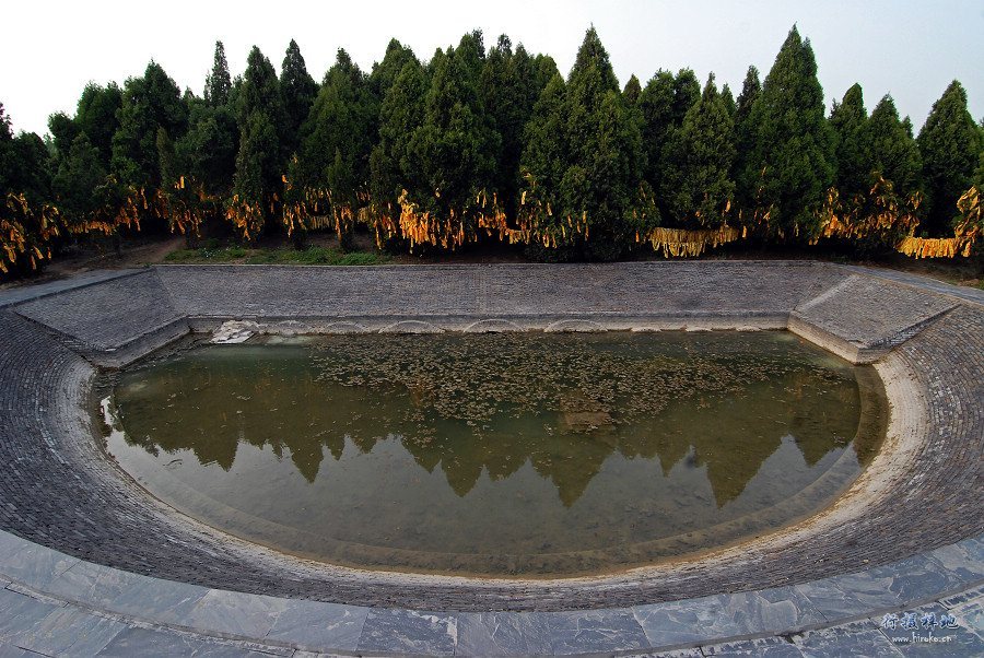
A half-moon pool and submerged gates are among the features within the complex. The burial mound is wooded.
Surviving structures and protective works
Southern Red Gate
Only part of the Southern Red Gate’s original remains survives, leaving its original appearance uncertain. The gate’s present reconstruction is oversized in relation to the surviving evidence.
Golden Brook Bridge
The original Golden Brook Bridge was replaced after severe damage. Fragments of it are preserved in the exhibition hall. An arch bridge and five exhibition rooms have also been built within the complex.
Embankment and grounds
The protective embankment measures 2,700 metres in length and about 15 metres in height. It narrows from roughly 20 metres across at its base to around 6 metres at the top. More than 9,700 pines, cypresses, poplars and willows grow around the complex.
Offering Hall and side hall
The Offering Hall and side hall became visible during the May 2011 drought. At that time, pond silt covered the complex’s nine arches, the beams beneath them and much of the upper surface of the paved approach; these features could be seen only as outlines.