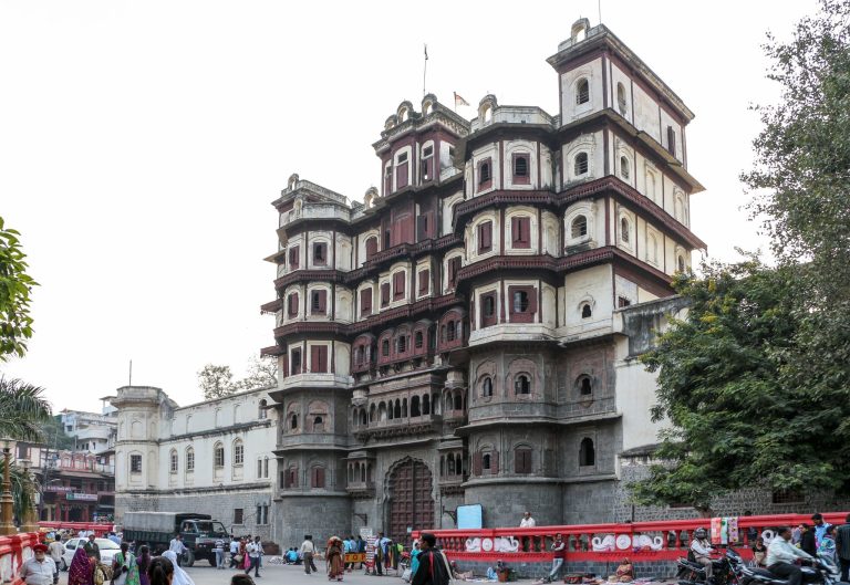
Mandu: A Fortified Town and Medieval Capital in India
Site at a Glance
- Popularity
- Very High
- Country
- India
- Primary era
- Medieval
- Eras represented
- Medieval, Early Modern
- Civilizations
- Maratha, Mughal
- Site type
- City
On this page48 sections
History
Mandu is a fortified hill town in Mandav, Madhya Pradesh, India, whose fortifications took shape under the Panwar rulers in the 12th century. It later became the capital of Malwa under the sultans who ruled from the 15th century, when a long building program reshaped the town. An inscription dated to 555 CE already points to Mandu as a flourishing settlement.
Early settlement and Paramara rule
Found at Talanpur, about 100 kilometres from Mandu, the 555 CE inscription records that the merchant Chandra Simha installed an image in a temple dedicated to Parshvanatha at Mandapa Durg. The name Mandu is associated with mandapa, a Prakrit word meaning hall or temple. Prakrit refers to a group of Middle Indo-Aryan languages.
Mandu gained prominence under the Paramaras, a medieval ruling dynasty in central India, during the 10th and 11th centuries. In the 11th century it formed part of the Tarangagadh, or Taranga, kingdom. Inscriptions identify Mandapa-Durga as a royal residence from the time of Jayavarman II. Jayavarman or his predecessor Jaitugi may have transferred the capital there from Dhara in response to attacks by neighbouring powers. Fort construction is associated with the Panwar rulers in the 12th century. The settlement was then called Mandap Durg, later Mandapgarh and Mandu.
Sultanate capital
In 1305, Delhi Sultan Alauddin Khalji sent his governor and commander Ayn al-Mulk Multani against Mahalakadeva, the last Paramara ruler of Malwa. A spy helped Multani’s forces enter the fort. Mahalakadeva was killed while trying to escape, and Malwa came under the control of the Delhi Sultanate.
After the Tughlaq dynasty’s power in Delhi declined, Malwa’s governor Dilawar Khan Ghuri declared independence in 1402. He began a building program at Mandu that continued for about 150 years. In 1406, his son and successor Hoshang Shah moved the capital from Dhara to Mandu and named it Shadiabad. Hoshang began the Jama Masjid and his own tomb; later rulers carried on the construction of major buildings.
The Khalji dynasty of Malwa, a regional sultanate that followed the Ghuri rulers at Mandu, was established in 1436. Under Mahmud Khalji and his successors, the town grew in political and architectural importance. Ghiyas-ud-din Khalji became ruler in 1469, and Mahmud Khalji II ruled from 1510 to 1526. In 1531, Gujarat’s ruler Bahadur Shah conquered Mandu. The Mughal emperor Humayun took it in 1534 and ordered a large-scale massacre of prisoners, but subsequently lost the town to Mallu Khan. A decade of conflict followed.
Conflict and Mughal rule
Baz Bahadur eventually emerged as ruler of Malwa. In 1561, Mughal forces led by Adham Khan and Pir Muhammad Khan defeated him at Sarangpur. Tradition remembers Roopmati as Baz Bahadur’s beloved; after hearing of Mandu’s fall, she died by poisoning herself. Baz Bahadur fled. Akbar recalled Adham Khan, while Pir Muhammad’s campaign into Khandesh ended in defeat and his death. Baz Bahadur briefly recovered Malwa, but Akbar’s army, commanded by Abdullah Khan, defeated him in 1562. In 1570 Baz Bahadur surrendered to Akbar and entered Mughal service.
Mandu remained under Mughal rule, with considerable independence, until the Maratha takeover in the early 1730s. In 1731, Maratha commanders Malhar Rao Holkar and Udaji Rao Pawar defeated the Mughal governor Darya Bahadur at the battle of Trala. In 1734, the Delhi emperor Muhammad Shah appointed Peshwa Baji Rao, the Maratha chief minister and military leader, as governor of Malwa. Population shifted away from Mandu, and the town became deserted. After Maratha power declined, the fort passed to the state of Dhar and ceased to serve a military role.
Religious traditions and conservation
Hoshang Shah’s tomb became a pilgrimage place where an annual urs, a commemorative observance for a Sufi saint, was held; the ceremony had been discontinued for about a century. A belief that drops of condensation falling onto the tomb were miraculous was associated with it. During Mandu’s prosperous years, people reportedly gathered each morning at Nahar Jharokha for the ruler’s public appearance. Rewa Kund also acquired religious importance. Hindu pilgrims making the journey around the Narmada bathed there, and a belief held that the river rose from the tank.
During British rule, the Dhar State Archaeological Department placed Mandu’s buildings under protection. Further conservation orders followed in 1956, and repair work continued afterward.
Remains
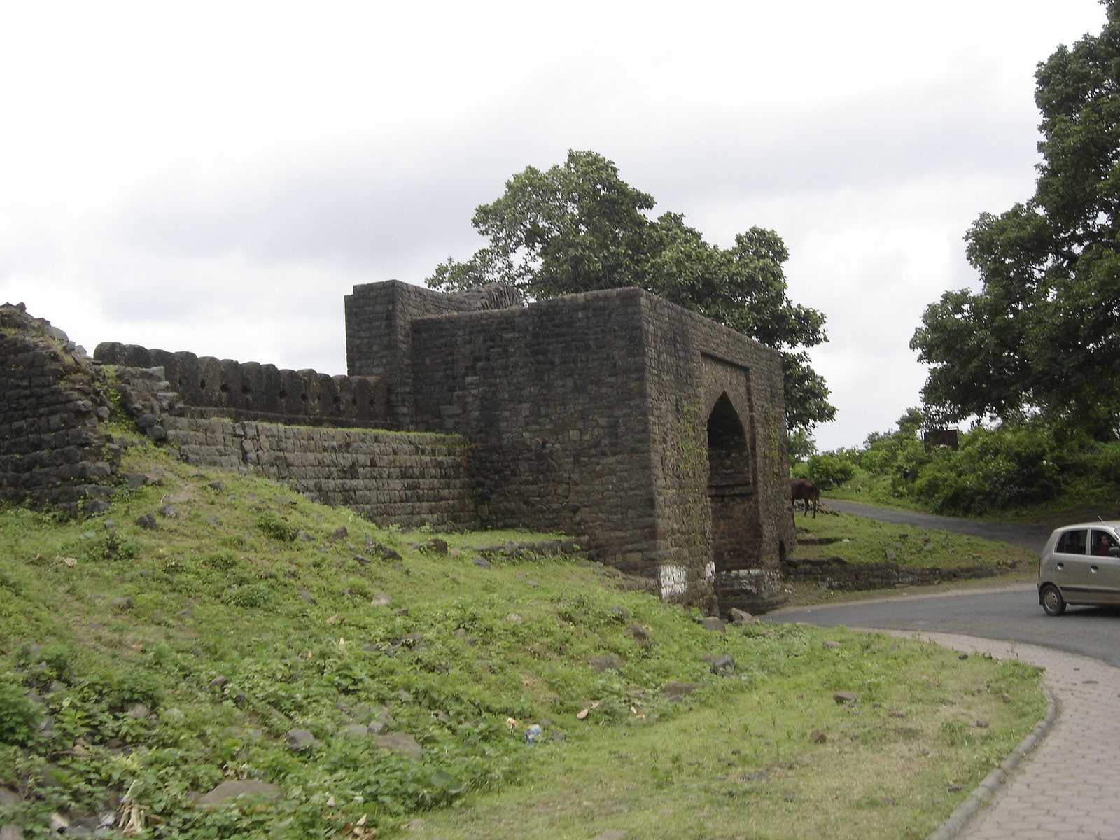
Mandu occupies a rocky height in the Vindhya Range, about 633 metres above sea level. The ridge overlooks the Malwa plateau to the north and the Narmada valley to the south. A deep, forested ravine curves around the hill and separates it from the plateau, creating a natural defensive barrier. A nearly 37-kilometre circuit of battlemented wall encloses the fort and includes 12 major gateways. At the town’s 15th-century height, its hilltop area was estimated at about 12,000 acres, with 560 fields, 370 gardens, 2,000 wells, 780 tanks and lakes, 100 market streets, 1,500 houses, 200 inns for travellers and merchants, 360 baths, 470 mosques and 334 palaces.
Fortifications and gateways
The gateways mark approaches from the lower slopes and different sides of the hill. Their dates and forms reflect the successive rulers who used and altered the fort.
Alamgir and Bhangi gates
At the foot of the hill, Alamgir Gate forms the first entrance to the fort and was repaired during Alamgir’s reign. Bhangi Gate lies beyond it and probably dates from the Hindu period. A local tradition explains its name by saying that a member of the Bhangi community was buried there after the fort was completed.
Kamani and Gadi gates
Kamani Gate lies between Bhangi and Gadi gates and has an arch shaped like a bow. Gadi Gate provides entry to the fort on the hilltop and was used by vehicles.
Delhi Gate
Built by Hoshang Shah during Dilawar Khan’s rule, Delhi Gate is an example of 15th-century architecture. Major fighting took place there during sieges of the fort.
Tripolia Gate
Opposite the eastern side of the Jama Masjid, Tripolia Gate survives as a tall ruin of brick and mortar. It originally had three openings and may have served royal processions or the conveyances of nobles.
Tarapur Gate
Tarapur Gate stands southwest of Mandu, above Tarapur village. Alp Khan, later Hoshang Shah, built it during Dilawar Khan’s rule. During Humayun’s campaign, Mughal forces climbed the fort walls and entered near this gateway, where the hill rises about 1,000 feet.
Bhagwania Gate
Set into the southern fort wall facing the Nimar valley, Bhagwania Gate lies about two to three miles from Bhagwanpur village. One approach follows the wall from Roopmati’s Pavilion; another is a footpath from the road to Baz Bahadur’s Palace. An inscription dates the gateway to Mahmud Khalji II’s reign.
Jahangirpur Gate
Jahangirpur Gate stands in the eastern wall, where the hill is lower and the fortification especially strong. It takes its name from Jahangirpur village, two to three miles away in the Nimar valley.
Rampol Gate
Northeast of Asharfi Mahal, Rampol Gate may be among Mandu’s earliest gateways. The arch supports and guardroom pillars display Hindu workmanship, while the roof follows an Islamic style. The Malwa sultans rebuilt the gate using material from an older structure.
Lohani Gate
Lohani Gate lies on the western edge of the hill, about two furlongs from Hoshang Shah’s tomb. A footpath descends from it toward villages in the Nimar valley, where ruins of tombs and palaces remain visible.
Mosques and religious buildings
Jama Masjid
Hoshang Shah began the Jama Masjid, or congregational mosque, and Mahmud Khalji completed it in 1454. Its rectangular plan measures 273 feet 19 inches from east to west and 274 feet 6 inches from north to south. The roof has three large domes and 58 smaller ones. Their arrangement carried the imam’s and preacher’s voices throughout the building.
Malik Mughith’s Mosque
East of Sagar Talab, Khan Jahan Malik Mughith built this mosque in 1432. An inscription is set into its eastern doorway. Its exterior follows an Islamic design, while Hindu artisans contributed to the building. The flat domes, unlike conical forms, resemble those associated with the Tughlaq period. The prayer niche indicating the direction of worship is plastered.
Dilawar Khan’s Mosque
Built in 1405, Dilawar Khan’s Mosque is described as Mandu’s earliest Islamic building. A walled path reaches it from Hindola Mahal. The mosque was reserved for residents of the royal palaces, and its design follows a style associated with Bengal. Its prayer hall and niches in the eastern entrance are among its described features.
Asharfi Mahal
Opposite the Jama Masjid’s eastern entrance, Asharfi Mahal is a large complex of three ruined buildings. Its first structure was a school for Islamic learning built under Hoshang Shah and associated with Ashraf Jahangir Semnani, a Sufi saint and religious teacher. The eastern court was later filled to support Mahmud Khalji’s tomb. Mahmud also built a seven-storey Victory Tower in the complex’s northeastern part to commemorate a victory over Mewar.
Tombs and memorial buildings
Hoshang Shah’s Tomb
Beside the enclosure along the Jama Masjid’s western wall, Hoshang Shah’s tomb was begun during his lifetime and completed under Mahmud Khalji. The square marble building has walls 11 feet thick and sides measuring 49 feet 2 inches. Arches 30 feet high transform the square interior into an eight-sided support for the dome. A marble marker stands above the actual grave. Stairs on the south once descended to it, but stone paving sealed the route.
Three tombs lie beneath the dome. One has a red-stone sarcophagus, while the others are finished with lime plaster; they are identified with members of Hoshang Shah’s family. Openings in the dome once allowed air to enter and condense, with drops falling onto the ruler’s sarcophagus. The marker resembles a writing case and is traditionally said to retain the scent of sandalwood.
Sayed Nizam Mandavi’s Tomb
Below the eastern retaining bank of Sagar Talab, among a forest nursery, this two-storey tomb was built by Sayed Nizam over the tomb of his father, Sayed Ashraf. Nizam was buried there as well. A central tomb is surrounded by large halls and a passage for walking around it on three sides.
Darya Khan’s Tomb Complex and Hathi Mahal
North of Hathi Mahal, a walled enclosure contains Darya Khan’s sandstone tomb, another tomb, a mosque, a pond and an inn. Darya Khan was a senior court official under Mahmud Khalji II. Hathi Mahal, also called Hathi Paga Mahal, is associated with the complex. Its very thick pillars resemble elephant legs, and a tomb stands beneath its massive dome.
Gor Mahal and Dai’s Palace and Tomb
About 100 paces south of the caravanserai, Gor Mahal is traditionally called the Palace of the Younger Sister of the Dai, but is identified as a woman’s tomb. It belongs to Mandu’s third architectural phase. Dai’s Palace and Tomb stands to its south. Its raised platform is 16 feet above the ground, with traces of corner turrets and upper pavilions; a tomb occupies the centre. Tradition identifies the building as the palace and tomb of Mahmud Khalji I’s nurse. The tomb domes produce echoes.
Jali Mahal
On a hill facing the southern end of Sagar Talab, Jali Mahal is identified as the tomb of a noble or minister. Its design combines Islamic forms with Indian motifs. Four graves lie beneath the dome inside its red-sandstone interior.
Elephant-Leg Palace and Chhappan Mahal
Elephant-Leg Palace takes its name from thick pillars resembling elephant legs. A grave lies in the building’s centre. It may have begun as a place for recreation before being converted to a tomb; its style suggests construction under Nasir-ud-din Khalji in the late 15th or early 16th century. Chhappan Mahal is identified as a noble’s palace and tomb, built of red sandstone and assigned to Mandu’s third architectural phase. During a famine, the state of Dhar repaired it and its maharaja used it as a rest house.
Palaces and audience buildings
Jahaz Mahal
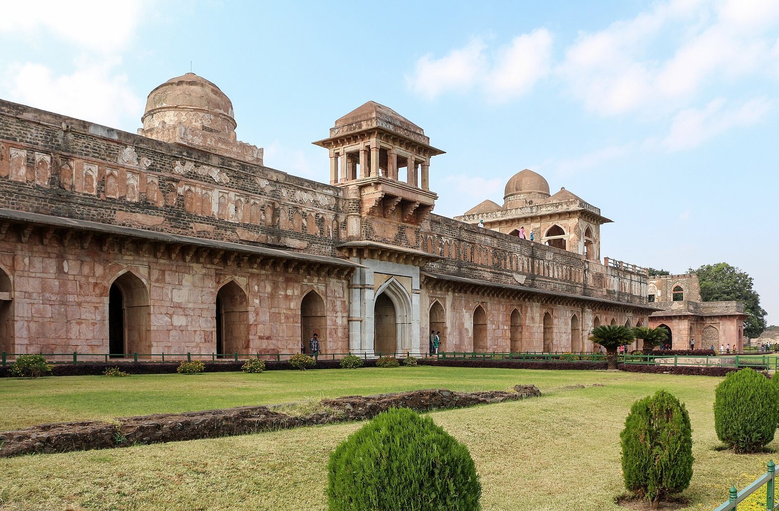
Jahaz Mahal stands in the royal enclosure between Kapoor Talab to the east and Munj Talab to the west; Champa Baoli is also to its west. Built under Ghiyas-ud-din Khalji as a private residential building for the ruler’s household, it measures 361 feet long, 48 feet wide and 31 feet 6 inches high. Its two storeys are reflected in Munj Talab, where the palace’s image appears ship-shaped and gives the building its name.
Hindola Mahal
Hindola Mahal, meaning Swing Palace, probably dates to the late 15th century under Ghiyas-ud-din Khalji. Its walls slope inward and are 7 feet 6 inches wider at the base than at the top. The building served as the sultan’s public audience hall.
Taveli Mahal
Taveli Mahal has a lower storey thought to have served as stables, with two upper storeys believed to have accommodated guards and soldiers. Its location near an entrance supports the interpretation that it functioned as both a guard post and a stable for royal horses.
Baz Bahadur’s Palace
On the slope east of Rewa Kund, this palace was built in 1508 under Nasir-ud-din Khalji as a residence. Baz Bahadur later made it his own residence and added to the building. Its design has been compared with that of Jahaz Mahal.
Roopmati’s Pavilion
Roopmati’s Pavilion stands beside the southern fort wall at Mandu’s highest point. It began as a military observation post and later became associated with Roopmati. The complex has a main building, a basement and a pavilion, with two domed roof structures facing north and south. The northern pavilion overlooks the fort interior; the southern one is linked with Roopmati.
The Nimar valley, Narmada River and Satpura hills can be seen from the pavilion. Tradition says Roopmati went there in the morning to view the Narmada, and Baz Bahadur may have built the roof pavilions for that purpose.
Lal Mahal
Lal Mahal, also called Lal Bangla, served as a summer residence for Malwa’s rulers and stood among woods. Its three sections included the sultans’ quarters in the centre and servants’ accommodation in the two side sections. The old entrance is built of red sandstone.
Nilkanth Mahal
Built under Akbar by Malwa governor Shah Badagh Khan, Nilkanth Mahal stands on the slope at the western edge of Mandu’s hill. It served as a pleasure and hunting lodge. A southern entrance chamber leads toward a central pool supplied with water from a tank higher on the hill. A statue of Shiva installed there by Peshwa Baji Rao in 1734 gives the place its religious association. The building is described as Mandu’s sole structure in a purely Mughal style.
Chishti Khan’s Palace
East of a road beside the ravine from Gadi Gate, Chishti Khan’s Palace was the residence of Chishti Khan, also known as Sheikh Qutbuddin. He commanded 12,000 troops under Mahmud Khalji II. The building was prepared for military use and as a monsoon residence.
Gada Shah’s buildings and Nahar Jharokha
The building called Gada Shah’s Shop is described instead as a large audience hall. Built on a greater scale in the style of Hindola Mahal, it is interpreted as a public audience hall, while Hindola Mahal served as the private one. Southwest of it, Gada Shah’s House shows Mughal architectural influence. Two wall paintings in a hall’s southwestern corner depict a nobleman and a woman; they may represent Baz Bahadur and Roopmati, or Medini Rai and his queen. The building is also associated with Medini Rai, a minister under Mahmud Khalji II, and Gada Shah, identified as Mahmud Khalji’s treasurer.
Nahar Jharokha stood on the southern edge of a large courtyard east of Dilawar Khan’s Mosque. The marble viewing balcony rested on a lion sculpture and has collapsed.
Tanks, wells and water systems
Kapoor, Munj and Sagar Talabs
Kapoor Talab lies east of Jahaz Mahal. It has masonry banks, walls on three sides and steps along its edges. A central pavilion and another on the western bank were joined by a stone walkway. Munj Talab, west of Jahaz Mahal, measures about 750 feet square and is larger than Kapoor Talab; ruins of royal palaces lie to its north and south. Sagar Talab, in the middle of the hill, is a large tank that does not dry up in summer.
Rewa Kund
Below Roopmati’s Pavilion, Baz Bahadur excavated and lined Rewa Kund to create a deep reservoir and supply water to the pavilion. Water from springs fed by the surrounding hills is suggested as the source.
Champa Baoli
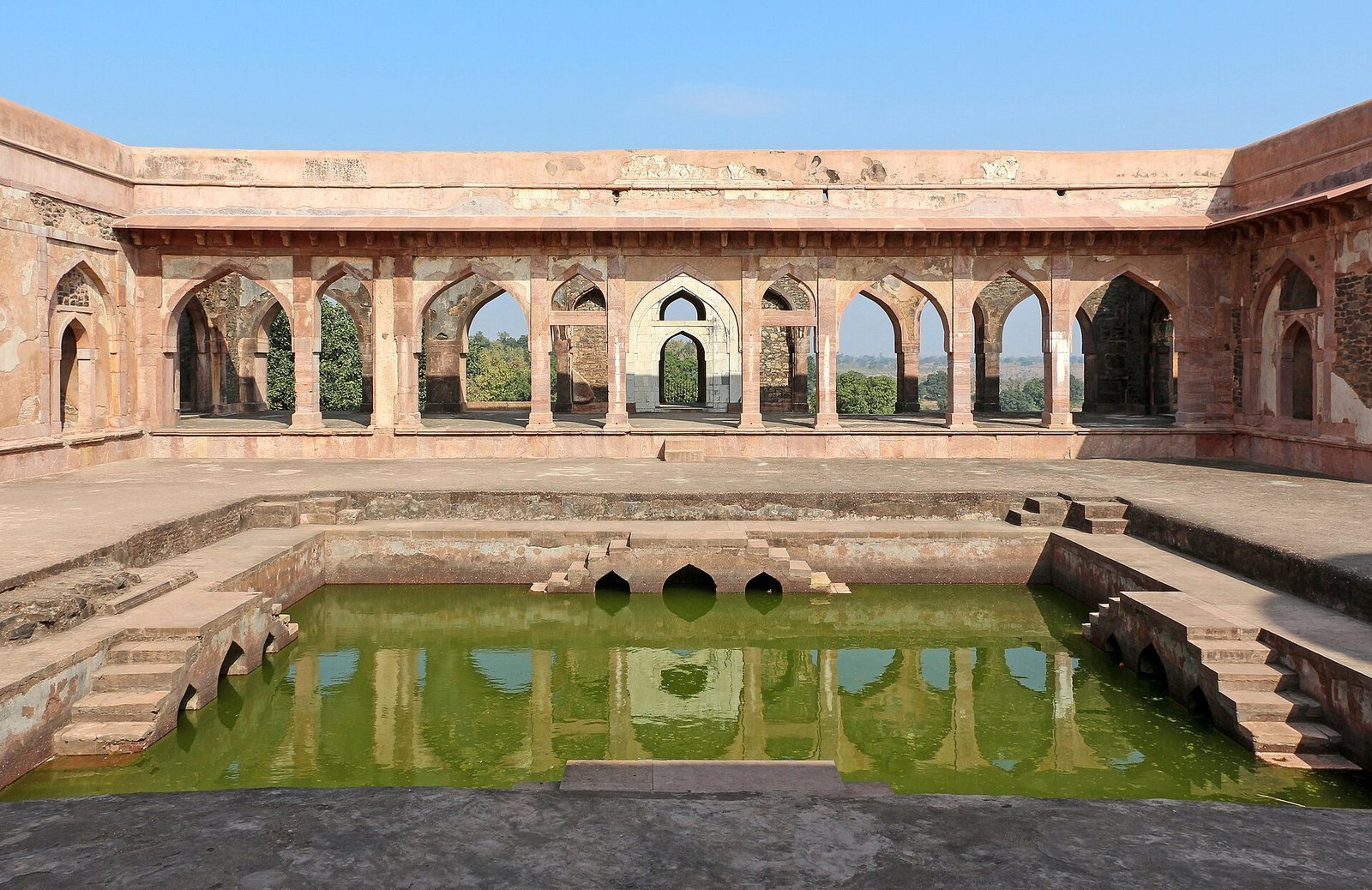
Near Hindola Mahal, Champa Baoli is a stepwell connected by a passage to a basement at the level of Munj Talab. The basement provided a cool retreat for residents of the royal palaces in hot weather. Another passage leads to a pavilion on the tank’s western bank, while steps descend from the basement to the well, which measures 18 feet square.
Ujali and Andheri Baolis
Ujali Baoli is a deep stepwell in the royal enclosure. Flights of steps descend from the east and west to the water and the bottom. A water-lifting device stands at its northern end, and a pavilion at the south served royal guards. Guardrooms flank the broad steps. Southwest of it, Andheri Baoli is covered at the top and enclosed by a passage, making its interior dark.
Other buildings and archaeological areas
Caravanserai and Echo Point
Opposite the eastern entrance of Malik Mughith’s Mosque, the caravanserai was associated with the mosque and accommodated travellers and merchants. It dates to the same period as the mosque. Near the eastern bank of Sagar Talab, Echo Point is a stone slab beside the road and a stand of trees. A voice directed from the slab toward Dai’s Palace echoes from the domes of Dai’s Palace and Gor Mahal; a position to either side produces a double echo.
Songarh Fort
Songarh Fort occupies a separate hill about two furlongs from Nilkanth Mahal. The Malwa sultans filled a narrow gap that had separated the hill from Mandu’s plateau, joining the two to block an approach by enemy forces. Tombs, a ruined mosque and a tank remain on the hill, including a tomb associated with Pir Ghayb.
Old Mandu and the Jain pilgrimage site
Outside the fort near Alamgir Gate, Old Mandu is a deserted area with a tank, ruins and broken images. Remains of Jain temples indicate habitation during the Jain period. The Mandavagadh Jain pilgrimage site belongs to the Shwetambar sect and is dedicated to Suparshvanatha. Its temple was expanded in the 14th century, while the image of Suparshvanatha is believed to be older. The white image, 91.54 centimetres high, shows the Tirthankara seated in the lotus posture. A smaller temple is dedicated to Shantinath, and Jain temple ruins and images also occur within the fort.
Ram temple
Near Asharfi Mahal, the Ram temple was built in 1769 by Maharani Sakarwar Bai Pawar.