Koumbi Saleh: An Archaeological Settlement Linked to the Ghana Empire
Site at a Glance
- Popularity
- High
- Country
- Mauritania
- Primary era
- Medieval
- Eras represented
- Medieval
- Civilizations
- Unclassified
- Site type
- City
On this page11 sections
History
Koumbi Saleh is an archaeological settlement in Mauritania, proposed by some scholars as the capital of the medieval Ghana Empire. The Ghana Empire was a West African state, distinct from the modern Republic of Ghana, but the link between the empire and these ruins remains disputed. In medieval Arabic writing, Ghana could refer to a royal title, a capital, or a kingdom, which complicates the interpretation of early accounts.
Written references and disputed identification
References to Ghana predate the archaeological study of Koumbi Saleh. The Persian astronomer Ibrahim al-Fazari mentioned Ghana in the late eighth century, and the scholar al-Khuwarizmi referred to it as a town around the middle of the ninth century. In the eleventh century, the Andalusi geographer al-Bakri described Ghana’s capital as two settlements roughly 10 kilometres apart. He had not travelled there and drew on earlier texts and informants.
In al-Bakri’s account, one settlement was a large Muslim town with twelve mosques, including a mosque for Friday prayer, and wells that supplied drinking water and supported vegetable growing. He described a separate royal town, Al-Ghaba, with a palace, domed houses inside an enclosure, and a mosque near the royal courts. Groves and thickets there were associated with ritual specialists serving the local religious cult, while habitation extended between the two settlements. The relationship between this account and the ruins at Koumbi Saleh has not been established.
Two chronicles written in the seventeenth century give different names for the dynasty that preceded the Mali Empire, a medieval West African state centered in the region of present-day Mali. The Tarikh al-fattash calls the dynasty Kayamagna and places its capital at Koumbi; the Tarikh al-Sudan gives the name Qayamagha and places the capital at Ghana. These dynastic names are generally taken to refer to Ghana’s rulers. A tradition noted in connection with a 1913 French translation of the first chronicle places the dynasty’s initial capital at Koumbi, in Ouagadou, northeast of Goumbou on the route toward Néma and Oualata.
Other interpretations identify Koumbi Saleh with the Berber town of Awdaghost and place Ghana’s capital at Djenne, a historic city in present-day Mali. Berbers are Indigenous peoples of North Africa. Another view treats Koumbi Saleh as an Arab-Berber trading settlement rather than an indigenous capital, pointing to the arid surroundings and relatively sparse archaeological hinterland. The site’s political identity therefore remains uncertain.
Urban growth, trade, and abandonment
The date when Koumbi Saleh was founded is uncertain. Some interpretations place its establishment or major expansion in the eighth century, while another allows for origins as early as the second or first century BC. Radiocarbon dating indicates that people occupied the site before the tenth century and continued living there into the fourteenth. Its principal phase of urban growth fell approximately between the eleventh and fourteenth centuries, and the settlement was abandoned in the fourteenth century.
The Ghana Empire drew wealth from the trans-Saharan gold trade, and Koumbi Saleh has been interpreted as a major trading center within networks crossing the Sahara. Exchange connected the town with North Africa, the Mediterranean, and the Middle East, and involved gold, iron, salt, ivory, and other goods.
The twelfth-century geographer al-Idrisi placed Ghana’s royal city beside a river he called the Nile. Geographers of his era sometimes treated the Niger and Senegal as parts of one river, also known as the Nile of the Blacks. Al-Idrisi dated the palace he described to 1116–1117. This has prompted the suggestion that a newer royal town had been rebuilt closer to the river and that the political center may have shifted south toward the Niger. The location of that town and this interpretation remain uncertain.
Archaeological investigation
The discovery of a seventeenth-century African chronicle in 1913 led French archaeologists to investigate Koumbi Saleh. Albert Bonnel de Mézières reported the extensive ruins in 1914. Excavations followed in 1914, 1949–1951, 1975–1976, and 1980–1981, involving Bonnel de Mézières, Paul Thomassey, Raymond Mauny, Serge Robert, and Sophie Berthier. Mauny estimated that the town had a population of 15,000–20,000, a large number for a Saharan settlement with limited water supplies.
Remains
Urban layout and buildings
Settlement form and houses
The principal settlement occupies a low hill rising about 15 metres above the surrounding plain; accumulated ruins contribute to its present height. The upper town covered an area of roughly 700 by 700 metres. A lower zone to the southwest, about 500 by 700 metres, probably contained less permanent buildings alongside occasional stone structures. Within the town, closely spaced houses were divided by narrow streets.
Builders used local schist and banco, an earth-based building material, rather than mortar. The amount of building debris suggests that some houses had more than one storey. Rooms were narrow, probably because large trees that could supply long roof beams were scarce.
Avenue and mosque
An east–west avenue, up to 12 metres wide, crossed the town. An open space at its western end was probably a marketplace, while the main mosque stood near the center of the avenue. The mosque measured about 46 metres from east to west and 23 metres from north to south. Its western end was probably open to the sky, and its mihrab, the niche indicating the direction of prayer, faced due east.
Proposed urban divisions
One reconstruction divides the town into a royal-palace area and a commercial district. In this interpretation, the palace stood on a raised platform enclosed by a moat, while the commercial zone had a large central market and smaller markets for particular goods. The town plan has also been interpreted as following Islamic planning principles, including the placement of the mosque and streets oriented toward Mecca.
Cemeteries and tombs
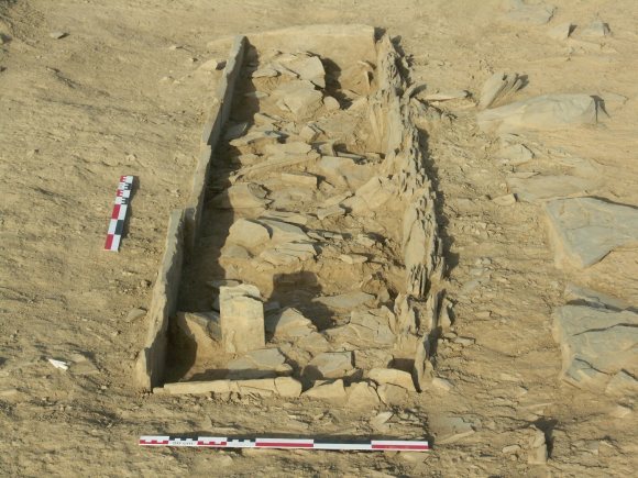
Two large cemeteries lay beyond the town. The western burial ground contains numerous funerary structures, including the Column Tomb, a complex with a central qubba (domed mausoleum). Some of its corner columns remain intact. A burial associated with the tomb has an isolated upright stone marker at the head, and excavated graves show burials in pits with arrangements at the surface.
Excavated objects
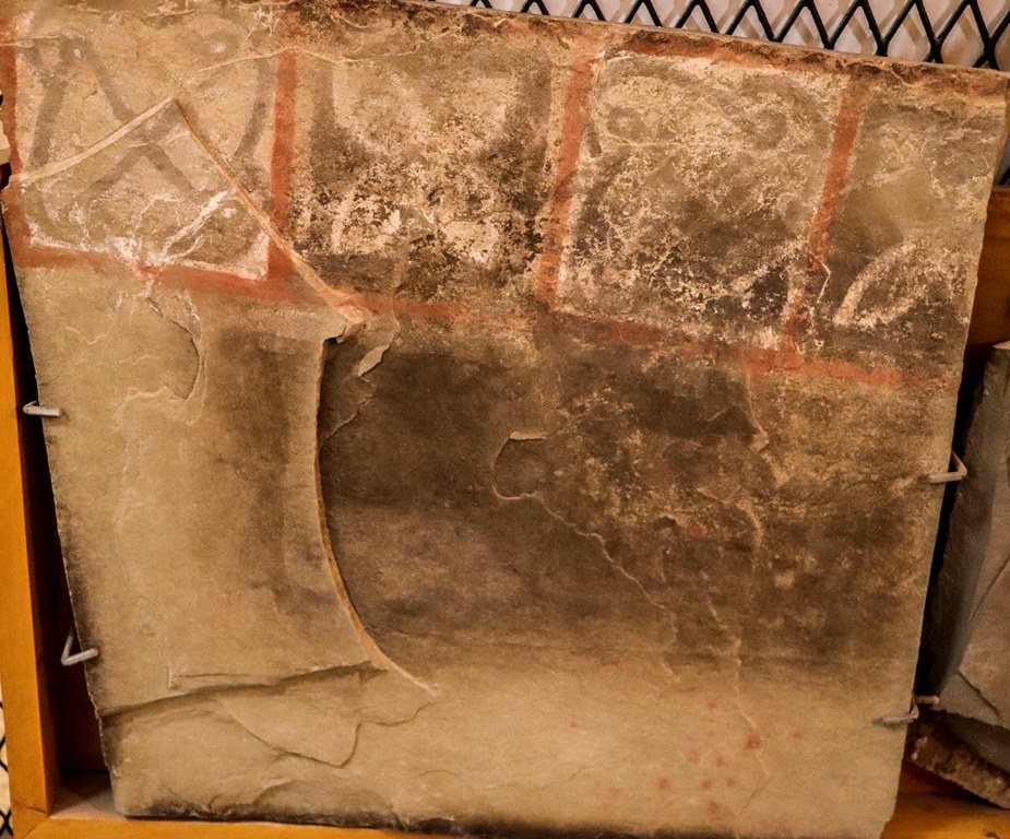
Excavations recovered many Islamic coins, ceramics, and glassware. Coins minted as far away as Baghdad provide evidence of Koumbi Saleh’s long-distance connections.