Iomnium: An Ancient Coastal Settlement in Algeria
Site at a Glance
- Popularity
- Medium
- Country
- Algeria
- Primary era
- Classical
- Eras represented
- Classical, Medieval
- Civilizations
- Byzantine, Roman
- Site type
- City
On this page29 sections
History
Early settlement and coastal routes
Iomnium was an ancient coastal settlement at present-day Tigzirt in Algeria, within the Roman province of Mauretania Caesariensis in North Africa. A Phoenician or Punic presence has been proposed because of the coastal location and the place-name, but the existence and date of an early settlement remain uncertain. A proposed Punic origin for the name, possibly connected with the word for an island, is also unconfirmed.
Ancient geographical works place Iomnium on the coastal route through Mauretania. The Itinerary of Antoninus and the Tabula Peutingeriana list it among the route’s stations. Errors in transmitted place-names and distances complicated the identification of Iomnium, Rusuccuru, and Rusippisir. The Tabula Peutingeriana, for example, gives a distance of 42 miles between Iomnium and Rusippisir, although the latter is identified with Taksebt, about 3 km to the east. Rusuccuru, identified with Dellys, lies about 21 km to the west. Iomnium has also been tentatively connected with Ioulíou in the Periplus of Pseudo-Scylax, an ancient account of coastal routes attributed to an uncertain author; the transmitted name may be corrupt.
Roman rule and civic dependence
Iomnium came under Roman rule after the Punic Wars, the series of conflicts between Rome and Carthage, and depended on nearby Rusuccuru. Between 198 and 211, Caius Iulius Felix, a citizen of Rusuccuru who had held several local magistracies, paid for a temple at Iomnium dedicated to the protective spirit of Rusuccuru’s municipal community. A municipium was a self-governing Roman town. The dedication supports the view that Iomnium belonged to Rusuccuru’s territory, perhaps as a pagus, or local district, although its precise legal status is not established by an inscription from Iomnium itself.
Rusuccuru became a colony in the early decades of the third century, while Iomnium and Rusippisir continued to depend on it for a time. The two settlements may later have gained municipal status, perhaps under Gallienus, a third-century Roman emperor, but this promotion remains unconfirmed.
Third-century disruption and Christian community
Iomnium suffered serious damage during the unrest of the third century. A thick deposit of ash and debris, together with an abandoned coin hoard whose latest coins date to 275–276, points to a destructive event shortly after 270. The event has been tentatively associated with conflict involving the Quinquegentanei, a group of Berber communities in Roman North Africa.
By the fourth century, Christian communities had built several churches at Iomnium. The Great Basilica may have been constructed between the middle of that century and 429. Its destruction in the early fifth century, possibly through an earthquake followed by fire, and a later, more modest occupation have both been proposed, but the dates and historical causes of these phases remain disputed.
Iomnium and Rusippisir appear to have shared an episcopal see. Their bishop was based at Iomnium in 411, while a successor resided at Rusippisir in 484. The Great Basilica has consequently been suggested as the cathedral of Iomnium’s Christian community. An inscription associated with the martyr Eusebius was found near a separate chapel, and has been interpreted as referring to a deposit containing the martyr’s blood. Both that interpretation and the reading of the inscription have been questioned.
Byzantine period and conquest
During the Byzantine period, the era of the eastern Roman Empire, settlement contracted to the tip of the promontory. A new defensive enclosure protected a smaller area, while older monuments, including the Great Basilica, stood beyond its boundary. Iomnium was conquered with the surrounding region in the late seventh century.
The ancient diocese was later revived by the Roman Catholic Church as a titular see, a historic diocesan title assigned to a bishop without ordinary authority over a local territory.
Rediscovery and archaeological study
Ruins at Tigzirt were often identified as Rusuccuru in nineteenth-century archaeological writing. A dedication found at the site initially helped sustain that confusion, but its reinterpretation alongside other inscriptions supported the identification of the settlement as Iomnium, dependent on Rusuccuru. Pierre Gavault’s study of 1897 retained the older identification, although his observations of the buildings remain useful when considered in light of later changes to the ruins.
Stone was quarried from the ruins around 1860. Systematic investigations began in 1886, shortly before the modern village of Tigzirt was founded in 1888–1889; subsequent development covered much of the ancient settlement. Charles Bourlier and Charles Pallu de Lessert joined Gavault in clearing the temple from 1886. Gavault excavated the Great Basilica from May 1894 to spring 1895, but died before completing his study. Stéphane Gsell arranged his notes and published them in 1897.
The temple and Great Basilica were restored between 1903 and 1905. This work changed the appearance of some monuments and removed later alterations in the basilica that nineteenth-century excavations had recorded. Further investigations took place from 1949 to 1954. During the Algerian War, construction of a military base led to the filling or levelling of part of the archaeological zone, while the basilica was spared. Algerian antiquities authorities resumed control after 1962. Fencing installed between 1985 and 1990 restricted movement through the ruins and reduced damage, and Jean-Pierre Laporte made further site checks in 1992.
Later surveys broadened understanding of the settlement’s hinterland and coastal activity. Investigations in 2018 examined rural installations associated with agricultural processing, while a study published in 2024 interpreted submerged remains and nearby storage buildings as evidence for more organized port activity than had previously been accepted. The extent and function of the coastal installations still require further investigation.
Remains
Settlement and fortifications
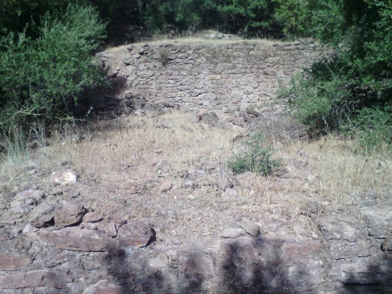
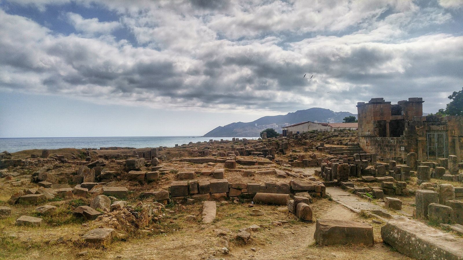
Iomnium occupied a coastal promontory opposite a small islet, with civic buildings concentrated near the cape’s end. The earlier settlement covered about 8 hectares by modern estimates; Gavault estimated 10–12 hectares. Two successive lines of fortification illustrate the change from the larger town to a more restricted defended area. Their construction differs: the earlier wall used small stones bonded with mortar, while the later enclosure incorporated large blocks reused from older buildings.
Earlier enclosure
The earlier fortification surrounded the larger settlement. Its wall was about 1.3 m thick, with two carefully laid stone faces and a mortar-bonded core. Round or square towers strengthened long stretches. Bastions protected a gate on the western side, while other entrances served the coastal road and routes leading inland.
Later enclosure
The later wall enclosed about 1.5 hectares. It was formed from stretches of wall between projecting sections and built largely with blocks taken from earlier monuments. On the eastern side, it reached about 2.1 m in thickness, with large blocks facing a less regular core. A gate, about 1.56 m wide and 2.25 m high, retains large stone fittings for its doors. Much of the enclosure survives well, although some stretches consist of a single course of stone. At the eastern and western ends, sections extend into the sea. Christian sculpture and other carved stones were built into the wall.
Civic buildings and central complexes
Excavations revealed a street grid and a Roman civic centre that included a forum, temple, courthouse, magistrates’ office, and public bath. The principal temple’s dedication provides evidence for Iomnium’s ties to Rusuccuru. Several other central buildings have been identified, but their functions remain uncertain.
Temple of Rusuccuru’s municipal spirit
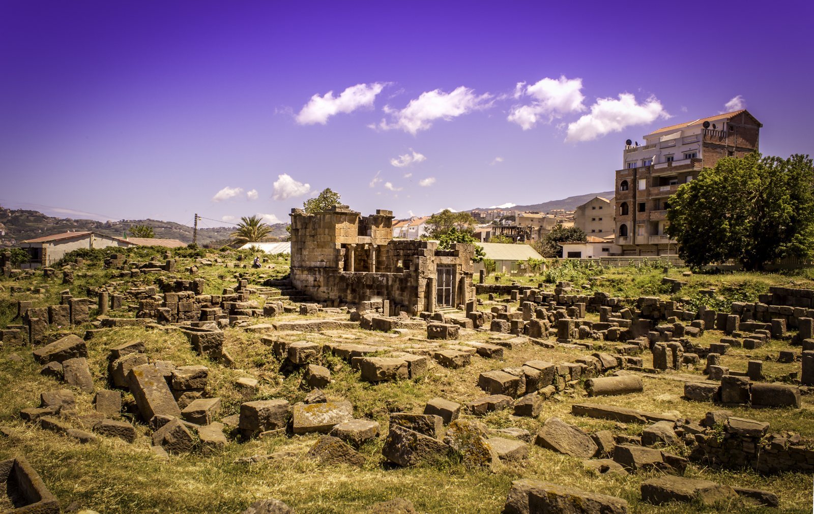
The temple dedicated to the protective spirit of Rusuccuru’s municipal community was one of Iomnium’s principal monuments. Its dedicatory inscription was found at the building and is important evidence for the relationship between the settlements. Excavation began in 1886, and restoration took place in 1903–1905. Parts of the temple’s reconstructed appearance are conjectural.
Building A
Beside the temple, Building A formed a quadrangle about 31.8 m on each side. It contained several columns, including two that remained standing. Their bases lay about 2.5 m below the level observed in the late nineteenth century. Walls and a small masonry channel stood at a higher level, and an inscription mentioning both Rusuccuru and Iomnium was found in the building. The complex has been interpreted as a possible forum or bath, but neither identification is secure.
Building B
Building B was a rectangular structure about 45 m long, aligned parallel to a street leading toward the temple.
Building C
Near the end of the promontory, Building C had a façade estimated at about 35 m and a wall surviving for at least 30 m. Its remains include a doorway about 1.35 m wide, substantial pillars more than 3 m high, rough-faced stone blocks, and stepped terraces. A pre-Roman date has been proposed from the masonry, but remains uncertain.
Building D
Building D, about 17 m long, underwent extensive alteration and incorporated reused blocks, some marked with Christian signs. A church function has been considered but is not established. One block was also reported to carry a relief inscription.
Buildings E and E bis
Buildings E and E bis stood at opposite ends of the later enclosure and retained large cylindrical columns. At Building E, two columns about 3.35 m high rest on simple bases. Their rough workmanship and later use in the enclosure make their original date and purpose uncertain.
Building F
Building F contained two parallel rows of supports defining a hall about 25 m long and 6.35 m across. A square well, about 0.70 by 0.85 m, had a sill and a fitting for a substantial cover. A likely entrance threshold, about 1.70 by 0.60 m, lay between two columns with moulded bases and scroll-shaped capitals. A nearby solid stone column may be related to those at Buildings E and E bis. It stood at least 4 m high, measured about 1.80 m around and 0.59 m across, and did not narrow toward the top.
Christian buildings
Several churches occupied Iomnium and its surroundings. A basilica is a large hall or church arranged around a central nave and side aisles. The surviving plans and fragments show a range of building forms, from the large Great Basilica to smaller churches and a baptistery, a structure used for Christian baptism.
Great Basilica and baptistery
The Great Basilica stood between the two fortification lines, only a few metres from the earlier wall. It was a rectangle about 38 m long and 21 m wide, with an apse, or curved end, projecting about 2 m to the east. A curved adjoining annex measured about 11 by 22 m at its widest point. The building’s long axis ran east to west. Its main façade faced the earlier wall, and its entrance appears to have opened onto a street or square paved with irregular stones.
The exterior walls were built mainly of small masonry reinforced at regular intervals with courses of cut stone blocks laid in regular rows. These courses were spaced 2.20–2.70 m apart. The façade of the central nave and about two-thirds of the south wall used a different arrangement, with irregularly laid cut blocks and smaller stones filling the gaps. This may represent rebuilding, although a separate construction technique is another possibility.
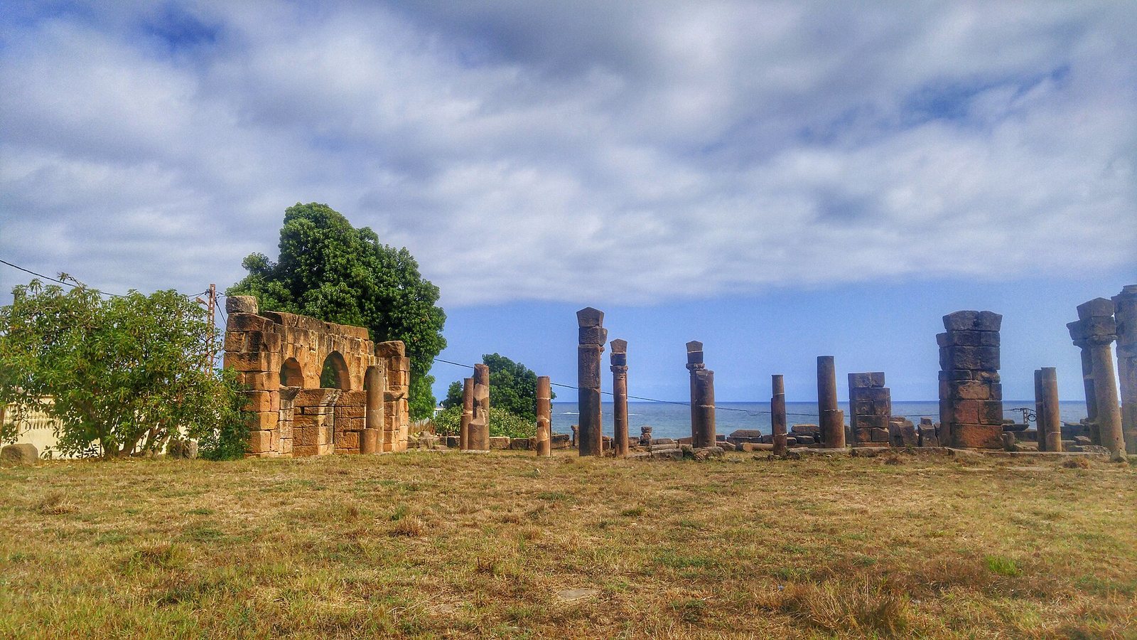
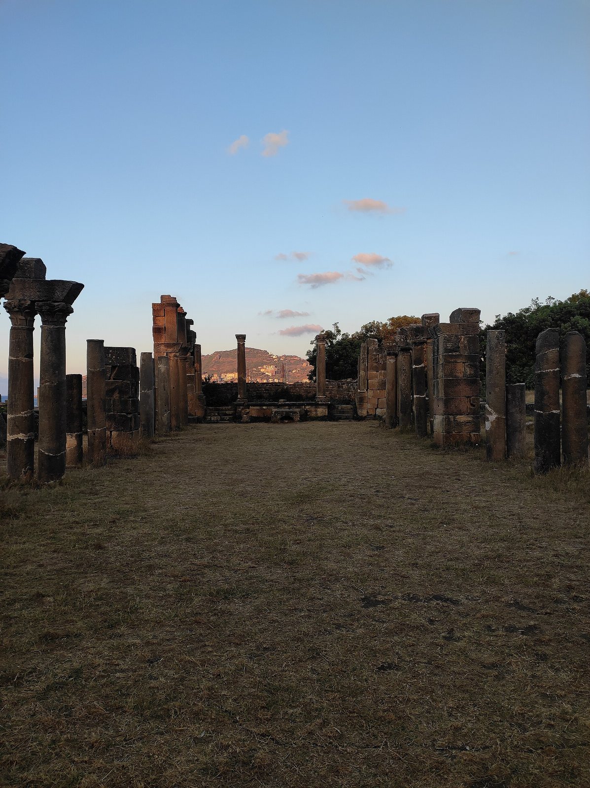
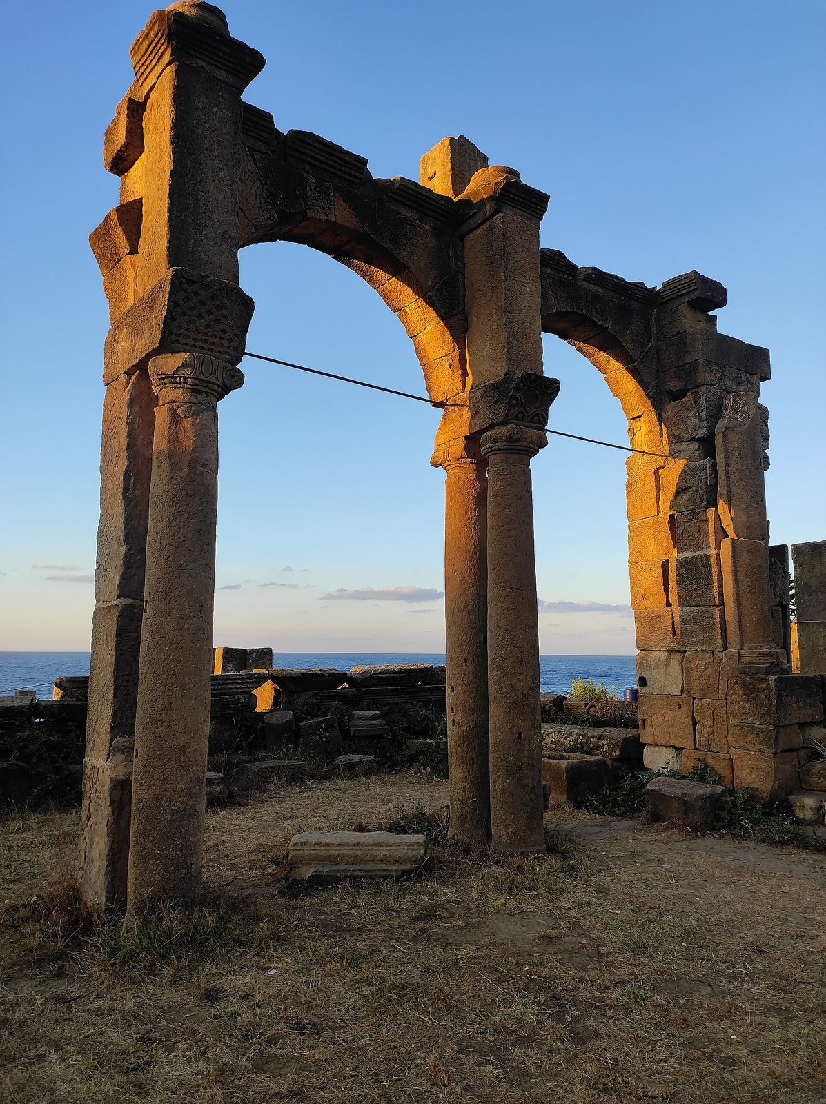
Two rows of supports separated the central nave from the side aisles. In the rows nearest the aisles, square piers sometimes took the place of columns; excavated columns were about 3 m high. Four large piers framed three openings in the western façade into the nave, while the aisles had no direct entrance there. The nave façade walls were about 1 m thick, compared with about 0.60 m for the side sections. Other recorded features include cut-stone bases, semicircular arches, T-shaped reinforcing blocks, and projecting courses that supported the arches.
The left colonnade is largely destroyed, while parts of the right colonnade survive fallen. Some columns rest on earth rather than separate bases. A square pier replaced one column, and a separate wall blocked part of the first bay, perhaps to reinforce it. Double columns marked the division between the nave and apse, and two isolated columns marked the apse entrance. The raised apse contained an altar and columns that may have supported a canopy over it. Vertical grooves indicate where movable barriers were fitted. Sculpted column bases, Christian designs on doorjambs, adjoining sacristies with separate inside and outside doors, and mosaic fragments that indicate former floor levels and stairs were also found. A rubble wall in front of the façade may have formed an entrance hall, though its function is uncertain.
A baptistery stood northeast of the basilica and formed an architecturally coherent unit with it in the building’s first phase. Mosaics, sculptural fragments, and numerous architectural blocks contributed to the basilica’s decoration.
Southern basilica
A separate basilica stood in the southern settlement against the earlier enclosure. Gavault recorded its foundations before village development covered them. The rectangular building measured about 25 by 13 m. Two rows of seven or eight square piers divided it into three naves, and its apse was about 7 m wide and 4.5 m deep.
Small church over an earlier complex
About 50 m south of the Great Basilica, a Christian building was erected above an earlier complex. Its lower level contained three connected spaces with slightly flattened barrel-shaped vaults, each about 3.3 by 7.2 m. Gavault called these chambers a crypt, while earlier observers had sometimes considered them cisterns. The upper level became a small church about 12.6 m long and 7.9 m wide inside, excluding its apse. The apse measured about 3.4 m wide by 4 m deep, with a many-sided interior end. Underfloor heating remains beneath or near the building may belong to earlier installations; their identification as baths is uncertain. The lower chambers had flooded, and the upper level was filled to a depth of about 1 m.
An inscription mentioning the martyr Eusebius was found a few metres from this chapel. It has been interpreted as referring to a deposit of relics, physical objects associated with a martyr, containing Eusebius’s blood. The reading of its first line and the proposed interpretation remain disputed.
Necropolis basilica
Another basilica stood in the necropolis east of the settlement, beyond the Targa-Roumizga ravine. It measured about 14.5 by 11.5 m, faced west, and had an eastern apse. Two rows of pillars divided its three naves. Sarcophagi were identified in the aisles. The building’s stones were later used in the surrounding village, but test pits and excavations established its plan. Spaces between the arches and their frames included a six-leaf rosette and a star formed from two interlaced squares; some carved pieces were later set into an administration building. A modern inventory also identifies another Christian structure as Church V.
Burials, inscriptions, and carved objects
Necropolis and tombs
The necropolis lay east of Iomnium beyond the Targa-Roumizga ravine. A few non-Christian burials were found there, and Christian burials were considered likely to have been more numerous. Beside the road from Dellys, tombs cut into a large boulder have one rounded end and one narrowing end. Their form has been cautiously compared with human-shaped Phoenician burials, but their date is uncertain; examples of the type span the Punic period through late antiquity.
Roadworks in the nineteenth century uncovered an unusual tomb in the southern settlement, outside the earlier fortifications and some distance from the later wall. Made of flat stones, it was 1.88 m long and covered by three square slabs, one marked with the letters M F L. The body lay on its back and was intact, although soil had entered the tomb and the bones had decomposed. Temporary concealment, perhaps during religious persecution, and a period of abandonment are possible explanations, not established conclusions.
Inscriptions and religious imagery
Latin inscriptions were found on rocks in the surrounding area. One, published in 1899, celebrates precautions taken to keep herds from falling into ravines. Another, read as AVGSR, has been interpreted as marking a boundary between imperial land and property belonging to a town or private owner. A separate second-century dedication records the decoration of a temple to Frugifer, a Latin divine title meaning “fruit-bearing,” and the enlargement of a portico for sacred ceremonies. The deity may have represented a form of Baal partly blended with Roman religious practice.
High-relief carvings of phalluses occur among the ruins, sometimes alone and sometimes in pairs. A limestone block near the citadel gate bears two facing examples, and an inscription fragment was found beneath another. These carvings have been interpreted as protection against the evil eye, although their exact meaning is uncertain. A sandstone slab about 0.51 by 0.76 by 0.09 m carries a relief with a phallus, a vase, and a standing woman. Two engraved lines read Bibe, manduca, succurre, meaning “Drink, eat, help.” The subject and intended interpretation of the scene are uncertain.
Coastal and rural installations
Islet and port remains
The small islet opposite the promontory has steep sides and is overgrown. Blocks along its shores have been interpreted as traces of a former stone causeway linking it to the coast, perhaps to make landing easier. A small vaulted chamber also survives on the islet. Submerged remains and storage structures on nearby land have been interpreted as evidence of more organized port activity, although the extent and function of these installations remain uncertain.
Rural agricultural installations
More than 40 ancient sites or groups in the hinterland have been identified with presses cut into bedrock, movable parts of presses, or related installations. Some presses occupied small two-room buildings, with the pressing equipment in one room. Other remains include timber presses anchored in stone; solid stone pressing tables supported on four cut blocks and grooved to drain liquid; probable counterweights; and large, smooth rectangular tables associated with crushing olives. Some presses were cut directly into rock and include basins and grooves. The dates of some installations cannot be fixed, and the evidence does not establish that they all operated at the same time.