Gurzuf Fortress: A Byzantine Coastal Stronghold in Crimea
Site at a Glance
- Popularity
- Medium
- Country
- Russia
- Primary era
- Unclassified
- Eras represented
- Unclassified
- Civilizations
- Unclassified
- Site type
- Military
- Remains
- Castle
On this page20 sections
History
Gurzuf Fortress is a Byzantine-founded coastal stronghold at Gurzuf in Crimea, Russia. Built in the sixth century, it controlled access to Gurzuf Valley, watched coastal shipping, and helped protect east-west trade routes. Its position supported Byzantine efforts to maintain a reliable sea connection between former Bosporan territory and Chersonesus, an ancient Greek city and the empire’s main naval base in Crimea. Overland journeys were vulnerable to nomadic raids, including attacks by the Huns.
Byzantine foundation and destruction
People had lived in the wider area for more than 30,000 years. Before the Byzantines arrived, the Gurzuf Valley was probably inhabited by Goths. Byzantine writers also used the name Goths for Crimea’s indigenous population, while the peninsula’s mountains and foothills were home to groups including Scythians, Alans, Sarmatians, and descendants of the Tauri.
The fortress’s earliest written reference appears in Procopius of Caesarea’s On Buildings, composed between 553 and 555. Procopius described Goths in nearby Dori who had stayed in Crimea rather than following Theodoric to Italy, and who were allied with Byzantium. The fortress’s position and construction reflect the empire’s need to secure its southern Crimean routes.
Khazar-Byzantine fighting brought the first fortress phase to an end. Khazar forces burned and destroyed the stronghold during attacks spanning the sixth to eighth centuries, and it remained largely deserted until about the middle of the tenth century.
Restoration and local rule
After the Khazars withdrew from Crimea, local inhabitants repaired the fortress. It became the residence of a toparch, a local feudal ruler of Gurzuf Valley. From the tenth through the thirteenth centuries, the defenses were repaired and altered. Gurzuf became part of the Principality of Theodoro, a medieval state in Crimea, during the thirteenth century.
A large, hall-like church with three apses, recessed spaces at its ends, stood at the fortress’s northwestern foot. It was probably built sometime between the twelfth and fourteenth centuries.
Genoese and Ottoman rule
Genoese forces captured the fortress in the second half of the fourteenth century. Gurzuf became one of four Genoese consulates on Crimea’s southern coast, administrative districts governed by consuls. In response to the introduction of firearms, the Genoese strengthened the fortifications and substantially improved their defensive capacity.
Ottoman forces destroyed Gurzuf in 1475. The fortress may nevertheless have continued for a time as a lookout post with a small garrison. In the early sixteenth century, enslaved people were transported through the area for shipment to Turkey. Under Suleiman I, Gurzuf lost importance as a military position and ceased to function as a fortress. The area remained under Ottoman sultans for roughly three centuries.
Ruins, investigation, and modern change
In the eighteenth century, academician Pallas studied and described the ruins. In 1872, E. L. Markov also wrote about the ruined castle, including fragments of walls, towers, and stairways. Archaeological work followed in 1951, with further exploratory trenches in 1963 and a comprehensive investigation of the site from 1965 to 1967.
Resort construction during both the Russian Empire and Soviet periods damaged the fortress and earlier archaeological layers. In the late 1960s, a hotel for the Artek camp was built on the fortress site. The fortress is recognized as a cultural heritage monument in Ukraine and as a federal-level cultural heritage site in Russia.
Remains
Setting and overall plan
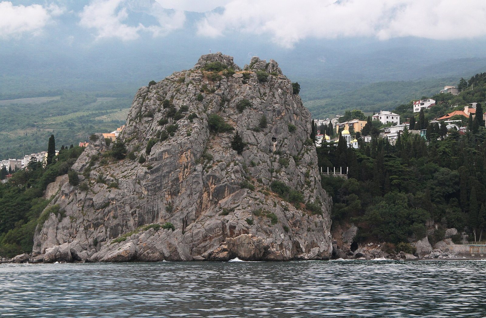
The fortress occupied a coastal cliff about 70 metres high at the entrance to Gurzuf Bay, west of the Shalyapin Rocks. Known today as Genoese Rock, the cliff’s name was given by Crimean Tatars in memory of the fortress. A broad cleft divides the rock into two parts. Steep cliffs and the sea protected three sides, while the northern side joined the land at the foot of Balgotur hill. The position afforded views across the valley, Gurzuf Saddle, the main Crimean mountain ridge, and the sea. The fortress was arranged over four platforms of different sizes, spread across the rock and the cleft between its two sides.
Byzantine platforms and defenses
Upper platform
The upper platform measured about 30 by 12 metres and stood above the other parts of the fortress. Its surface was levelled, and stone walls with a protective parapet secured the seaward edge. A structure against one wall was probably a large water cistern. On the platform’s northern side, a chapel stood against a steep rock projection. A small crag above the northwestern edge formed a lookout, protected by a stone parapet and reached by steps cut into the rock.
Northern platform
The northern platform held a fortified chamber that served as the fortress’s principal defensive point. Its outer walls reached four metres in thickness, while walls facing the citadel interior were about one-third as thick. Builders used dressed sandstone blocks and lime mortar mixed with coarse sea sand, apparently brought from eastern Crimea. On the platform’s northeastern side, a tall, column-like rock bore traces of steps. Its summit formed a small lookout platform with handrails and battlements. Another lookout tower, also protected by a parapet, stood at the rock’s foot and joined the outer defensive wall.
Middle and lower platforms
The middle and lower platforms occupied the broad cleft between the two rock spurs, supported by massive retaining walls. The lower platform opened toward a small cove enclosed by rocks and was divided from the middle one by a wall with a gate. From the base of the citadel, a defensive wall extended outward to a northern gate. Across from and above the gate stood the principal tower, which contained living quarters, an arsenal, and stores of food and water for a siege. A two-storey guard building and the residence of the governor of Gurzuf province also stood within the fortress.
Later defensive changes
Intervening phase
In the period between Byzantine and Genoese control, builders filled gaps in surviving walls and laid a new outer wall, with small watchtowers, over debris beside the earlier defenses. Its thinner sections followed a broken, angled plan that allowed defenders to attack assailants from the side. Small buildings of rubble, coated with clay and limewash, were built directly against the fortress walls.
Genoese rebuilding
The Genoese dismantled the old outer wall and systematically demolished houses on the lower platform. They cut some side walls into wedge shapes, left parts of the rear walls standing, and used stone and rubble to fill gaps and level the slope below the citadel wall and gate. On the northern platform, they extended a bastion, a projecting fortified position, to a natural mass of boulders. This enlarged the platform and enclosed wall remains from the earlier phases. The inward-facing walls were about half as thick as the others. A two-storey room below served as a guardroom, with a stone bed, bench, and fireplace for cooking and heating. The principal tower by the gate on the middle platform was rebuilt as a residence. The northern side of the gate was reconstructed farther inside the citadel, and the projecting southern part of the bastion flanked the entrance. The walls were thickened and large openings for guns were added to the bastion.
Archaeological finds
Early occupation and burials
Finds from the rock include pottery from the Copper Age, dated to the middle of the third millennium BCE, and deposits of mussel and oyster shells. In a small grotto beneath a rock shelter, remains of a badly damaged dwelling associated with the ancient Tauri included a hearth, simple wall traces, and handmade pottery from the seventh and sixth centuries BCE. The grotto was also used in the Middle Ages.
Beneath sixth-century building remains lay a burial from late antiquity, the transition between classical antiquity and the early Middle Ages. It contained the remains of an adolescent girl, a silver ring, and a crushed red-clay-coated bowl holding chicken eggshells. A coin dated to about AD 212 bore the image of Plautilla, wife of the Roman emperor Caracalla.
Medieval cemetery
The lower platform served as a medieval cemetery. A tiled grave discovered there in 1959 held a woman’s remains beside fragments of linen clothing and abundant lace woven from gold thread. The lace had trimmed the garment’s collar, sleeves, and hem. Another grave, lined and covered with stone slabs and dated to the eleventh or twelfth century, was associated with the remains of the large church.
Storage, water, and pottery
In the 1950s, a large ceramic storage jar, nearly as tall as a person and filled with barley, was recovered from a pit beneath a concrete support for a footbridge from the lower platform. Another large jar lay under almost three metres of earth on Chekhov Street. A lead plate secured an old crack in its side, and it was probably used to store grain. Excavations in 1965–1967 recovered 15 storage jars of different shapes and sizes. A medieval water conduit supplied by mountain springs was also found during pipe-trench work. Its ceramic pipes were more than half filled with dense lime deposits.
Finds from three exploratory trenches in 1963 included pottery dating from the first centuries CE through the fifteenth century. They also included large roof-tile pieces with rounded edges and raised stamps, fragments of ribbed clay transport jars with twisted handles, and plates coated with a fine red clay slip. Excavators also encountered hearth traces and an intact storage jar set against a wall.
Weapons and destruction deposits
Excavations in 1965–1967 uncovered hundreds of small, round sling stones, arranged in piles in shallow depressions at three places among the remains of twelfth- and thirteenth-century walls. Nearby were stone projectiles about 12 centimetres across, made for ancient mechanical artillery. Similar ammunition came from layers associated with the reigns of Justinian and the period of Procopius, as well as from Khazar and post-Khazar deposits. Leaf-shaped spear and javelin points and arrowheads were also found near the fortress.
Beneath the fire layer associated with the destruction of 1475, a crushed storage jar held charred wheat grains. Glazed pottery from the fourteenth and fifteenth centuries also came from excavations on the rock. Together, these finds preserve evidence of the fortress’s occupation, defenses, and destruction.
Later descriptions and surviving traces
Pallas described a defensive wall on the rock’s northern summit and, about six sazhen below it, what he identified as a Genoese gun battery. A sazhen is a traditional Russian unit of length. The battery was built of rubble stone in lime mortar, with walls about one and a half sazhen thick. One side had two gun openings facing the bay, and another had five facing the valley. Pallas also described a wall closing the passage between the cliffs, further defenses and a circular defensive structure at the cliff’s foot, foundations of a circular tower below the battery, and a fortress wall descending toward the shore. A small sheltered harbor lay between a submerged rock and an artificial mole.
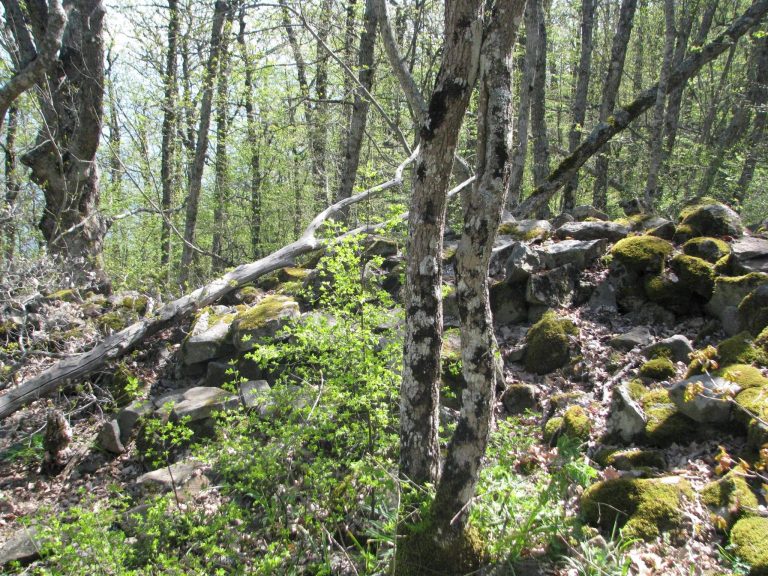
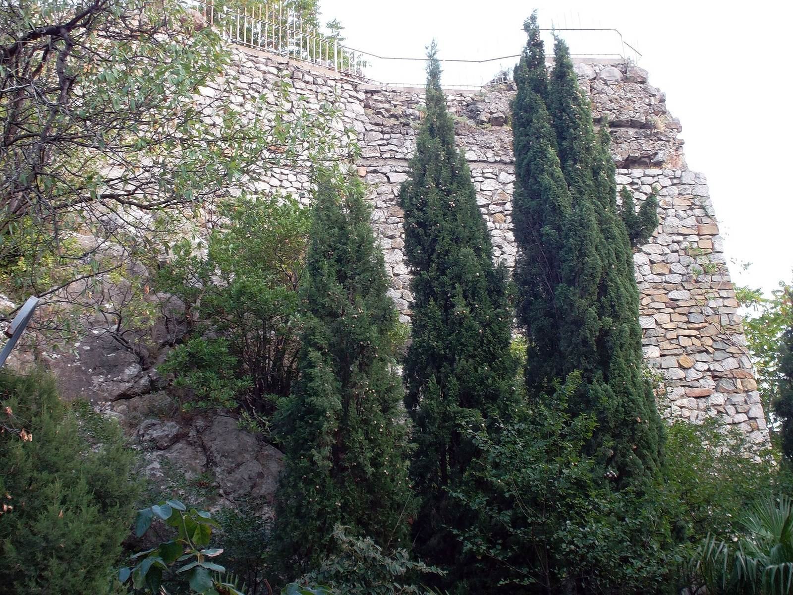
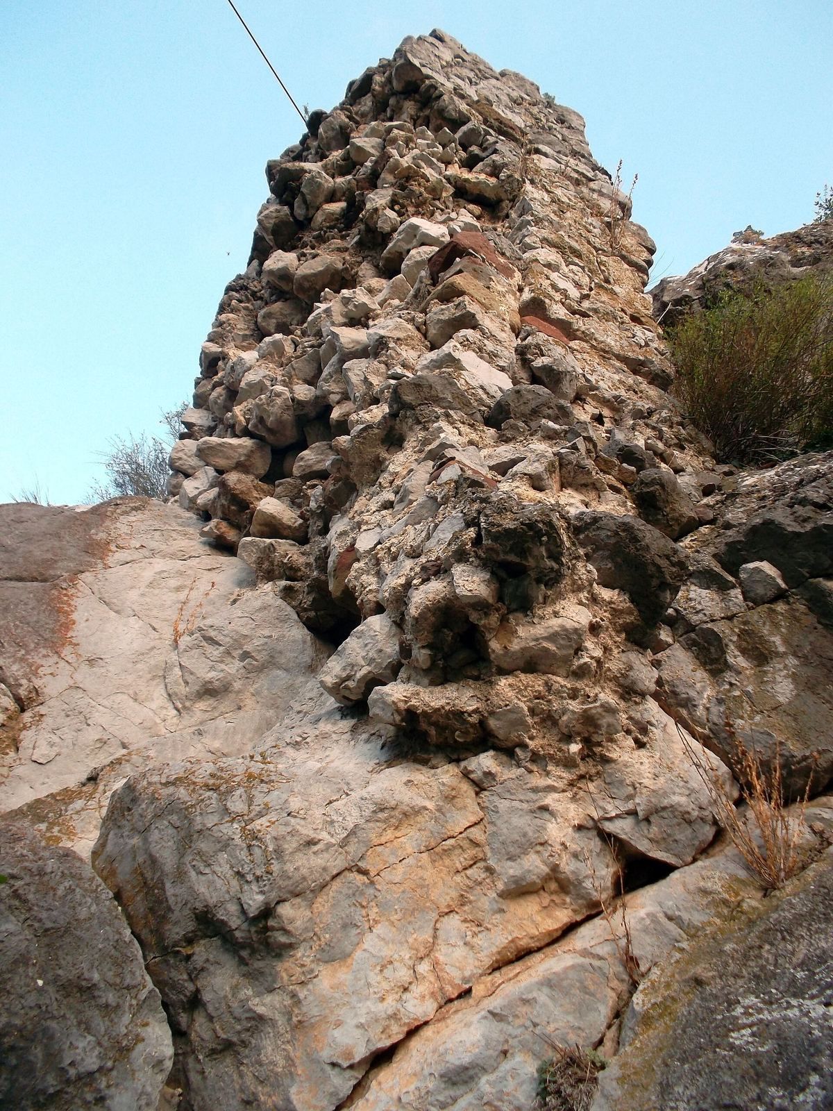
The surviving traces described today are a wall built of undressed stone and steps cut into the rock.