Gila Cliff Dwellings National Monument: Mogollon Cliff Dwellings in New Mexico
Site at a Glance
- Rating
- 4.9
- Popularity
- Medium
- Country
- United States
- Primary era
- Medieval
- External website
- Open
- Eras represented
- Classical, Medieval
- Civilizations
- Unclassified
- Site type
- Domestic
- Remains
- House
On this page14 sections
History
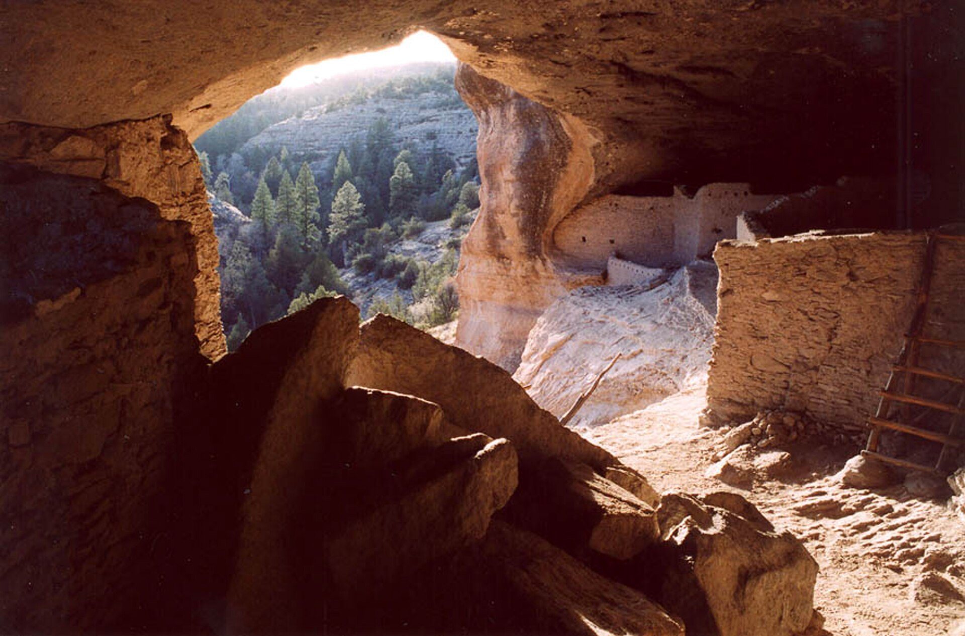
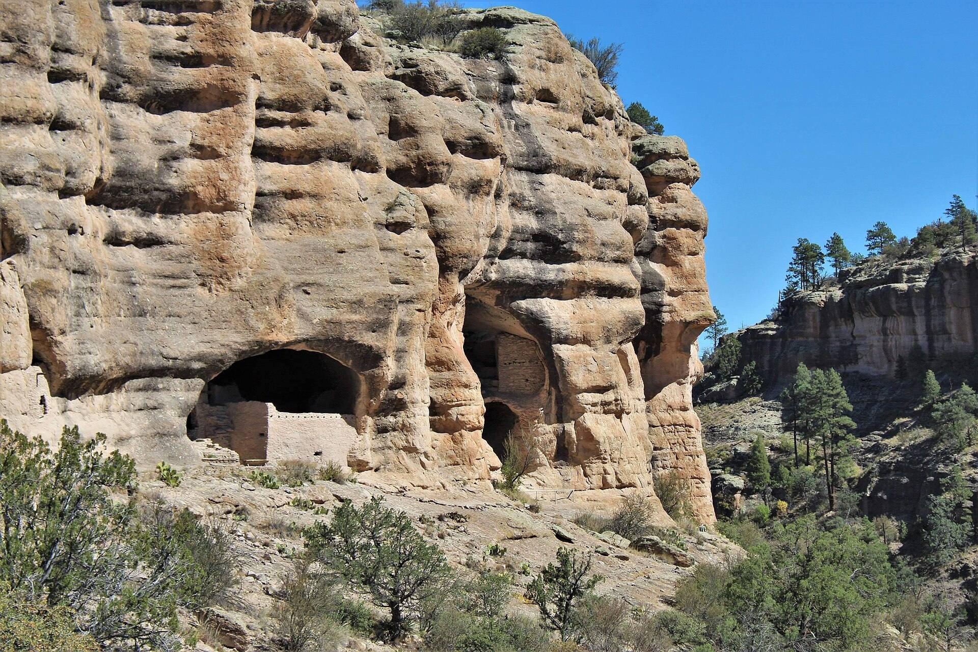
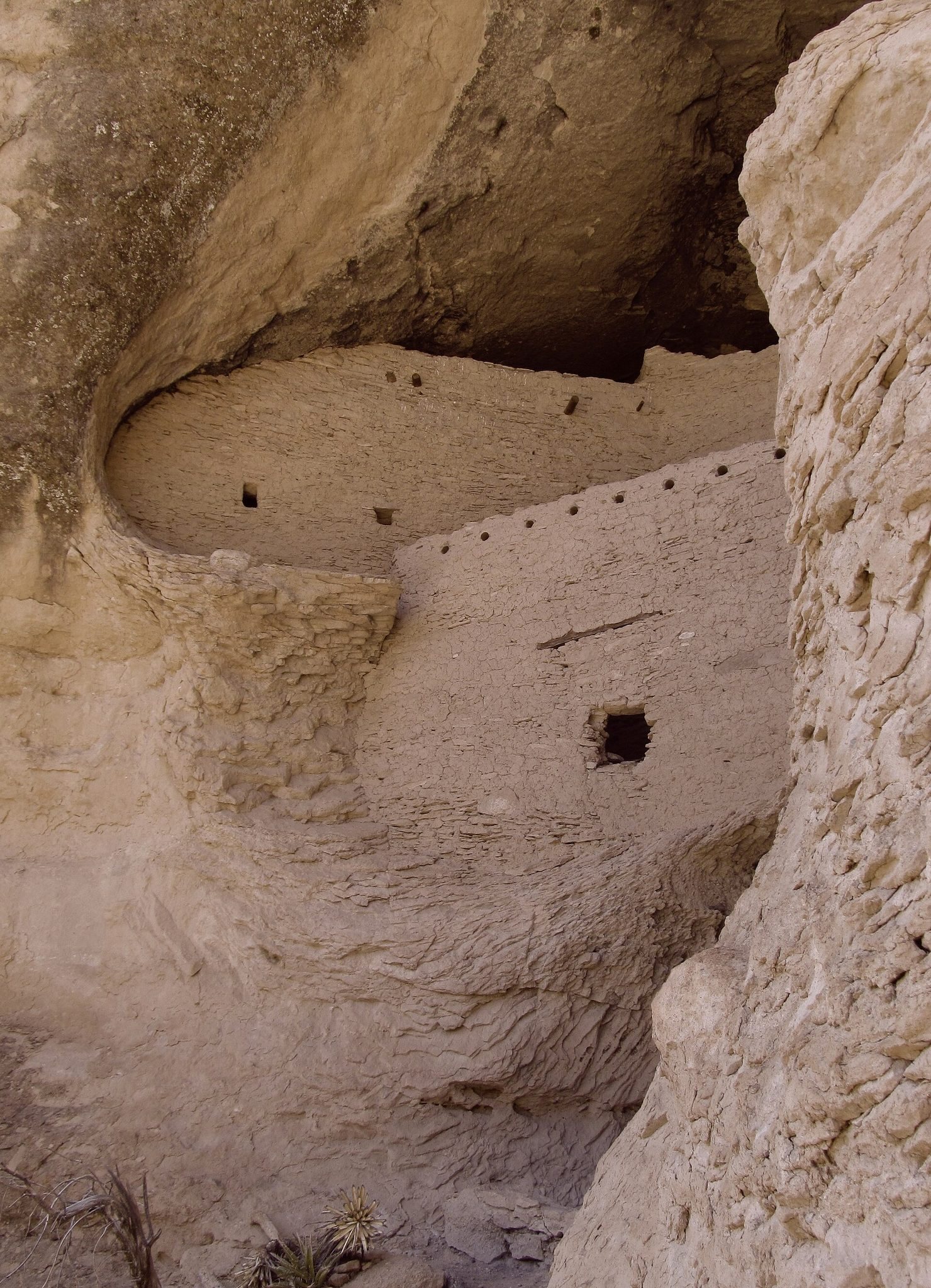
Gila Cliff Dwellings National Monument, in southwestern New Mexico, United States, preserves Mogollon settlements built in natural cliff caves during the thirteenth-century Pueblo III period. President Theodore Roosevelt established the approximately 533-acre (216-hectare) monument on November 16, 1907, under the Antiquities Act, a 1906 law that allows presidents to protect important archaeological and historic places as national monuments. The monument lies in the Gila Wilderness near the headwaters of the Gila River.
Earlier Mogollon settlement
The Mogollon, a prehistoric cultural tradition associated with farming, hunting, gathering, pottery, and settled communities, occupied the upper Gila region long before the cliff dwellings were built. Some early settlements contained circular pit houses with floors below ground level. Earlier underground dwellings in the region date from approximately AD 100 to 400. By around AD 1000, rectangular structures stood above ground, generally using masonry and sometimes woven branches.
These architectural traditions later included ceremonial complexes and, in some communities, kivas, which were communal or ceremonial rooms. The upper Gila community used local agricultural, gathering, and hunting resources. Mogollon inhabitants occupied the region from approximately AD 1275 into the early fourteenth century, but the reason for their eventual abandonment remains unknown.
The cliff-dwelling community
During the thirteenth century, Mogollon residents constructed interconnected rooms in five natural caves or cliff alcoves above Cliff Dweller Canyon. Timber used in the buildings was dated by dendrochronology, the study of annual tree rings, to trees cut between 1276 and 1287. The dwellings probably accommodated about 10 to 15 families for roughly one generation.
After the cliff dwellings were abandoned in the early fourteenth century, nomadic Apache groups later inhabited the surrounding area. Spanish settlers subsequently established communities mainly south and east of the present monument. After the 1853 Gadsden Purchase and the expansion of settlement, conflict with local Apache communities contributed to the establishment of a military camp at nearby Gila Hot Springs to protect settlers.
Discovery, collecting, and preservation
Local Native American communities probably knew the ruins before their first recorded European-American discovery. Henry B. Ailman, who lived in Silver City, reached the site during a prospecting trip in the summer of 1878. In the 1890s, the Hill brothers established a resort near Gila Hot Springs and began leading some of the earliest tours of the ruins.
Several mummified bodies were found at the site, although most were lost to looters and private collectors. A burial ground discovered in 1912 contained a mummified infant later called “Zeke.” The discovery drew national attention and increased visitation. The infant is recognized as the only known mummy from the monument acquired by the Smithsonian Institution.
In December 1906, Gila Forest Supervisor R. C. McClure recommended federal preservation because hunters and prospectors were removing artifacts. Doc Campbell, an early settler and the monument’s first park ranger, later helped National Park Service crews stabilize the ruins.
Federal administration and recognition
Administration transferred from the U.S. Department of Agriculture to the National Park Service on August 10, 1933, under Executive Order 6166. President John F. Kennedy subsequently added approximately 375 acres (1.52 square kilometers), including the TJ site and additional wilderness. The Gila National Forest administered the monument under a cooperative agreement beginning in 1975, and administration returned to the National Park Service in 2003.
Gila Cliff Dwellings National Monument was added to the National Register of Historic Places on October 15, 1966. New Mexico placed it on the State Register of Cultural Properties on May 21, 1971.
Remains
Cliff dwellings and natural setting
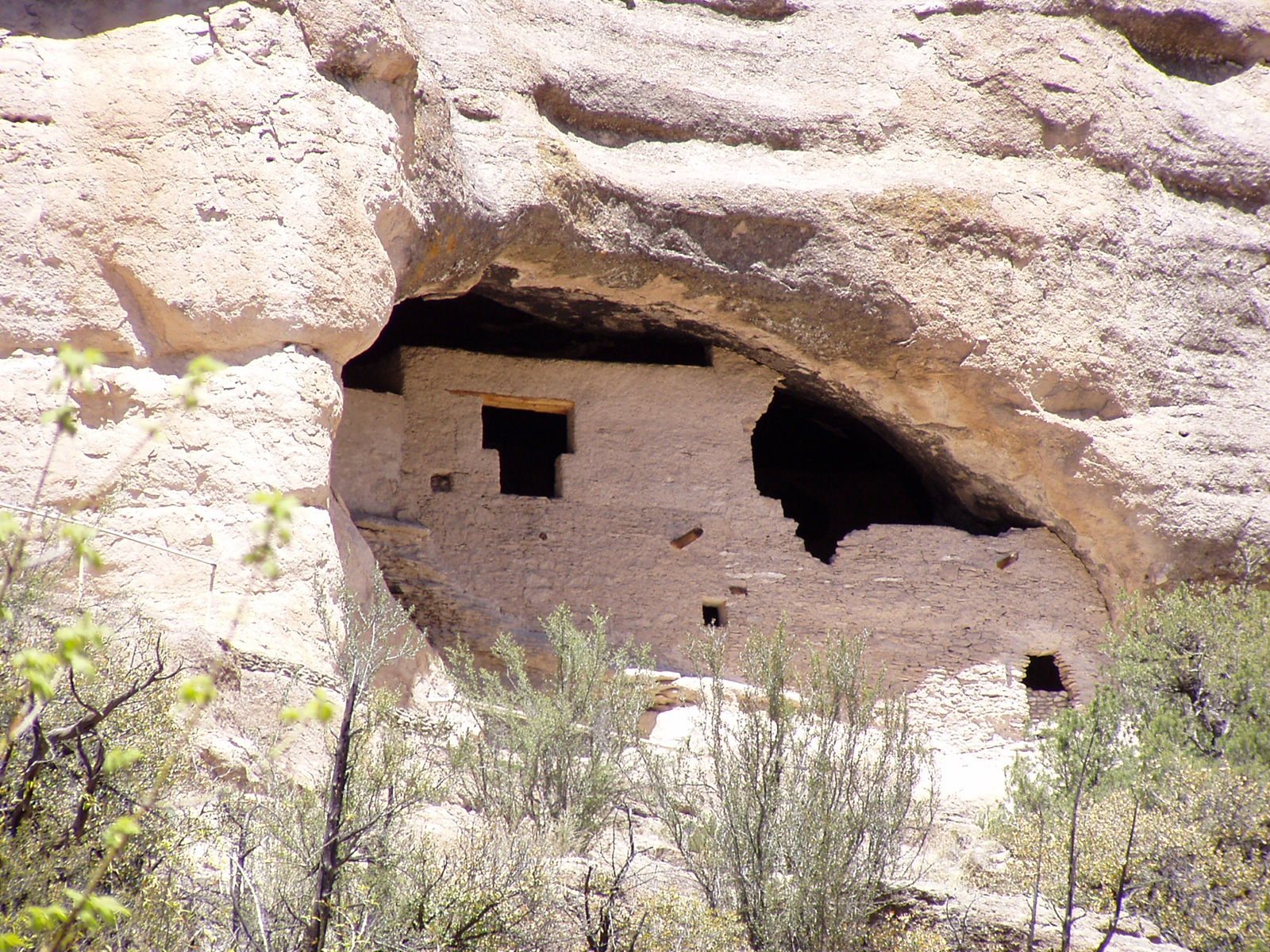
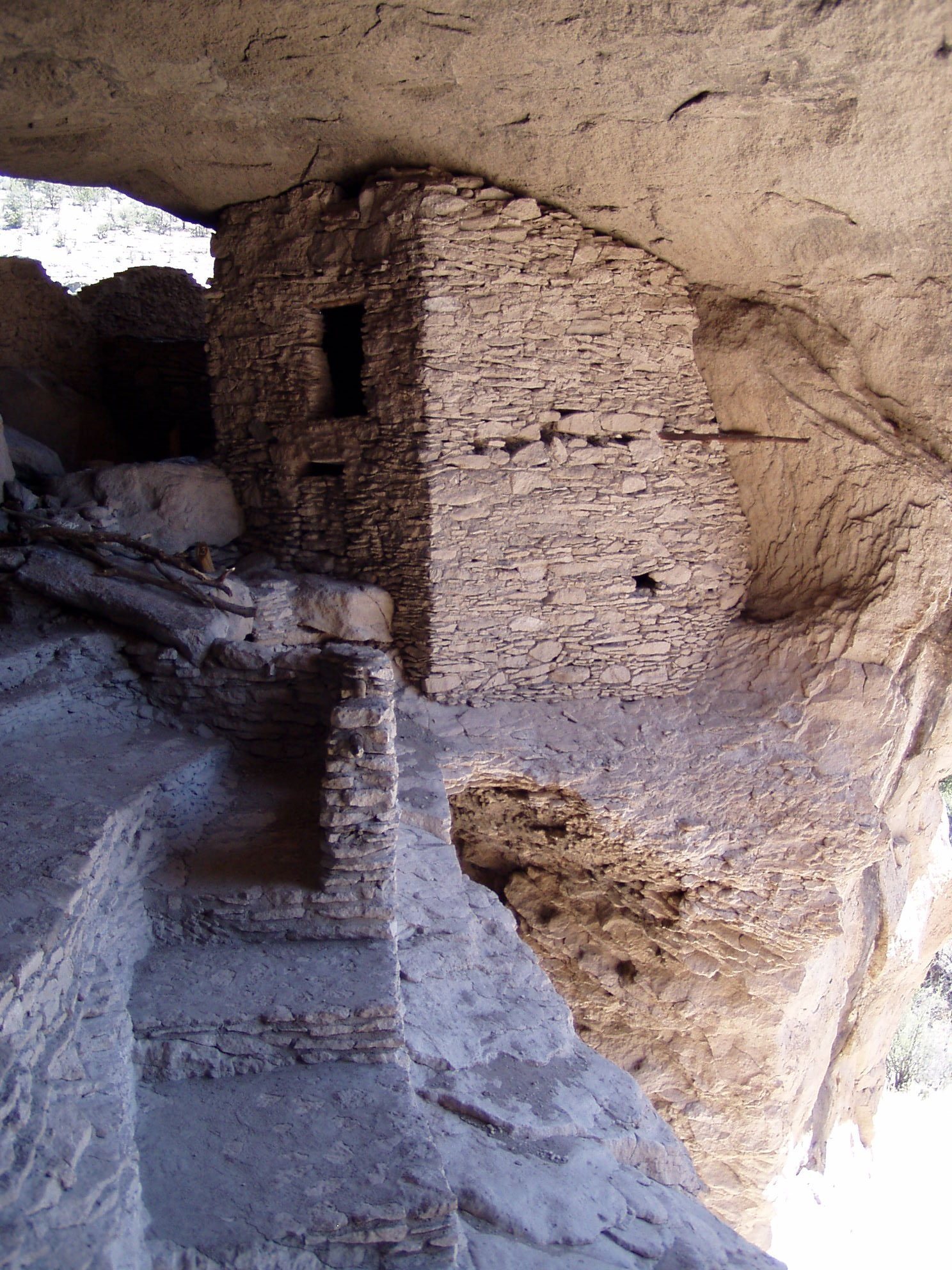
The principal ruins occupy five natural caves or cliff alcoves above Cliff Dweller Canyon. Stone gathered from the immediate area forms the walls, while timber cut between 1276 and 1287 supported the construction. Archaeologists have identified 46 interconnected rooms, and some entrances have T-shaped forms. The dwellings are set within steep-sided canyons, shallow spring-fed rivers, mesas, and forested bluffs.
The monument follows the West Fork and Middle Fork of the Gila River across elevations ranging from approximately 5,700 to 7,300 feet (1,700 to 2,200 meters). The surrounding terrain is arid and rugged, with ponderosa pine, Gambel oak, Douglas fir, New Mexico juniper, piñon pine, and alligator juniper. The landscape’s geology reflects the Oligocene epoch and later volcanic activity that deposited ash. Hot springs in the area are remnants of this volcanic history.
Associated archaeological sites
TJ Ruins
The TJ Ruins, also called the Heart-Bar Site, stand on TJ Mesa on a bluff overlooking the Gila River. Much of the site remains unexcavated. The name of the mesa comes from a former ranch. The visitor center and museum are located near the TJ Ruins.
Javelina House
Javelina House lies approximately one-third of a mile, or about 533 meters, above the principal cliff dwellings. It forms part of the wider group of archaeological sites associated with the monument.
West Fork and Three Mile ruins
West Fork Ruin lies beneath Highway 15 opposite Woody Corral. Three Mile Ruin stands along the West Fork of the Gila River, adding another archaeological location to the sites distributed through the river corridors.
Cosgrove Ruin
Cosgrove Ruin contains 11 rooms beside the Middle Fork of the Gila River. Its position beside the river reflects the distribution of associated settlements through the monument’s canyon landscape.
Earlier architectural remains
The monument’s archaeological record includes circular pit houses with floors below the surrounding ground level and later rectangular buildings constructed above ground. Masonry became an important building method, while some structures also used woven branches. Ceremonial complexes and kivas developed from earlier pit-house traditions, linking the area’s later architecture with older forms of Mogollon settlement.
Objects and trade connections
The museum near the TJ Ruins displays Apache and Mogollon artifacts from the monument and the surrounding wilderness. Among them is a bracelet made from a Glycymeris bittersweet-clam shell, found by student park ranger Charles Grymko. Hohokam artisans etched and perforated the shell. The bracelet is believed to have traveled through trade from the Gulf of California to Snaketown and then north along the Gila River from Arizona.