Gheriat esh-Shergia: A Roman Frontier Fort in Libya
Site at a Glance
- Popularity
- Very Low
- Country
- Libya
- Primary era
- Classical
- Eras represented
- Classical, Modern
- Civilizations
- Italian, Roman
- Site type
- Military
- Remains
- Fort
On this page10 sections
History
Gheriat esh-Shergia is a Roman military post in an oasis in Libya, near Qaryat. Its occupation is dated either to before or during the Severan dynasty, which began with Emperor Septimius Severus in AD 193. The post formed part of the Limes Tripolitanus, Rome’s system of forts and military posts in Tripolitania. Its garrison carried out frontier surveillance and security in the provinces of Africa Proconsularis and Numidia.
Roman occupation and chronology
The oasis stood beside a historic route running north through the valley toward Fezzan. It offered water, dates, grain, and vegetables before the difficult crossing of the barren Hammada al-Hamra. Gheriat esh-Shergia may have remained in military use until shortly after AD 260.
The post was generally thought to have been established later than the larger fort at Gheriat el-Garbia, whose construction inscription dates it to AD 198–201. David Mattingly considered an earlier foundation possible, partly because Gheriat esh-Shergia resembles Gasr Banat. Type 27 African Red Slip pottery, a fine red-coated ware made in Roman North Africa, found at Gasr Banat is dated to AD 160–220 in John W. Hayes’s pottery classification.
Withdrawal from the southern frontier
Michael Mackensen proposed that Gheriat esh-Shergia and other southern posts were abandoned shortly after AD 260, as Rome moved its frontier north. Some cavalrymen from Cohors VIII Fida, a Roman auxiliary military unit, were sent from their base at Secedi to Gholaia in AD 258 or 259. By AD 263, the cohort had moved about 600 kilometres northwest to establish a post at Talalati, now Ras el Aïn in Tunisia. The wider troop movement took place between AD 259 and 263.
Military defeats, internal conflict, shortages of troops, and strategic concerns during Rome’s crisis may have contributed to the withdrawal under Emperor Gallienus, who ruled from AD 260 to 268.
Italian military use and archaeological study
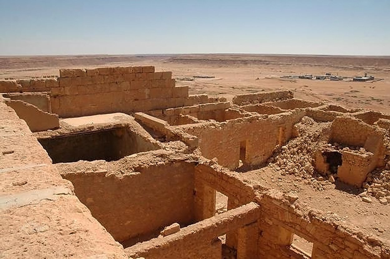
After Italy conquered Libya during the Italo-Turkish War of 1911–1912, Italian forces moved from the Mizda area to Gheriat esh-Shergia during a local uprising. They took possession of the site on 14 July 1928. By 1943, the Roman fort had been greatly enlarged as Fort Bacone, a fortified military position. Italian forces left after their defeat in the North African campaign. The conversion substantially changed the Roman interior, with offices and other military rooms incorporated into the fort.
Richard Goodchild had investigated Roman settlement and the Limes Tripolitanus in Tripolitania since 1946. In 1949, he and John Bryan Ward-Perkins published the first report on Gheriat esh-Shergia. René Rebuffat visited in the early 1970s, and David Mattingly directed an important investigation in 1980 as part of the UNESCO Libyan Valleys Survey, which studied the development of Roman agriculture in Libya’s arid interior.
Remains
Fort layout and landscape
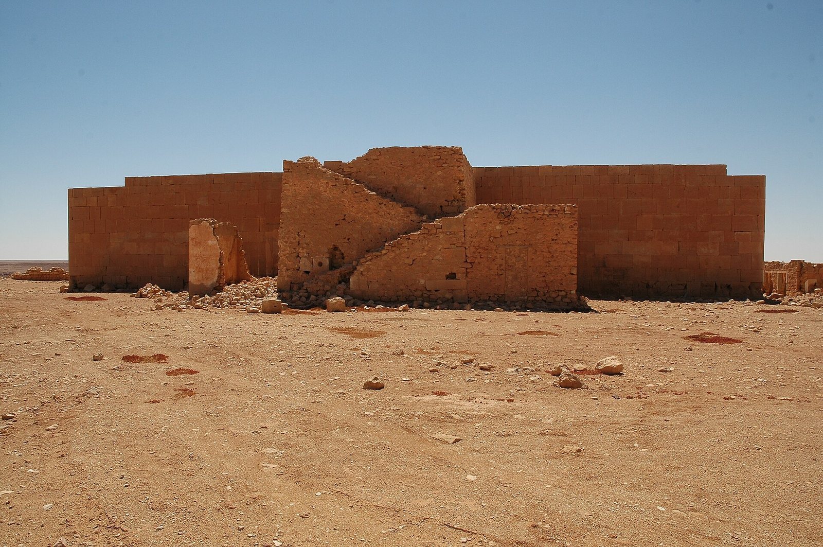
The fort occupies the southern end of a rocky plateau about 300 metres long and 260 to 330 metres wide, at an elevation of roughly 480 metres. Its rectangular enclosure measures 38.80 by 26 metres, covering about 0.10 hectares; its corners are rounded and clipped, and its walls are built from carefully cut limestone blocks. The plateau overlooks the south, west, and north. A cliff and debris-covered slope descend about 20 metres toward the oasis to the southwest. The oasis centre lies in a narrow, northeast-oriented valley about a kilometre south, at roughly 490 metres. Qaryat lies west of the fort, which overlooks the road north toward Ash Shurayf despite its limited northern view. Gheriat el-Garbia, a larger fort of about 2.25 hectares, lies roughly 20 kilometres west. A signal tower on the ridge between them may have enabled communication.
Surviving architectural fabric
Roman enclosure
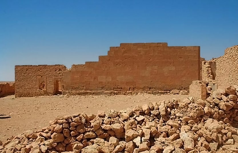
Three sides of the limestone enclosure remain well preserved, rising to about seven metres. The carefully dressed blocks on the exterior are up to 0.70 metres high. They were probably reinforced on the inside with rubble masonry, much of which has fallen or been destroyed. Richard Goodchild thought the southeastern wall had collapsed down the slope. During his 1980 investigation, Mattingly proposed that it may instead have been taken down when the Romans’ fort was incorporated into Fort Bacone, making way for Italian offices and military rooms.
Interior and entrance
The rougher inner face of the enclosure bears traces of walls that once joined it, while internal partitions appear to have met the outer wall. The building probably had at least two storeys. A pair of massive threshold stones, apparently still in their original positions, marks the entrance to an interior room. The entrance is thought to have been on the southeastern side.
Italian additions
Fort Bacone incorporated the Roman enclosure and added towers on its northwest and northeast sides. The northwest stair tower was built against the Roman wall. The Italian additions used rough rubble masonry, contrasting with the Roman walls of carefully cut limestone blocks.