Gerdkuh Castle: A Nizari Ismaili Fortress in Iran
Site at a Glance
- Popularity
- High
- Country
- Iran
- Primary era
- Medieval
- Eras represented
- Medieval
- Civilizations
- Mongolian, Seljuk
- Site type
- Military
- Remains
- Castle
On this page16 sections
History
Early references and Seljuq control
Gerdkuh Castle is a mountain fortress about 15–18 km west of Damghan in Iran. It may have originated before Islam, but its builders and foundation date are unknown. Its earliest known historical mention comes from the tenth century, when it was the residence of the Ismaili missionary Abd al-Malik Kawkabi, a successor of the religious leader Abu Hatim al-Razi.
The Seljuqs, a dynasty that ruled much of Iran and neighboring regions, took control of Gerdkuh in the eleventh century. In the early 1060s, the fortress belonged to Qutalmish, a cousin of Sultan Tughril. After Sultan Alp Arslan defeated Qutalmish in a struggle for power in 1064, Qutalmish sought refuge there.
During Sultan Malik-Shah’s reign, his court companion Hurdak received the partly ruined fortress and appointed a governor. Later, under Sultan Barkiyaruq, the Seljuq emir Amirdad Habashi secured an order transferring Gerdkuh to him and maneuvered to have Hurdak killed. After three months of fighting, Hurdak’s governor surrendered the fortress to Habashi in July or August 1096.
A Nizari stronghold
Habashi appointed Ra’is Mu’ayyad al-Din Muzaffar ibn Ahmad Mustawfi as governor, directed Damghan’s revenues toward improvements, and moved his treasury to Gerdkuh. After Habashi died around 1099–1100, Muzaffar transferred the fortress to Hasan-i Sabbah, the founding leader of the Nizari state in Iran. Muzaffar had secretly converted to Nizari Ismailism, a branch of Ismaili Shi’a Islam, well before then. He commanded Gerdkuh for about forty years, after which his son Sharaf al-Din Muhammad succeeded him.
In 1105–1106, while the Seljuqs were besieging Alamut, Hasan sent his wife and two daughters to Gerdkuh for safety. The fortress became a major Nizari stronghold in Qumis, the region around Damghan and Semnan. Its position beside a caravan route connecting western Iran with Khorasan, on the Silk Road, supported its strategic role. Nizari authorities collected tolls from travelers. In 1134, an emir besieged Gerdkuh during Sultan Ahmad Sanjar’s reign, but the attackers withdrew, apparently after the defenders bribed them.
The Mongol siege
During the Mongol invasion of western Asia, Sultan Muhammad II of Khwarazm retreated to Ray. When the Mongol general Subutai reached Damghan in pursuit, local notables sought shelter at Gerdkuh. In May 1253, Kitbuqa, a commander in Hülegü’s advance, arrived with 5,000 mounted and foot soldiers. His forces surrounded the fortress with siege works, defensive lines and barriers built to contain it, then left an army under Büri to maintain the blockade. In December, the garrison attacked at night, killing at least 100 Mongols, including Büri.
A cholera outbreak weakened the defenders in 1254. The Nizari imam Ala al-Din Muhammad, a Shi’a religious leader, sent Mubariz al-Din Ali Turan and Shuja al-Din Hasan Astrabadi with 110 fighters to reinforce the garrison. Each commander carried two man, a traditional weight measure, of henna for treatment and three man of salt. The party broke through the Mongol lines and entered the fortress.
In 1256, Nizari imam Rukn al-Din Khurshah ordered Gerdkuh and other Nizari fortresses to surrender, but its garrison continued to resist. That October, Shams al-Din Gileki, Khurshah’s chief minister, returned to Hülegü with the fortress governor, Qadi Taj al-Din Mardanshah, an Islamic judge who had surrendered. In 1257, while traveling to the Mongol court, Khurshah personally urged the garrison to give in while secretly telling it to continue fighting.
The fall of Maymun-Diz and Alamut in 1256 formally ended the Nizari state. Held by the Mongols, Khurshah asked to travel to Möngke, the Mongol Empire’s Great Khan, to persuade the remaining fortresses to surrender. Möngke rebuked him for failing to secure the surrender of Lambsar and Gerdkuh, then ordered a general massacre of Nizari Ismailis that included Khurshah.
Gerdkuh’s garrison surrendered on 15 December 1270, after a siege of about seventeen years. The defenders had run out of provisions, and a lack of clothing also contributed to their capitulation. The Mongols killed the surviving garrison but left the fortress standing. Gerdkuh was the last major Nizari stronghold in Persia to fall.
Later use and modern investigation
Ilkhanid rulers, members of the dynasty Hülegü established in Iran, later used Gerdkuh as a prison for rebellious princes, some of whom were executed there. The rebellious governor Amir Vali of Astarabad briefly captured the fortress in 1384. Gerdkuh was probably abandoned by the early Safavid period, when the Safavids began ruling Iran.
In the Qajar period, Naser al-Din Shah encouraged Shaykh Mohammad Mehdi Abdol-Rabb-Abadi to examine the site; his brief report included accurate measurements. Researcher Peter Willey later visited repeatedly and prepared a detailed description. Many pottery fragments and other artifacts were present in 1967, but few remained the following year. Archaeological investigation stayed limited. A field survey in September and October 2006 covered the hill and an area within 20 km, producing a topographic map and identifying the fortress’s historical boundaries. Gerdkuh became an Iranian National Heritage site on 15 March 2000.
In the Middle Ages, Gerdkuh was also called Dezh-e Gonbadan, meaning “fortress of the domes.” It may be the fortress where Isfandiyar, a heroic prince in the Persian epic poem Shahnameh, was imprisoned.
Remains
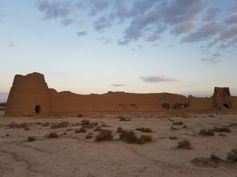
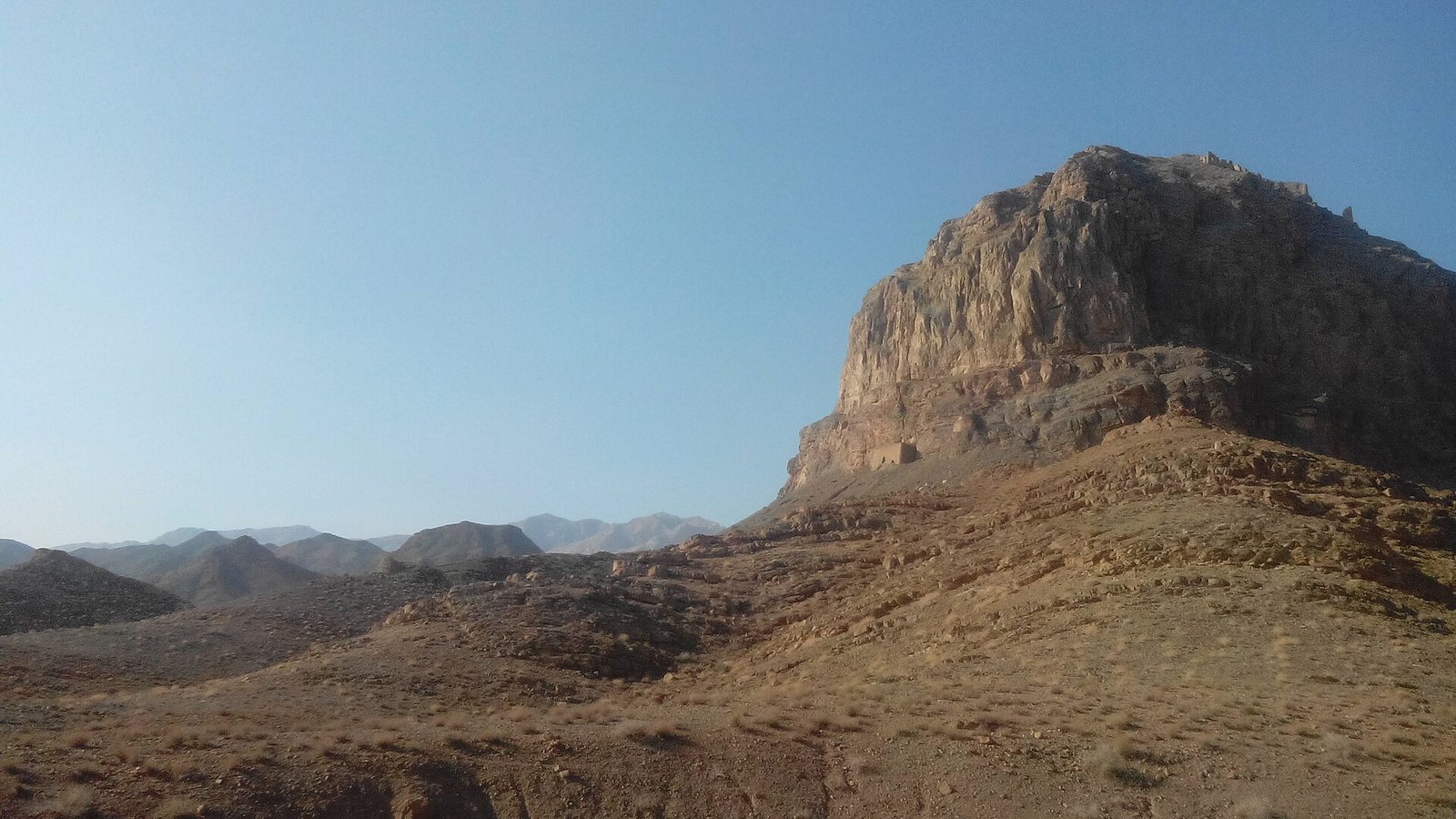
The remains occupy an isolated rocky hill, with buildings on the summit and slopes and defenses extending down toward the base. Stone, mud brick, and plaster appear in the surviving construction. The fortress is now largely ruined and has survived poorly.
Hilltop and defenses
Hill and outer forts
The rock rises about 300 m above the surrounding slopes. Its summit stands at roughly 1,525 m above sea level, while the plain lies at about 1,230 m. Seen from the south, the hill has a rounded, dome-like profile, the form from which Gerdkuh takes its name. Thirty-five forts formed three rings around the hill’s base, with a combined perimeter of about 6 km. They were concentrated on the eastern side: one line stood about 300 m from the castle, another about 200 m away, and the third at the hill’s foot. These outer forts may have protected cultivated land, provided places to collect caravan tolls, and offered storage.
Walls and gateways
Except on the eastern side, the slopes were nearly impossible to climb. Double walls linked towers on the mountain, while steep natural drops strengthened the defenses. A rectangular outer gatehouse on the south may have served as a reception point. The principal entrance was an eastern gatehouse about 10.5–12 m wide and 7.5 m high, with a pair of round towers on each side built of finely cut stone. The ramp leading to it was probably made by the Mongol besiegers. A spring lies just above the gatehouse, and defenses continue from there to an inner gatehouse guarding the only possible climb to the main castle.
Citadel and water supply
Summit citadel
The summit citadel, the fortress’s inner stronghold, measured about 30.5 by 24 m. Its base was built of cut stone, and a well occupied the center.
Residential buildings
The principal residential area consisted of two rows of buildings on the southeastern slope. Each building rose at least two or three stories and could be seen from the plain. On the northeastern side, a later mud-brick wall and sparse building remains survive. The southwestern slope contains a water tank and the remains of a defensive tower.
Water storage and wells
Three main water tanks, or cisterns, stood on the hill’s southern side, where the ground drops steeply by about 60.5 m. Their outer walls were 3 m thick, made of stone and mud brick, and coated with plaster. The tanks had arched roofs and turrets. Other cisterns and wells were distributed within the fortifications. Muzaffar spent 12,000 dinars on two wells inside the walls and ordered another to be cut through hard rock on a defensive wall. Work reached 300 gaz, a traditional Persian unit of length whose value varied, without reaching water, so the excavation was abandoned. Years after Muzaffar’s death, an earthquake caused water to gush from it.
Siege remains
Mongol structures and siege works
Ruins of permanent buildings, houses, and defensive walls built by Mongol forces survive in Hajjiabad-e Razveh and other nearby villages. Siege works also remain in the plain between Hajjiabad-e Razveh and Gerdkuh. Residential quarters made by the besiegers were still visible on the hill in the late twentieth century.
Stone projectiles
Two types of stone projectiles used by Nizari and Mongol forces for mangonels, medieval siege engines that hurled stones, lay scattered on the northeastern slope in the late twentieth century, including in 1985.