Fortress of Louisbourg: A French Colonial Stronghold in Canada
Site at a Glance
- Rating
- 4.8
- Popularity
- Medium
- Country
- Canada
- Primary era
- Early Modern
- External website
- Open
- Eras represented
- Early Modern
- Civilizations
- French
- Site type
- Military
- Remains
- Fortified Town
On this page16 sections
History
Fortress of Louisbourg is an eighteenth-century French fortified settlement in Canada, on Cape Breton Island near the town of Louisbourg. Founded in 1713, it developed as a major stronghold and maritime centre of New France, France’s North American colonial domain. Its fortifications protected Québec and the entrance to the Gulf of St. Lawrence while supporting French access to the Grand Banks and the North Atlantic cod fishery.
Foundation and French expansion
The settlement was founded by people from Terre-Neuve after France lost Plaisance in Newfoundland through the Treaty of Utrecht. Initially called Havre à l’Anglois, it began with 116 men, 10 women, and 23 children. The name later became Havre Louisbourg, after Louis XIV, the Bourbon king of France. In 1718, the settlement became the capital of Île Royale, the French colonial name for present-day Cape Breton Island.
French officials had first considered Port Dauphin, the former site of Fort Sainte-Anne, for a naval base. Winter ice made that harbour unsuitable, so they selected Louisbourg’s protected, ice-free harbour instead. Smaller French garrisons at present-day St. Peter’s and Englishtown supported the settlement’s defensive system.
Construction of the fortifications began in 1719, and the walls were built mainly between 1720 and 1740. The engineering work took about 28 years. Jean-François du Vergery de Verville initiated the project, followed by Étienne Verrier and Louis Franquet, France’s highest-ranking engineering officer in North America. The final cost reached about 30 million livres, far above the original estimate of four million.
Port, population, and economy
Louisbourg grew into one of the busiest ports in eighteenth-century North America and France’s second most important stronghold and commercial city in New France after Québec. Its activities included cod fishing and processing, maritime trade, markets, inns, taverns, and commerce with Europe, the French West Indies, Québec, Acadia, New England, and other parts of the Atlantic world.
The settlement depended less on agriculture than most communities in New France. In 1731, its fishermen exported about 167,000 quintals of cod and 1,600 barrels of cod-liver oil. Around 400 shallops operated from the port, together with 60 to 70 ocean-going schooners. Fish exports supplied Québec, Europe, the French Caribbean, Acadia, and the British American colonies.
The population rose from 823 people in 1719 to 1,296 in 1726, 1,616 in 1734, and 4,174 in 1752. Smallpox severely affected the community in 1731 and 1732. The garrison, fishing industry, and maritime trade produced a predominantly male population that included people from France’s Atlantic provinces and free Black servants.
Sieges and changes of control
Louisbourg was captured by a New England force supported by a Royal Navy squadron on 16 June 1745, during the War of the Austrian Succession, an eighteenth-century conflict fought in Europe and North America. A French expedition led by Jean-Baptiste de La Rochefoucauld de Roye, duc d’Anville, attempted to recover the fortress in 1746. Storms, disease, and British naval attacks destroyed the expedition before it reached Louisbourg.
The Treaty of Aix-la-Chapelle restored Louisbourg to France in 1748 in exchange for territories gained in the Austrian Netherlands and the British trading post of Madras in India. France considered the harbour essential to its fishing interests, while New England colonists opposed its return. Britain responded by establishing Halifax in 1749 as a rival fortified port and naval base.
A major French naval deployment prevented a British attack in 1757. The following year, however, inadequate French naval support allowed a British expedition to land. General Jeffrey Amherst led the operation, and the fortress capitulated on 26 July 1758 after a siege lasting six weeks. British forces then used Louisbourg as a base for the 1759 campaign against Québec during the wider Seven Years’ War, which included the French and Indian War in North America.
Demolition and early preservation
After the British capture in 1758, French soldiers and inhabitants were expelled to France. British military engineers began systematically demolishing the town and fortifications in 1760, continuing for six years to prevent France or another power from using them again. Britain kept a garrison until 1768 and had abandoned the site by 1785. Some of the cut stone was later reused in Halifax and Sydney, Nova Scotia.
Preservation efforts began before the site received national recognition. The Society of Colonial Wars erected a monument at Rochefort Point in 1895, and Nova Scotia declared Louisbourg a historic monument of the Dominion of Canada in 1906. After its creation in 1919, the federal historical monuments commission became concerned with the site’s preservation. The Fortress of Louisbourg was designated a National Historic Site of Canada on 30 January 1920. The federal parks administration acquired most of the former town by the 1930s, and a national historic park was created around 1940.
Reconstruction and interpretation
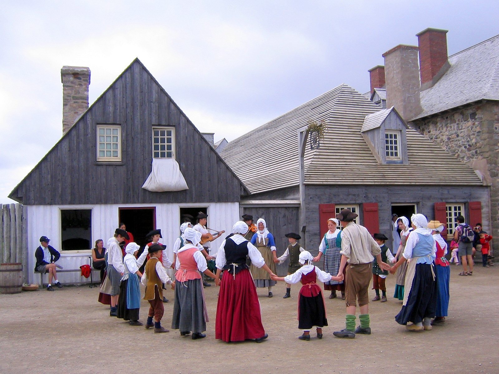
In 1961, the Canadian government began a partial reconstruction intended to represent Louisbourg at its eighteenth-century height. The project covered approximately one-quarter of the original fortified town and its defences. Work continued through the 1970s and into 1981, employing unemployed coal miners from industrial Cape Breton and bringing together archaeologists, historians, engineers, architects, and craftsmen.
The reconstruction drew on about 750,000 pages of documents and 500 maps and plans, together with archaeological investigation. Ron Bovaird served as head stonemason, while Yvon LeBlanc designed most of the reconstructed town buildings with research support. The project required the expropriation of the community known as West Louisbourg. It also created employment during the decline of coal mining and the North Atlantic fishery.
Archaeological work connected with the reconstruction uncovered more than one million artifacts. Further restoration and conservation in 2018–2020 addressed rising water and restored parts of the fortress, while additional work followed Hurricane Fiona in 2022–2023. Parks Canada operates the site as a living-history museum. The broader historic site includes the Fortress of Louisbourg, Wolfe’s Landing National Historic Site, and Royal Battery National Historic Site. Wolfe’s Landing commemorates James Wolfe’s landing and the attack of 8 June 1758, while the Royal Battery is associated with the sieges of 1745 and 1758.
The Louisbourg Cross, formerly displayed in the fortress chapel, was taken to New England after the 1745 capture. It was rediscovered in the Harvard University archives during the latter twentieth century and is now on long-term loan to the historic site. The museum is affiliated with the Canadian Museums Association, the Canadian Heritage Information Network, and the Virtual Museum of Canada.
Remains
The fortress and town occupy a low peninsula near the southeastern part of Cape Breton Island. The Atlantic Ocean borders the site to the south and east, while Louisbourg Harbour lies to the north. The surrounding park covers about 6,000 hectares and includes approximately 31 kilometres of coastline.
Town defences and reconstructed buildings
Natural features helped protect the settlement. A reef south of the fort and an island near the harbour entrance narrowed the approach, requiring ships to use a channel about 500 feet, or 150 metres, wide. Nearby hills overlooked the low-lying fortress, making its landward defences comparatively weak. The original design therefore concentrated more heavily on defence from the sea.
Walls and entrances
The fortified town was enclosed by about 2.5 miles of walls. On the western landward side, the walls were approximately 30 feet, or 9.1 metres, high and 36 feet, or 11 metres, wide, with a broad ditch and ramparts. On the harbour side, they were about 16 feet, or 4.9 metres, high and 6 feet, or 1.8 metres, wide, with 15 guns directed toward the water.
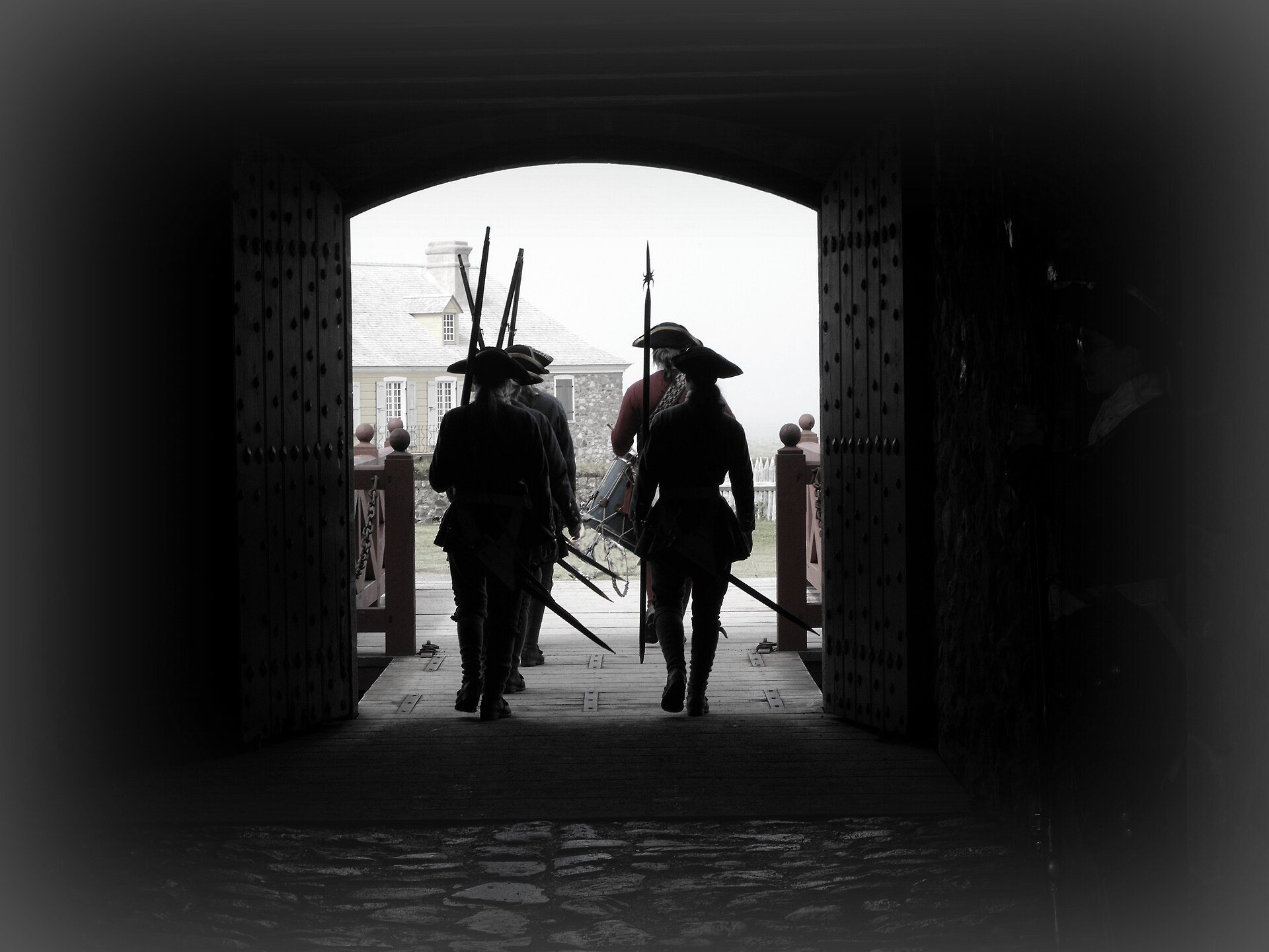
Four gates controlled movement through the fortifications. The reconstructed Dauphin Gate was the busiest entrance and connected the town with the fishing compounds and inland road. The reconstructed Frederick Gate served as the waterfront entrance. The decorated Maurepas Gate faced the narrows and linked the fishing establishments, dwellings, and cemeteries at Rochefort Point. The Queen’s Gate stood on the sparsely populated seaward side.
Bastions and principal buildings
Six projecting fortifications, called bastions, formed part of the defensive circuit. Bastions allowed defenders to fire along the faces of adjoining walls. They were named the Dauphin, King’s, Queen’s, Princess, Maurepas, and Brouillon bastions. The Dauphin Bastion was modified into a demi-bastion, and the Dauphin and King’s bastions have been reconstructed.
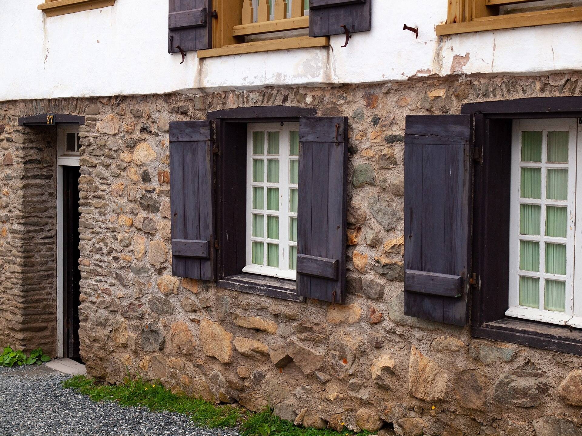
The fortifications contained 148 embrasures, or openings in defensive walls for guns, although historians estimate that only about 100 held weapons. The reconstructed area includes the King’s Bastion, the governor’s quarters, the hospital, two gates, and the Ocean Gate at the end of the main street beside the harbour. By the end of the reconstruction program, about 65 large buildings and 20 smaller buildings or structures, including dovecotes and sentry boxes, had been rebuilt to represent the eighteenth-century settlement.
Hospital
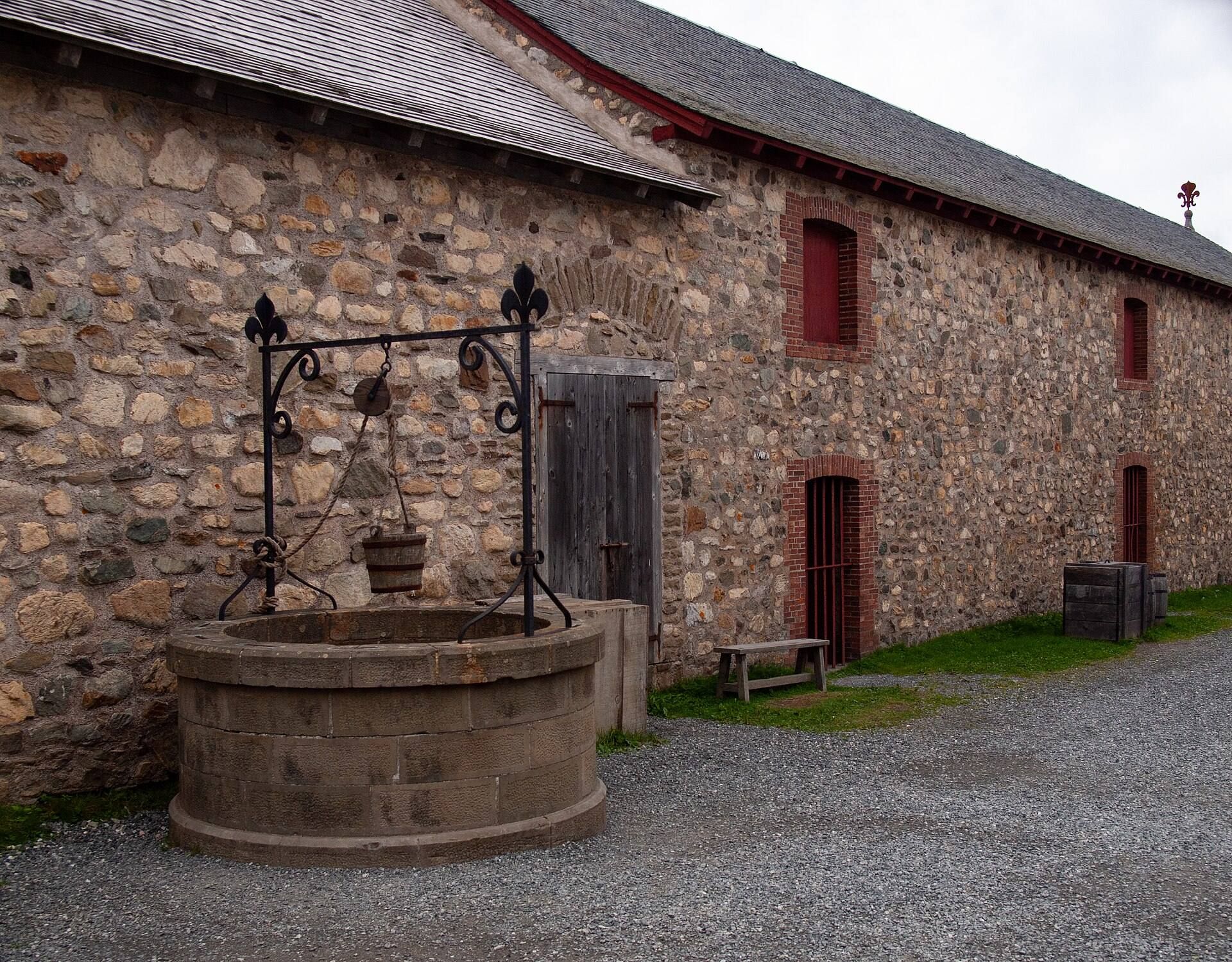
The hospital was one of the town’s principal buildings and among the largest structures in the fortress. By 1744, it had a tall spire, 100 beds, six Brothers of Saint-Jean-de-Dieu, and access to 40 medicines for surgery and other care. Its associated facilities included a bakery, kitchen, laundry, well, stables, and housing for enslaved Black people.
Military Chapel
Recollet missionaries served the Military Chapel, which was open to the population during French rule. Recollets belonged to a reformed branch of the Franciscan religious order. The chapel is among the structures that have been fully restored.
Harbour defences
Island Battery
The Island Battery stood on a small island at the harbour entrance. Its walls were about 10 feet, or 3 metres, high and 8 feet, or 2.4 metres, thick. Thirty-one 24-pounder guns faced the harbour. The island had room for only a few small vessels and included a small landing place.
Royal Battery
The Royal Battery stood across the harbour from the town and protected the entrance with about 40 guns. Built between 1724 and 1728 on the harbour’s north shore, it included a barracks behind ramparts, a ditch, a covered way, and a glacis, a sloping bank of earth designed to shield a fortification from direct fire.
British forces destroyed the battery in 1760, and some of its larger stones were later reused, including in houses in Halifax. The remaining ruins are largely covered by a grassy earthwork. A reinforced-concrete wall and rock armouring protect the shoreline from wave erosion, and reconstruction has been considered.
Archaeological remains and later heritage buildings
The original town and fortifications were largely demolished after 1760. Masonry was removed for reuse elsewhere, while archaeological remains beneath and around the reconstructed buildings preserve evidence of the former settlement. Excavations associated with the reconstruction produced more than one million artifacts, helping reveal the layout and material life of Louisbourg.
The Museum and Caretakers’ Residence, built around 1935–1936 within the historic site, is a Classified Federal Heritage Building. Together with the reconstructed buildings, surviving earthworks, harbour defences, and archaeological remains, it forms part of a partial representation rather than a complete rebuilding of the eighteenth-century fortress.