Fort Témiscamingue: A Historic Fur-Trading Post in Quebec
Site at a Glance
- Rating
- 4.7
- Popularity
- Low
- Country
- Canada
- Primary era
- Early Modern
- External website
- Open
- Eras represented
- Early Modern
- Civilizations
- French
- Site type
- Military
- Remains
- Fort
On this page10 sections
History
Indigenous gathering place and French beginnings
Fort Témiscamingue is a historic fur-trading post on the eastern shore of Lake Timiskaming in Duhamel-Ouest, Quebec, Canada. Used from the late seventeenth century until 1902, it developed within an Indigenous landscape known as Obadjiwan Point and became part of the French and later British North American fur trade. Archaeological investigations show that Anicinabek communities used the site more than 6,000 years ago, and that it had long served as a gathering place for the Anicinabek and other Indigenous nations.
Around 1679, Montreal fur merchants established an earlier fort on the western side of Lake Timiskaming to compete with English posts linked to Hudson Bay. The position connected routes toward Lakes Temagami, Nipissing, and Abitibi, as well as the waterway leading to James Bay. In 1682, the merchants created the Company of the North. French traders exchanged merchandise for furs obtained through Indigenous networks, then sent the pelts toward Europe with voyageurs.
War and destruction
In 1686, an expedition led by the Chevalier de Troyes and commanded militarily by Pierre Le Moyne d’Iberville stopped at Fort Témiscamingue while travelling from Montreal toward the English posts in Hudson Bay. The expedition followed the Blanche River and received essential assistance from First Nations, including guidance and permission to cross their territory. It later captured the English forts in Hudson Bay.
Iroquois forces destroyed the fort in 1688 during their conflict with Huron and Algonquin peoples allied with the French. The Treaty of Utrecht in 1713, which ended major aspects of the War of the Spanish Succession, required France to return its forts to England. A new phase began after Paul Guillet, a Montreal merchant, received a trading licence for the Abitibi and Témiscamingue region in 1720. He built another Fort Témiscamingue near Lake Timiskaming, south of present-day Ville-Marie.
Commercial expansion and changing control
The later fort’s commercial activity flourished until the early 1760s. Its furs were resold to François-Étienne Cugnet, director of the Western Farm. The Treaty of Paris in 1763 transferred New France, France’s North American colonial domain, to Britain and reduced the fort’s importance as a trading post. Independent traders reoccupied it after the fall of New France, the North West Company took control in 1788, and the Hudson’s Bay Company assumed control in 1821.
Under the direction of George Simpson, the Hudson’s Bay Company initially supplied the post from Moose Factory rather than Montreal. Improvements in transportation after 1863 made it possible to resume supply from Montreal. Lumbermen, railways, and steamships then changed the character of the settlement, which developed into a general store. Its main store moved to Ville-Marie in 1887.
Mission, closure, and preservation
A Roman Catholic mission associated with the fort moved to the western shore in 1863. The post itself closed in 1902, ending its long period of fur-trade activity. Fort Témiscamingue was designated a National Historic Site of Canada in 1931 in recognition of its historical importance.
Donat Martineau researched and wrote the site’s history between 1967 and 1970, submitting the work to the federal department responsible for Parks Canada. Parks Canada later acquired the site for heritage preservation. It is administered in partnership with the Timiskaming First Nation, and its interpretation emphasizes Anicinabek history, the organization of the former trading post, and life during the Hudson’s Bay Company period, especially from 1840 to 1880.
Remains
Landscape and water route
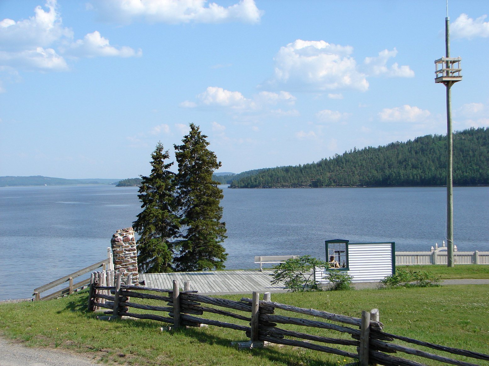
The historic site occupies a point on the eastern shore of Lake Timiskaming near the Narrows, where the two shores are less than 250 metres apart. The point faces the Ontario shore and was formerly known as Obadjiwan Point, a name meaning “the strait where the current flows.” The landscape consists of a plateau, escarpments, and lowlands. More than 80 percent of the territory is wooded, with approximately 20 forest stands and plants associated with the Laurentian maple forest and the Upper St. Lawrence forest sub-region.
The location formed part of a canoe route between Hudson Bay and the St. Lawrence River. The route ran through James Bay, Moose Factory, the Abitibi River, Lake Abitibi, a portage, Lake Timiskaming, and the Ottawa River toward Montreal. A portage is a route over which canoes and their cargo are carried between waterways. Lake Timiskaming lay approximately midway along a journey that took about 40 days.
Archaeology and surviving fort features
Excavations recovered arrowheads, tools, and flakes from worked stone. These objects show long-term Indigenous use of Obadjiwan and particularly reflect Anicinabek activity more than 6,000 years ago. Around 1980, the surviving historic fabric included standing chimneys. The present historic site also contains a modern visitor centre and exhibitions that interpret the former fort, its spatial organization, and its cultural history.
Western shore mission
The former Roman Catholic mission on the western shore included a presbytery for Oblate fathers, members of the Missionary Oblates of Mary Immaculate; a small hospital operated by two Grey Sisters of the Cross, a Catholic women’s religious congregation involved in medical and charitable work; and a frame church.
Enchanted Forest and shoreline
A nearby area known as the Enchanted Forest contains numerous eastern white cedars with markedly twisted trunks. The trees are approximately 150 years old, and the area also includes a pebble beach.