Fort du Mûrier: A Séré de Rivières Fort Protecting Grenoble
Site at a Glance
- Popularity
- Medium
- Country
- France
- Primary era
- Modern
- Eras represented
- Modern
- Civilizations
- French
- Site type
- Military
- Remains
- Fort
On this page16 sections
History
Construction and defensive purpose
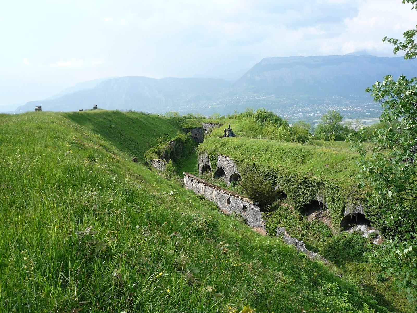
Fort du Mûrier is a first-generation French fort east-southeast of Gières, France, built as part of Grenoble’s fortified perimeter. Construction began in April 1875 and was completed in 1878, after France’s defeat in the Franco-Prussian War against Germany and a westward shift of the border. The fort belonged to the Séré de Rivières system, a network of French fortifications developed after the war by military engineer General Raymond Adolphe Séré de Rivières. It was one of the few forts to follow his specifications exactly, under the supervision of Colonel Cosseron de Villenoisy.
The fort was intended to block an approach to Grenoble from Chambéry and to place the Grésivaudan Valley under crossfire with Fort du Bourcet, on the opposite bank of the Isère. It was also positioned to watch the upper Isère Valley and strategic points near Pinet d’Uriage and Combloup, and to protect approaches to Fort du Bourcet and Fort des Quatre Seigneurs. When plans were drawn up, it was intended to be the strongest fort in the Grenoble region.
Military service and renaming
Fort du Mûrier could accommodate more than 542 men. Its 1881 garrison consisted of 16 officers, 40 non-commissioned officers, 440 other ranks and 46 men assigned to the lower battery. Advances in artillery had made the fort nearly obsolete by the time it entered service, and it never saw combat. Two auxiliary batteries were added a few years after construction, with two more added during the First World War. The fort held German prisoners of war during that conflict and later served as a depot for military materiel. The army retained the property until 1978.
A decree issued on 21 January 1887 by War Minister Georges Boulanger temporarily renamed forts, batteries and barracks after former military commanders. Fort du Mûrier became Fort Randon, named for Jacques Louis César Alexandre, Count of Randon (1795–1871). Born in Grenoble, Randon rose from sergeant at the Battle of the Moskowa to Marshal of France in 1856 and served as governor-general of Algeria. Boulanger’s successor, Théophile Ferron, reversed the decree on 13 October 1887, and the fort resumed its former name.
Ownership and conservation
The commune of Gières bought the fort in 1978. After a period of neglect, preservation funding was sought between 1983 and 1993. Vegetation was cleared before restoration began in 1993. Waterproofing work concluded in 1999 after seven years, and repairs to the façades and interiors followed between 2000 and 2006. The fort has been listed as a historic monument since 19 August 1994. Following restoration, it was used for cultural activities, and a collective of visual artists rents a studio there.
Remains
At 420 metres above sea level, the fort has a V-shaped plan and a raised artillery platform. Its schist masonry was vulnerable to frost damage, and the exterior walls were later covered with concrete. The layout groups the courtyard and accommodation within the main works, with a dry ditch around the fort and detached batteries on nearby heights to the south.
Outer defenses
Ditch and entrance
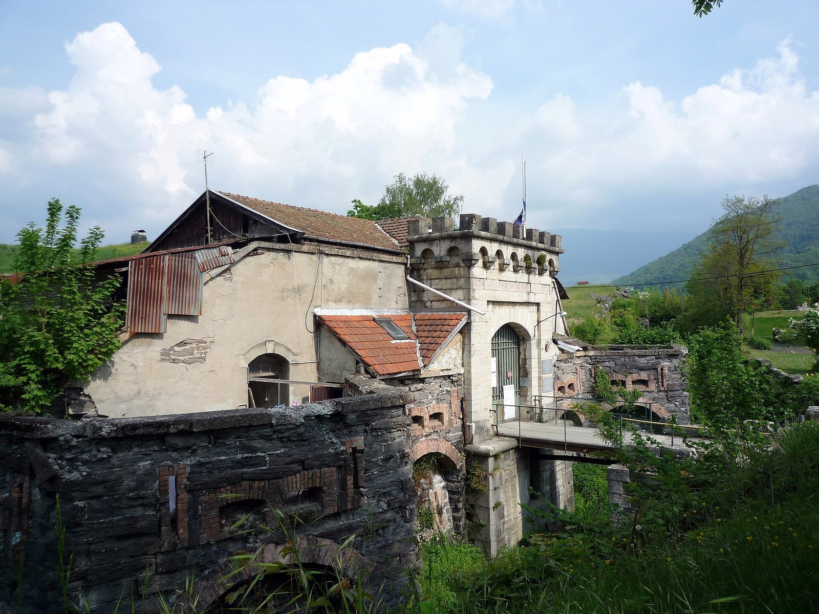
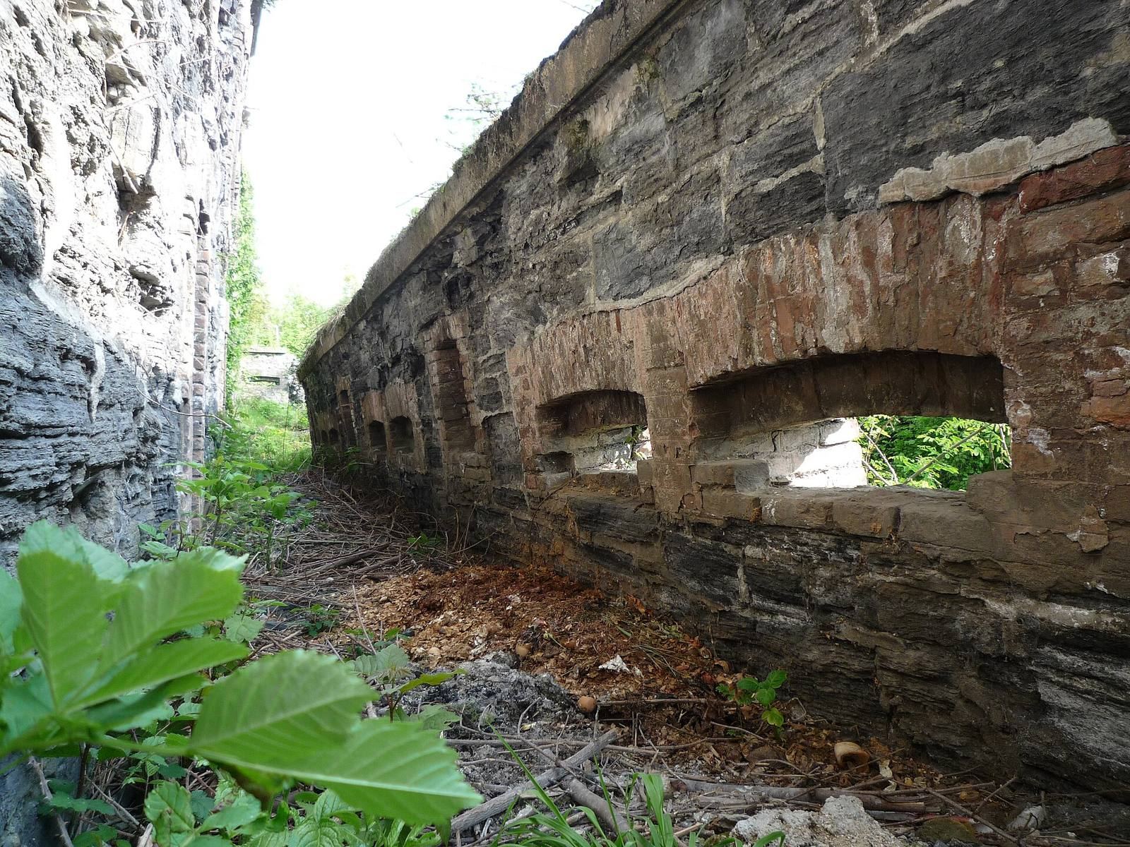
A dry defensive ditch is faced on its outer side with masonry. Two double caponiers, protected works designed to fire along a ditch, cover the ditches at the front of the fort. Two smaller flanking works beside the entrance form a short defensive wall across the rear side. The entrance is marked by a decorative pediment with crenellations.
Glacis and gun access
The glacis, the sloping ground outside a fortification, includes two circular anti-aircraft positions at projecting angle II and four circular positions for 75 mm anti-aircraft guns. Infantry parapets follow the caponiers at angles II and IV, about 15 metres in front of the ditch’s outer wall; angle III is recessed. A stair with a turn between angles II and III leads to the parapets, and a separate staircase reaches the first floor. A reconstructed cannon and ventilation openings above the fort are also present. Part of the ditch wall on the northwest side collapsed in 2015.
Courtyard and artillery platform
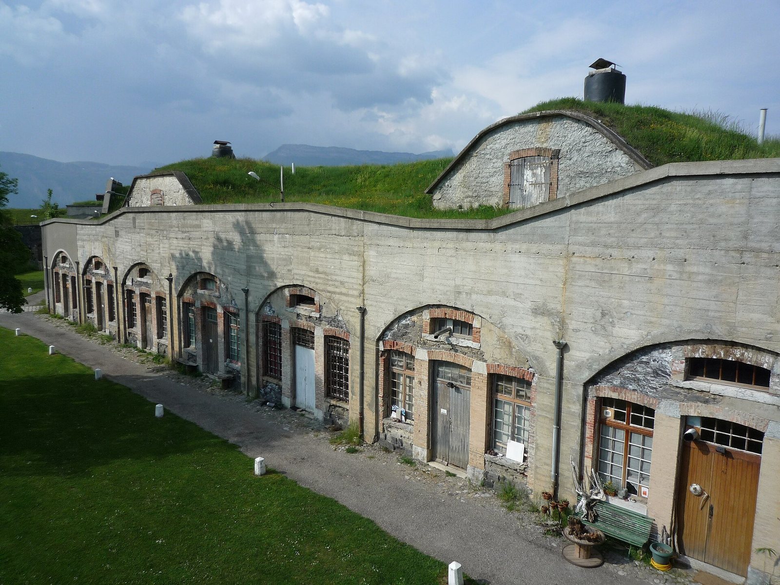
The courtyard follows the outline of the fort’s front and has two single-storey wings, each with seven bays. Above it, the raised artillery platform has four shelter traverses, protective banks with interior shelter. These hollow works also gave lateral cover to guns fired over the parapets. Metal lanterns remain in the platform’s light wells.
Interior facilities
Powder and cartridge stores
Two powder magazines on the right side of the courtyard consist of adjoining chambers, divided for part of their length by a thick pier and reached through a shared side entrance. Their ceilings are formed by segmental arches, shallow arches shaped from part of a circle, and unusually high openings served the lamps. The magazines sit on either side of the barrack accommodation and directly adjoin a sleeping room. Together they held 154.8 tonnes of black powder. A separate cartridge store had capacity for 1,088,600 cartridges.
Accommodation and water
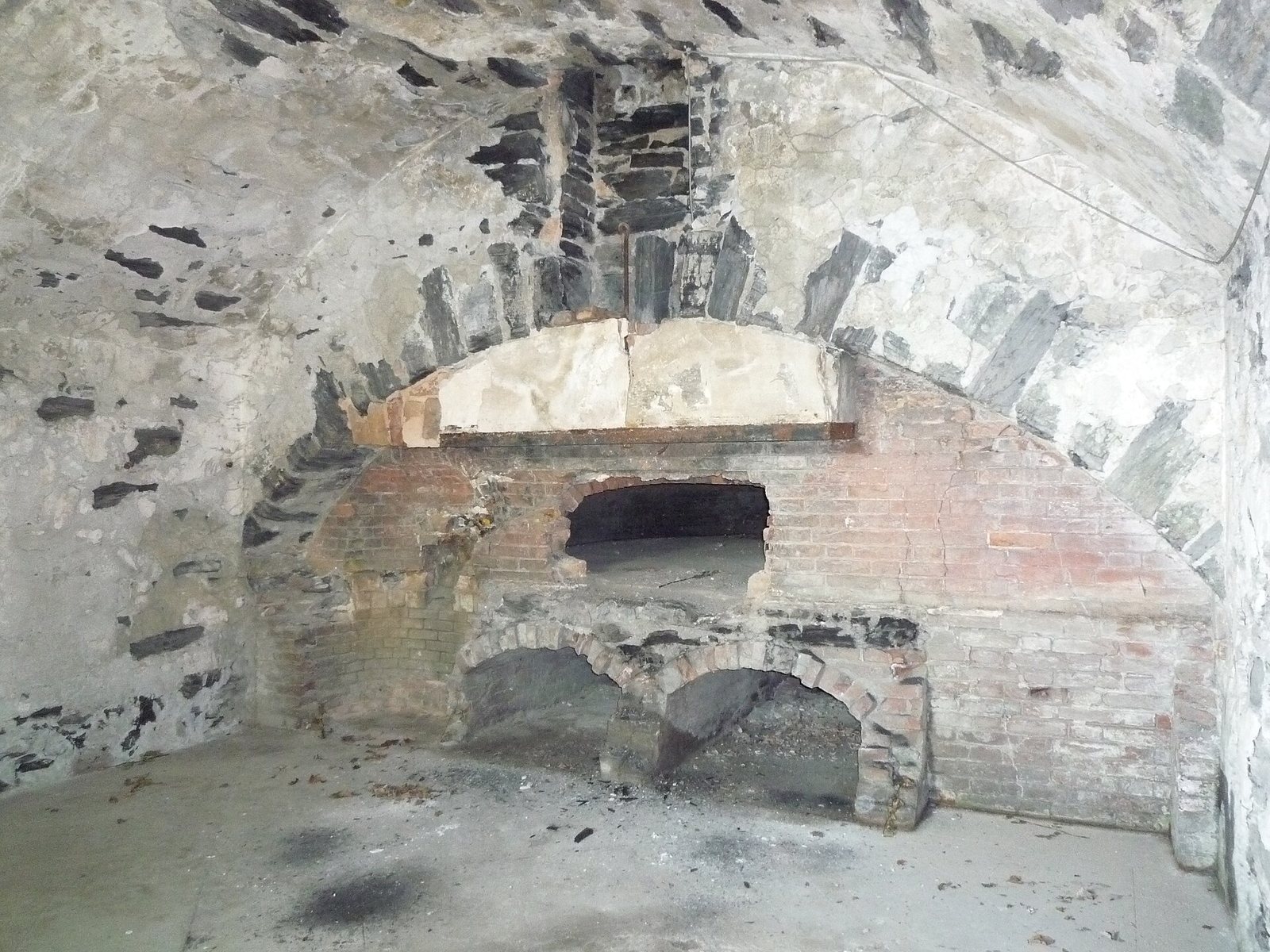
The officers’ quarters face the rear ditch at projecting angle V. A fixed bread oven could provide 380 daily rations, while a portable Laspinasse oven could bake 180 loaves a day in the event of mobilization. The infirmary had 30 beds. A cistern held 270 cubic metres of water; springs were located in the lower battery and in the hamlet of Les Mûriens.
Armament
The 1879 armament comprised ten 138 mm Model 1873-74 guns, four additional 138 mm guns, four 150 mm smoothbore mortars and four 220 mm smoothbore mortars. In 1884 it included ten 138 mm guns, two 150 mm mortars, four 220 mm mortars and four 120 mm L Model 1878 guns. By 1890, the 138 mm guns numbered twelve, alongside two 150 mm mortars, four 220 mm mortars and four 120 mm L Model 1878 guns. The 1913 and 1914 armaments each comprised two 150 mm mortars, four 220 mm mortars, a machine-gun detachment, four 120 mm L Model 1878 guns and twelve 95 mm Lahitolle guns.
Detached batteries
The detached batteries lie several hundred metres south of the fort, on heights of 557 and 573 metres above sea level. They are now within the commune of Saint-Martin-d’Hères. Their masonry structures remain fairly visible in woodland.
Lower battery
The lower battery, at 557 metres, included a shelter traverse, a platform for two guns, a small solid traverse, a second double platform and a larger solid traverse. A traverse is a protective bank placed between gun positions; the shelter traverse also provided covered space.
Upper battery
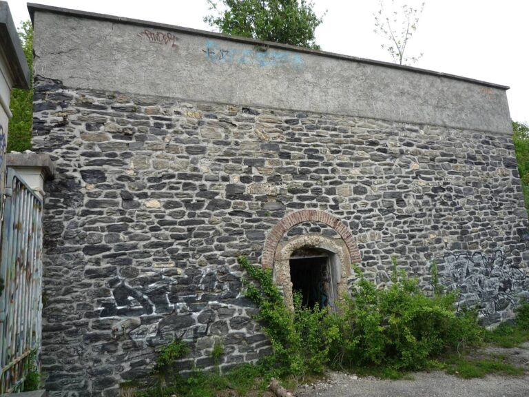
The upper battery, at 573 metres and about 150 metres south of the lower one, had four platforms and eight gun positions. Its traverses included three masonry shelters with barrel-vaulted interiors covered by earth; the central shelter was larger. Solid traverses separated gun positions. Some shelter façades are now pulling away from the main structures, and graffiti is present.