Etowah Indian Mounds: A Mississippian Ceremonial and Political Center in Georgia
Site at a Glance
- Rating
- 4.7
- Popularity
- Medium
- Country
- United States
- Primary era
- Medieval
- External website
- Open
- Eras represented
- Classical, Medieval, Early Modern
- Civilizations
- Unclassified
- Site type
- City
On this page14 sections
History
Early occupation and the first mounds
Etowah Indian Mounds is a 54-acre South Appalachian Mississippian archaeological site on the north bank of the Etowah River near Cartersville, Georgia, in the United States. Indigenous communities built and occupied it during three principal phases, approximately 1000–1200, 1250–1375, and 1375–1550 CE. Its greatest political power came around 1325–1375 CE, when the settlement had become the central place of a complex chiefdom in the Etowah River Valley.
An earlier Middle Woodland occupation, dating approximately from 200 BCE to 600 CE, is represented by pottery associated with the Swift Creek culture. This settlement may have been connected with Leake Mounds, a Swift Creek center about two miles downstream. Centuries later, Etowah developed within the South Appalachian form of the wider Mississippian tradition, a network of Indigenous societies known for farming, ranked communities, platform mounds, ceremonial plazas, and centralized political leadership. The people who occupied Etowah are considered ancestral to the historic Muskogean-speaking Muscogee, or Creek, peoples.
During the Early Etowah Phase, around 1000–1100 CE, the community’s first platform mound was raised at the center of the settlement. A platform mound is an earthen structure with a flattened summit for important buildings, ceremonies, or elite residences. Mound A continued in use during the Late Etowah Phase, approximately 1100–1200 CE, while construction of Mound B began. Several centers along the river may then have been independent chiefdoms rather than parts of one unified polity.
Political expansion and the Wilbanks phases
Around 1200 CE, the three chiefdoms in the Etowah River Valley declined, apparently after populations dispersed. Etowah emerged again as a political center around 1250 CE during the Early Wilbanks Phase, approximately 1250–1325 CE. Mounds A and B were enlarged, and construction of Mound C began. Single-mound settlements also appeared near Etowah, including locations south of the river, to the east, and to the northwest. Their distribution indicates the growth of a more complex chiefdom centered on Etowah and exercising influence across the valley.
During the Late Wilbanks Phase, approximately 1325–1375 CE, the principal mounds reached their final major forms. The ceremonial plaza and defensive system were established, and elite burials with rich grave goods were placed in Mound C. Other mound centers appeared as far as approximately 70 kilometers east and west of Etowah and may have belonged to its sphere of influence. Successive, shifting chiefdoms occupied the settlement during this period, probably including political groups associated with the Coosa network.
Destruction, reoccupation, and changing identities
By the late fourteenth century, Etowah and other mound centers in the region had been abandoned. The defensive palisade had burned, but the cause is uncertain. The fire may have been accidental, deliberately set by inhabitants, or caused by an external attack. Disturbed and broken contents in Burial 15 of Mound C have been interpreted as possible evidence of violent destruction and the collapse of the ruling lineage, although that interpretation remains circumstantial.
Etowah was reoccupied as a single chiefdom during the Brewster Phase, approximately 1475–1550 CE. Mounds D, E, and F were constructed, and Mound B was reused. The settlement may then have exercised authority across the Etowah and western Oostanaula river valleys. Etowah may also have been the town called Itaba, visited by Hernando de Soto’s expedition in 1540, although the identification is uncertain. The expedition’s chroniclers did not mention large mounds, which may have been overgrown or poorly maintained at the time.
The name Etowah derives from the archaic Muscogee place name Italwa, probably associated originally with the solar-cross symbol and meaning “town” in modern Muskogee. The similar name Itaba has been interpreted in the Alabama language as “boundary” or “trail crossing.” In the nineteenth century, European-American settlers wrongly attributed the mounds to the historic Cherokee. Archaeological evidence places their construction centuries before the Cherokee reached this part of Georgia in the late eighteenth century. The historic Muscogee Creek later occupied the region, while many Creek communities were removed to Indian Territory during the 1830s. The Muscogee (Creek) Nation of Oklahoma and the Poarch Band of Creek Indians of Alabama regard Italwa, or Etowah, as their most important ancestral town. The Cherokee also regard the site as sacred.
Investigation and preservation
Missionary Elias Cornelius visited Etowah in 1817 and described it in a journal published in 1833. Cyrus Thomas and John P. Rogan tested the site in 1883 for the Smithsonian Institution, and Rogan’s work at Mound C in 1884 uncovered eleven burials and two raised-design copper plates later called the Logan Plates.
Warren K. Moorehead carried out the first well-documented archaeological investigation during the winter of 1925 and continued through 1927 or 1928. His excavations in Mound C exposed numerous Mississippian burials and richly furnished grave goods, advancing the study of pre-contact Native American art and helping define the Southeastern Ceremonial Complex, an interconnected tradition of religious imagery, ritual objects, and ceremonial themes found across many Mississippian societies.
Arthur R. Kelly, the founding chairman of the University of Georgia’s Department of Anthropology, also excavated and researched Etowah before regional flood-control projects, including the construction of Allatoona Dam upstream in 1947. Lewis H. Larson Jr. conducted more systematic investigations for the Georgia Historical Society from 1954 to 1967. Although earlier excavations had disturbed parts of Mound C, Larson located previously undisturbed areas, recorded 244 additional burials, documented extensive grave goods, and established that the mound had been built in several major stages.
Research has continued through radiocarbon dating, magnetometry, and other methods. Magnetometer mapping from 2005 to 2008 showed that the settlement was more complex than previously understood and identified 140 buildings. Etowah became a U.S. National Historic Landmark in 1964 and was added to the National Register of Historic Places in 1966. The Georgia Department of Natural Resources manages the historic site. In 2022, many funeral-related artifacts were repatriated to the Muscogee Creek Nation under the Native American Graves Protection and Repatriation Act.
Remains
Etowah’s surviving layout centers on six principal mounds, a raised ceremonial plaza, and a large ditch and palisade system. Three major platform mounds, A through C, occupy the central area, while the smaller rectangular Mounds D through F belong to the later Brewster Phase. Excavated borrow pits around the settlement mark places where earth was removed to build the large central mounds; they were once interpreted as moats.
Platform and burial mounds
Mound A
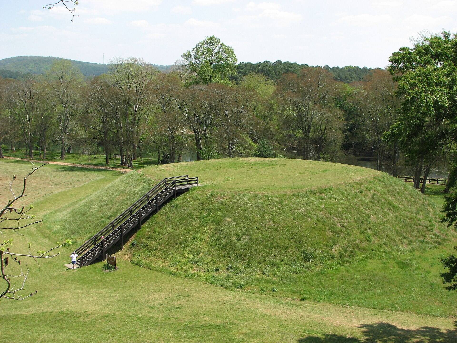
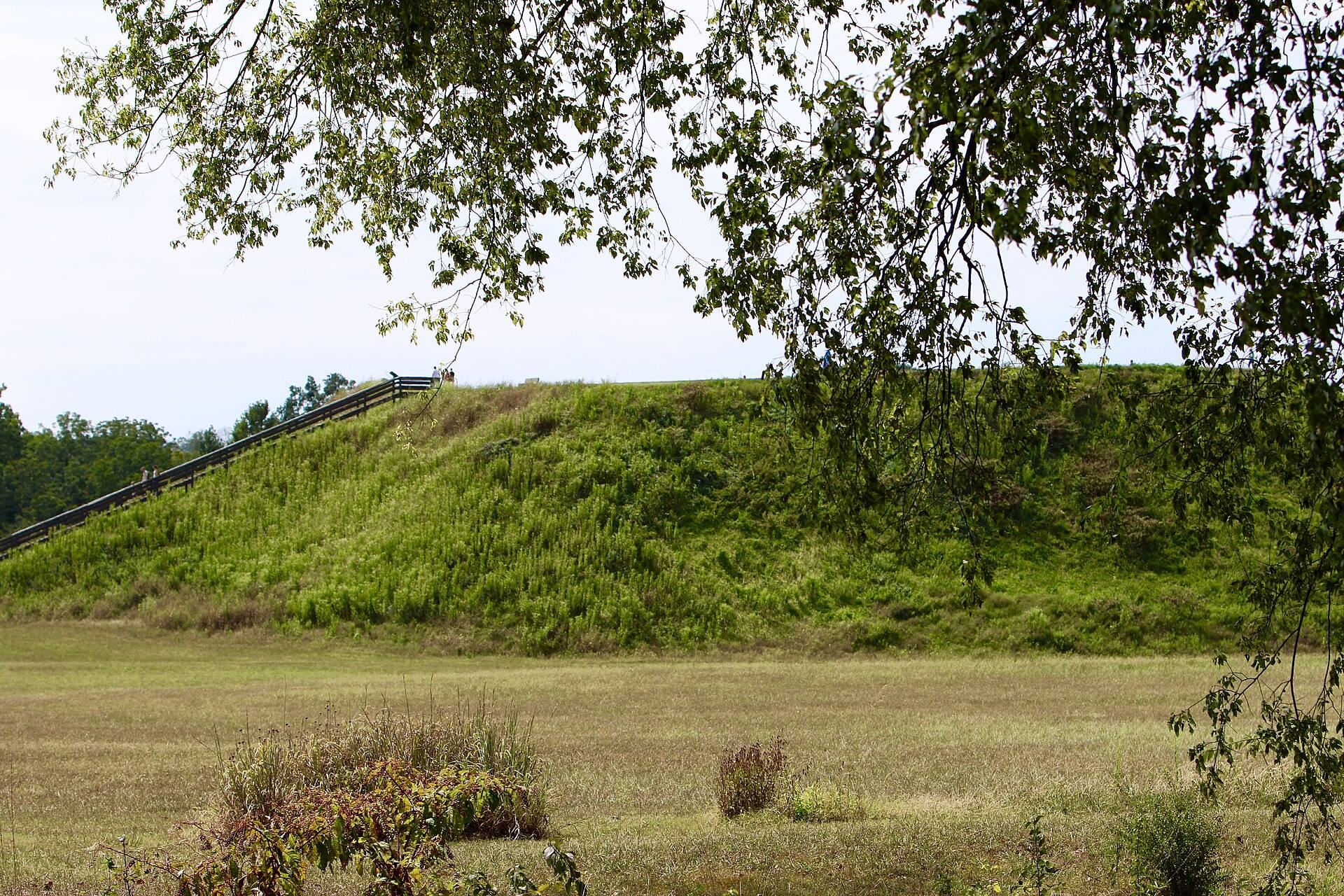
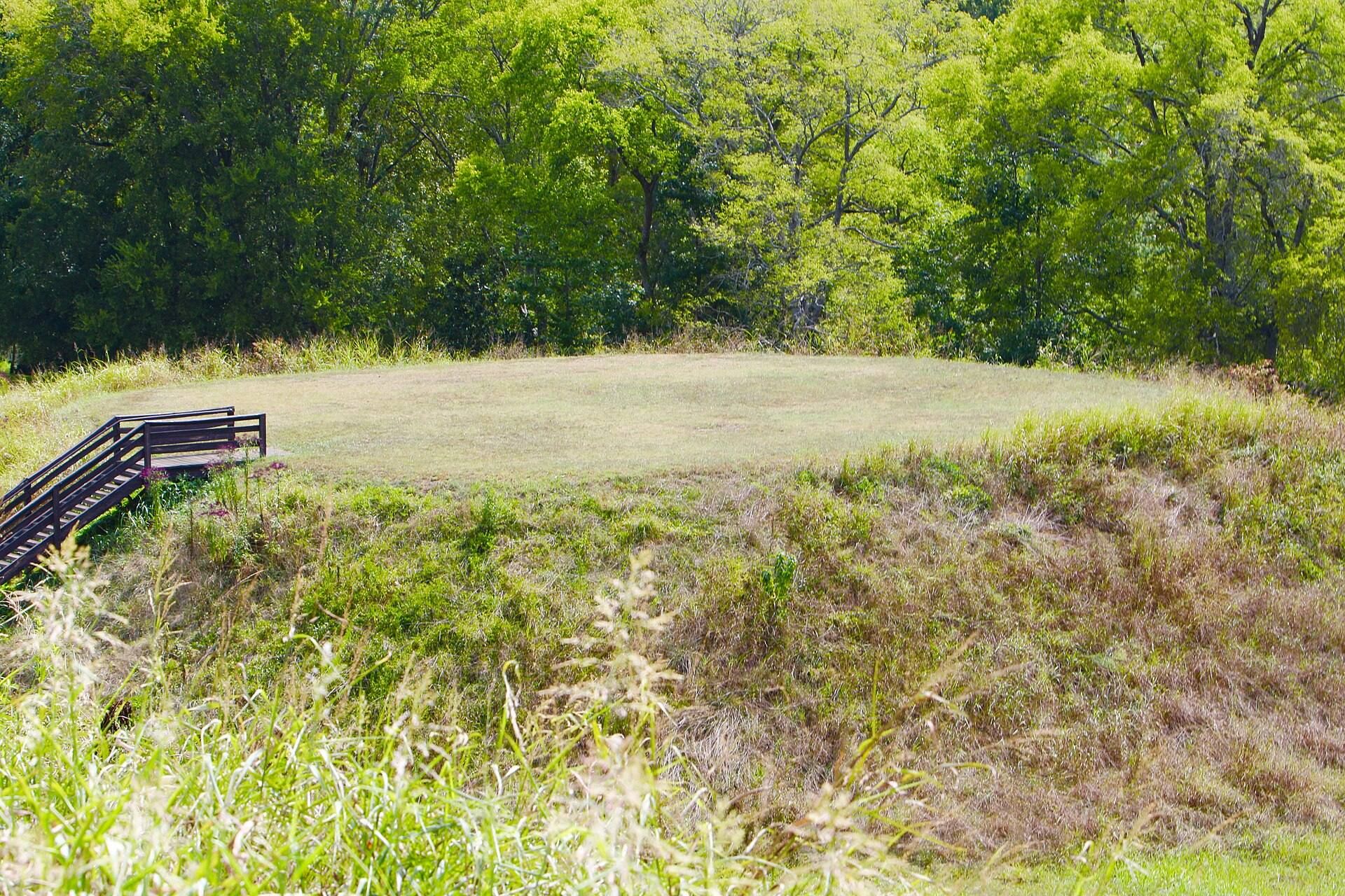
Mound A, also called the Temple Mound, rises approximately 63 feet, or 19 meters, and covers about 3 acres, or 12,000 square meters, at its base. An eastern access route or ramp projects toward the summit, while a lower terrace-like structure extends along the southern side. At the community’s height, the summit supported four major structures and a courtyard. Magnetometer investigations identified temples or other buildings made from logs and thatch.
Mound B
Mound B is approximately 25 feet, or 7.6 meters, high. It was enlarged during the Early Wilbanks Phase and later reused during the Brewster Phase, linking its physical form to more than one period of occupation.
Mound C
Mound C rises approximately 10 feet, or 3 meters, and is the only mound reported as completely excavated. It served as an elite burial mound and was built in several major stages. Defensive walls or ditches accompanied successive construction stages. Early burials lay near the summit, while later construction included substantial graves along the northern base, with northern projections added during at least two stages. The graves included simple pits, stone-lined graves, and log-lined graves.
Mounds D, E, and F
Mounds D, E, and F are rectangular and approximately 3 meters high. They were constructed during the Brewster Phase. Mound F has not been investigated as extensively as the other mounds.
Plaza and defensive works
A raised, level ceremonial plaza lies beside the mounds. It was used for ceremonies, stickball, chunkey games, and the exchange of trade goods. Chunkey was a Southeastern game involving a rolling stone or disk and the movement of spears or poles in relation to it. During the Late Wilbanks Phase, a low stone wall bounded the plaza and its surface was paved.
A semicircular ditch, or ring-ditch system, enclosed approximately 22 hectares around the ceremonial center. Two pond-like projections extended from the ditch and may have served as landing places for boats, although this function is uncertain. The ditch reached approximately 9–10 feet, or 2.7–3 meters, in depth. It hindered direct access to the palisade and also helped drain the area during major floods.
An inner palisade levee and archer towers formed the principal defensive system. Upright logs approximately 12 feet, or 3.7 meters, high were set in a trench at intervals of about 12 inches, or 300 millimeters, then backfilled to create the palisade and levee. Guard towers stood approximately 80 feet, or 24 meters, apart. An outer belt of nut trees helped obstruct attacks using masses of flaming arrows.
Burials, sculpture, and ceremonial objects
Mound C produced copper tools, weapons, ornamental plates, stone blades, stone axes, crown fragments, shell gorgets, and brightly colored textiles with elaborate patterns. A shell gorget is a polished, often carved shell pendant worn on the chest or throat. Copper placed against the textiles helped preserve some fibers. Designs on the gorgets include Hightower-style compositions, turkey themes, geometric forms, triskelion-like spirals, crosses, and human figures. Their distribution among burial groups indicates several distinct elite or kin-based groups rather than one simple extended-family hierarchy.
Etowah’s artifacts include Birdman, hand-in-eye, solar-cross, and other motifs associated with the Southeastern Ceremonial Complex. The Logan Plates are raised-design copper plates made using repoussé, a technique that creates decoration by hammering metal from the reverse side, and they bear Birdman imagery.
Excavations around the site recovered numerous clay figurines and ten Mississippian stone statues. Many paired statues show a cross-legged man and a kneeling woman. The figures have elaborate hairstyles, the women wear wraparound skirts, and the men are generally shown without visible clothing. These pairs have been interpreted as lineage ancestors. Individual kneeling female statues display sexual characteristics not present in the paired figures and have been interpreted as fertility or Earth Mother figures, although that interpretation is uncertain.
Burial 15 contained two painted marble figures, one cross-legged male and one kneeling female, together with four other statues that had been smashed and scattered among grave goods. The figures have been interpreted as ancestors of the chiefdom or founders of its ruling lineage, but that interpretation remains uncertain. The site museum has displayed pottery, stone axes, statuary, copper jewelry, shell gorgets, and other excavated materials, while many funeral-related objects were later repatriated.
River landscape and material resources
The fertile floodplain of the Etowah River supported the cultivation of corn, beans, and squash. River cane supplied arrow shafts, thatching, baskets, benches, and mats for walls and floors. More than 100 V-shaped rock fish weirs have been identified along the river. These structures channeled or trapped catfish, freshwater drum, and gar in river-cane baskets, and one weir has been restored within the historic site.
Trade and tribute brought Gulf of Mexico whelk shells, while copper, mica, and flint came from the Cumberland Plateau. Galena, graphite, ochers, greenstone, and marble came from the Piedmont. These materials served in tools, weapons, pigments, buildings, body painting, artwork, and ritual objects. The surrounding environment also provided chestnuts, walnuts, hickory nuts, persimmons, stinging nettle, red mulberry, white-tailed deer, wild turkey, and smaller game. Leaves and stems of a native holly were brewed into Black Drink, a strongly caffeinated beverage used in ritual purification and ceremonial contexts.