El Infiernito: A Pre-Columbian Archaeoastronomical Site in Colombia
Site at a Glance
- Rating
- 4.3
- Popularity
- Low
- Country
- Colombia
- Primary era
- Iron Age
- Eras represented
- Iron Age, Classical
- Civilizations
- Muisca
- Site type
- Religious
- Remains
- Sanctuary
On this page7 sections
History
El Infiernito is a pre-Columbian archaeoastronomical site near Villa de Leyva in Boyacá, Colombia, associated with the Herrera and Muisca cultural periods. Archaeoastronomy examines how past societies observed and incorporated astronomical phenomena into sites and cultural practices. The site formed part of the pre-Muisca archaeological landscape and was later associated with the Muisca Confederation, a network of organized chiefdoms rather than a centralized state. It served as a setting for religious ceremonies, spiritual purification rites, and astronomical observation.
Herrera and Muisca Periods
The site lies on the Altiplano Cundiboyacense, where the Herrera period preceded the later Muisca period. Its ritual use included ceremonies and purification practices, while its stone arrangements were connected with observations of the Sun. The surrounding region belonged to the wider world of the Muisca, an Indigenous society whose political and religious communities occupied much of the Colombian highlands before and during the Spanish conquest.
Spanish conquistadors gave the place the name El Infiernito, meaning “The Little Hell,” because they viewed it as diabolical and associated it with pagan worship. The name was already in use before the site was identified archaeologically.
Nineteenth-Century Descriptions
In 1847, Colombian army geographer Joaquin Acosta described 25 stone columns, some partly buried in the Monquirá Valley. Alexander von Humboldt later examined the remains and proposed that their alignments could help anticipate astronomical events, including solstices and equinoxes. Acosta also described a central column in 1850 that was apparently used to measure the Sun’s position during the equinoxes.
Archaeological Investigation
Radiocarbon dates from charcoal in three archaeological layers indicate early habitation in the Altiplano Cundiboyacense. The reported results are 2,490 ± 195 years before present for El Infiernito No. 2, 2,180 ± 140 years before present for El Infiernito No. 1, and 2,880 ± 95 years before present for El Infiernito No. 2. In radiocarbon dating, “before present” uses AD 1950 as its conventional reference point.
Anthropologist Eliécer Silva Celis directed the first formal archaeological excavations in 1981, after which the site was declared an archaeological park. Grave robbery had severely disturbed the burial mounds and dispersed human remains. Archaeoastronomer Juan Morales later made a more detailed study of the stone arrangements. He found that the principal columns have an azimuth, or horizontal direction measured in degrees from north, of 91 degrees toward the summit of Morro Negro. This direction indicates the equinoctial sunrise, while the alignment toward Lake Iguaque has been interpreted in relation to the sunrise at the summer solstice.
Remains
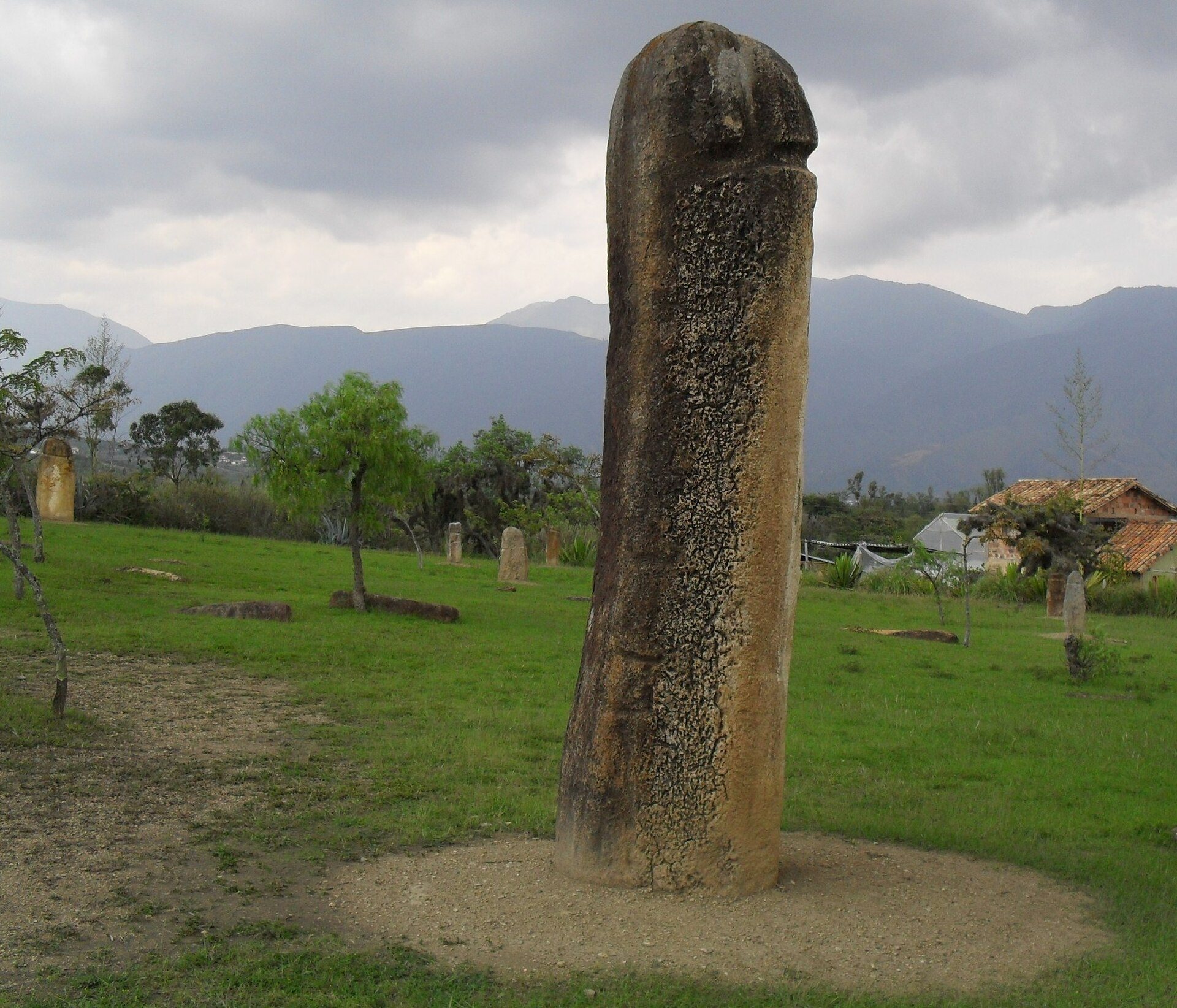
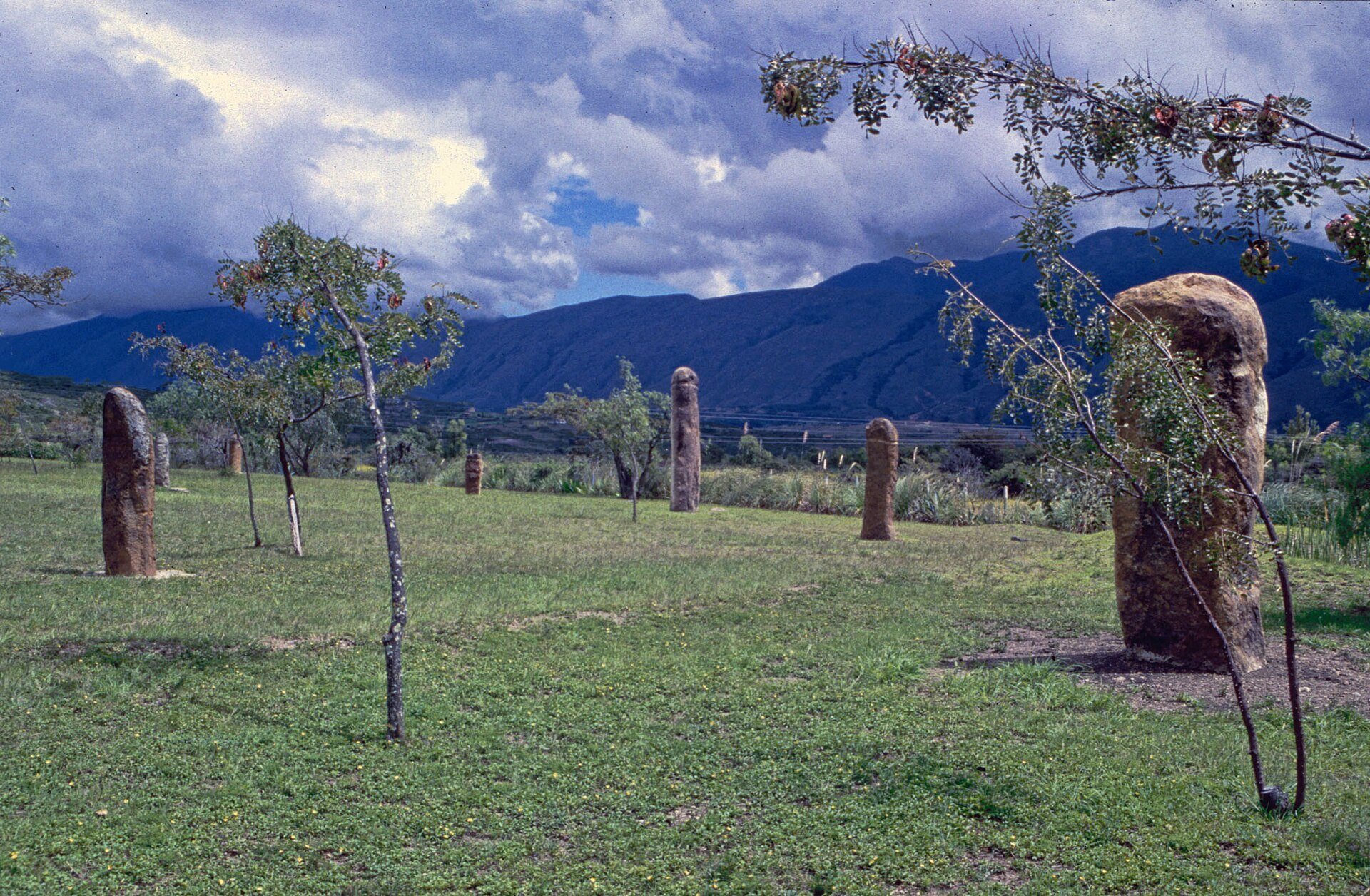
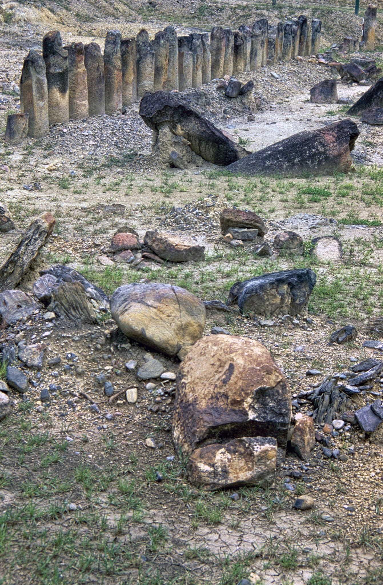
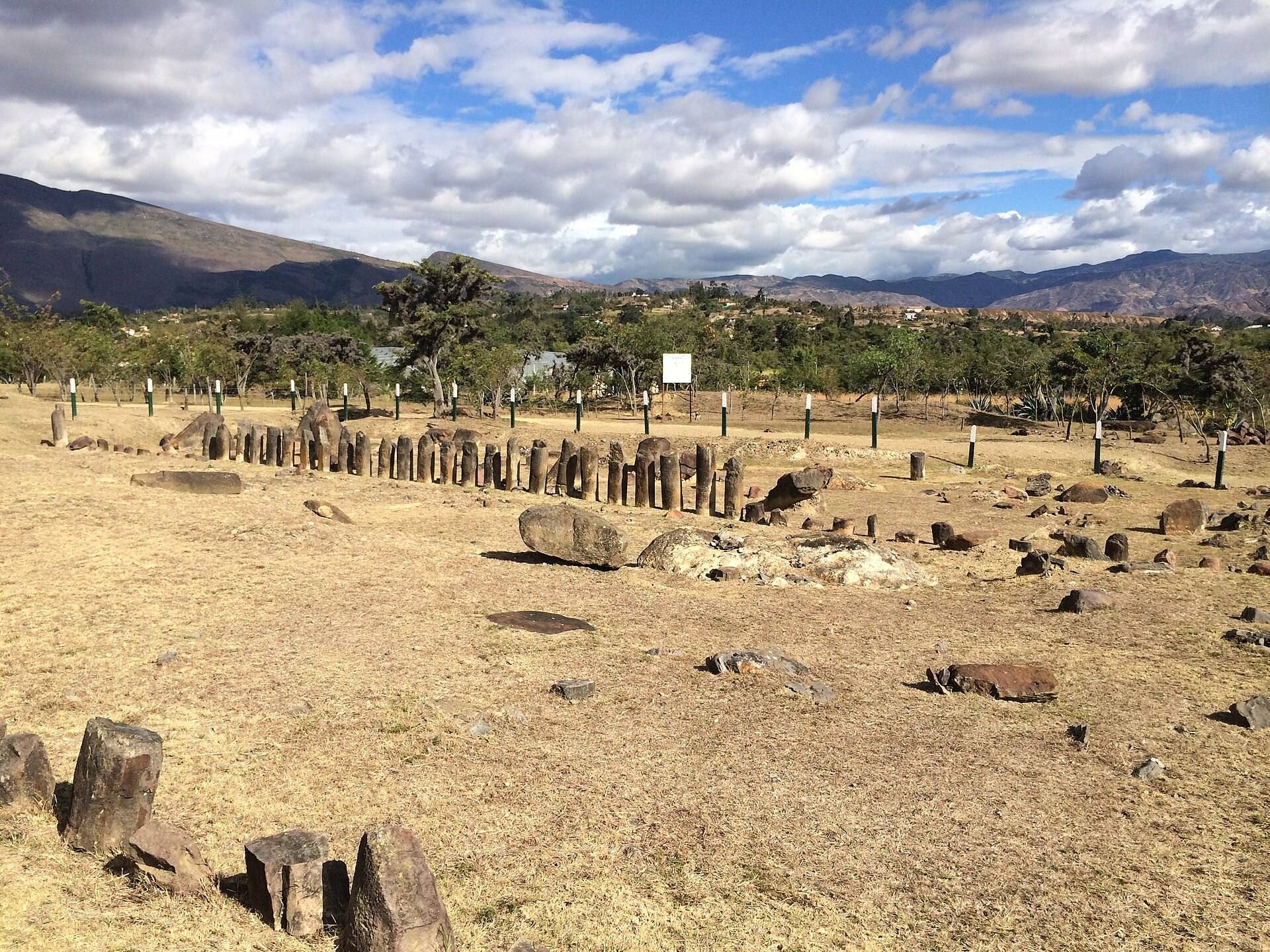
El Infiernito consists of earthworks surrounding upright stones, or menhirs, together with burial mounds. A menhir is a large upright stone erected as a marker or monument. The monoliths are made from pink sandstone, and many have column-like forms with an incised ring. The site is divided into two principal areas by two east-west stone rows: the northern sacred field, called Infiernito No. 1, and the southern sacred field, called Infiernito No. 2. Together, the rows contain 109 excavated monoliths, with 54 in the north and 55 in the south. Their arrangement has been interpreted as a Muisca calendar.
Stone Fields and Alignments
The northern and southern rows organize the principal stone landscape into two sacred fields. Their east-west orientation provides the physical basis for interpretations connecting the site with solar events. In the southern field, a large monolith was surrounded by burned carved rocks and stone flakes in the third stratigraphic level, along with the remains of a large bonfire.
Burials and Ritual Deposits
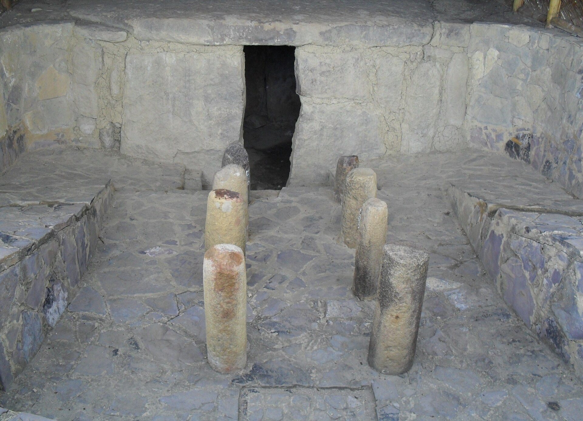
The site also contains burial mounds, a dolmen tomb, isolated phallic figures, and a phallic megalith. The burial mounds were heavily disturbed by grave robbery, and human remains became dispersed. The central column described in the nineteenth century, approximately 5 metres high, is missing.
The archaeological layers preserve material associated with successive activities. The earliest contains animal remains, plant ash, red ochre, incense, and resins. The second contains mainly remains of maize offerings. The third includes the burned carved rocks, lithic flakes, and large-bonfire remains found around the monolith in the southern sacred field.