Derbent Fortress: A Sasanian Defensive Stronghold in Russia
Site at a Glance
- Rating
- 4.9
- Popularity
- Low
- Country
- Russia
- Primary era
- Medieval
- External website
- Open
- Eras represented
- Medieval
- Civilizations
- Sassanid
- Site type
- Military
- Remains
- Citadel
On this page10 sections
History
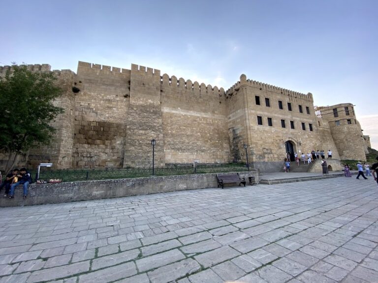
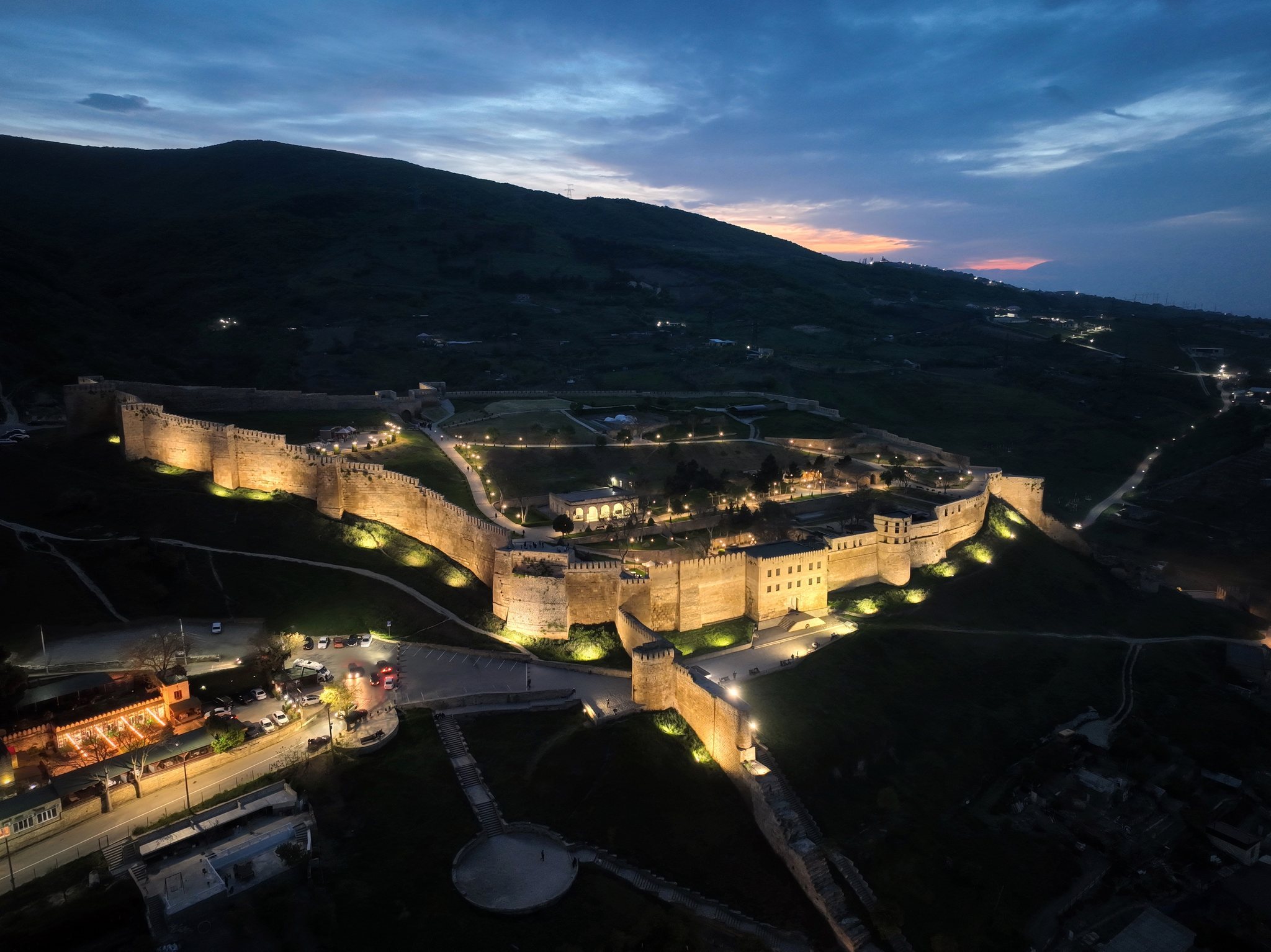
Derbent Fortress in Russia, in the city of Derbent in the Republic of Dagestan, is a sixth-century Sasanian defensive complex built after AD 562 on the orders of Khosrow I Anushirvan. It formed the eastern section of the Caucasus Wall, a system intended to protect the Caucasus and Western Asia from nomadic invasions approaching along the Caspian coast.
Early references and Sasanian construction
The passage at Derbent was known in antiquity as the Caspian or Albanian Gates. Hecataeus of Miletus, an early Greek geographer, mentioned the gates in the sixth century BC, while Herodotus connected the region with Scythian campaigns in Asia during the late eighth or early seventh century BC. These references place Derbent within a long-established route between the Caspian shore and the Caucasus mountains.
The surviving fortress belongs to the Sasanian period. The Sasanian Empire was the Persian imperial state that ruled Iran and neighbouring regions from the third to the seventh century. Khosrow I, a sixth-century Sasanian shah, ordered major defensive works along the northern frontier, including Derbent’s citadel, walls, and associated barriers. The construction placed a heavy burden on the local Caucasian population, as later described by Moses of Kalankatuy.
The fortifications controlled an approximately 3-kilometre passage between the Caspian Sea and the mountains. This position made Derbent the key point for movement through the coastal corridor. Attempts by neighbouring states to expand through the region generally began with efforts to capture the city and its fortress.
Arab administration and medieval rule
From AD 735, Derbent and Naryn-Kala became the military and administrative centre of the Arab Caliphate in Dagestan. The Arab Caliphate was an expanding Islamic imperial polity that administered Derbent and much of Dagestan from the eighth century. The city also functioned as a major commercial port and as a centre for the spread of Islam in the region.
In the fourteenth century, Derbent Fortress surrendered to Timur without resistance. Timur, also known as Tamerlane, was a Central Asian conqueror who founded the Timurid Empire. He later fought Tokhtamysh, a ruler of the Golden Horde, near Nizhny Dzhulat. These events placed Derbent within the conflicts that shaped political power across the wider Caucasus and steppe regions.
Russian control and the loss of military importance
During the Russian advance into the Caspian region, Derbent became part of the Russian Empire. Peter the Great went from a local dugout to the khan’s palace, where the bey of Derbent presented him with the city’s keys on a silver dish covered with Persian brocade. The inscription on the dish invoked the legendary foundation of Derbent by Alexander the Great and presented the transfer of the city to another great ruler as historically justified. Alexander is not recorded as having reached the Derbent Gates, so the association belongs to the fortress’s later legend rather than to a documented campaign.
During the Russo-Persian War of 1796, Russian forces under General Valerian Zubov regained control of the fortress. Zubov, who commanded the campaign, established his general headquarters there. Derbent’s military role later declined. After the Dagestan Oblast was established in 1860, its administrative centre moved to Temir-Khan-Shura, now Buynaksk. The fortress was removed from the military-department register in 1867, and its towers gradually deteriorated. Local residents dismantled some of them for building materials.
In 1870, General Komarov ordered the demolition of approximately 500 metres of fortifications to improve communication between the fortress and the part of Derbent that had expanded beyond the southern wall. Repeated rebuilding and modernization under successive rulers nevertheless left the complex with physical evidence of several historical periods. Derbent’s fortifications are now a federal cultural-heritage site of Russia and form part of the UNESCO World Heritage property comprising the citadel, old town, and fortifications of Derbent.
Remains
The integrated defensive system
Derbent’s defenses were organized as a connected system of a western citadel, city walls, two parallel sea walls, and the mountain barrier called Dag-bary, meaning “Mountain Wall.” The city walls joined Naryn-Kala on the west, while the sea walls continued eastward toward the Caspian. The medieval city lay between the two coastal walls, which stood approximately 350 to 450 metres apart.
Naryn-Kala citadel
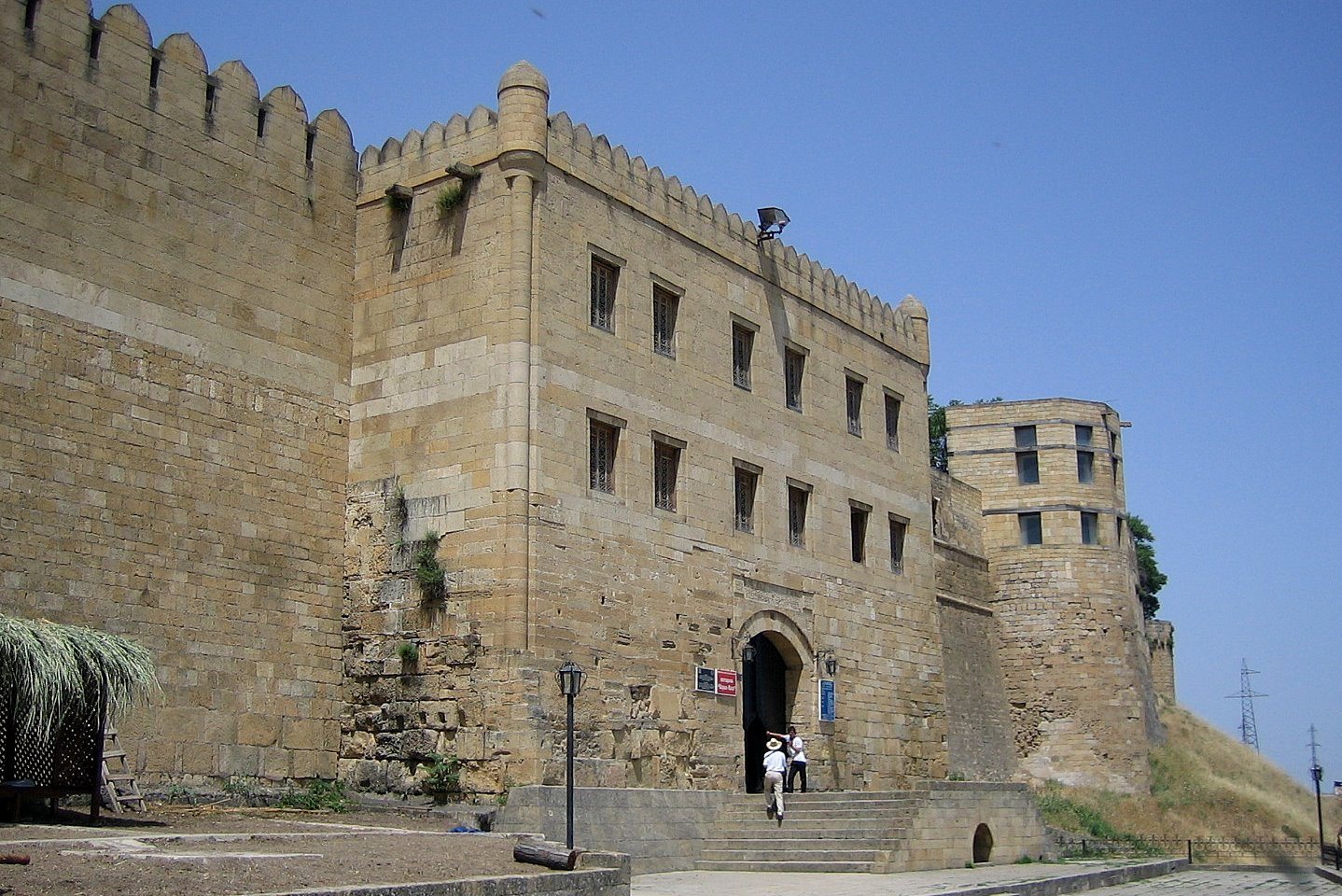
Naryn-Kala, the elevated western core of the defensive system, extends for approximately 700 metres. Its walls were built from Upper Sarmatian limestone with rubble infill bonded in mortar. Surviving sections range from about 6.5 to 20 metres in height and reach up to 3.5 metres in thickness. Adam Olearius, a seventeenth-century Holstein diplomat and traveller, described the walls as broad enough for a cart to pass along them.
City and sea walls
The city walls connected the citadel with the coastal defenses and enclosed the urban passage between the mountains and the sea. The two sea walls blocked movement along the shore and prevented attackers from bypassing the fortress through shallow water. Their eastern ends formed a harbour for ships. The Caspian Sea fell at the end of the sixth century, and the walls were extended farther into the sea as a result.
Dag-bary mountain wall
Dag-bary extended from the Derbent fortifications into the Caucasus toward Tabasaran. Its defenses included walls, towers, gates, and protected settlements placed at strategically important locations. The mountain barrier controlled routes through the highlands and extended approximately 40 kilometres into the mountains. Adam Olearius gave its length as nearly 100 kilometres, reflecting the scale attributed to the wider defensive line.
Survival, damage, and historical associations
The fortifications survive in uneven condition and are partly ruined. A historical description records dressed stone slabs on the northern side and numerous surviving battlements. Tree roots, rain, and vegetation damaged parts of the walls, while some sections disappeared beneath plant growth before later re-emerging.
During the Arab period, the northern wall was known, and still remained known in the nineteenth century, as the Wall of the Infidels because it faced toward the Khazar lands. The complex was also sometimes called the Wall of Alexander. That name derived from the legend that Alexander the Great had built the defenses, although the historical record does not place him at the Derbent Gates.