Clausura Bir Oum Ali: A Roman Frontier Barrier in Tunisia
Site at a Glance
- Rating
- 4.8
- Popularity
- Very Low
- Country
- Tunisia
- Primary era
- Classical
- Eras represented
- Classical
- Civilizations
- Roman
- Site type
- Military
- Remains
- Wall
On this page6 sections
History
Clausura Bir Oum Ali is a Roman Principate-period barrier at C103 in Tunisia, built probably in the early second century to control movement through a natural pass. The Principate was the Roman imperial system in which emperors retained the outward forms of the earlier republic. The installation formed part of the Limes Numidiae, a frontier system of barriers and military stations that enclosed the southern side of the Roman province of Africa Proconsularis. Bir Oum Ali is regarded as the beginning of this frontier, which continued southeastward from the opposite end of the Schott Fedjedj as the Limes Tripolitanus.
A Roman frontier installation
Roman soldiers placed the barrier along the northern edge of the Schott Fedjedj, a sedimentary basin in what is now northern Kebili Governorate. It controlled the passage formed by the Wadi Oum Ali through the Djebel Oum Ali, together with the adjoining heights. Alongside Bir Oum Ali and other controlled positions around the basin, the installation enabled Roman forces to supervise movement across this extensive landscape.
The exact construction date remains uncertain. Evidence points to a possible early second-century origin, while pottery collected near the gatehouse includes a rim sherd dated to the second or third century. The barrier was associated with an ancient road that approached through the wadi from the southwest before climbing the western side of the valley.
Rediscovery and changing interpretations
The Roman valley barrier became known to modern researchers at the end of the nineteenth century. The French officer Paul Goetschy investigated it in 1894 and measured the surviving remains. René Cagnat’s 1892 study of the Roman army in Africa did not yet include the discovery. During a four-year investigation of the Roman frontier in Tunisia that began in 1967, the ancient historian Maurice Euzennat could not undertake detailed work at the site. The British archaeologist David Mattingly later carried out field survey at Bir Oum Ali.
Euzennat considered the barrier’s unusual design evidence of strategic planning unlike that used at the barriers of the Limes Tripolitanus, and suggested that Bir Oum Ali might be older than the Tebaga Clausura, another Roman barrier in that frontier system. Earlier interpretations treated the wall as a fighting position from which the garrison could repel attackers. Mattingly rejected this view because the supposed parapet is too low for that purpose. He instead proposed that the wall passage may have carried rainwater to a cistern during heavy rainfall. He also interpreted the circular structure beside the gatehouse as a possible plaster-lined cistern rather than a tower.
Remains
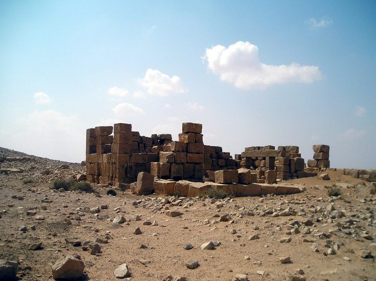
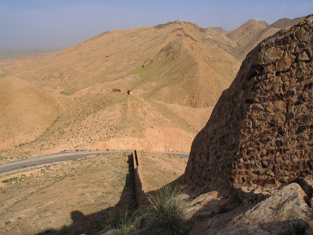
The barrier extends for more than 600 metres from the steep eastern slope of the wadi, across its bed, and up the western heights. Its height varies from about 3.5 to 6 metres, while its average thickness is approximately 1.5 metres. Small stones form carefully laid, mortared outer faces around a core of mortared rubble. The wall is partly very well preserved, although the gatehouse was largely destroyed when a modern road was constructed across the passage.
Wall and possible water channel
At least in the central section, the wall contains an open passage about 0.75 metres wide. Low parapets, each approximately 0.60 metres high, border it on both sides. Sections of the floor and side surfaces retain plaster. Where the western section rises steeply toward the heights, the passage becomes vaulted. The vault has a gable-arched form made from the same masonry, and Goetschy measured it at 1.20 metres high at its apex.
The Wadi Oum Ali crosses the barrier while descending from southwest to northeast. The wall follows the terrain of the Oum Ali ridge, which forms the northern boundary of the Schott Fedjedj along the foothills of the Aurès Mountains and the southern edge of the Djebel Asker. Goetschy described the passage floor as very hard concrete resembling Roman drainage construction and noted irregular channels beside the covered section. These features support Mattingly’s interpretation of the passage as a plastered water channel that may have fed the adjacent cistern.
Gatehouse and ancient road
The gatehouse stood midway up the western slope, at the lowest point of the barrier, where the ancient road passed through the controlled route. It was largely sacrificed to modern road construction. The building probably had two flanking towers, although the surviving evidence does not securely establish this arrangement. Beside the entrance, Goetschy recorded a circular structure. Its surviving description gives inconsistent measurements, including an internal diameter of about four metres and an overall diameter of approximately 2.5 metres. He interpreted it as either a tower or a wellhead, while its plaster lining and position support the possibility that it was a cistern serving the border-guard detachment and travellers using the pass.
The ancient road remains traceable in sections east of the modern route, and one of the two southern ashlar gateway piers survives in place. Ashlar means regularly shaped stone blocks laid in masonry. Pottery found near the gatehouse was sparse and not closely differentiated, but the rim sherd dated to the second or third century provides a chronological indication for activity at the installation.