Citadel of the Hồ Dynasty: A Medieval Capital in Vietnam
Site at a Glance
- Rating
- 4.3
- Popularity
- Medium
- Country
- Vietnam
- Primary era
- Medieval
- Eras represented
- Medieval, Early Modern
- Civilizations
- Unclassified
- Site type
- Military
- Remains
- Citadel
On this page10 sections
History
The Citadel of the Hồ Dynasty is a medieval Vietnamese capital in Vĩnh Tiến, Vietnam, founded by Đại Việt in 1397 during the late fourteenth-century political crisis. Its construction followed the reforms of Hồ Quý Ly, a senior statesman and maternal relative of the king, who moved the capital from Thăng Long, near modern Hanoi, to the Thanh Hóa region. The new citadel embodied military, political, and ritual changes that reshaped the state.
Foundation and the Tây Đô capital
By the 1390s, Đại Việt faced peasant rebellions and attacks from both the north and south. Hồ Quý Ly, appointed first minister in 1395, chose a new capital that was considered more centrally located, relatively secure, and accessible through land routes and navigable rivers. The site between the Ma and Bưởi rivers also suited political ideas that connected government authority with the surrounding landscape.
The relocation formed part of a wider programme that strengthened the army, introduced paper currency, limited Buddhist and Taoist influence, and promoted Confucianism. The citadel became known as Tây Đô, meaning “Western Capital.” It served as the capital under the Trần dynasty from 1398 to 1399 and under the Hồ dynasty from 1400 to 1407.
Conquest and later dynastic struggles
In 1407, the Ming dynasty, the Chinese ruling house, conquered Đại Việt. Independence was restored in 1427 through the Lam Sơn uprising, after which the capital returned to Thăng Long. Archaeological evidence indicates that Tây Đô continued to function, possibly as a political centre, even after it ceased to be the principal capital.
The citadel later became a stronghold of the Lê dynasty during its struggles with the Mạc dynasty. In 1516, Lê forces used it as the base for an attack on the capital. The Mạc captured both the citadel and the capital in 1527, while the Lê recovered the citadel in 1543. During the second half of the sixteenth century, Tây Đô remained the Lê dynasty’s military and cultural stronghold, while the Mạc maintained its centre at Thăng Long.
After the Lê defeated the Mạc and captured the capital in 1591, the citadel was abandoned. The Nguyễn dynasty, which came to power in 1802, later took a strong interest in the site. Its Neo-Confucian principles, a political and ethical tradition based on Confucian statecraft and metaphysical ideas, had influenced the design of Tây Đô. When the Nguyễn established their new capital at Huế, related principles were applied to its construction.
Archaeology and heritage recognition
The inner citadel and its surrounding moat were recognized as a national monument in 1962. Excavations in 2004 and 2008, together with the work of a site management board established in 2007, supported the citadel’s interpretation and its nomination for international recognition. In 2011, UNESCO inscribed the site as a World Heritage cultural site under criteria (ii) and (iv). The inscribed property covers 155.5 hectares and includes the Inner Citadel, a section of the La Thành Outer Wall, and the Nam Giao Altar, with a buffer zone of 5,078.5 hectares.
In February 2026, archaeologists uncovered dozens of rare gold-enamelled terracotta objects behind the central stone dragons. Among them were gilded Bodhi-leaf ornaments decorated with dragons. The finds, approximately 600 years old, helped researchers locate the main hall, or palace area, of the former Tây Đô Citadel more precisely.
Remains
The World Heritage property is arranged in three spatial components: the Inner Citadel, the La Thành Outer Wall, and the Nam Giao Altar. The site lies between the Ma and Bưởi rivers, with limestone mountains and lakes around it. Its northwest to southeast axis links the Tuong Son mountains with Đốn Sơn Mountain. The layout reflects feng shui, a traditional system that relates buildings and landscapes to terrain, orientation, and environmental forces, together with Neo-Confucian ideas about political power and the landscape.
Inner Citadel
Walls and gates
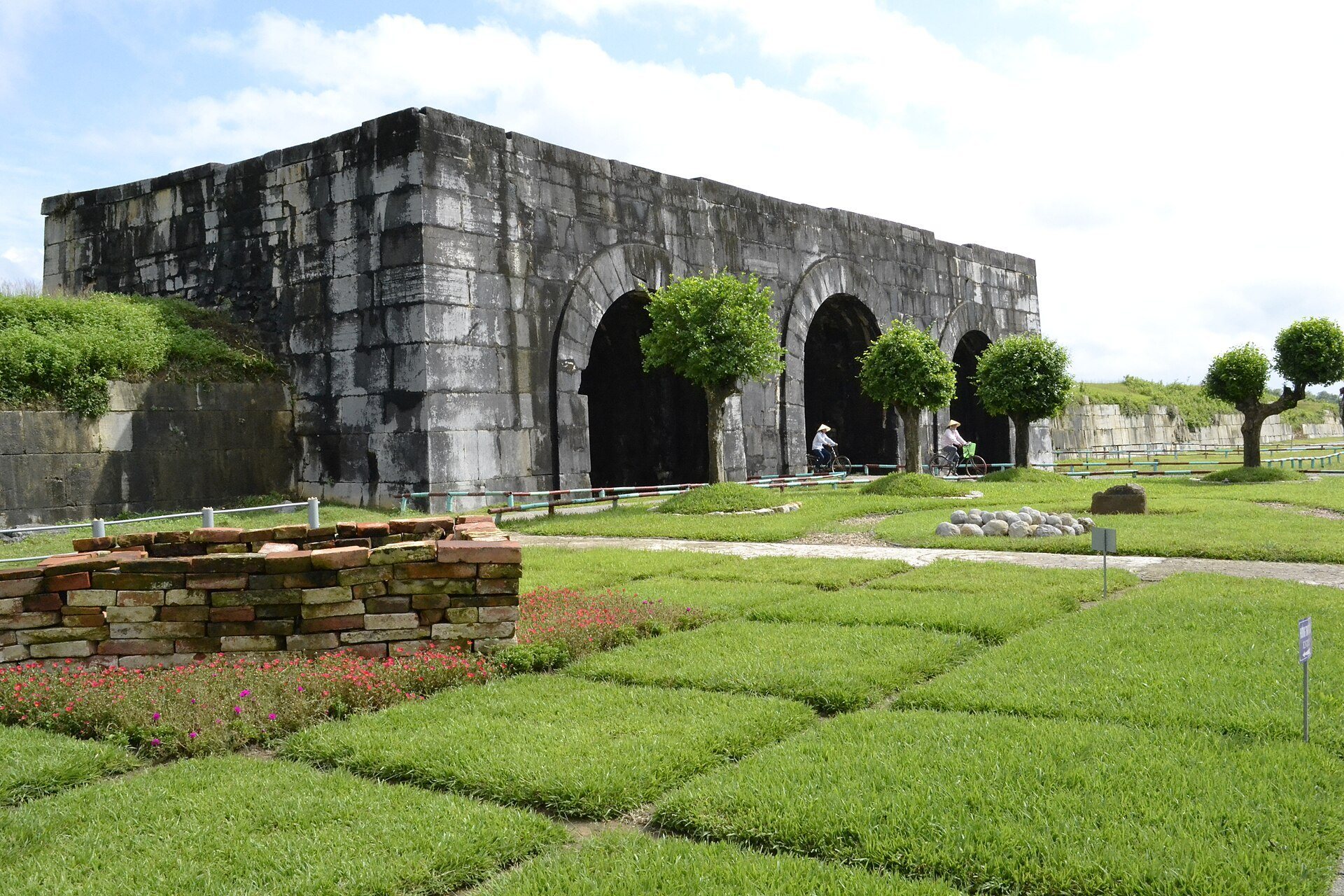
Built in 1397, the Inner Citadel covers 142.2 hectares and forms a large rectangle measuring 883.5 metres from east to west and 870.5 metres from north to south. Its stone walls follow a northwest to southeast alignment and stand on foundations of rammed earth. They reach up to 21.36 metres in thickness at the base and about 15 metres across at the top. Limestone blocks from nearby mountains were laid in horizontal courses against sloping wall faces. The blocks average about 2.2 metres long, 1.5 metres wide, and 1.2 metres high, while some are more than twice these dimensions and weigh as much as 26.7 tonnes.
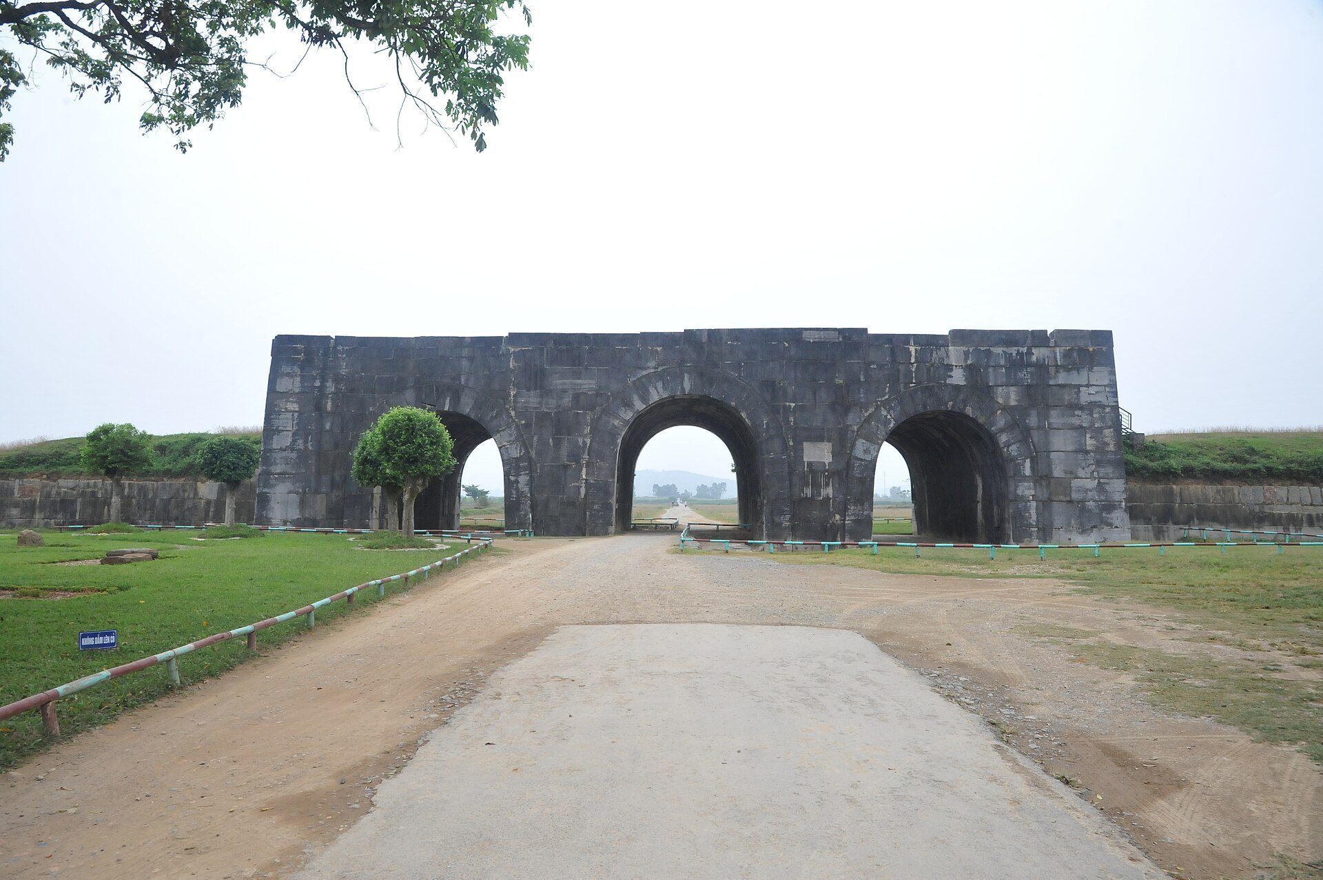
A vaulted stone gate stands at the centre of each side. The southern gate has three openings, while the northern, eastern, and western gates each have one. The southern entrance is approximately 9.5 metres high and 15.17 metres wide. Remains of paved roads extend from the four gates toward the centre, dividing the enclosure into four quadrants. The southern gate connected with the Imperial Road, which ran approximately 2.5 kilometres southeast to the Nam Giao Altar. A moat surrounded the enclosure, with visible remains on every side except the west, and a southeastern channel linked it with the Bưởi River. Paved areas survive inside and outside the southern gate.
Palace area and internal features
Written records describe palaces for the king, the queen, and the king’s father within the Inner Citadel. They also place a temple to the Hồ ancestors in the eastern part, a temple to the Trần ancestors in the western part, and a temple dedicated to grain deities within the enclosure. Most buildings were constructed in the late fourteenth century, although work continued from the fifteenth through the seventeenth centuries and included the reuse of earlier materials.
Two headless stone dragons remain at the centre of the Inner Citadel and represent royal authority. Four lakes, one in each quadrant, can also be seen. Behind the dragons, the discovery area contained gold-enamelled terracotta objects, including gilded Bodhi-leaf ornaments with dragon motifs. These objects are associated with the palace-area remains and helped identify the position of the former main hall.
La Thành Outer Wall
The La Thành Outer Wall was an approximately 10-kilometre-long defensive earthwork built from rammed earth in 1399. Located between one and three kilometres from the Inner Citadel, it linked natural hills and mounds on the eastern side and extended from Đốn Sơn Mountain in the south to the Tuong Son mountains in the north. The surviving World Heritage section lies northeast of the Inner Citadel. It measures 2,051.9 metres in length, about 5 metres in height, approximately 37 metres in thickness at the base, and about 9.2 metres across at the top.
Nam Giao Altar
The Nam Giao Altar was built in 1402 between two peaks of Đốn Sơn Mountain, approximately 2.5 kilometres southeast of the southern gate. Its name means “Worship of Heaven,” and the complex served as a ritual platform for ceremonies honouring Heaven. It covers a nearly square area measuring 130 by 120 metres and consists of raised terraces of different shapes that share a central point at the rear.
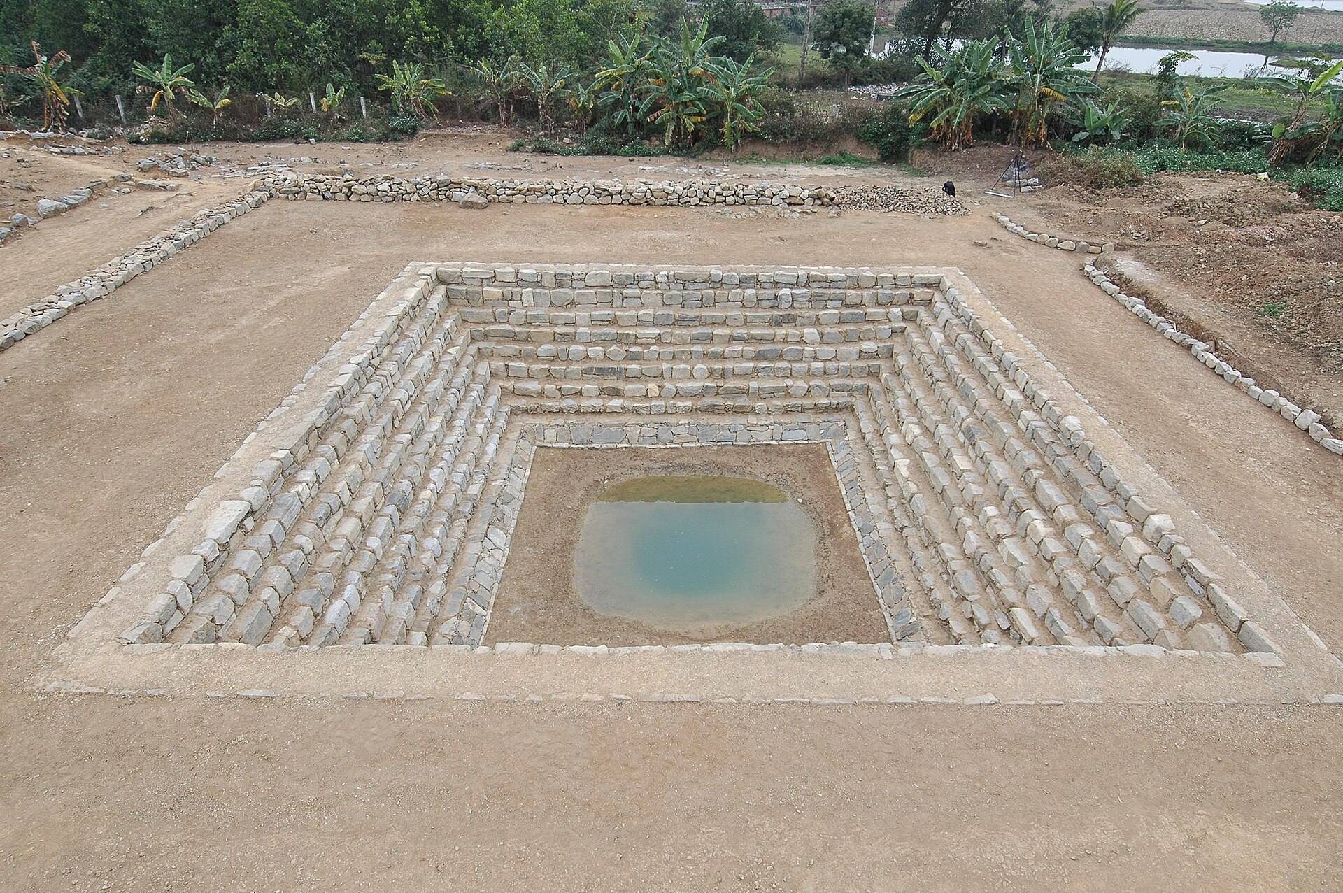
The highest terrace stands 21.7 metres above sea level. It has a paved polygonal form with many sides, while the remains of a 3.6-metre-wide ceremonial road rise towards its southwestern side. Archaeological evidence indicates that a roofed timber structure once stood above the altar. Slate and limestone formed the foundations, walls, and lower terraces, whose limestone wall slopes inward towards the upper part. At the southeastern corner of the lowest terrace stands a square water well known as the Jade Well and locally as the King’s Well. Pottery and metal objects were found at the altar.