Casa de Pedra do Gambá: Archaeological Ruins of a Colonial Expedition Site
Site at a Glance
- Rating
- 4.7
- Popularity
- Very Low
- Country
- Brazil
- Primary era
- Early Modern
- Eras represented
- Early Modern, Modern
- Civilizations
- Portuguese
- Site type
- Domestic
- Remains
- House
On this page11 sections
History
Casa de Pedra do Gambá is an archaeological site in Entre Rios de Minas, Minas Gerais, Brazil, associated with colonial-era bandeirante expeditions and centered on a stone building constructed in 1701. The house was built by sertanistas, people who traveled or settled in the interior of colonial Brazil, after members of Fernão Dias’s expedition remained in the region.
The Fernão Dias expedition
In the late seventeenth century, Fernão Dias left São Paulo with forty men from São Paulo and two hundred Indigenous people in search of emeralds in the territory then called the Sertão dos Cataguás. The expedition crossed the valleys of the São Francisco, das Velhas, Jequitinhonha, and Pardo rivers before reaching the area near the Paraopeba River, a tributary of the São Francisco.
On the Gambá mountain range, a landmark for expeditions crossing the region, the group established a fort known as the Fortim dos Bandeirantes. Bandeirantes were colonial expeditions from Portuguese America that traveled through the interior for purposes including mineral prospecting, territorial expansion, settlement, and the enslavement of Indigenous people. The fort may have protected the expedition from attacks by the Cataguá or supplied food to sertanistas passing through the area, but its primary purpose remains uncertain.
Settlement and later interpretation
Casa de Pedra do Gambá became the site’s first headquarters and its earliest surviving construction. The first European inhabitants later established farms and pastures in an area that had previously been covered by Atlantic Forest. In 1713, the Portuguese settlers Pedro Domingues and Bartolomeu Machado arrived and founded the settlement of Brumado, which later developed into the city of Entre Rios de Minas.
The site has traditionally been regarded as a bandeirista construction, meaning a building associated with bandeirante expeditions. Archaeological prospecting did not confirm that interpretation scientifically. Disturbed soil layers, irregular excavations linked to treasure hunting, buried or collapsed walls, and the removal of elements from earlier floors limited the investigation. Recovered materials indicate activity between the eighteenth and twentieth centuries, while assessment of the surviving architecture points to the seventeenth century. No pre-colonial material culture was identified at the site, despite evidence of Cataguá occupation in the wider region.
Records, conservation, and protection
The oldest official record concerning Casa de Pedra do Gambá dates to 1912, when Álvaro A. da Silveira, chief engineer of the Geographical and Geological Commission of Minas Gerais, described its condition and construction. He identified the house as a 1701 building and considered it to be in excellent condition after more than two centuries.
The site later fell within the area affected by an industrial district developed by the Companhia de Desenvolvimento Econômico de Minas Gerais. Environmental licensing required historical and archaeological research, site delimitation, and conservation measures. The resulting project was carried out with the Instituto de Memória e Patrimônio and Detzel Consultores Associados and reviewed by Brazil’s federal heritage institute, IPHAN. A reconnaissance visit took place on 19 November 2014, archaeological surveying ran from October 2015 to January 2016, and the study was completed in July 2017.
The intervention included clearing, marking, structural stabilization, archaeological prospecting, and educational activities focused on heritage preservation. A 1.80-metre-high fence was built around the site. Vegetation and accumulated debris were removed from the ground, stone structures, and house interior, while insecticide was applied against termites and the structures were cleaned of fungi, moss, and lichen. Cracks were filled, unstable walls were supported, and collapsed or endangered elements were reconstructed.
Industrial mortar was rejected in favor of a regional mixture of clay, medium sand, hydrated lime, and red pigment. Steel cables were installed in sector A to restrict movement in two large walls. A small wall from a later local intervention, probably built about forty years before the conservation project, was retained because it represented a resident’s connection with the site and was associated with a small coffee planting. IEPHA, the heritage institute of Minas Gerais, protects Casa de Pedra do Gambá as a heritage property, and its conservation status is described as being in ruins.
Remains
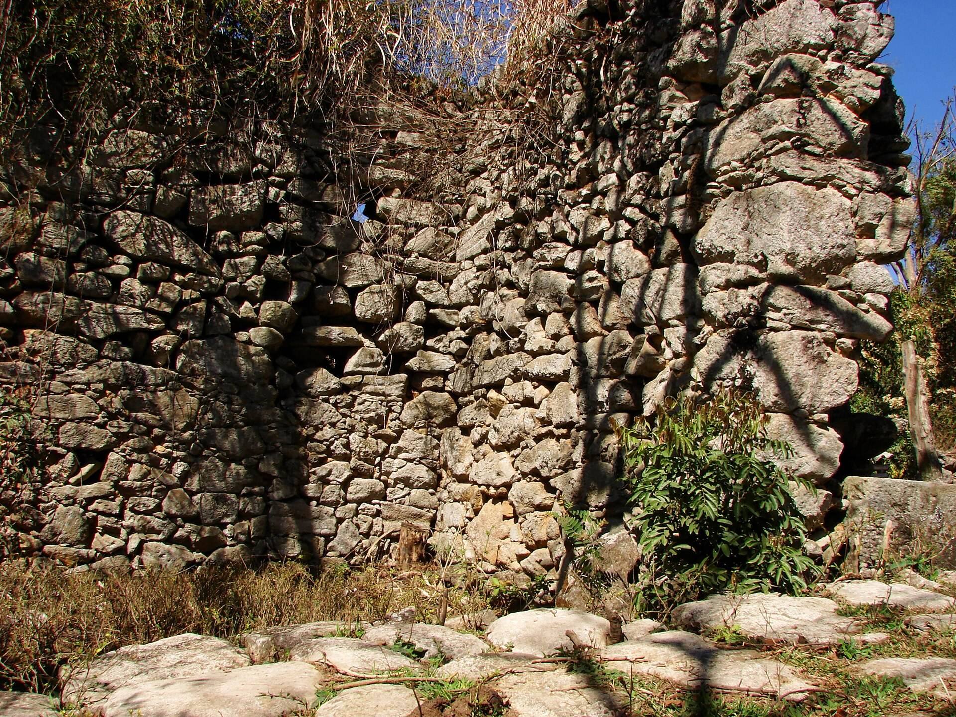
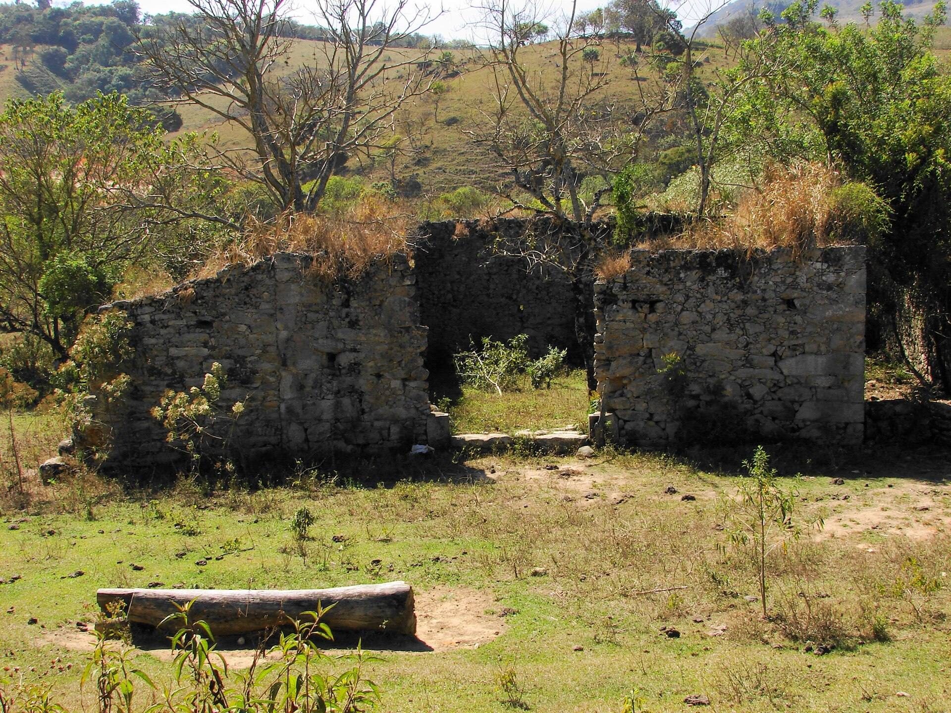
The archaeological site covers approximately 8,200 square metres on the right bank of the Gambá stream, a tributary of the Brumado River and, through it, of the Paraopeba River. Its surviving fabric consists mainly of stone walls and related remains. The structures were built with locally available stone, and conservation measures have stabilized parts of the ruin while protecting the masonry from rainwater, erosion, insects, fungi, and further movement.
Stone buildings and occupied area
Casa de Pedra do Gambá
Casa de Pedra do Gambá is the oldest building on the site. Its walls were built entirely from local stone, with the construction adapted to a landscape formerly covered by Atlantic Forest. In the early eighteenth century, the residence was regarded as imposing within the surrounding wilderness. Its doors and windows used wooden rotating pivots instead of conventional metal hinges. Wooden projections at the ends of the movable elements fitted into cylindrical cavities cut into stone thresholds, sills, and upper frame elements.
Fortim dos Bandeirantes
The Fortim dos Bandeirantes was also constructed from local stone, partly because iron fittings were difficult to obtain in the region. Historical descriptions compared its unusual appearance to a palace among the forests. Its possible defensive or provisioning function forms part of the site’s association with Fernão Dias’s expedition, although the fort’s primary purpose remains unresolved.
Historic pavement
Clearance around the house revealed a previously hidden pavement measuring approximately one metre wide and three metres long. It formed part of the historic area used for activity and occupation at the site.
Masonry conservation
Galvanized-sheet coverings were placed along the tops of the walls to reduce rainwater impact and the erosion of original mortar. Walls with cracks or inclinations received treated-wood supports intended to limit damage from insects, fungi, expansion, and additional cracking.
Some sections were built as dry-stone masonry, in which stones are fitted together without mortar. Because this construction is vulnerable to displacement, the conservation treatment enclosed these sections with galvanized mesh. Stakes and thin reinforcing bars secured the mesh along the wall edges, helping prevent stones from rolling out. The treatment also used regional clay-based mortar rather than industrial mortar, and steel cables helped restrain movement in two large walls in sector A.
Archaeological materials and site management
Archaeological recovery produced 847 fragments representing 734 numbered and catalogued pieces. The assemblage included 489 historical ceramic and tableware pieces, six construction elements, three faunal remains, 110 metal pieces, 111 glass pieces, two buttons, one historical pipe, and twelve other items. Together, these materials indicate activity at the site from the eighteenth through the twentieth centuries.
The site remains a ruin, with surviving stone walls and associated remains stabilized through conservation. Protection and management works also included a modern fence, interpretive panels, and warning and guidance signs.