Camp d’Affrique: A Leuque Fortified Settlement of the Iron Age
Site at a Glance
- Popularity
- Medium
- Country
- France
- Primary era
- Iron Age
- Eras represented
- Iron Age
- Civilizations
- Celtic, Hallstatt culture
- Site type
- Settlement
- Remains
- Town
On this page10 sections
History
Camp d’Affrique is a fortified settlement of the Leuques near Nancy, France, occupied from the fifth century BC within the Hallstatt culture, an early Iron Age culture of central Europe. The Leuques were an ancient Gallic people associated with northeastern Gaul. The settlement was abandoned around the fourth century BC, and its fortifications were in use for a relatively short time.
Settlement and economic activity
Mining may have taken place at the site during the Celtic period. A bronze-working workshop and Hallstatt-style brooches point to local metal production and possible exchange. This evidence does not support describing Camp d’Affrique as a major mining center.
The name and later interpretation
In 1520, local lord Nicolas de Ludre adopted the title Count of Affrique, recalling Mont Afrique in Burgundy, the hill from which his family originated. The fortified site he owned later took the same name. In the eighteenth century, it was mistakenly identified as a Roman camp.
French archaeologist Jules Beaupré excavated the site from 1901 to 1912 and secured its protection in 1907 as a site and monument of artistic character. Excavations from 1981 to 1988 established the fifth-century BC beginning of occupation and abandonment around the fourth century BC. The site was registered as a historic monument in 1998.
Remains
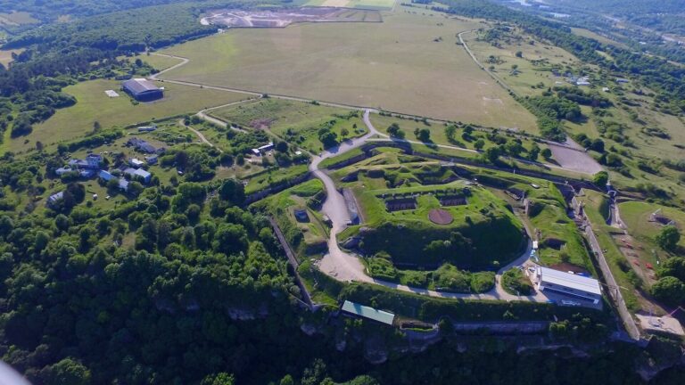
Camp d’Affrique occupies the southeastern end of the Haye plateau near Nancy, across Messein and partly within Ludres. It reaches 417 metres above sea level, about 200 metres above the Moselle valley. The fortified settlement is arranged as two enclosures, with the main enclosure protected by a broad double rampart.
Enclosures and defenses
Main enclosure
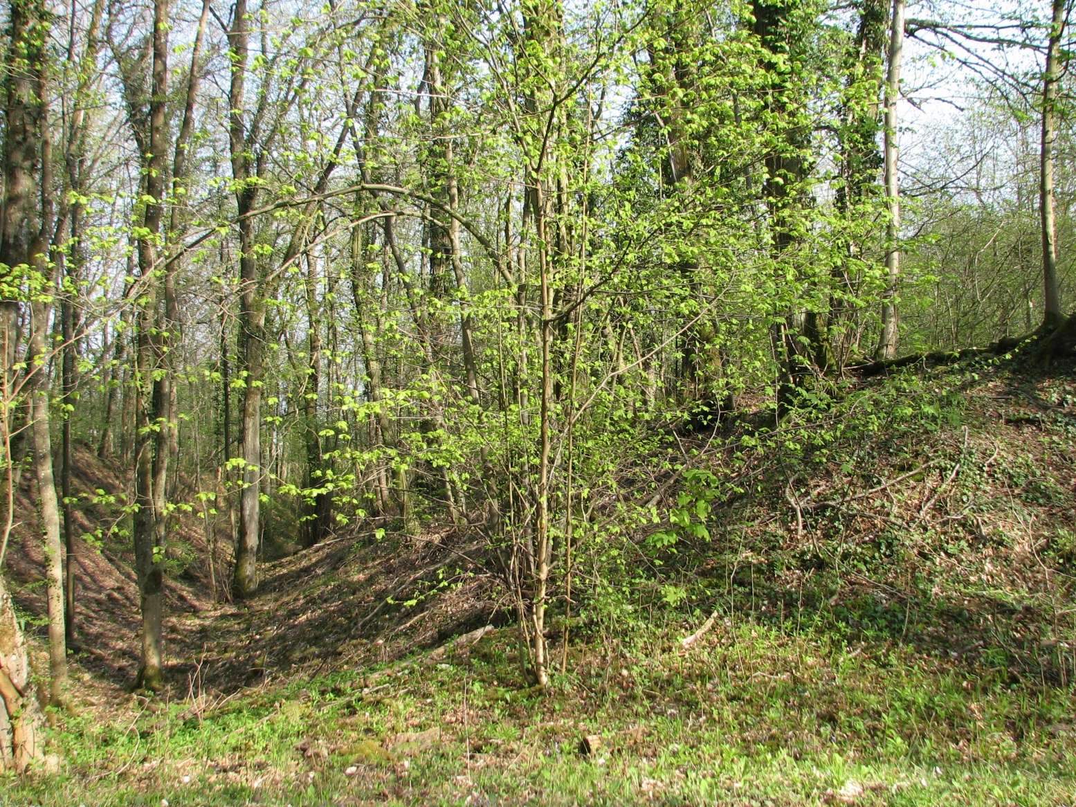
The main enclosure measures about 325 by 225 metres at its greatest breadth and covers roughly seven hectares. Its double fortification is about 55 metres wide. The ramparts were earthen and built with stone, clay, and lime; lime, produced on site, formed their core. Habitation appears to have been concentrated mainly beside the inner ramparts and along the cliff edge.
The rampart is classified as a burnt rampart, meaning its materials were altered by intense heat. This condition may have resulted from the construction process rather than from later destruction.
Old Market enclosure
A separate, rectangular enclosure known as the Old Market lies on a terrace descending toward Ludres. It measures about 220 by 70 metres and covers roughly 1.5 hectares.
Mining and metalworking features
Mine galleries
Old mine galleries open in the cliff below the tip of the fortified spur. Tools associated with Celtic miners were found in the galleries.
Bronze-working workshop
A bronze-working workshop was found within the fortified enclosure. Pottery, arrowheads, and slag were also recovered at the site.