Burg Lingen: A Medieval Lowland Castle and Fortress in Germany
Site at a Glance
- Rating
- 4.5
- Popularity
- Low
- Country
- Germany
- Primary era
- Early Modern
- External website
- Open
- Eras represented
- Early Modern
- Civilizations
- Spanish
- Site type
- Military
- Remains
- Castle
On this page8 sections
History
Burg Lingen is a former medieval lowland castle and fortress in Lingen, Germany, developed by the Counts of Tecklenburg from a manorial estate first mentioned in 1227. It had become a castle by the beginning of the fourteenth century at the latest and primarily defended Tecklenburg possessions against the Bishoprics of Münster and Osnabrück, ecclesiastical territories governed by bishops.
From Tecklenburg estate to residence
Castlemen, military or administrative officials responsible for service at a castle, are recorded at Lingen in 1327. In 1402, Count Nicholas II transferred the castle to his wife, Elisabeth. This transfer was probably connected with an expansion that allowed the site to serve as an occasional residence. A castle chapel is documented in 1435.
Lingen functioned as a permanent residence probably only from 1498 to 1541. During this period, the County of Lingen was separated from the County of Tecklenburg because of family disputes. In 1518, Bishop Erich II of Saxe-Lauenburg, bishop of Münster, captured the castle by surprise during a church service. The cathedral chapter, a body of senior clergy involved in administering a cathedral and its bishop, pressed him to return it to the Tecklenburg family.
Changing lordships and military conflict
In 1526, the County of Lingen became a fief, land or jurisdiction held from a superior lord in return for allegiance and service, of the Duchy of Guelders. In 1548, Emperor Charles V, whose Habsburg rule extended across much of Europe, enfeoffed Count Maximilian of Büren with the county as Guelders’ legal successor. Three years after Büren’s death, Charles V bought the county back from Büren’s daughter.
The castle chapel was demolished after 1542 to enlarge the market square. In 1541, the fortifications were expanded, and the surrounding castlemen’s estates were demolished to improve the field of fire, the area defenders could observe and cover with weapons. The fortress continued to grow under its successive owners.
As a possession of the Spanish kings, Lingen became involved in the Dutch Revolt, the prolonged uprising of the Netherlands against Spanish rule. Maurice of Nassau occupied the town and fortress from 1597 to 1605, after which Spanish forces retook them. In 1605, a fire completely destroyed the powder tower and damaged other buildings in part, although the damage was repaired.
Demolition and later survival
In 1632, the county and its fortress returned to the House of Orange-Nassau, the dynasty associated with leadership of the Dutch Republic and the later Dutch monarchy. At the citizens’ urging, the castle and fortress were demolished in 1632–33 because their upkeep was expensive and their presence attracted enemy armies. Some fortification sections were temporarily repaired in 1636 in anticipation of an imperial attack.
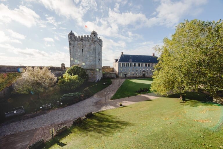
The medieval castle and fortress no longer survive as a complete complex. In 1960, a local citizens’ association rebuilt the powder tower to a height of two storeys on the foundations of its old cellar. The street name “An dem Wall” is the only surviving indication of the former fortifications.
Remains
The physical form of the medieval castle is uncertain. A raised earthwork supporting a fortified structure, known as a motte, with an adjoining enclosed outer bailey is presumed, but this interpretation is unproven. Land-register evidence places the former castle and outer bailey at approximately 150 by 110 metres. No medieval buildings are known to survive. The reconstructed powder tower, two storeys high, stands on the foundations of the old cellar.
Evidence for the early-modern fortress
Written descriptions, maps, siege plans, and a later engraving provide the main evidence for the fortress. Matthäus Merian’s engraving, produced in 1647 after the demolition of 1632, depicts a residential tower with a stepped gable and roof turret adjoining a palas, the principal residential or representative hall of a medieval castle. It also shows a smaller castle chapel, identified by a cross on a pyramidal roof, together with two rounded artillery towers.
Walls, towers, and bridge
A description and map from 1597 indicate four strong rondels, rounded artillery fortifications, with a bridge linking the fortress to the town across a moat. A 1605 siege plan shows two triangular bastions on the field side, projecting angular works designed to strengthen the fortress and support gunfire. These replaced the earlier rondels on that side.
Buildings within the fortress
The 1605 siege plan shows that the central fortified house had disappeared and been replaced by numerous smaller buildings. A later plan, depicting expansion after 1605, shows the town-side rondels removed and the field-side bastions greatly enlarged. A separate siege depiction places the castle chapel north of a fortified house at the centre of the complex.
Nearby sites