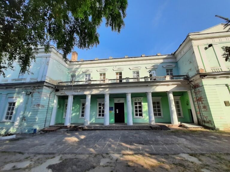
Bilevska Fortress in Krasnohrad: A Fortress of the Ukrainian Defensive Line


Site at a Glance
- Rating
- 4
- Popularity
- Low
- Country
- Ukraine
- Primary era
- Early Modern
- Eras represented
- Early Modern
- Civilizations
- Russian
- Site type
- Military
- Remains
- Fort
On this page12 sections
History
Bilevska Fortress in Krasnohrad, Ukraine, was an earthen fortress of the Russian Empire built between 1731 and 1733 in the bastioned system associated with Vauban, the fortification principles of the French engineer Sébastien Le Prestre de Vauban. It was the tenth fortress of the Ukrainian Defensive Line, an eighteenth-century chain of forts, ramparts, and moats across the steppe frontier, and became the first structure of the future city.
Construction and military settlement
Construction began on 11 August 1731 under General Tarakanov and was completed on 20 October 1733. The fortress formed part of a wider defensive programme begun earlier that year. A ceremonial record describes the establishment of the first fortress of the Ukrainian Line on the Berestova River on 23 June 1731. Empress Anna Ioannovna ordered that earlier fort to be called the Fortress of Saint John, while Bilevska became the line’s tenth installation.
The garrison was the 2nd Battalion of the Belyov Regiment. This unit belonged to the land militia, a force whose soldiers combined military service with agricultural work, and was one of 20 such regiments formed in Belyov in Tula Governorate. The fortress took its informal name from the regiment, while the regiment itself was named for Belyov.
Families of soldiers, land militiamen, and officers settled east of the fortification in an area known as Soldiers’ Suburb. The land militiamen guarded the fortress and adjoining sections of the defensive line, joined Russian army campaigns and exercises, and received land, exemption from duties, and small payments for their service. Government-appointed assistants helped with farming and household tasks, allowing the military settlement to develop alongside the fort.
Growth around the fortress
After the Russo-Turkish War of 1735 to 1739, the reduced danger of Tatar raids encouraged voluntary settlement along the Ukrainian Line and supported the expansion of agriculture. Merchants and craftsmen were drawn to the settlement around Bilevska Fortress. A commercial and craft quarter grew west of the settlement center, while a forge was established between the fortress and the inhabited areas. The first fairs took place in 1745, and the state built shop premises for them.
The fortress also became an administrative and educational center. From 1736 to 1764, it housed the Chancellery of the Ukrainian Land-Militia Corps, the Land-Militia Commission, and the General Land-Militia Court. In 1752, a primary school opened for children of land militiamen. Its subjects included reading, writing, arithmetic, engineering, and artillery science, preparing pupils for military service.
East of the fortress, land militiamen planted the 33-desyatina Kazenny Garden, which included 1,000 square sazhen of garden area. Silk establishments were built there. In 1757, the fortress served as a place where prospective silk producers could observe silkworm breeding and the cultivation of mulberry trees, activities encouraged by the imperial government.
Administrative transformation
The Ukrainian Line lost strategic importance during the Russo-Turkish War of 1768 to 1774, after the Russian frontier moved south and the Dnieper Line was built farther south. Bilevska Fortress was then used as a transit point and as a detention site for peasants who resisted feudal exploitation.
In 1775, the newly created Azov Governorate, an administrative province of the Russian Empire, placed its central administration at Bilevska Fortress. General V. O. Chertkov received 3,000 desyatinas of land on the left bank of the Berestova River and founded the settlement of Natalino there. In October 1778, the governorate administration moved to Yekaterinoslav, and Bilevska became a district center of the Azov Governorate.
By 1784, the settlement contained 617 inhabitants, 130 houses, three forges, about 20 shops, several taverns, and three annual fairs. An imperial decree issued by Catherine II that year renamed Bilevska Fortress as the city of Konstantinograd, in honor of her grandson Constantine. The fortress later lost its direct strategic function but remained tied to the administrative and urban development of the settlement. In 1796, Konstantinograd became a non-staff town, meaning a town without the full administrative status of a regular staffed town, within the Little Russia Governorate.
Bilevska Fortress remains the central figure on the coat of arms of the Berestyn district, although it is not the central figure on the coat of arms of the city itself.
Remains
Bilevska Fortress survives as a rectangular or quadrangular earthen enclosure measuring approximately 100 metres on each side. Four bastions strengthened its corners, while the surrounding earthworks connected it to adjoining sections of the Ukrainian Defensive Line. Parts of the moat and rampart remain, although two northern bastions and the rampart have been damaged.
Fortifications
Earthen enclosure
The fortress was formed by an earthen rampart with four corner bastions. A curtain, the straight rampart joining two bastions, enclosed the sides. The northern curtain contained the entrance, giving access through the fortified perimeter. On the southern side, the defences were strengthened by a ravelin, an outwork placed in front of a fortified side, directed toward the Berestova River.
Southern outworks
A redoubt, a detached defensive work, stood immediately beyond the southern moat. Together with the ravelin and the moat, it extended the protection of the southern approach toward the river. The surviving earthworks preserve part of this defensive arrangement, while the fortress as a whole remains in moderate condition.
Connection with the Ukrainian Line
The defensive rampart of the Ukrainian Line joined two bastion vertices of Bilevska Fortress. From the fortress, the rampart and moat extended toward Ivanivska, the ninth fortress, and Fedorivska, the eleventh. A section of the rampart survives at Fedorivska Fortress, preserving part of the wider connection between the forts.
Interior and later underground works
Fortress buildings
The interior contained barracks for the garrison, a zeikhhaus, or military storehouse for weapons, ammunition, and related equipment, a powder magazine for gunpowder, a treasury, and a well. These facilities supported the fortress as both a military post and an administrative center during the period when the Ukrainian Line remained active.
Underground passages
Underground passages were later built from the fortress toward the pond and Soldiers’ Suburb. The network gradually branched through the town, creating connections beyond the original enclosure. The period in which these passages were constructed has not been established.