Aqua Alexandrina: A Roman Aqueduct in Rome
Site at a Glance
- Popularity
- High
- Country
- Italy
- Primary era
- Classical
- Eras represented
- Classical
- Civilizations
- Roman
- Site type
- Infrastructure
- Remains
- Aqueduct
On this page10 sections
History
Construction and purpose
Aqua Alexandrina is an ancient Roman aqueduct in Rome, Italy, built in AD 226 under Emperor Alexander Severus. It was the last of ancient Rome’s eleven aqueducts, constructed to supply the enlarged Baths of Nero, which were renamed the Baths of Alexander.
Repairs and continued use
The aqueduct remained in use from the third through the eighth century. Repairs took place during Emperor Diocletian’s reign, between the third and fourth centuries, and again between the fifth and sixth centuries. In the eighth century, further repairs were made under Pope Adrian I.
From 1586, the spring at Pantano Borghese also supplied Acqua Felice, a later Roman aqueduct. In 1680, the Italian antiquarian Raffaello Fabretti described Aqua Alexandrina. Restoration work near Parco Giordano Sangalli was carried out in 1997.
Remains
The aqueduct ran mostly in a straight line for about 22.4 kilometres, from Pantano Borghese to the Baths of Alexander on the Campus Martius, an area of ancient Rome. Its course combined underground passages with raised sections of concrete faced with brick, including arches where it crossed valleys.
Underground course and entry into Rome
The source at Pantano Borghese was near Gabii, in an area now part of Monte Compatri. The first 6.4 kilometres of the aqueduct were underground, and tunnels also carried it beneath higher ground. These passages measured about 0.72 metres wide and 1.80 metres high. The underground route continued as far as the Torre Angela estate, where the channel crossed ditches on arches. Beyond Marranella, the course of an underground stretch toward Torpignattara is uncertain. From there, the aqueduct continued underground until it entered Rome near Porta Maggiore, at the ground level of the time. A basin for settling impurities was probably located nearby.
Arches and surviving stretches
Arches across valleys
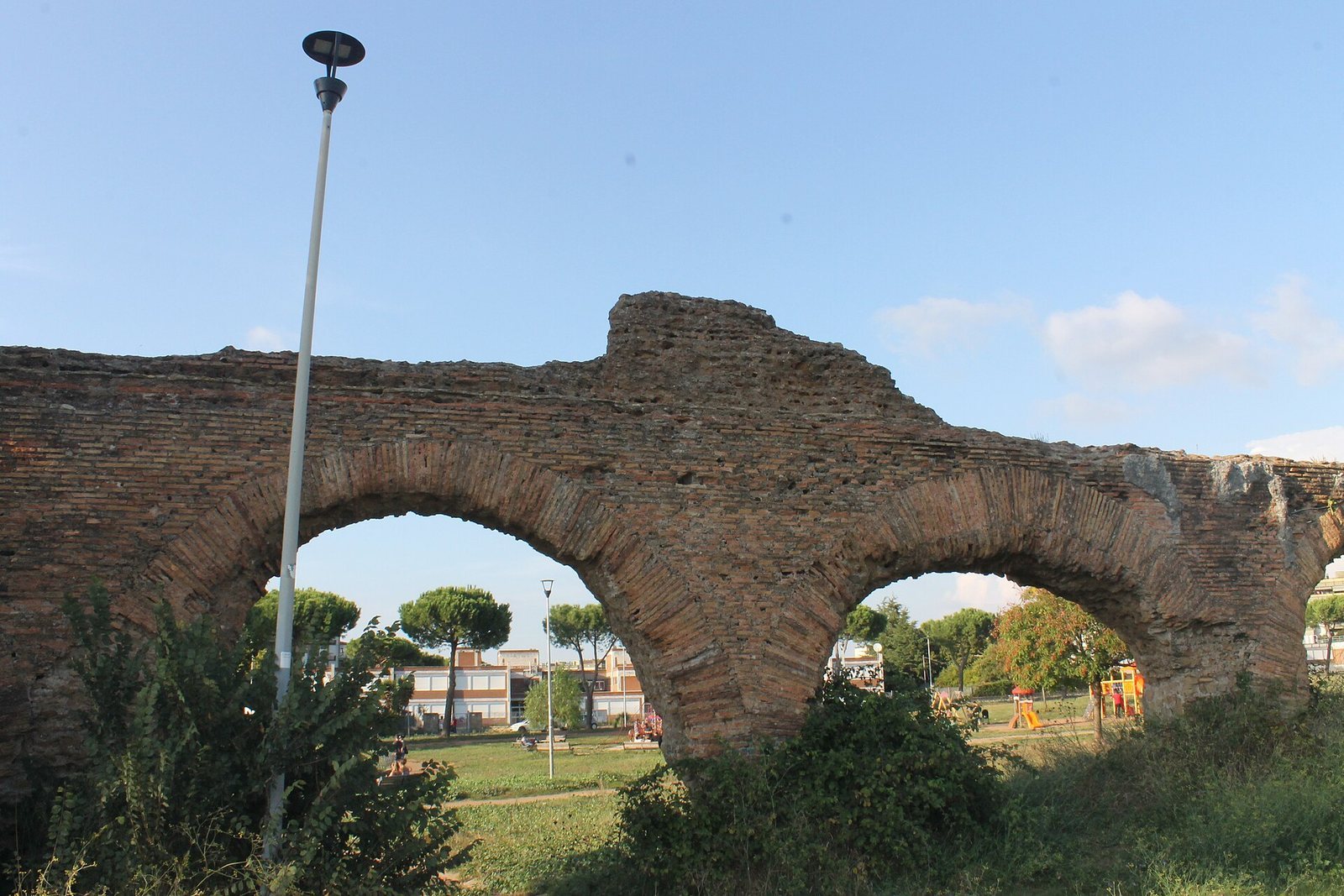
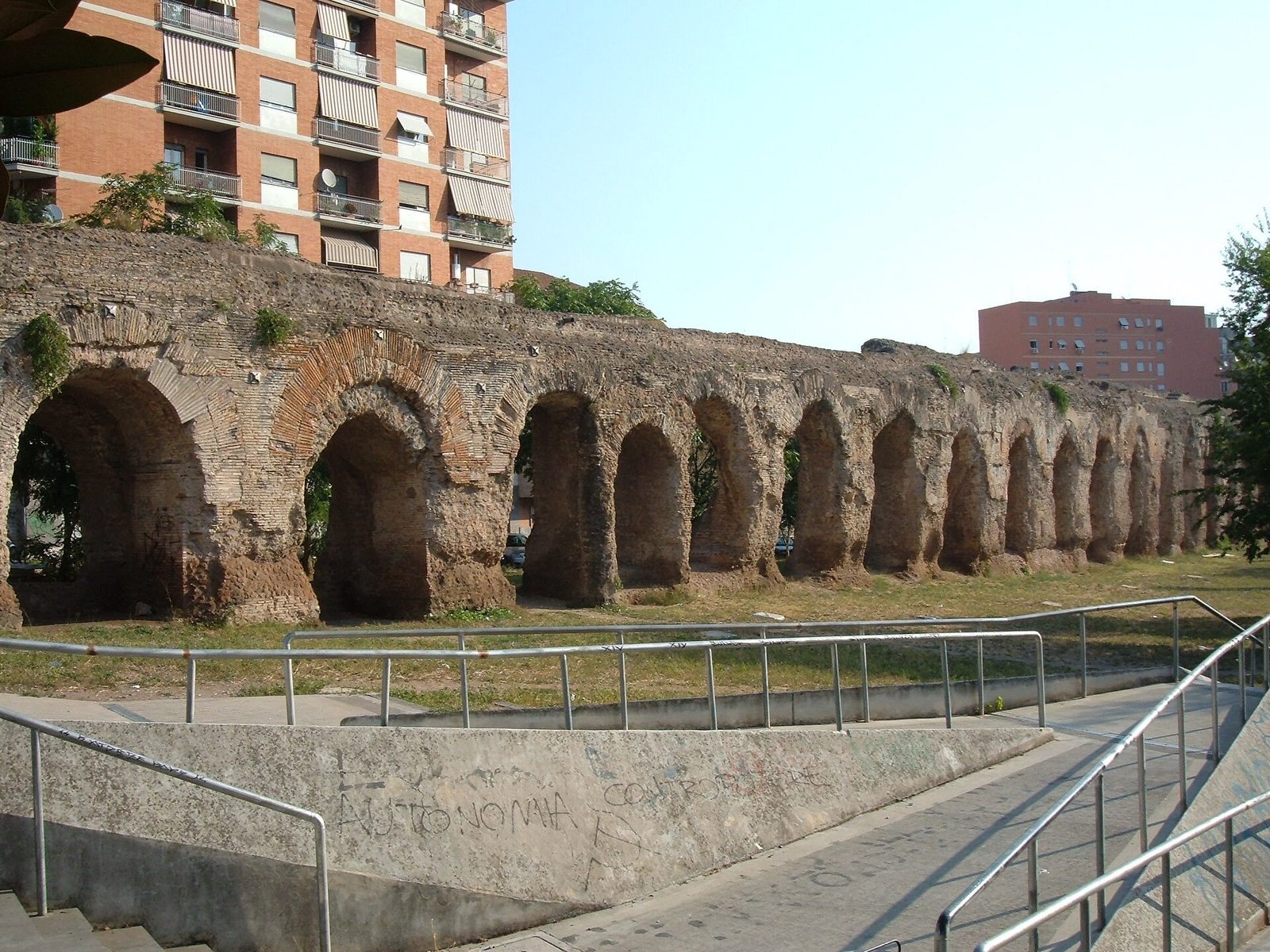
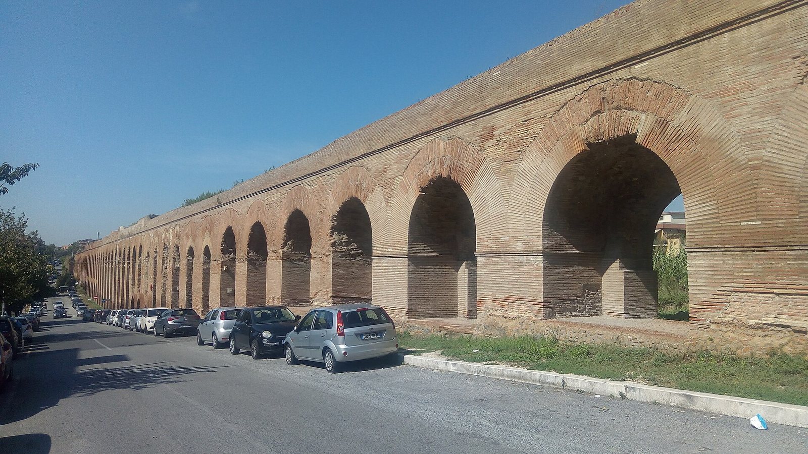
A further 2.4 kilometres of the route crossed valleys on arches in the Roman Campagna, the countryside surrounding Rome. Their concrete cores were faced with brick. At Viale Palmiro Togliatti, the arches reach about 20 to 25 metres in height. Four small brackets made of travertine, a type of limestone, sit at the top of each pier; their purpose is unknown. The aqueduct carried an estimated 120,000 to 320,000 cubic metres of water per day, depending on the season.
Centocelle
The longest continuous above-ground stretch runs through Centocelle along Via dei Pioppi and Via degli Olmi. Monumental arches also rise over Viale Palmiro Togliatti, north of Via Casilina, following the old ditch of Centocelle. Dense housing now surrounds this section, whose brick facing is better preserved than the more heavily eroded surfaces elsewhere.
South of Via Casilina
A second long stretch follows Via dell’Acquedotto Alessandrino south of Via Casilina. Its arches cross a valley whose lowest point lies at present-day Via Carlo Della Rocca. Houses and Parco Giordano Sangalli surround the ruins, and the arched section ends at the junction with Via di Tor Pignattara.
Toward Pantano Borghese
Remains can be traced from Centocelle toward Pantano Borghese through fields and scattered farmsteads, as far as Rome’s Grande Raccordo Anulare. Lower arches cross ditches and hollows, including behind the Tor Tre Teste housing estate, where a public park was established around the ruins. A chalk deposit on the aqueduct indicates that water leaked from it.